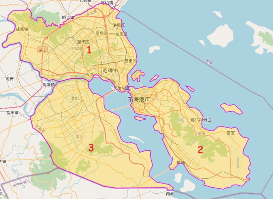
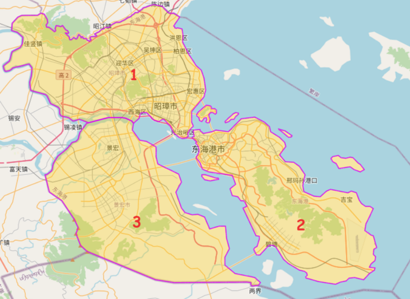
File:Dunghoi Districts.png
Size of this preview: 800 × 583 pixels. Other resolution: 872 × 635 pixels.
Original file (872 × 635 pixels, file size: 491 KB, MIME type: image/png)
Summary
Districts of Dunghoi taken from the following overpass query: [1]
Licensing
| This map is a derivative of the OpenGeofiction base map, which is licensed under the Creative Commons Attribution-NonCommercial-ShareAlike License and is released under the same license. |
File history
Click on a date/time to view the file as it appeared at that time.
| Date/Time | Thumbnail | Dimensions | User | Comment | |
|---|---|---|---|---|---|
| current | 04:21, 3 December 2023 | | 872 × 635 (491 KB) | Zhenkang (talk | contribs) | Update with labels |
| 04:19, 3 December 2023 | Error creating thumbnail: File missing | 872 × 635 (504 KB) | Zhenkang (talk | contribs) | Districts of Dunghoi taken from the following overpass query: [https://turbo.ogf.rent-a-planet.com/?q=LyoKVGhpcyBoYcSGYmVlbiBnxI1lcmF0ZWQgYnkgdGhlIG92xJJwxIlzLXR1cmJvIHdpemFyZC7EgsSdxJ9yaWdpbmFsIHNlxLBjaMSsxIk6CsOiwoDCnGFkbcS6X2xlxKFsPTbFiMKdCiovCltvdXQ6anNvbl1bdGltZcWdxZ8yNV07Ci8vxI_ElMSdciByZXN1bHRzCigKICDFsiBxdcSSxJrEo3J0IGZvcjogxYjFisWMxY7FkMWSxZTFlsaCIG5vZGVbIsWLxY1uxY_FkWVsIj0iNiJdKHt7YsSqeH19KcWwxoN3YXnGosakxpfGqMaqxqzGrsawxrLGtG_Gtsa4xrrFuMapxJRpxaPGv8aWxqbGmMapxqvGrcavxrHGs8a1xrfGuQr... |
You cannot overwrite this file.
File usage
The following page uses this file: