File:Demirhan, 1820.png

Size of this preview: 692 × 600 pixels. Other resolution: 1,500 × 1,300 pixels.
Original file (1,500 × 1,300 pixels, file size: 207 KB, MIME type: image/png)
Summary
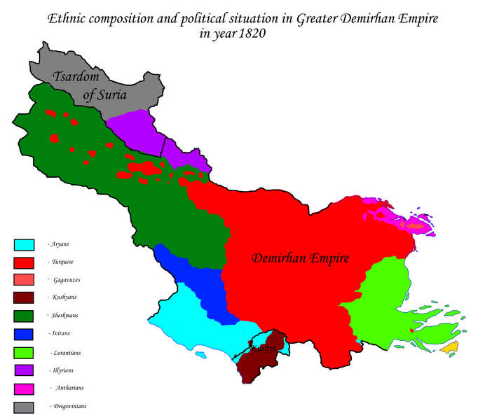
Demirhan Empire at maximum of territorial extent, 1820. Map made by me, Rustem Pasha
Licensing
| This image is licensed under the Creative Commons Attribution-NonCommercial-ShareAlike License |
File history
Click on a date/time to view the file as it appeared at that time.
| Date/Time | Thumbnail | Dimensions | User | Comment | |
|---|---|---|---|---|---|
| current | 18:20, 13 October 2021 | | 1,500 × 1,300 (207 KB) | Rustem Pasha (talk | contribs) | Demirhan Empire at maximum of territorial extent, 1820. Map made by me, Rustem Pasha Category:Demirhan Empire |
You cannot overwrite this file.
File usage
The following page uses this file: