File:IC CC2b.png
Size of this preview: 733 × 600 pixels. Other resolutions: 2,503 × 2,048 pixels | 3,819 × 3,125 pixels.
Original file (3,819 × 3,125 pixels, file size: 942 KB, MIME type: image/png)
Summary
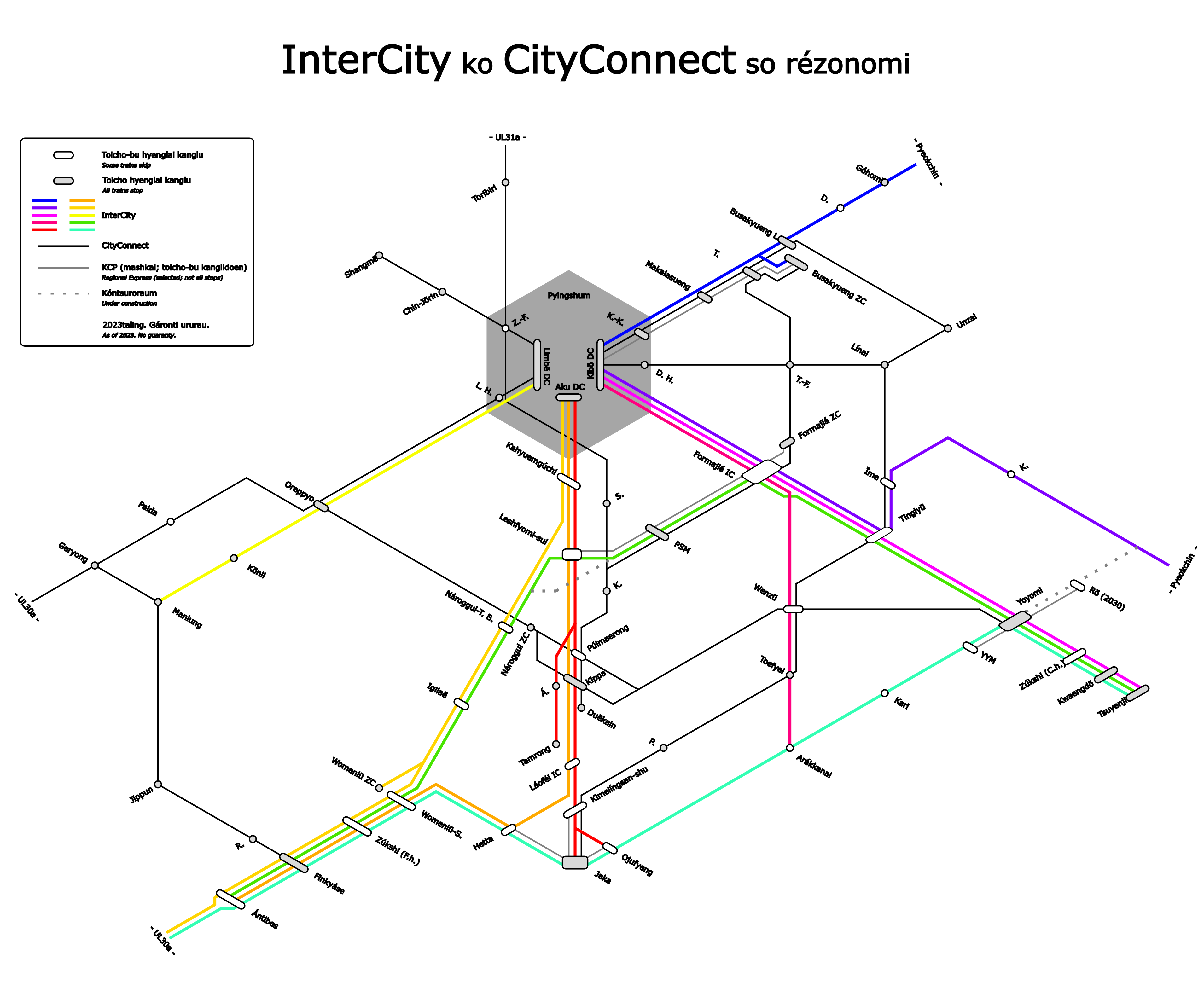
Done by me in Inkscape.
Licensing
| This image is licensed under the Creative Commons Attribution-NonCommercial-NoDerivatives License |
File history
Click on a date/time to view the file as it appeared at that time.
| Date/Time | Thumbnail | Dimensions | User | Comment | |
|---|---|---|---|---|---|
| current | 16:25, 3 May 2024 | | 3,819 × 3,125 (942 KB) | Leowezy (talk | contribs) | changes in Kippa area |
| 18:24, 13 February 2024 |  | 2,293 × 1,803 (394 KB) | Leowezy (talk | contribs) | changed Tamrong IC | |
| 18:16, 10 September 2023 | Error creating thumbnail: File missing | 3,819 × 3,125 (927 KB) | Leowezy (talk | contribs) | Done by me in Inkscape. Category:Kojo Category:Transport maps |
You cannot overwrite this file.
File usage
The following page uses this file: