File:New carnaby roads.png: Difference between revisions
Fluffr Nuttr (talk | contribs) (Traced map of New Carnaby) |
Rustem Pasha (talk | contribs) m (categories) |
||
| Line 3: | Line 3: | ||
== Licensing == | == Licensing == | ||
{{Cc-ogf-map}} | {{Cc-ogf-map}} | ||
[[Category:New Carnaby]] | |||
[[Category:Federal States collaborative documentation]] | |||
Latest revision as of 10:28, 25 August 2023
Summary
Traced map of New Carnaby
Licensing
| This map is a derivative of the OpenGeofiction base map, which is licensed under the Creative Commons Attribution-NonCommercial-ShareAlike License and is released under the same license. |
File history
Click on a date/time to view the file as it appeared at that time.
| Date/Time | Thumbnail | Dimensions | User | Comment | |
|---|---|---|---|---|---|
| current | 02:28, 20 August 2023 | 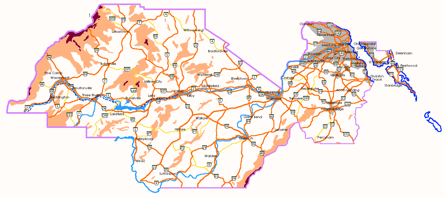 | 1,497 × 667 (57 KB) | Fluffr Nuttr (talk | contribs) | Traced map of New Carnaby |
You cannot overwrite this file.
File usage
There are no pages that use this file.