Forum:Territory application/AN117 - White Islands
- Please fill in the information below to make a territory request.
| Territory ID and proposed name | |
|---|---|
| The Territory ID (from OpenGeofiction:Territories, e.g. AR123a) and proposed name of the country |
AN117∈⊾ - White Islands (Republic of the United White Islands)
| Physical geography | |
|---|---|
| An overview of climate, topography and landscape of the country. It is advised to also create a sketch, you can add a link to this (hosted on imgur or similar) |
Climate
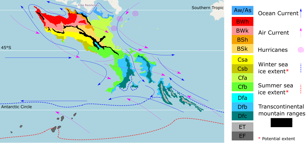
The climate overall is subtropical, having rainy winters and warm summers, however the temperature usually lays around 16c in the winter and 30c in the summer due to the ocean currents bringing the warm waters from southern Antarephia, as we can see on the map of climates provided in the wiki page about Antarephia (link: https://wiki.opengeofiction.net/images/6/67/Antarephia_Climate.png). Because the currents pull the hot tropical waters from northern Antarephia to the archipelago, some stronger hurricanes sometimes do hit the archipelago.
Topography
Topography map: https://imgur.com/a/IIk0rp1
The overall topography of the archipelago is flat lands near the coast with some islands having small mountains on their center caused by former or active volcanos which created them. The ocean swell comes from the north, which created many beaches with strong waves, but specially the northeastern most island, which has got the biggest waves in the entire archipelago. Those waves can reach heights of 6 meters on strong swells and will usually be 1 or 2 meters tall. The waves get to such heights because the island is located off the archipelago ocean shelf as it can be seen on this map: https://imgur.com/a/sNbjTOQ
Landscape
Example photo of the coast of the islands: https://imgur.com/a/JRnNeFP
Example photo of coastline 2: https://imgur.com/a/ewExgOi
 | Human geography |
|---|---|
| A brief description of the territory demographics, economic development, land occupation, infrastructure and mapping style |
Cities and Regions map:https://imgur.com/a/OIDYcei
The Republic of the Union of the White Islands is divided into three regions acting almost as "states" which each region having its own capital. The three regions are usually refered as regions A, B and C as it is their native name's first letter (Amnya, Boho and Chiy'u), those names were from the past three civilizations that used to occupy the modern day single country after their unification.
The richest region is region A, having double the population of the regions B and C combined and the most amount of tourists, which is the main economic activity of the archipelago. One of the reasons for more tourism on this region has to do with the big surfing industry present in the Northeastern most island, which has the name Mou'opo, meaning Big wave island in the native language. Region A is also one of the most developed regions because of the area of flat lands being much higher than the other regions, making agriculture and urban development more present on the region. The island of Torné (the island where the capital is located) had its largest city, Tornéha, became the capital thanks to its natural harbor, which made trading something very present since the start of the relations of Amnya with the outside world.
Region B has Meaha as the capital of the region, the third largest city in the country, and its island, Oú'opo, has the third largest area of flat land in the entire country, the city was the former capital of the kingdom of Boho, however this is the island with the largest production of grains in the country and the longest beach, which is also has very clean waters that drag tourists to it, also the reefs along the region are also a big tourist check for their vacation in the archipelago.
Region C is the most undeveloped and poorest region overall of the archipelago, having little flat land and many high mountains , which made agriculture really hard and the natural disasters were a major problem as landslides are a very big issue for the regional capital, Epo'a which means in the native language instable ground. However the high mountains are a tourist attraction, but the lack of infrastructure in the region does not help.
- The economy of this proposed country would not be too big, having simillar gdp per capita to Seychelles (at 10.366,3 USD), being mainly dependent on tourism and houses being sold to foreign buyers and the small historic production of wheat.
The urban and rural areas are squeezed in between the mountains in most islands, and the quick development of the nation that occured during the 1950s lead to old dirt roads or trails becoming pavimented streets, meaning that in many islands the general shape of the roads on historical centers of cities is very curvy and odd, however the newer regions (suburbs with the exception of the island Mou'opo).
| History & culture | |
|---|---|
| A brief description of the intended culture and language |
~450 BC - First arrival of ethnic Ullanyés on the islands of the modern day region of Chiy'u
~200 BC - Most of the islands of the modern day country are now populated and the first organized civilizations start to emerge in the regions B and C
~100 BC - Foundation of the civilization of Amnya
~60 BC - Union of the kingdoms of Tsii and Uo, after a marriage, which lead to the new kingdom of Shii'uo
~2 AD - Foundation of the kingdom of Wu'o on the island of Oú'opo
73 - War of Pontus, essentially started due to the sudden death of the king Pontus and the uncertainty of who should assume the throne of the kingdom of Shii'uo
74 - The kingdom of Wu'o invades the island where Epo'opo (Island where modern day Epo'a is located) and essentially takes control over the kingdom of Shii'uo and turns into an empire
126 - The Wu'o empire fails invading the kingdom of Amnya, leading to the decline of the empire
149 - Split of the Wu'o empire into the kingdoms of Chiy'u and Boho
278 - Yéo'u declares independence from the kingdom of Chiy'u, under the rule of the king's brother and sieges the city of Epo'a, starting a civil war in which the kingdom of Boho joins on the side of the former Chiy'u kingdom, which was lead by the Boho King's Cousin
280 - Yéo'u loses the war and the kingdoms of Chiy'u and Boho merge and form the kingdom of Chiboho
561 - The kingdom of Amnya merges with the kingdom of Chiboho, forming the first unification of the archipelago, transforming into the kingdom of Amu
987 - After many revolts, the kingdom of Chiy'u defects the United Kingdom of Amu due to the common feeling that the region of the archipelago was being "forgotten" by the monarchy and the first democracy in the archipelago is set up
991 - First trading relations with nearby kingdoms
1464 - Trading starts with the Ingerish and Fraquese, trading the large amounts of wood the natives had for wheat seeds
1523 - After the Ingerish and Franquese see the agricultural potential with the volcanic soil, and the possible use of the island as a naval base, an agreement is made to split the kingdom of Amu in half, with Ingerland getting the eastern islands and the Franquese getting the western rest of the archipelago and the William-Sèlm agreement is signed by both empires.
1531 - On august, the two empires arrive with guns and cannons on the archipelago and take control of the Amu Kingdom, ending the old kingdom.
1568 - The kingdom of Chiy'u is invaded by the Franquese after the sponsored assassination of the President
1815 - After many revolts against the colonial policies, and sieges, the Franquese government decided to establish the Republic of the Western White Islands (or Le République Des Îles Blanches De l'Ouest), which was a name chosen because the wheat fields on the islands made them on the distance look white. This name was also chosen by the Franquese to try to reduce Amu Nationalism, as this new country was a puppet state of Franqueterre. After the establishment of the western part of the old kingdom of Amu, the Ingerish colonial policies got harsher and more opressive to prevent a revolution like the one on the western part of the arquipelago.
1867 - A nationalist group, with the dillema of restablishing the Amu Kingdom from the Western White Islands sieged the colonial Ingerish establishments on Fort Williams, which got known as the siege of Fort Williams, inspiring the population to revolt against the Ingerish, which lead to the island being completely uncontrolled by the Ingerish. On the next day, the entire eastern part of the former Amu kingdom ended up revolting against the Ingerish, killing the colonial leaders.
1868 - After the period of total anarchy on the eastern part of the archipelago, the Ingerish invaded the islands again, but weren't able to take full control of the population and signed the treaty of Fort Williams, which granted independence for the eastern part of the country in 20 years, under the condition that Ingerish military bases would remain in the archipelago.
1888 - Full Independence of the Eastern Republic of the White Islands
1891 - Treaty of Meaha also granted full independence in 10 years to the Republic of the Western White Islands after revolts and threats from the recently independent nation right on its doorstep
1901 - Independence of the Republic of the Western White Islands and the unification of the archipelago, forming the nation of the Republic of the United White Islands
1908 - Alliance with the (proposed in AN118) republic of the Karvan islands as those got their independence recently too and were looking forward to great relations with the neighboring country that had a simillar culture
1940 - 1950 Great war economic crisis
2002 - Housing stock market crash crisis
2005 - Economic boom because of tourism
Because of all the occupation from those countries, the amu language split in three dialects, which will be completely created by me in a wiki article, written in the latin alphabet having many similarities with French and English language because of loanwords and loan spelling, one example is the accent marks (ex:é) or the word television. The culture is completely different from any other country, because of the ~2000 years of some sort of isolation of most the archipelago from the outside world, this culture has its own traditions and own religion, which would need another wiki article (that I would love to write), however during the modern era, and the revolution of communication, less people in the younger generations follow their traditional religion and beliefs and the increasing amount of foreign people living makes this process faster.
- Another important point is the fact that after the unification, in 1901, the country established a Democracy, with a little middle - right predominance.
| Past mapping | |
|---|---|
| To support your request provide links to areas of OGF mapping which showcase your mapping skill. Mapping relevant to the requested theme & geography is especially useful | |
| The {{coord}} template can optionally be used to link to the OGF map - it results in a nice formatted link. Or you can paste in a URL. |
https://opengeofiction.net/#map=13/-26.2472/166.1746&layers=B -> this was my first city mapped, it was mapped almost a month ago on Tierra Nueva, a blue territory
https://opengeofiction.net/#map=13/-37.0056/155.5247&layers=B -> Linden is the city I am actively working on, its twin city, Heidelberg, is also a city that is undergoing development, those are my main cities which I am working on. The areas near South Linden Lake are the most developed so far. The rural areas around Linden and Heidelberg were all mapped by me, the most developed ones are the ones on north of Linden, west of Hannah Hamlet.
I am also working with Minimapper on the city of Springfield as a collab city, if you want as an extra you can check out our progress so far.
| Username & date | |
|---|---|
| Sign and date the application by typing four tildes like this: ~~~~ |
What3089 / Jake on the discord server (talk) 0:11 AM, 10th october 2023 (UTC)
 | Discussion |
|---|---|
| Discussion for clarification & decision |
- Hi, Freedemia mapper here again. It may take a bit for me to fully respond to this. But did want to at least respond to some initial key thoughts:
- Check with Infrarojo on what he's assumed for Geare, but at least based on Freedemia, Aeragny, and Cabelia's history, the Franquese empire proper within the region (really the Rivagien empire offshooting from the Franquese) would likely already have been mostly collapsed by the 1720s. As such I'm not sure how likely they'd be to be taking more land or having the strength to maintain land taken after that/into the 1800s.
- I also think I may have had the Ingerish arriving a bit later than your timeline would imply (but not by much, more around the 1570s or so).
- While I hesitate to suggest changing things entirely, it does seem the Castellanese may have had a longer standing presence, and there actually was canonically a truce between Castellan and Ingerland's crowns. I've actually integrated that into Freedemia's history, with Jhuandan having been a shared trading hub similar to what you described. As such using Castellan in place of Franqueterre here might make some sense. Alternatively (though less likely) maybe try talking to varnel.maiser, the Cabelia mapper, or Taka, the Aeragny mapper, about whether Cabelia or Aeragny as one of the few remaining former-Franquese strongholds would have enough power at that time to fill in within the later parts of your timeline.
- Only other point I'd make is that Freedemia's native Budrians were supposed to have either been seafarers themselves leaving from Jhuandan or to have been a hub for seafaring cultures to come trade with the mainland. As such there may have been *some* contact at least as early as maybe 1000 or so. But I'm happy to work with you on those details, and it probably wouldn't change the fundamental point about minimal contact
- Beyond that I actually do really like this proposal! It's original, well thought out, creative, and fits the region well as a whole. I wish you the best of luck! Ernestpkirby (talk) 11:59, 12 October 2023 (UTC)
- Hey there, I'm Zeke, the owner of nearby Cabelia. Ernest told me about your application and I've suddenly become invested in it. For the Rivages, their power definitely declined by the early to mid-1700s, as Ernest said, but Cabelia continued on as its successor rump state. At that point, it would still have enough power to fulfil the "Franqueterre" role in White Islands' history. If you want, we can discuss that history in more detail (I would like to restart region-wide historic discussions for the Lyc in any case). I hope the application goes well! --- Thanks, Zekiel (talk) 12:50, 12 October 2023 (UTC)
- [answering Ernestpkirby's comment]
- Thank you so much for your comment as it always helps me so much, so here is what I am going to change regarding your points:
- The independence from Franqueterre will be changed to an earlier date, but not much earlier, considering that it was still a small island archipelago with a small population that would not require much strength to hold control on;
- I have been in contact with Minimapper, who is interested in the archipelago above, AN118, and maybe he might want to use the castellanese theme, but im not sure as I haven't asked about it, so I left it to him;
- I also added contact between Jhuandan and the natives of Amnya on the timeline, as it really would make more sense if there was contact earlier;
- What3089/Jake (talk) 16:16, 12 October 2023 (UTC)
[Answering Zekiel's comment]
Thank you too for your time spent on this and as for your comment, so I made the independence date (start of the puppet) earlier, in 1815, however the puppet state lasts for quite a long time, still lasting until 1901. What3089/Jake (talk) 16:21, 12 October 2023 (UTC)
- Good day, it seems that we made a mistake in locating AN117: it's not near Freedemia, as we thought it was. Some of our history-related discussions would not apply anymore, but there's still a lot we can work on together. It's a bit further of a stretch, but the Cabelian rump state could still maintain some level of influence over White Islands' government to fill in the role of "puppeteer," for example. (To my knowledge there's not much solid information on Franqueterre since the project is still in its really early stages) --- Thanks, Zekiel (talk) 17:56, 13 October 2023 (UTC)
- Sorry for not noticing the clear missunderstanding, but considering that not many changes were made, I don't think many things need to be changed, as for the influence that the Cabelian rump state could have under the puppet state of the Western White Islands, I believe that it would be better if we talked about those via Discord, feel free to contact me, as I want to make sure everything I change is coherent.
What3089/Jake (talk) 20:10, 13th October 2023 (UTC)
+++++++++++++++++++++++++++++++++++++++++++++++++++++++++++++++++++++++++++++++++++++++++++++++++++
Hi What3089,
Thank you for your application. I have a few questions/comments:
- Physical geography
- Climate: there's no RW location exactly similar to AN117 but I feel you may found some inspiration from places such as Auckland, NZ or southernmost tip of Australia's East Coast (Gippsland, Tasmania east coast): something between subtropical and oceanic. If you browse the Internet for photos of these locations, that may give you ideas of the landcover to map.
- Topography: Nothing to add. Be mindful that these islands are small, if not tiny, when considering mountains/hills altitude, rivers/streams width.
- I created a land_area relation for the whole territory and relations each island (all temporarily named "Island"). That may be useful for you look for RW islands with the same area and consider how they could be mapped in detail.
- Human geography:
- Thanks for the map. In most cases, for islands this size, "major" towns are located on the coast and serve all purposes: admin, trade and industry centre, port. Often, they hold a disproportionate portion of the island's population. Apart from the capital city or Epo'a city, please reconsider your towns' location. Where was it safe, in the past with no extensive artificial harbour, to moor? That's where your towns would have developed in a context such AN117's.
- Regarding cereals, you may consider this ongoing Forum entry regarding common flora and fauna for the Tarephias. It mentioned (from parallel Discord discussions) maize/corn as one of the native cereals. I personally considered it for my country Guai on the west coast of the continent.
- History & culture
- Due to the their sizes, I'm unsure the term Empire fits the territory. A collection of petty kingdoms (if they're not unified) would make more sense.
- If you mention other owned territories, please make sure your ideas fits in their already established history (e.g. Ullanyé).
- You may also contact nearby Layr and Tamor owners who have developed non-Ulethan cultures and mapping style. AN117 is not that remote from the continent.
- 1464: again, the territory is small. It may have wood but not in enormously large quantity.
- 1568: why a kingdom would have a president?
- 1815: for the French translation, you'd better have République des Îles Blanches Occidentales. The article la (république is feminine. You seem to be based in Brazil so same gender as in Portuguese) would be required in a full sentence but not as a title such as on a map, except if it's part of the actual location's name (Le Havre vs. Réunion (Island) though in a full sentence, it'd be la Réunion)
- 2005, given its location, not that far from the continent, I would consider tourism starting earlier. Try to mimic RW similar destinations' development history.
- Leave some room for evolution/adaption. Have general guidelines as start, add details along the way as you map and develop your country (incl. on the wiki) on your own of with other mappers, regionally or those sharing similar bits of history.
- For the country's name, as Amu is the national language, you may consider have White Islands as name:en and have an Amu endonym as name (e.g. name=Brasil, name:en=Brazil, official:name=República Federativa do Brasil...)
Does the above make sense to you? Cheers, --Aiki (talk) 19:55, 16 October 2023 (UTC)