Search results
Page title matches

File:World Map.png Outline of world continents on a projection similar to Robinson or Kavrayskiy VII. [[Category:World maps]](800 × 398 (102 KB)) - 15:15, 18 September 2021
File:Ogf base world map.svg Blank map of the OGF world landmasses, with latitude and longitude lines every 15 degrees over the oce [[Category:Maps]] [[Category:World maps]](1,020 × 549 (1.67 MB)) - 22:59, 24 April 2024


Page text matches
File:World Map.png Outline of world continents on a projection similar to Robinson or Kavrayskiy VII. [[Category:World maps]](800 × 398 (102 KB)) - 15:15, 18 September 2021File:Ogf base world map.svg Blank map of the OGF world landmasses, with latitude and longitude lines every 15 degrees over the oce [[Category:Maps]] [[Category:World maps]](1,020 × 549 (1.67 MB)) - 22:59, 24 April 2024
File:L-Reglè RouteMap.png ...Eastern Antarephia. Based on an adapted and redetailed version of Timboh's world map and a screenshot of the OGF regular render map.(2,455 × 989 (376 KB)) - 12:30, 5 December 2021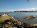
File:Fsa elwaypier.png Photo by User:BMSOUZA, July 27th 2022. In real world, it is Barra de São João, in Casemiro de Abreu (Rio de Janeiro state). In(583 × 435 (363 KB)) - 13:58, 30 July 2022
File:Fsa frankfortroads.png Photo by User:BMSOUZA, July 27th 2022. In real world, it is RJ-178 state road in some point between Carapebus and Macaé (Rio de(582 × 415 (558 KB)) - 13:58, 30 July 2022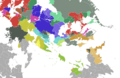
File:East uletha culture proposal.png {{legend|#7a8e7f|'''New ideas (introducing real-world language families with no current representation on the map, conlangs, expa(2,710 × 1,770 (1.38 MB)) - 16:32, 27 June 2022


