File:1917 Dregolesian Moraines Plebiscite.png
Jump to navigation
Jump to search


Size of this preview: 800 × 563 pixels. Other resolution: 1,063 × 748 pixels.
Original file (1,063 × 748 pixels, file size: 64 KB, MIME type: image/png)
Summary
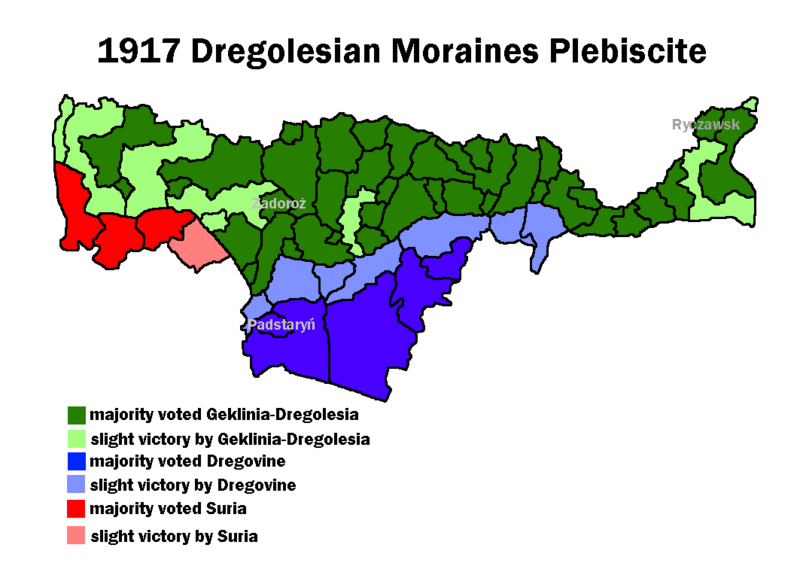
Results of the 1917 Dregolesian Moraines Plebiscite that defined the borders in the area.
Licensing
| This map is a derivative of the OpenGeofiction base map, which is licensed under the Creative Commons Attribution-NonCommercial-ShareAlike License and is released under the same license. |
File history
Click on a date/time to view the file as it appeared at that time.
| Date/Time | Thumbnail | Dimensions | User | Comment | |
|---|---|---|---|---|---|
| current | 14:06, 27 March 2022 | | 1,063 × 748 (64 KB) | Mie (talk | contribs) | Results of the 1917 Dregolesian Moraines Plebiscite that defined the borders in the area. Category:Dregovine Category:Suria Category:Geklinia-Dregolesia Category:Political maps |
You cannot overwrite this file.
File usage
The following 2 pages use this file: