File:Amtrak network map 2016.svg
Jump to navigation
Jump to search


Size of this PNG preview of this SVG file: 800 × 533 pixels. Other resolutions: 320 × 213 pixels | 640 × 427 pixels | 1,024 × 683 pixels | 1,280 × 853 pixels | 2,560 × 1,707 pixels | 1,152 × 768 pixels.
Original file (SVG file, nominally 1,152 × 768 pixels, file size: 1.45 MB)
Summary
| Description |
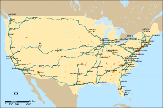
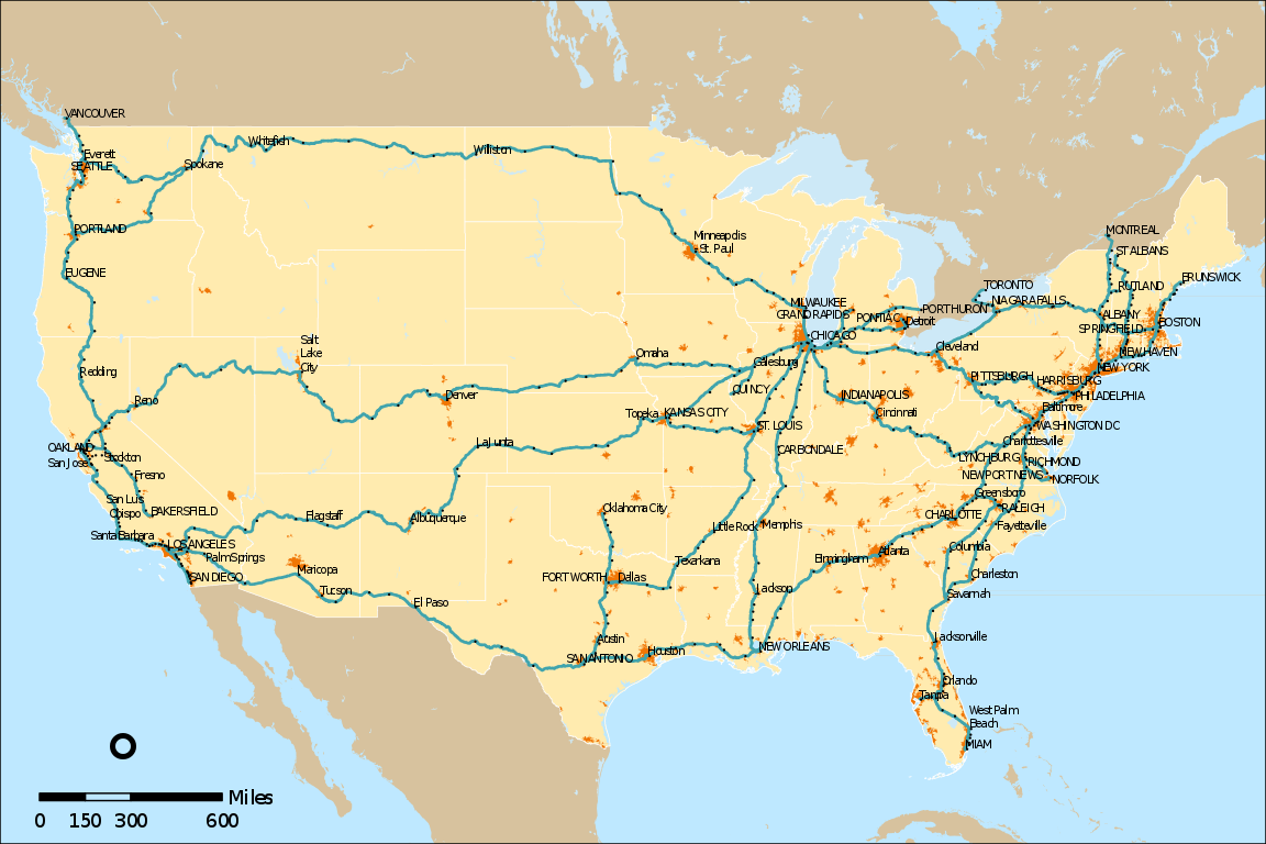
English: Map of Amtrak's rail network as of mid 2016. Updates should be uploaded as separate files rather than overwriting this one. |
| Date | |
| Source | Own work |
| Author | User:Pi.1415926535 |
| Other versions |
 |
Licensing
I, the copyright holder of this work, hereby publish it under the following license:
This file is licensed under the Creative Commons Attribution-Share Alike 4.0 International license.
- You are free:
- to share – to copy, distribute and transmit the work
- to remix – to adapt the work
- Under the following conditions:
- attribution – You must give appropriate credit, provide a link to the license, and indicate if changes were made. You may do so in any reasonable manner, but not in any way that suggests the licensor endorses you or your use.
- share alike – If you remix, transform, or build upon the material, you must distribute your contributions under the same or compatible license as the original.
File history
Click on a date/time to view the file as it appeared at that time.
| Date/Time | Thumbnail | Dimensions | User | Comment | |
|---|---|---|---|---|---|
| current | 21:07, 7 October 2019 | | 1,152 × 768 (1.45 MB) | wikimediacommons>Snooze123 | severe code cleanup |
File usage
The following page uses this file: