File:Bai provinces map 280722.svg
Jump to navigation
Jump to search


Size of this PNG preview of this SVG file: 737 × 600 pixels. Other resolution: 2,517 × 2,048 pixels.
Original file (SVG file, nominally 800 × 651 pixels, file size: 188 KB)
Summary
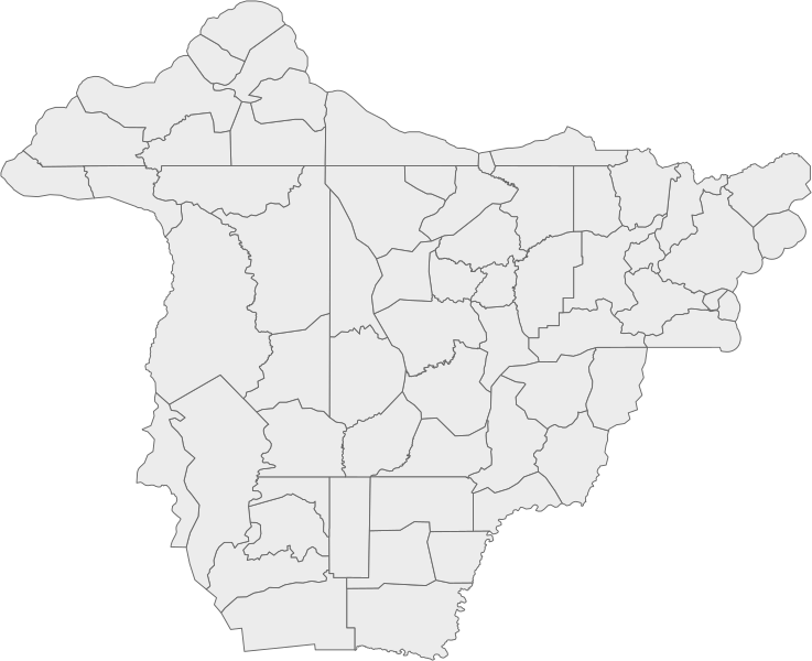
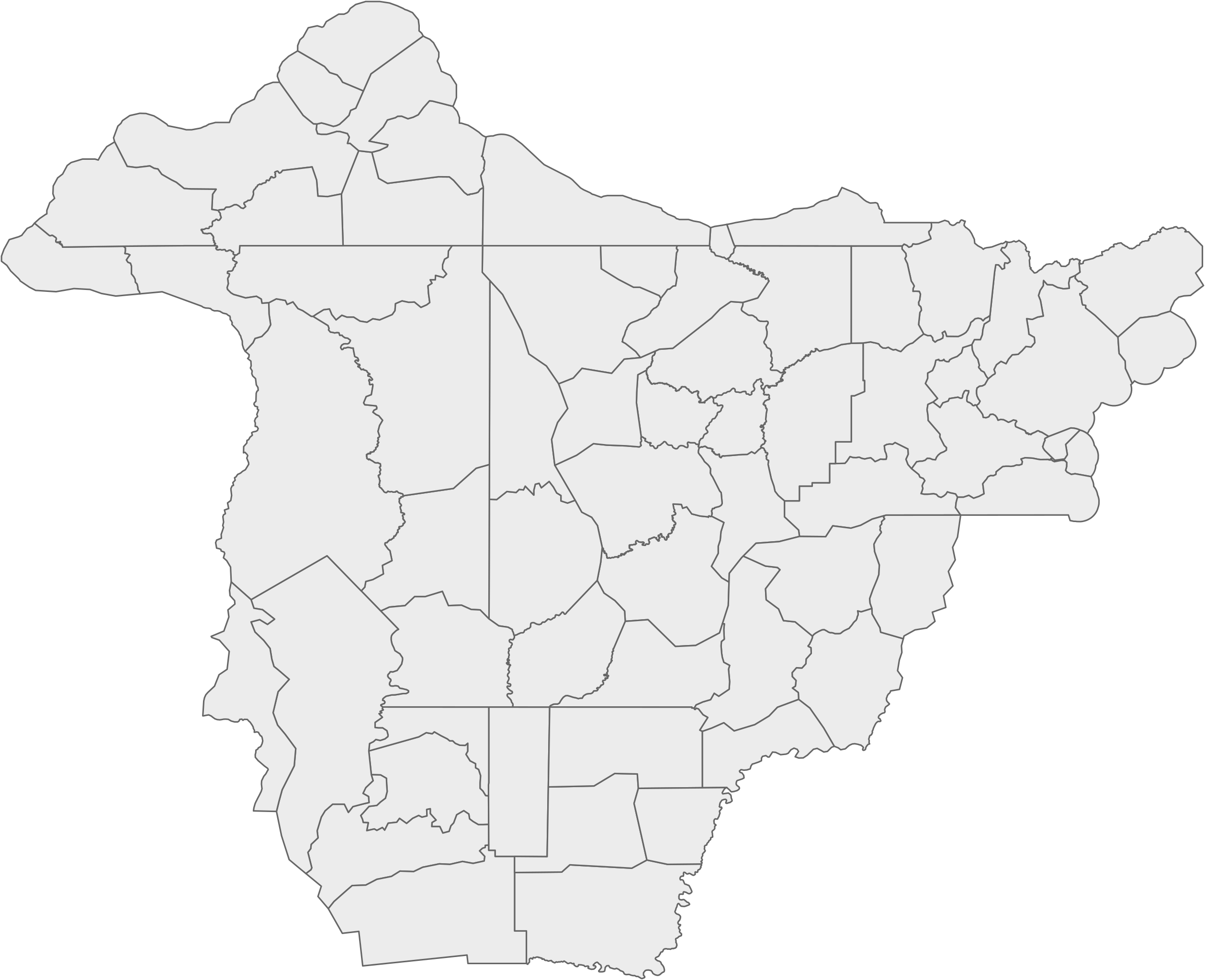
Svg map of the Bai Empire, extracted from the following Overpass query and exported into svg file via mapshaper
Licensing
| This map is a derivative of the OpenGeofiction base map, which is licensed under the Creative Commons Attribution-NonCommercial-ShareAlike License and is released under the same license. |
File history
Click on a date/time to view the file as it appeared at that time.
| Date/Time | Thumbnail | Dimensions | User | Comment | |
|---|---|---|---|---|---|
| current | 00:26, 29 July 2022 | | 800 × 651 (188 KB) | Zhenkang (talk | contribs) | Lightened version |
| 09:15, 28 July 2022 | Error creating thumbnail: File missing | 800 × 651 (234 KB) | Zhenkang (talk | contribs) | Svg map of the Bai Empire, extracted from [https://turbo.ogf.rent-a-planet.com/?Q=(area%5B%22ogf%3Aid%22%3D%22AR909%22%5D%3B%0A)-%3E.bndarea%3B%0A(rel(area.bndarea)%5B%22admin_level%22%3D%224%22%5D%5B%22bg%3Aid%22%5D%3B%0A)%3B%0Aout%20body%3B%0A%3E%3B%0Aout%20skel%20qt%3B&C=25.83945;168.96973;4 the following Overpass query] and exported into svg file via [[https://mapshaper.org/ mapshaper] Category:Bai EmpireCategory:Bai collaborative documentation |
You cannot overwrite this file.
File usage
There are no pages that use this file.