File:East Uletha overview.png
Jump to navigation
Jump to search
Size of this preview: 596 × 600 pixels. Other resolutions: 2,036 × 2,048 pixels | 3,313 × 3,333 pixels.
Original file (3,313 × 3,333 pixels, file size: 1.45 MB, MIME type: image/png)
Summary
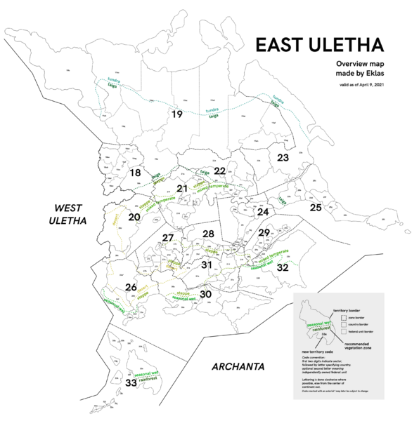
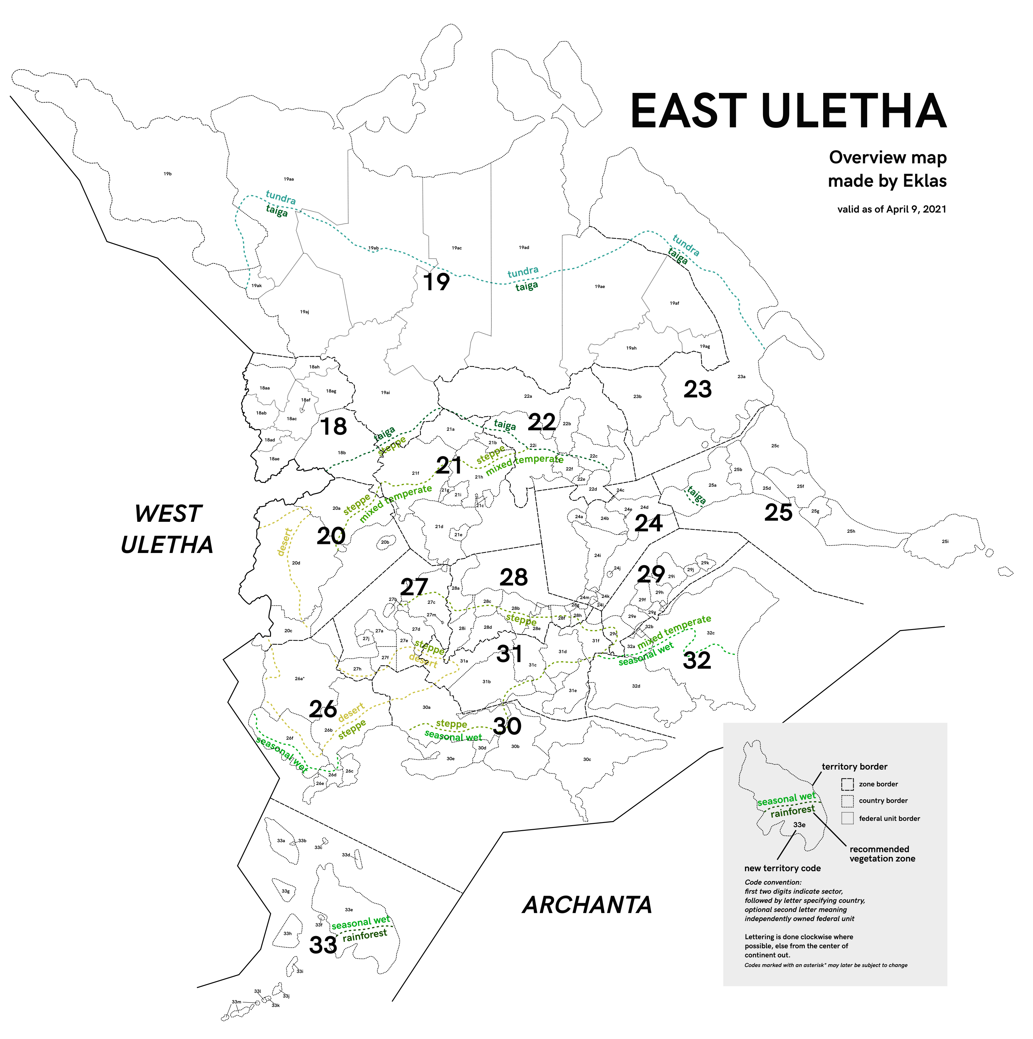
Overview of East Uletha, the grouping of territories into sectors based on climactic and cultural similarities. Original uploaded by User:Eklas
Licensing
| This image is licensed under the Creative Commons Attribution-NonCommercial-ShareAlike License |
File history
Click on a date/time to view the file as it appeared at that time.
| Date/Time | Thumbnail | Dimensions | User | Comment | |
|---|---|---|---|---|---|
| current | 21:30, 13 October 2021 | | 3,313 × 3,333 (1.45 MB) | Wangi (talk | contribs) | Overview of East Uletha, the grouping of territories into sectors based on climactic and cultural similarities. Original uploaded by User:Eklas |
You cannot overwrite this file.
File usage
The following page uses this file: