File:FSA Draft Passenger Rail Plan.png
Jump to navigation
Jump to search

Size of this preview: 372 × 600 pixels.
Original file (800 × 1,290 pixels, file size: 360 KB, MIME type: image/png)
Summary
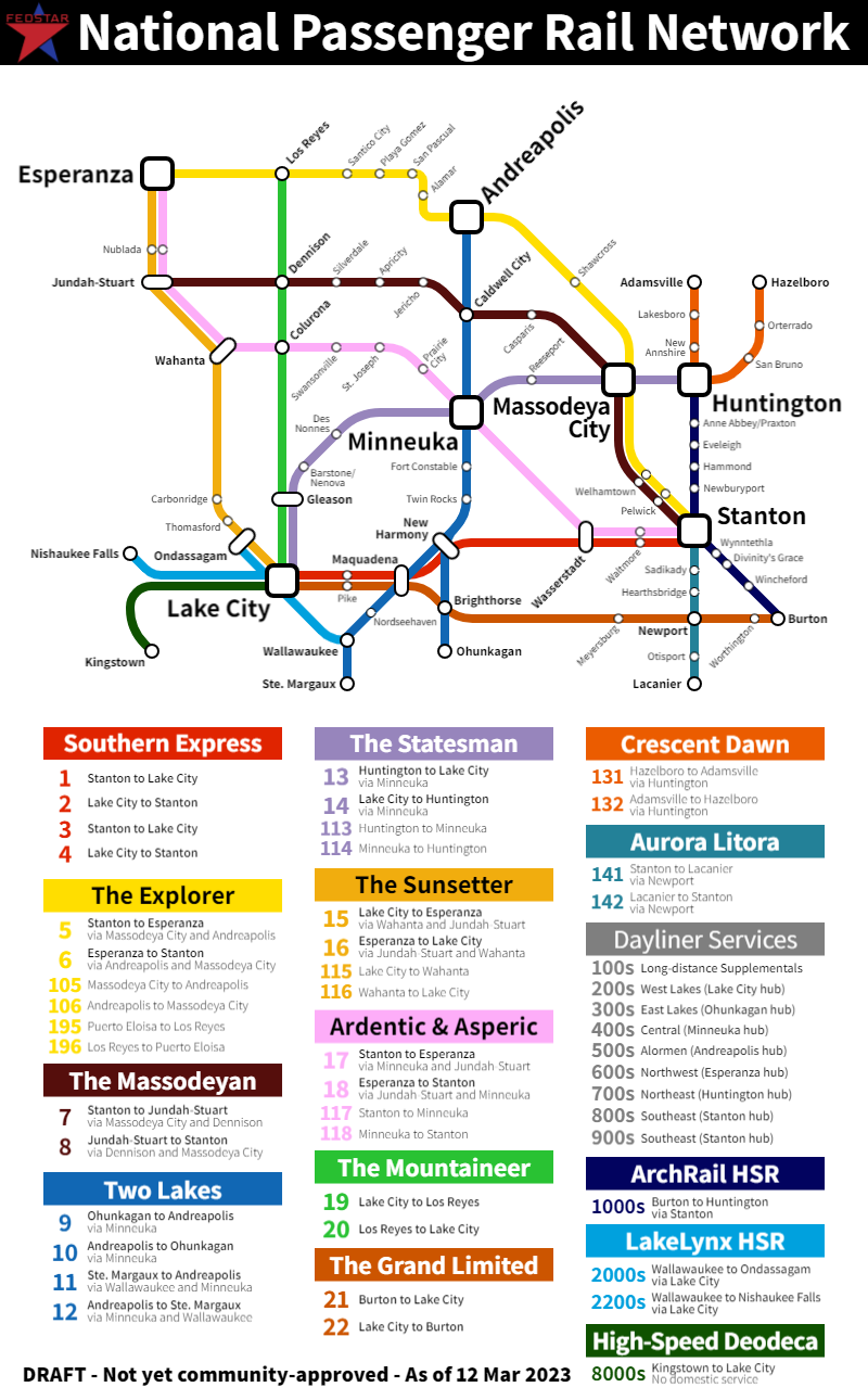
A preliminary draft sketch of potential long-distance passenger train routes in the FSA.
Licensing
| This map is a derivative of the OpenGeofiction base map, which is licensed under the Creative Commons Attribution-NonCommercial-ShareAlike License and is released under the same license. |
File history
Click on a date/time to view the file as it appeared at that time.
| Date/Time | Thumbnail | Dimensions | User | Comment | |
|---|---|---|---|---|---|
| current | 22:35, 13 March 2023 | | 800 × 1,290 (360 KB) | TheMayor (talk | contribs) | Higher resolution |
| 21:16, 12 March 2023 | Error creating thumbnail: File missing | 800 × 1,290 (360 KB) | TheMayor (talk | contribs) | More polished version | |
| 23:37, 5 March 2023 | Error creating thumbnail: File missing | 1,737 × 893 (1.38 MB) | TheMayor (talk | contribs) | Updated based on input from iiEarth | |
| 17:04, 2 March 2023 | Error creating thumbnail: File missing | 1,737 × 893 (1.39 MB) | TheMayor (talk | contribs) | Updated based on feedback from Glauber re: A&A | |
| 17:51, 27 February 2023 | Error creating thumbnail: File missing | 1,737 × 893 (1.1 MB) | TheMayor (talk | contribs) | A preliminary draft sketch of potential long-distance passenger train routes in the FSA. Category:Federal States |
You cannot overwrite this file.
File usage
The following page uses this file: