File:Hunter gatherer's camp at Irish National Heritage Park - geograph.org.uk - 1252699.jpg
Jump to navigation
Jump to search


Size of this preview: 800 × 600 pixels. Other resolutions: 320 × 240 pixels | 640 × 480 pixels | 1,024 × 768 pixels | 1,280 × 960 pixels | 1,600 × 1,200 pixels.
Original file (1,600 × 1,200 pixels, file size: 442 KB, MIME type: image/jpeg)
Summary
| Description |
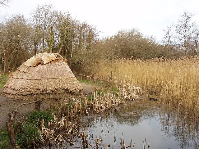
English: Hunter gatherer's camp at Irish National Heritage Park Exhibit showing how a 7000 B.C. campsite of Mesolithic period hunter gatherers would have looked. They were nomadic and built temporary houses. Wood, bone and flint were the materials of their tools. They fished using dugout canoes - there is one in the photo.
More photos in the park, see https://www.geograph.org.uk/gallery/irish_national_heritage_park_county_wexford_10033 . |
| Date | |
| Source | From geograph.org.uk |
| Author | David Hawgood |
| Attribution (required by the license) | David Hawgood / Hunter gatherer's camp at Irish National Heritage Park / |
| Camera location | | View this and other nearby images on: OpenStreetMap |
|---|
_heading:135.00&language=en)
| Object location | | View this and other nearby images on: OpenStreetMap |
|---|
_heading:135.00&language=en)
Licensing

|
This image was taken from the Geograph project collection. See this photograph's page on the Geograph website for the photographer's contact details. The copyright on this image is owned by David Hawgood and is licensed for reuse under the Creative Commons Attribution-ShareAlike 2.0 license.
|
This file is licensed under the Creative Commons Attribution-Share Alike 2.0 Generic license.
Attribution: David Hawgood
- You are free:
- to share – to copy, distribute and transmit the work
- to remix – to adapt the work
- Under the following conditions:
- attribution – You must give appropriate credit, provide a link to the license, and indicate if changes were made. You may do so in any reasonable manner, but not in any way that suggests the licensor endorses you or your use.
- share alike – If you remix, transform, or build upon the material, you must distribute your contributions under the same or compatible license as the original.
File history
Click on a date/time to view the file as it appeared at that time.
| Date/Time | Thumbnail | Dimensions | User | Comment | |
|---|---|---|---|---|---|
| current | 21:41, 7 September 2017 | | 1,600 × 1,200 (442 KB) | wikimediacommons>Geograph Update Bot | Higher-resolution version from Geograph. |
File usage
The following page uses this file: