File:LCX FlightPaths.png

Size of this preview: 800 × 533 pixels. Other resolution: 1,920 × 1,280 pixels.
Original file (1,920 × 1,280 pixels, file size: 214 KB, MIME type: image/png)
Summary
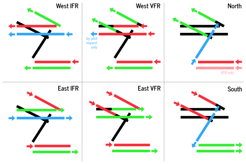
Operational schemes at Lake City International Airport.
Licensing
| This image is licensed under the Creative Commons Attribution-NonCommercial License |
File history
Click on a date/time to view the file as it appeared at that time.
| Date/Time | Thumbnail | Dimensions | User | Comment | |
|---|---|---|---|---|---|
| current | 15:19, 28 June 2023 | | 1,920 × 1,280 (214 KB) | TheMayor (talk | contribs) | Updated runway layout at LCX. |
| 20:41, 24 November 2021 | Error creating thumbnail: File missing | 640 × 640 (73 KB) | TheMayor (talk | contribs) | Operational schemes at Lake City International Airport. Category:Minnonigan |
You cannot overwrite this file.
File usage
The following page uses this file: