File:Lycene Geology AikiProp 1.svg
Jump to navigation
Jump to search

Size of this PNG preview of this SVG file: 800 × 420 pixels. Other resolution: 2,560 × 1,345 pixels.
Original file (SVG file, nominally 1,747 × 918 pixels, file size: 1.78 MB)
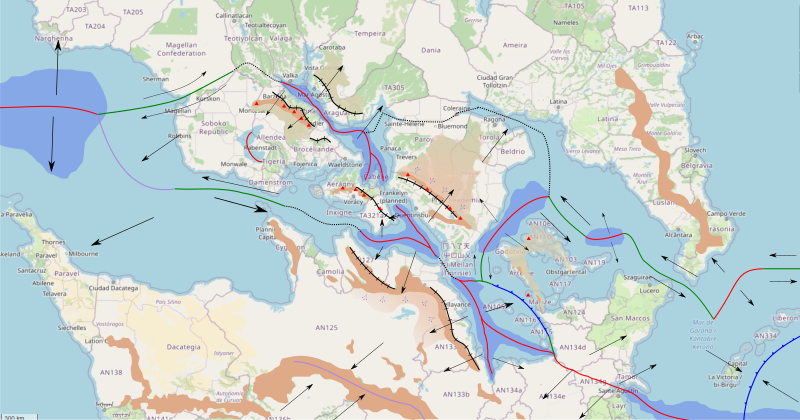
Summary
Own work using Inkscape:
- arrow is for plate direction
- brown area is for mountain
- lighter brown area is for plateau
- black with dashes is for horst
- dotted black is for undefined boundary
- red is divergent boundary
- green is for transform fault
- purple is for collision (mostly continental)
- blue is for subduction
Licensing
| This map is a derivative of the OpenGeofiction base map, which is licensed under the Creative Commons Attribution-NonCommercial-ShareAlike License and is released under the same license. |
File history
Click on a date/time to view the file as it appeared at that time.
| Date/Time | Thumbnail | Dimensions | User | Comment | |
|---|---|---|---|---|---|
| current | 21:42, 13 March 2023 | | 1,747 × 918 (1.78 MB) | Aiki (talk | contribs) | == Summary == Own work using Inkscape: * arrow is for plate direction * brown area is for mountain * lighter brown area is for plateau * black with dashes is for horst * dotted black is for undefined boundary * red is divergent boundary * green is for transform fault * purple is for collision (mostly continental) * blue is for subduction == Licensing == {{Cc-by-nc-sa}} |
You cannot overwrite this file.
File usage
The following page uses this file: