File:Navenna admin divisions blank.svg
Jump to navigation
Jump to search


Size of this PNG preview of this SVG file: 326 × 600 pixels. Other resolution: 1,113 × 2,048 pixels.
Original file (SVG file, nominally 512 × 942 pixels, file size: 738 KB)
Summary
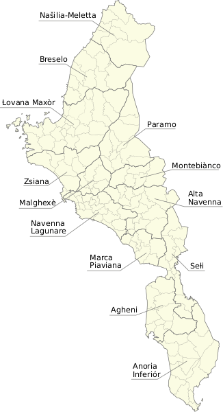
Administrative divisions map of Navenna based on map data exported from OGF
Licensing
| This map is a derivative of the OpenGeofiction base map, which is licensed under the Creative Commons Attribution-NonCommercial-ShareAlike License and is released under the same license. |
File history
Click on a date/time to view the file as it appeared at that time.
| Date/Time | Thumbnail | Dimensions | User | Comment | |
|---|---|---|---|---|---|
| current | 14:23, 13 July 2022 | | 512 × 942 (738 KB) | Timboh (talk | contribs) | Text cropping fix |
| 14:20, 13 July 2022 | Error creating thumbnail: File missing | 512 × 953 (738 KB) | Timboh (talk | contribs) | Added canton annotations, since wikitext annotations seem impossible | |
| 11:50, 13 July 2022 | Error creating thumbnail: File missing | 512 × 982 (732 KB) | Timboh (talk | contribs) | Administrative divisions map of Navenna based on map data exported from OGF Category:Navenna Category:Political maps |
You cannot overwrite this file.
File usage
The following page uses this file: