File:Reun administrative.png
Jump to navigation
Jump to search
Size of this preview: 612 × 599 pixels. Other resolution: 1,010 × 989 pixels.
Original file (1,010 × 989 pixels, file size: 57 KB, MIME type: image/png)
Summary
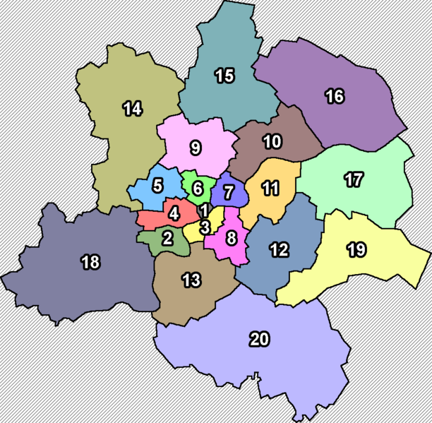
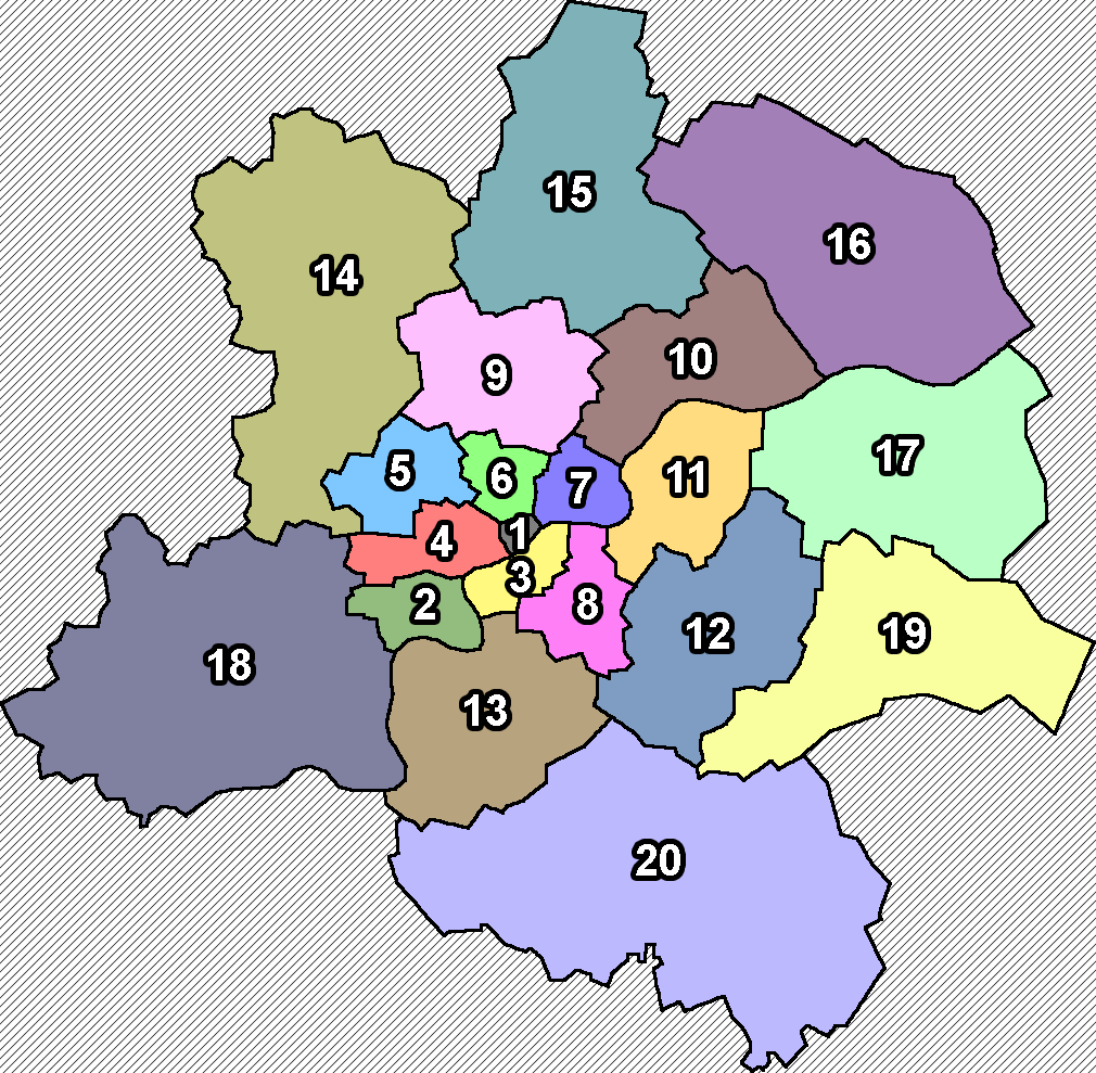
An administrative map of Reun with all 20 districts.
Licensing

|
This image has been released into the public domain in the United States and the country of origin either by the copyright holder, because its copyright has expired, or because it is ineligible for copyright. |
File history
Click on a date/time to view the file as it appeared at that time.
| Date/Time | Thumbnail | Dimensions | User | Comment | |
|---|---|---|---|---|---|
| current | 21:15, 10 March 2022 | | 1,010 × 989 (57 KB) | ReCharged (talk | contribs) | An administrative map of Reun with all 20 districts. |
You cannot overwrite this file.
File usage
The following page uses this file: