Clamash: Difference between revisions
m (→Municipalities) |
No edit summary |
||
| (15 intermediate revisions by the same user not shown) | |||
| Line 7: | Line 7: | ||
| native_language = | | native_language = | ||
| capital = Clifford | | capital = Clifford | ||
| population = | | population = 2,059,342 | ||
| population_year = 2020 | | population_year = 2020 | ||
| motto = Your Next Adventure | | motto = Your Next Adventure | ||
| Line 15: | Line 15: | ||
| zoom = 6 | | zoom = 6 | ||
| relation = 90153 | | relation = 90153 | ||
| intro = '''Clamash''', officially the '''State of Clamash''', is a state of the [[Federal States]]. The state is situated along the coast of the '''[[Asperic Ocean]]''', with an international border with the '''[[Deodeca]]''' (Provinces of '''[[Peralia]]''' and '''AR060-11''') to the west, the state of '''[[Tauhon]]''' to the north, the state of '''[[Sierra]]''' to the northeast, state of '''[[Riopoderos]]''' to the east, '''[[ | | intro = '''Clamash''', officially the '''State of Clamash''', is a state of the [[Federal States]]. The state is situated along the coast of the '''[[Asperic Ocean]]''', with an international border with the '''[[Deodeca]]''' (Provinces of '''[[Peralia]]''' and '''AR060-11''') to the west, the state of '''[[Tauhon]]''' to the north, the state of '''[[Sierra]]''' to the northeast, state of '''[[Riopoderos]]''' to the east, '''[[Wychelle]]''' to the southeast, and state of '''AR120-47''' to the south. Clamash is well known for the eastern mountain range. Other important geographical features in the state include the Henrietta River Valley and Limestone Hills. Due to its location and topography, Clamash is one of the rainiest states. | ||
The state's name derives from the Clamash River, which's name is derived from the Castellanese "clamar" in reference to the former Blanco Rapids. Clamash has just over | The state's name derives from the Clamash River, which's name is derived from the Castellanese "clamar" in reference to the former Blanco Rapids. Clamash has just over 2 million residents. | ||
The largest city in Clamash is Wahanta, with approximately | The largest city in Clamash is '''[['''Wahanta]]''', with approximately 62.22% of the state's population in the metropolitan area (Trentonson, Meade, & San Ramon Counties). Wahanta is an important industrial and economic hub, developed as a port and rail hub for commodities of the West Lakes region. While transportation remains the principal sector of the city's business base, Wahanta has become a major center of the FSA insurance industry. | ||
The state capital, Clifford, is part of the Wahanta-Clifford Metropolitan Area. Unlike Wahanta, Clifford is located on the ocean coast. Clifford is an older city than Wahanta and was originally a Castellanese mission. The city is home to the unicameral state government, which is the chief sector of the local economy. Clifford is home to Spiritus Apparitio University which is located at the site of the original mission. | The state capital, Clifford, is part of the Wahanta-Clifford Metropolitan Area. Unlike Wahanta, Clifford is located on the ocean coast. Clifford is an older city than Wahanta and was originally a Castellanese mission. The city is home to the unicameral state government, which is the chief sector of the local economy. Clifford is home to Spiritus Apparitio University which is located at the site of the original mission. | ||
| Line 27: | Line 27: | ||
-Gantiac, which is located at the crossroads of FS-50 and FS-91 and is home to the flagship state land-grant university, University of Clamash-Gantiac. | -Gantiac, which is located at the crossroads of FS-50 and FS-91 and is home to the flagship state land-grant university, University of Clamash-Gantiac. | ||
-Cook Springs, which is located in the Cordilleras. Cook Springs was named for the Cook Hot Springs, which are now a resort. The city is a popular year-round destination for locals, second-home buyers, | -Cook Springs, which is located in the Cordilleras. Cook Springs was named for the Cook Hot Springs, which are now a resort. The city is a popular year-round destination for locals, second-home buyers, and tourists. The 1996 Pax Nova Winter Games were held in Cook Springs. | ||
-Saunebago | -Saunebago, which is located in southern Clamash. Saunebago is the economic hub of the southern half of the state. | ||
}} | }} | ||
| Line 39: | Line 39: | ||
=History= | =History= | ||
Before | Before Ulethan settlement, Native Archantan tribes including the Pahareek, Burrakoo, Nantee, Lumquah, Saunebago, and Gahaha. | ||
The northern Clamashegian coast was settled by the Castellanese in the early 1700s. Despite the fertility of the Henrietta River valley, the Castellanese only founded a few coastal settlements including San Ramon. The Ingerish eventually fought and won most of present day Clamash from the Castellanese. As per the Treaty of San Ramon, the Castellan ceded all territory claims in present day Clamash with the exception of San Ramon. After Deodeca's independence from Ingerland, Clamash became a province in the nation of Deodeca. It was not until the 1842 when Clamash became territory of FSA through the Clamash Purchase. In 1866, the State of Clamash was admitted to the union. | |||
=Geography= | =Geography= | ||
Clamash is the southernmost coastal state in the Federal States. It borders Tauhon to the north, primarily separated by the Clamash River. Sierra is to the northeast. Clamash borders Riopoderos and Wychelle to the east which's border is formed by the Cordilleras. AR120-47 is located to the south. Clamash and AR120-47 comprised the Clamash Territory until partitioned. To the west are the Asperic Ocean and the Deodecan provinces of Peralia, AR060-11, and AR060-09. | |||
Clamash is part of a region known as the Northwest. It is also considered part of the Mountain States, and the southern half is sometimes considered part of the West Lakes region. | |||
Clamash | |||
=== '''Regions''' === | |||
Clamash can generally be divided into four regions: coastal Clamash, eastern Clamash, middle Clamash, and southern Clamash. | |||
Coastal Clamash consists of rolling hills, coastal plains, and river valleys from the foothills of the Cordilleras to the Asperic Ocean as well as the northern extent of the Limestone Hills. Eastern Clamash consists of the most mountainous parts of the state in the Cordilleras. Due this region being sparsely populated, it more typically refers to the northeastern corner of the Clamash around Cook Springs rather than the full extent of the Cordilleras. | |||
Middle Clamash is generally as the area between the City of Gantiac and City of Rexville west of the Cordilleras. It consists of the broad Henrietta and Gahaha River valleys and the majority of the Limestone Hills. Southern Clamash consists of approximately the lower 1/3 of the state. It is relatively flat compared to the rest of the state. It consists of river valleys and rolling hills, and is split between the Henrietta River and Grand lakes watersheds. It is considered part of the West Lake Plains. | |||
===='''Natural Landforms'''==== | |||
'''Mountain Ranges''' | |||
The Cordilleras mountain range is located along the eastern border of Clamash. The state's tallest point, Meades Peak is located in the northeastern part of the state. | |||
While not mountain ranges, the Limestone Hills are a distinct highland landform located along the Clamash-Peralia border. Their namesake being the large limestone deposits found throughout the highlands. | |||
'''Rivers''' | |||
The State of Clamash takes its from the Clamash River, a navigable river forming the majority of the Clamash-Tauhon Border. | |||
The longest and largest river in Clamash is the Henrietta River and nearly 80% of the state is located in its watershed. The Henrietta River is __ miles long. The Henrietta River takes it name from Henrietta Prinkletter, the daughter of the Clamash Province Governor George Prinkletter. Major tributaries of the Henrietta River include the Udlith River, Big Verde River, Gahaha River, Ogatakan River, Indigo River, ___ River, and ___ River. | |||
The Yellow Frog River is the largest river in southern Clamash and drains into Lake Amanecer. Major tributaries of the Yellow Frog River include the Ingram River and Union River. | |||
The Grenoke River is the largest river in the Clamashegian portion of the Limestone Hills and drains the interior of the hills. | |||
The headwaters of the Jersey and Mullumbidgee Rivers are also located in the Limestone Hills. | |||
{| class="wikitable" | |||
|+List of Rivers in Clamash | |||
!Rank | |||
!Name | |||
!Mouth | |||
!Length | |||
!Source | |||
!States, Provinces, and Clamash Counties | |||
|- | |||
| | |||
|Henrietta River | |||
| | |||
| | |||
| | |||
| | |||
|- | |||
| | |||
|Gahaha River | |||
| | |||
| | |||
| | |||
| | |||
|- | |||
| | |||
|Mullumbidgee River | |||
| | |||
| | |||
| | |||
| | |||
|- | |||
| | |||
|Jersey River | |||
| | |||
| | |||
| | |||
| | |||
|- | |||
| | |||
|Big Verde River | |||
| | |||
| | |||
| | |||
| | |||
|- | |||
| | |||
|Udlith River | |||
| | |||
| | |||
| | |||
| | |||
|- | |||
| | |||
|Ogatakan River | |||
| | |||
| | |||
| | |||
| | |||
|- | |||
| | |||
|Indigo River | |||
| | |||
| | |||
| | |||
| | |||
|- | |||
| | |||
|Grenoke River | |||
| | |||
| | |||
| | |||
| | |||
|- | |||
| | |||
|Little Verde River | |||
| | |||
| | |||
| | |||
| | |||
|- | |||
| | |||
|Yellow Frog River | |||
| | |||
| | |||
| | |||
| | |||
|- | |||
| | |||
|Union River | |||
| | |||
| | |||
| | |||
| | |||
|- | |||
| | |||
|Ingram River | |||
| | |||
| | |||
| | |||
| | |||
|- | |||
| | |||
|Clamash River | |||
| | |||
| | |||
| | |||
| | |||
|} | |||
'''Lakes''' | |||
Most lakes in Clamash are either manmade or oxbow lakes. The largest natural lake is Floyd Lake located in the northeastern part of the state. Significant manmade reservoirs in Clamash are Rubicue Lake, Fawn Creek Reservoir, Lake Spalding, and Lake Louisa. | |||
{| class="wikitable" | |||
|+List of Largest Lakes in Clamash | |||
!Rank | |||
!Name | |||
!Clamash Counties | |||
!Area | |||
!Type | |||
|- | |||
| | |||
|Floyd Lake | |||
|Sidney County | |||
| | |||
|Natural | |||
|- | |||
| | |||
|Rubicue Lake | |||
|Trentonson County | |||
| | |||
|Man-made | |||
|- | |||
| | |||
|Yalensky Lake | |||
|Trentonson & Gardiwapeka Counties | |||
| | |||
|Man-made | |||
|- | |||
| | |||
|Fawn Creek Reservoir | |||
|Kennard County | |||
| | |||
|Man-made | |||
|- | |||
| | |||
|Lake Spalding | |||
|Grelling & Darracott Counties | |||
| | |||
|Man-made | |||
|- | |||
| | |||
|Lake Triloka | |||
|Puma County | |||
| | |||
|Natural | |||
|- | |||
| | |||
|Chalmers Reservoir | |||
|Huntington County | |||
| | |||
|Man-made | |||
|} | |||
=Government= | =Government= | ||
| Line 79: | Line 253: | ||
! Area in sq mi | ! Area in sq mi | ||
! Population | ! Population | ||
! Population per | ! Population per sq mi | ||
|- | |- | ||
|Albin County | |Albin County | ||
| Line 86: | Line 260: | ||
|2,707.10 | |2,707.10 | ||
|1,049.08 | |1,049.08 | ||
| | |4,193 | ||
| | |4.00 | ||
|- | |- | ||
|Blaney County | |Blaney County | ||
| Line 94: | Line 268: | ||
|1,489.64 | |1,489.64 | ||
|575.16 | |575.16 | ||
| | |3,115 | ||
| | |5.42 | ||
|- | |- | ||
|Boshokie County | |Boshokie County | ||
| Line 102: | Line 276: | ||
|1,515.17 | |1,515.17 | ||
|585.01 | |585.01 | ||
| | |7,248 | ||
| | |12.39 | ||
|- | |- | ||
| Briggs County | | Briggs County | ||
| Line 110: | Line 284: | ||
| 1,159.58 | | 1,159.58 | ||
| 447.72 | | 447.72 | ||
| | | 60,733 | ||
| | |135.65 | ||
|- | |- | ||
|Butte County | |Butte County | ||
| Line 118: | Line 292: | ||
|2,900.34 | |2,900.34 | ||
|1,119.83 | |1,119.83 | ||
| | |5,279 | ||
| | |4.71 | ||
|- | |- | ||
|Chalmers County | |Chalmers County | ||
| Line 126: | Line 300: | ||
|1,845.33 | |1,845.33 | ||
|712.49 | |712.49 | ||
| | |4,422 | ||
| | |6.21 | ||
|- | |- | ||
| Chester County | | Chester County | ||
| Line 134: | Line 308: | ||
| 1,685.78 | | 1,685.78 | ||
| 650.88 | | 650.88 | ||
| | | 1,696 | ||
| | | 2.61 | ||
|- | |- | ||
|Clayton County | |Clayton County | ||
| Line 142: | Line 316: | ||
|1,821.62 | |1,821.62 | ||
|703.33 | |703.33 | ||
| | |2,565 | ||
| | |3.65 | ||
|- | |- | ||
| Cortizas County | | Cortizas County | ||
| New | | New Watson | ||
| New | | New Watson | ||
| 1,170.96 | |1,170.96 | ||
| 452.11 | |452.11 | ||
| | | 5,906 | ||
| | | 13.06 | ||
|- | |- | ||
|Darracott County | |Darracott County | ||
| Line 158: | Line 332: | ||
|2,326.85 | |2,326.85 | ||
|898.40 | |898.40 | ||
| | |3,506 | ||
| | |3.90 | ||
|- | |- | ||
|Foster County | |Foster County | ||
| Line 166: | Line 340: | ||
|2,017.11 | |2,017.11 | ||
|778.81 | |778.81 | ||
| | |1,804 | ||
| | |2.32 | ||
|- | |- | ||
| Gardiwapeka County | | Gardiwapeka County | ||
| Tauhon City | | Tauhon City | ||
| Tauhon City | | Tauhon City | ||
| 1,813.89 | |1,813.89 | ||
| 700.35 | |700.35 | ||
| | |13,222 | ||
| | | 18.88 | ||
|- | |- | ||
| Grelling County | | Grelling County | ||
| Line 182: | Line 356: | ||
| 2,399.67 | | 2,399.67 | ||
| 926.52 | | 926.52 | ||
| | | 12,663 | ||
| | |13.67 | ||
|- | |- | ||
|Grover County | |Grover County | ||
| Line 190: | Line 364: | ||
|1,999.38 | |1,999.38 | ||
|771.96 | |771.96 | ||
| | |3,844 | ||
| | |4.98 | ||
|- | |- | ||
|Henrietta County | |Henrietta County | ||
| Line 198: | Line 372: | ||
|2,269.77 | |2,269.77 | ||
|876.36 | |876.36 | ||
| | |9,731 | ||
| | |11.10 | ||
|- | |- | ||
|Hillman County | |Hillman County | ||
| Line 206: | Line 380: | ||
|1,282.40 | |1,282.40 | ||
|495.14 | |495.14 | ||
| | |2,436 | ||
| | |4.92 | ||
|- | |- | ||
| Huntington County | | Huntington County | ||
| Line 214: | Line 388: | ||
| 2,335.73 | | 2,335.73 | ||
| 901.83 | | 901.83 | ||
| | | 6,187 | ||
| | |6.86 | ||
|- | |- | ||
|Kennard County | |Kennard County | ||
| Line 222: | Line 396: | ||
|1,649.65 | |1,649.65 | ||
|636.93 | |636.93 | ||
| | |3,377 | ||
| | |5.30 | ||
|- | |- | ||
|Lindley County | |Lindley County | ||
| Line 230: | Line 404: | ||
|2,582.90 | |2,582.90 | ||
|997.26 | |997.26 | ||
| | |6,564 | ||
| | |6.58 | ||
|- | |- | ||
|Lowell County | |Lowell County | ||
| Line 238: | Line 412: | ||
|1,867.89 | |1,867.89 | ||
|721.20 | |721.20 | ||
| | |3,587 | ||
| | |4.97 | ||
|- | |- | ||
|Mannon County | |Mannon County | ||
| Line 246: | Line 420: | ||
|1,869.00 | |1,869.00 | ||
|721.62 | |721.62 | ||
| | |2,875 | ||
| | |3.98 | ||
|- | |- | ||
| McGeorge County | | McGeorge County | ||
| Line 254: | Line 428: | ||
| 4,087.47 | | 4,087.47 | ||
| 1,578.18 | | 1,578.18 | ||
| | | 1,392 | ||
| | | 0.88 | ||
|- | |- | ||
| Meade County | | Meade County | ||
| Line 262: | Line 436: | ||
| 1,560.44 | | 1,560.44 | ||
| 602.49 | | 602.49 | ||
| | | 518,855 | ||
| | | 861.18 | ||
|- | |- | ||
|Merryman County | |Merryman County | ||
| Line 270: | Line 444: | ||
|1,489.64 | |1,489.64 | ||
|575.16 | |575.16 | ||
| | |8,438 | ||
| | |14.67 | ||
|- | |- | ||
|Nash County | |Nash County | ||
| Line 278: | Line 452: | ||
|2,196.00 | |2,196.00 | ||
|847.88 | |847.88 | ||
| | |7,487 | ||
| | |8.83 | ||
|- | |- | ||
| Nepoee County | | Nepoee County | ||
| Line 286: | Line 460: | ||
| 1,954.23 | | 1,954.23 | ||
| 754.53 | | 754.53 | ||
| | | 7,072 | ||
| | | 9.37 | ||
|- | |- | ||
|Onslow County | |Onslow County | ||
| Line 294: | Line 468: | ||
|1,933.84 | |1,933.84 | ||
|746.66 | |746.66 | ||
| | |5,443 | ||
| | |7.29 | ||
|- | |- | ||
| Pahareek County | | Pahareek County | ||
| Line 302: | Line 476: | ||
| 2,691.46 | | 2,691.46 | ||
| 1,039.18 | | 1,039.18 | ||
| | | 35,870 | ||
| | |34.52 | ||
|- | |- | ||
| Plummer County | | Plummer County | ||
| Line 310: | Line 484: | ||
| 2,042.54 | | 2,042.54 | ||
| 788.63 | | 788.63 | ||
| | | 22,993 | ||
| | | 29.16 | ||
|- | |- | ||
|Puma County | |Puma County | ||
| Line 318: | Line 492: | ||
|2,938.39 | |2,938.39 | ||
|1,134.52 | |1,134.52 | ||
| | |4,940 | ||
| | |4.35 | ||
|- | |- | ||
| Purchase County | | Purchase County | ||
| Line 326: | Line 500: | ||
| 1,291.22 | | 1,291.22 | ||
| 498.54 | | 498.54 | ||
| | | 7,024 | ||
| | | 14.09 | ||
|- | |- | ||
|Ralley County | |Ralley County | ||
| Line 334: | Line 508: | ||
|1,954.90 | |1,954.90 | ||
|754.79 | |754.79 | ||
| | |24,455 | ||
| | |32.40 | ||
|- | |- | ||
|Rudeen County | |Rudeen County | ||
| Line 342: | Line 516: | ||
|2,762.15 | |2,762.15 | ||
|1,066.47 | |1,066.47 | ||
| | |2,246 | ||
| | |2.11 | ||
|- | |- | ||
| San Ramon County | | San Ramon County | ||
| Line 350: | Line 524: | ||
| 1,431.23 | | 1,431.23 | ||
| 552.60 | | 552.60 | ||
| | | 43,393 | ||
| | | 78.53 | ||
|- | |- | ||
|Sanawappan County | |Sanawappan County | ||
| Line 358: | Line 532: | ||
|2,182.42 | |2,182.42 | ||
|842.64 | |842.64 | ||
| | |1,180 | ||
| | |1.40 | ||
|- | |- | ||
| Sidney County | | Sidney County | ||
| Line 366: | Line 540: | ||
| 4,675.47 | | 4,675.47 | ||
| 1,805.21 | | 1,805.21 | ||
| | | 7,041 | ||
| | | 3.90 | ||
|- | |- | ||
| Strawes County | | Strawes County | ||
| Line 374: | Line 548: | ||
| 5,117.63 | | 5,117.63 | ||
| 1,975.93 | | 1,975.93 | ||
| | | 2,110 | ||
| | | 1.07 | ||
|- | |- | ||
|Swanson County | |Swanson County | ||
| Line 382: | Line 556: | ||
|1,851.57 | |1,851.57 | ||
|714.89 | |714.89 | ||
| | |5,752 | ||
| | |8.05 | ||
|- | |- | ||
| Trentonson County | | Trentonson County | ||
| Line 390: | Line 564: | ||
| 1,843.30 | | 1,843.30 | ||
| 711.70 | | 711.70 | ||
| | | 719,092 | ||
| | | 1010.39 | ||
|- | |- | ||
| Valley County | | Valley County | ||
| Line 398: | Line 572: | ||
| 1,304.19 | | 1,304.19 | ||
| 503.55 | | 503.55 | ||
| | | 67,091 | ||
| | | 133.24 | ||
|- | |- | ||
| Verde County | | Verde County | ||
| Line 406: | Line 580: | ||
| 4,424.19 | | 4,424.19 | ||
| 1,708.19 | | 1,708.19 | ||
| | | 43,197 | ||
| | | 25.29 | ||
|- | |- | ||
|Wamboldt County | |Wamboldt County | ||
| Line 414: | Line 588: | ||
|2,061.30 | |2,061.30 | ||
|795.87 | |795.87 | ||
| | |4,608 | ||
| | |5.79 | ||
|- | |- | ||
|Woodbine County | |Woodbine County | ||
| Line 422: | Line 596: | ||
|2,024.45 | |2,024.45 | ||
|781.64 | |781.64 | ||
| | |57,426 | ||
| | |73.47 | ||
|- | |- | ||
|Yellow Frog County | |Yellow Frog County | ||
| Line 430: | Line 604: | ||
|2,937.78 | |2,937.78 | ||
|1,134.28 | |1,134.28 | ||
| | |8,198 | ||
| | |7.23 | ||
|- | |- | ||
|} | |} | ||
| Line 452: | Line 626: | ||
*Huntington Heights - 24,952 | *Huntington Heights - 24,952 | ||
*Dunlap - 23,897 | *Dunlap - 23,897 | ||
* | *Norrisant- 21,851 | ||
'''Second Class City (4,000-19,999''' | '''Second Class City (4,000-19,999''' | ||
*Wardsville - 17,520 | *Wardsville - 17,520 | ||
| Line 464: | Line 638: | ||
* | * | ||
* | * | ||
=Economy= | =Economy= | ||
The largest sectors in Clamash's economy are agricultural, forestry, tourism, healthcare, | The largest sectors in Clamash's economy are agricultural, forestry, tourism, healthcare, manufacturing, transportation, and financial/insurance. The Wahanta-Clifford metropolitan area is the economic center of the state. | ||
Several large companies have headquarters in Clamash. These companies include Huckelberry's, Greeley Mart, ConcordaHealth, Second National Bank, Cordilleras Southern Railroad, Sir Saves-A-Lot, Prudent Choice Investments, WLT Advisors, Mutual of Wahanta, TaxFSA, and Bassett-Leyton Hotel Brands. | |||
=Culture= | =Culture= | ||
===='''Arts'''==== | |||
{| class="wikitable" | |||
|+Museums | |||
!Name | |||
!Location | |||
!Type | |||
|- | |||
| | |||
| | |||
| | |||
|- | |||
| | |||
| | |||
| | |||
|- | |||
| | |||
| | |||
| | |||
|} | |||
{| class="wikitable" | |||
|+Performing Arts | |||
!Name | |||
!Location | |||
!Type | |||
|- | |||
| | |||
| | |||
| | |||
|- | |||
| | |||
| | |||
| | |||
|- | |||
| | |||
| | |||
| | |||
|} | |||
Wahanta Mammoths - Hockey | ====Sports==== | ||
{| class="wikitable" | |||
|+Professional Sports | |||
!Team | |||
!Home | |||
!Sport | |||
!League | |||
|- | |||
|Wahanta Scouts | |||
|Wahanta - Mutual of Wahanta Stadium | |||
|Baseball | |||
| | |||
|- | |||
|Wahanta Whirlpool | |||
|Wahanta - TaxFSA Center Arena | |||
|Basketball | |||
| | |||
|- | |||
|Sporting Wahanta | |||
|Wahanta - ConcordaHealth Field | |||
|Soccer | |||
| | |||
|- | |||
|Wahanta Mammoths | |||
|Wahanta - TaxFSA Center Arena | |||
|Ice Hockey | |||
| | |||
|- | |||
|Clifford Cruisers | |||
|Clifford - Chopwitz Arena | |||
|Ice Hockey | |||
| | |||
|- | |||
| | |||
|Sprucewood - Clamash Speedway | |||
|Racing | |||
| | |||
|} | |||
{| class="wikitable" | |||
|+College Sports | |||
!Team | |||
!School | |||
!City | |||
!Division | |||
!Football | |||
!Basketball (M/W) | |||
!Baseball | |||
!Softball | |||
!Ice Hockey (M/W) | |||
!Soccer (M/W) | |||
!Wrestling | |||
!Cross Country | |||
!Track & Field | |||
!Tennis | |||
|- | |||
| | |||
|University of Clamash - Gantiac | |||
|Gantiac | |||
|I | |||
| | |||
| | |||
| | |||
| | |||
| | |||
| | |||
| | |||
| | |||
| | |||
| | |||
|- | |||
| | |||
|University of Clamash - Wahanta | |||
|Wahanta | |||
|I | |||
| | |||
| | |||
| | |||
| | |||
| | |||
| | |||
| | |||
| | |||
| | |||
| | |||
|- | |||
| | |||
|University of Clamash - Port Union | |||
|Port Union | |||
|II | |||
| | |||
| | |||
| | |||
| | |||
| | |||
| | |||
| | |||
| | |||
| | |||
| | |||
|- | |||
| | |||
|University of Clamash - Saunebago | |||
|Saunebago | |||
|II | |||
| | |||
| | |||
| | |||
| | |||
| | |||
| | |||
| | |||
| | |||
| | |||
| | |||
|- | |||
| | |||
|McKnight University | |||
|Wahanta | |||
|I | |||
| | |||
| | |||
| | |||
| | |||
| | |||
| | |||
| | |||
| | |||
| | |||
| | |||
|- | |||
| | |||
|Rancaster University | |||
|Cook Springs | |||
|II | |||
| | |||
| | |||
| | |||
| | |||
| | |||
| | |||
| | |||
| | |||
| | |||
| | |||
|- | |||
| | |||
|Clamash Bartholomewan University | |||
|Wahanta | |||
|II | |||
| | |||
| | |||
| | |||
| | |||
| | |||
| | |||
| | |||
| | |||
| | |||
| | |||
|- | |||
| | |||
|St. Urbicius College | |||
|Wahanta | |||
|III | |||
| | |||
| | |||
| | |||
| | |||
| | |||
| | |||
| | |||
| | |||
| | |||
| | |||
|- | |||
| | |||
|Spiritus Apparitio University | |||
|Clifford | |||
|II | |||
| | |||
| | |||
| | |||
| | |||
| | |||
| | |||
| | |||
| | |||
| | |||
| | |||
|- | |||
| | |||
|Clifford University | |||
|Clifford | |||
|I | |||
| | |||
| | |||
| | |||
| | |||
| | |||
| | |||
| | |||
| | |||
| | |||
| | |||
|- | |||
| | |||
|Grawton College | |||
|Grawton | |||
|III | |||
| | |||
| | |||
| | |||
| | |||
| | |||
| | |||
| | |||
| | |||
| | |||
| | |||
|} | |||
=Education= | |||
'''University of Clamash System''' | |||
* University of Clamash - Gantiac (flagship campus) | |||
* University of Clamash - Wahanta | |||
* University of Clamash - Port Union | |||
* University of Clamash - Saunebago | |||
'''Clamash State College System''' | |||
* Brampton State College - Brampton | |||
* Cook Springs State College - Cook Springs | |||
* Muehling State College - Muehling | |||
* Dunlap State College - Dunlap | |||
* Clamash Mountain State College - Stakesville | |||
* Confluence State College - Confluence | |||
'''Community College Systems''' | |||
Clifford | * Northern Clamash Community College - Clamash Valley (Tauhon City), San Ramon, Wardsville, City Center (Wahanta), Jane Valley (Huntington Heights), and Clifford | ||
* Eastern Clamash Community College - Marcher and Cook Springs, | |||
* Mid-Clamash Community College - South Coast (Brubecks), Fort Bellis, and Gantiac | |||
* Clamash Valley Community College - Quitman, Clamash Tribal (Bovina), Dunlap, and Thorbecke | |||
* Southern Clamash Community College - Andersen, Ardentic, Saunebago, and East Ingram | |||
'''Private Colleges/Universities''' | |||
Clamash | * Wildwood College - Robertsville | ||
* Udlith Valley University - Wardsville | |||
* McKnight University - Wahanta | |||
* St. Urbicius College - Wahanta | |||
* Clamash College of Technology - Wahanta | |||
* Lyman College - Wahanta | |||
* Clamash Bartholomewan University - Wahanta | |||
* Mount Mirgo Seminary - Wahanta | |||
* Clifford University - Clifford | |||
* Spiritus Apparitio University - Clifford | |||
* Grawton College - Grawton | |||
* Rancaster University - Cook Springs | |||
* Verde View University - Gantiac | |||
* Grace College - Supurb | |||
* | |||
The flagship university is the University of Clamash-Gantiac. Other campuses are the University of Clamash-Port Union, University of Clamash-Saunebago and University of Clamash-Wahanta. | |||
Clamash has one state college system. | Clamash has one state college system. | ||
Clamash has one community college system. | Clamash has one community college system. | ||
=Transportation= | =Transportation= | ||
The | The three primary motorways in Clamash are FS 40, FS 50, and FS 91. Other motorways can be found in the Wahanta-Clifford Metropolitan Area including FS 350, and FS 691. | ||
In 2009, the Clamash Department of Transportation started the Statewide Expressway Project in which significant routes would be upgraded to four-lane divided expressways. Due to a lack of funding, the majority of the project is still incomplete as of 2022. Completed expressways are CL 85 in Trentonson County and CL 43 in Meade County. Construction is underway and portions | In 2009, the Clamash Department of Transportation started the Statewide Expressway Project in which significant routes would be upgraded to four-lane divided expressways. Due to a lack of funding, the majority of the project is still incomplete as of 2022. Completed expressways are CL 85 in Trentonson County and CL 43 in Meade County. Construction is underway and portions are completed of CL 47, which will connect Port Union with Tauhon City. Other highways designated for upgrades are CL 31 from Gantiac to Tauhon City, CL 17 from Dunlap (FS 91) to Wychelle, and an extension of CL 26 from FS 91 to San Ramon. | ||
<gallery position="right" widths="200"> | |||
File:Clamash Highway Sign.png|Clamash State Highway Shield for State Highway 31, the longest state route in Clamash. | |||
</gallery> | |||
The Sunsetter is a passenger rail service in west FSA. The main stations in Clamash are located in Wahanta, Cook Springs, Dunlap, Saunebago, and Gantiac. Freight rail lines cross the state connecting The Lakes Region with the Port of Wahanta and the port in Jundah, Tauhon. | |||
There are four commercial airports in Clamash: Wahanta-Clifford International Airport, Cook Springs Regional Airport, Saunebago Regional Airport and Dunlap Regional Airport. | |||
=Protected Areas= | |||
{| class="wikitable" | |||
|+National Parks | |||
!Name | |||
!Location | |||
!Acreage | |||
!Information | |||
|- | |||
|Fort Walprove National Historic Site | |||
|Wahanta | |||
| | |||
| | |||
|- | |||
|Hurricane Caverns National Park | |||
|Sundan | |||
| | |||
| | |||
|} | |||
{| class="wikitable" | |||
|+State Parks | |||
!Name | |||
!Location | |||
!Acreage | |||
!Information | |||
|- | |||
|Basin State Park | |||
|Basin | |||
| | |||
| | |||
|- | |||
|Clamash Bluffs State Park | |||
|Tauhon City | |||
| | |||
| | |||
|- | |||
|Confuence State Park | |||
|Confluence | |||
| | |||
| | |||
|- | |||
|Floyd Lake State Park | |||
|Marcher | |||
| | |||
| | |||
|- | |||
|Henry Sturholdt State Park | |||
|Wahanta | |||
| | |||
| | |||
|- | |||
|Indigo Canyon State Park | |||
|Indigo Rapids | |||
| | |||
|unmapped | |||
|- | |||
|Lake Spalding State Park | |||
|West Gahaha | |||
| | |||
| | |||
|- | |||
|Old Limey State Park | |||
|Humor Springs | |||
| | |||
| | |||
|- | |||
|Poison Ivy Falls State Park | |||
|Granit | |||
| | |||
| | |||
|- | |||
|Sundan State Park | |||
|Sundan | |||
| | |||
| | |||
|- | |||
|Tall Pine State Park | |||
|Thorbecke | |||
| | |||
| | |||
|} | |||
{| class="wikitable" | |||
|+State Recreation Areas | |||
!Name | |||
!Location | |||
!Acreage | |||
!Information | |||
|- | |||
|Arborland Reservoir State Recreation Area | |||
|Elmland | |||
| | |||
| | |||
|- | |||
|Chadman State Recreation Area | |||
|Chadman | |||
| | |||
| | |||
|- | |||
|Chalmers Reservoir State Recreation Area | |||
|Quitman | |||
| | |||
| | |||
|- | |||
|Covered Wagon Lake State Recreation Area | |||
|Campbell | |||
| | |||
| | |||
|- | |||
|Crab Beach State Recreation Area | |||
|Dayport | |||
| | |||
| | |||
|- | |||
|Fawn Creek Reservoir State Recration Area | |||
|Normsfield | |||
| | |||
| | |||
|- | |||
|Grebe Lake State Recreation Area | |||
|Vesper | |||
| | |||
| | |||
|- | |||
|Henrietta River State Recreation Area | |||
|Rushram | |||
| | |||
| | |||
|- | |||
|Lake Louisa State Recreation Area | |||
|Louisa | |||
| | |||
| | |||
|- | |||
|Rubicue Lake State Recreation Area | |||
|Taylin | |||
| | |||
| | |||
|- | |||
|South Bay Beach State Recreation Area | |||
|South Bay | |||
| | |||
| | |||
|- | |||
|Strawes Reservoir State Recreation Area | |||
|Mimrose | |||
| | |||
| | |||
|- | |||
|Tekbota State Recreation Area | |||
|Tekbota | |||
| | |||
| | |||
|- | |||
|Tenn Butte State Recreation Area | |||
|Tenn Butte | |||
| | |||
| | |||
|} | |||
{| class="wikitable" | |||
|+State Forests | |||
!Name | |||
!Location | |||
!Acreage | |||
!Information | |||
|- | |||
|Gilbert State Forest | |||
| | |||
| | |||
| | |||
|- | |||
|Limestone Hills State Forest | |||
| | |||
| | |||
| | |||
|- | |||
|Lumquah State Forest | |||
| | |||
| | |||
| | |||
|- | |||
|McFranklin State Forest | |||
| | |||
| | |||
| | |||
|- | |||
|San Ramon State Forest | |||
| | |||
| | |||
| | |||
|- | |||
|Verde Rivers State Forest | |||
| | |||
| | |||
| | |||
|} | |||
{| class="wikitable" | |||
|+State Historical Parks | |||
!Name | |||
!Location | |||
!Acreage | |||
!Information | |||
|- | |||
|Black Feather Hill State Historical Park | |||
|Kotzbauer | |||
| | |||
| | |||
|- | |||
|Castillo San Ramon Oeste State Historical Park | |||
|San Ramon | |||
| | |||
|unmapped | |||
|- | |||
|Debock Farm Fossil Beds State Historical Park | |||
|Franzer | |||
| | |||
| | |||
|- | |||
|Fort Hunderstatt State Historical Park | |||
|Fort Hunderstatt | |||
| | |||
| | |||
|- | |||
|Kilby Mine State Historical Park | |||
|Stakesville | |||
| | |||
| | |||
|- | |||
|Toleka Point State Historical Park | |||
|Toleka | |||
| | |||
| | |||
|} | |||
Revision as of 01:48, 7 March 2023

|
State of Clamash Capital: Clifford
Population: 2,059,342 (2020) Motto: Your Next Adventure |
Loading map... |
Clamash, officially the State of Clamash, is a state of the Federal States. The state is situated along the coast of the Asperic Ocean, with an international border with the Deodeca (Provinces of Peralia and AR060-11) to the west, the state of Tauhon to the north, the state of Sierra to the northeast, state of Riopoderos to the east, Wychelle to the southeast, and state of AR120-47 to the south. Clamash is well known for the eastern mountain range. Other important geographical features in the state include the Henrietta River Valley and Limestone Hills. Due to its location and topography, Clamash is one of the rainiest states.
The state's name derives from the Clamash River, which's name is derived from the Castellanese "clamar" in reference to the former Blanco Rapids. Clamash has just over 2 million residents.
The largest city in Clamash is '''Wahanta, with approximately 62.22% of the state's population in the metropolitan area (Trentonson, Meade, & San Ramon Counties). Wahanta is an important industrial and economic hub, developed as a port and rail hub for commodities of the West Lakes region. While transportation remains the principal sector of the city's business base, Wahanta has become a major center of the FSA insurance industry.
The state capital, Clifford, is part of the Wahanta-Clifford Metropolitan Area. Unlike Wahanta, Clifford is located on the ocean coast. Clifford is an older city than Wahanta and was originally a Castellanese mission. The city is home to the unicameral state government, which is the chief sector of the local economy. Clifford is home to Spiritus Apparitio University which is located at the site of the original mission.
Other important cities include:
-Gantiac, which is located at the crossroads of FS-50 and FS-91 and is home to the flagship state land-grant university, University of Clamash-Gantiac.
-Cook Springs, which is located in the Cordilleras. Cook Springs was named for the Cook Hot Springs, which are now a resort. The city is a popular year-round destination for locals, second-home buyers, and tourists. The 1996 Pax Nova Winter Games were held in Cook Springs.
-Saunebago, which is located in southern Clamash. Saunebago is the economic hub of the southern half of the state.
Area
Area = 97,488.91 square kilometers
Area = 37,640.68 square miles
History
Before Ulethan settlement, Native Archantan tribes including the Pahareek, Burrakoo, Nantee, Lumquah, Saunebago, and Gahaha.
The northern Clamashegian coast was settled by the Castellanese in the early 1700s. Despite the fertility of the Henrietta River valley, the Castellanese only founded a few coastal settlements including San Ramon. The Ingerish eventually fought and won most of present day Clamash from the Castellanese. As per the Treaty of San Ramon, the Castellan ceded all territory claims in present day Clamash with the exception of San Ramon. After Deodeca's independence from Ingerland, Clamash became a province in the nation of Deodeca. It was not until the 1842 when Clamash became territory of FSA through the Clamash Purchase. In 1866, the State of Clamash was admitted to the union.
Geography
Clamash is the southernmost coastal state in the Federal States. It borders Tauhon to the north, primarily separated by the Clamash River. Sierra is to the northeast. Clamash borders Riopoderos and Wychelle to the east which's border is formed by the Cordilleras. AR120-47 is located to the south. Clamash and AR120-47 comprised the Clamash Territory until partitioned. To the west are the Asperic Ocean and the Deodecan provinces of Peralia, AR060-11, and AR060-09.
Clamash is part of a region known as the Northwest. It is also considered part of the Mountain States, and the southern half is sometimes considered part of the West Lakes region.
Regions
Clamash can generally be divided into four regions: coastal Clamash, eastern Clamash, middle Clamash, and southern Clamash.
Coastal Clamash consists of rolling hills, coastal plains, and river valleys from the foothills of the Cordilleras to the Asperic Ocean as well as the northern extent of the Limestone Hills. Eastern Clamash consists of the most mountainous parts of the state in the Cordilleras. Due this region being sparsely populated, it more typically refers to the northeastern corner of the Clamash around Cook Springs rather than the full extent of the Cordilleras.
Middle Clamash is generally as the area between the City of Gantiac and City of Rexville west of the Cordilleras. It consists of the broad Henrietta and Gahaha River valleys and the majority of the Limestone Hills. Southern Clamash consists of approximately the lower 1/3 of the state. It is relatively flat compared to the rest of the state. It consists of river valleys and rolling hills, and is split between the Henrietta River and Grand lakes watersheds. It is considered part of the West Lake Plains.
Natural Landforms
Mountain Ranges
The Cordilleras mountain range is located along the eastern border of Clamash. The state's tallest point, Meades Peak is located in the northeastern part of the state.
While not mountain ranges, the Limestone Hills are a distinct highland landform located along the Clamash-Peralia border. Their namesake being the large limestone deposits found throughout the highlands.
Rivers
The State of Clamash takes its from the Clamash River, a navigable river forming the majority of the Clamash-Tauhon Border.
The longest and largest river in Clamash is the Henrietta River and nearly 80% of the state is located in its watershed. The Henrietta River is __ miles long. The Henrietta River takes it name from Henrietta Prinkletter, the daughter of the Clamash Province Governor George Prinkletter. Major tributaries of the Henrietta River include the Udlith River, Big Verde River, Gahaha River, Ogatakan River, Indigo River, ___ River, and ___ River.
The Yellow Frog River is the largest river in southern Clamash and drains into Lake Amanecer. Major tributaries of the Yellow Frog River include the Ingram River and Union River.
The Grenoke River is the largest river in the Clamashegian portion of the Limestone Hills and drains the interior of the hills.
The headwaters of the Jersey and Mullumbidgee Rivers are also located in the Limestone Hills.
| Rank | Name | Mouth | Length | Source | States, Provinces, and Clamash Counties |
|---|---|---|---|---|---|
| Henrietta River | |||||
| Gahaha River | |||||
| Mullumbidgee River | |||||
| Jersey River | |||||
| Big Verde River | |||||
| Udlith River | |||||
| Ogatakan River | |||||
| Indigo River | |||||
| Grenoke River | |||||
| Little Verde River | |||||
| Yellow Frog River | |||||
| Union River | |||||
| Ingram River | |||||
| Clamash River |
Lakes
Most lakes in Clamash are either manmade or oxbow lakes. The largest natural lake is Floyd Lake located in the northeastern part of the state. Significant manmade reservoirs in Clamash are Rubicue Lake, Fawn Creek Reservoir, Lake Spalding, and Lake Louisa.
| Rank | Name | Clamash Counties | Area | Type |
|---|---|---|---|---|
| Floyd Lake | Sidney County | Natural | ||
| Rubicue Lake | Trentonson County | Man-made | ||
| Yalensky Lake | Trentonson & Gardiwapeka Counties | Man-made | ||
| Fawn Creek Reservoir | Kennard County | Man-made | ||
| Lake Spalding | Grelling & Darracott Counties | Man-made | ||
| Lake Triloka | Puma County | Natural | ||
| Chalmers Reservoir | Huntington County | Man-made |
Government
State Government
Unlike most state legislatures, Clamash has a unicameral legislature.
Administrative Divisions
Clamash is divided into 44 counties.
List of Counties
| Name | County Seat | Largest City | Area in km² | Area in sq mi | Population | Population per sq mi |
|---|---|---|---|---|---|---|
| Albin County | Richland | Stakesville | 2,707.10 | 1,049.08 | 4,193 | 4.00 |
| Blaney County | Brookford | Brookford | 1,489.64 | 575.16 | 3,115 | 5.42 |
| Boshokie County | Boshokie Center | Boshokie Center | 1,515.17 | 585.01 | 7,248 | 12.39 |
| Briggs County | Port Union | Port Union | 1,159.58 | 447.72 | 60,733 | 135.65 |
| Butte County | Gray Rock | Gray Rock | 2,900.34 | 1,119.83 | 5,279 | 4.71 |
| Chalmers County | Brome | Brome | 1,845.33 | 712.49 | 4,422 | 6.21 |
| Chester County | Theoville | Theoville | 1,685.78 | 650.88 | 1,696 | 2.61 |
| Clayton County | Lawfield | Lawfield | 1,821.62 | 703.33 | 2,565 | 3.65 |
| Cortizas County | New Watson | New Watson | 1,170.96 | 452.11 | 5,906 | 13.06 |
| Darracott County | West Gahaha | West Gahaha | 2,326.85 | 898.40 | 3,506 | 3.90 |
| Foster County | Herbert | Brantgomery | 2,017.11 | 778.81 | 1,804 | 2.32 |
| Gardiwapeka County | Tauhon City | Tauhon City | 1,813.89 | 700.35 | 13,222 | 18.88 |
| Grelling County | Grawton | Grawton | 2,399.67 | 926.52 | 12,663 | 13.67 |
| Grover County | Jessamine | Appahappa | 1,999.38 | 771.96 | 3,844 | 4.98 |
| Henrietta County | Ardentic | Ardentic | 2,269.77 | 876.36 | 9,731 | 11.10 |
| Hillman County | Vanito | Trowell | 1,282.40 | 495.14 | 2,436 | 4.92 |
| Huntington County | Quitman | Quitman | 2,335.73 | 901.83 | 6,187 | 6.86 |
| Kennard County | Normsfield | Normsfield | 1,649.65 | 636.93 | 3,377 | 5.30 |
| Lindley County | Arrowhead | Bovina | 2,582.90 | 997.26 | 6,564 | 6.58 |
| Lowell County | Federal Camp | Federal Camp | 1,867.89 | 721.20 | 3,587 | 4.97 |
| Mannon County | Tekbota | Tekbota | 1,869.00 | 721.62 | 2,875 | 3.98 |
| McGeorge County | Willoch | Red Owl | 4,087.47 | 1,578.18 | 1,392 | 0.88 |
| Meade County | Clifford | Clifford | 1,560.44 | 602.49 | 518,855 | 861.18 |
| Merryman County | Andersen | Andersen | 1,489.64 | 575.16 | 8,438 | 14.67 |
| Nash County | Supurb | Rexville | 2,196.00 | 847.88 | 7,487 | 8.83 |
| Nepoee County | Chambersville | Chambersville | 1,954.23 | 754.53 | 7,072 | 9.37 |
| Onslow County | Stevensport | Stevensport | 1,933.84 | 746.66 | 5,443 | 7.29 |
| Pahareek County | Dunlap | Dunlap | 2,691.46 | 1,039.18 | 35,870 | 34.52 |
| Plummer County | Fort Bellis | Fort Bellis | 2,042.54 | 788.63 | 22,993 | 29.16 |
| Puma County | Thorbecke | Thorbecke | 2,938.39 | 1,134.52 | 4,940 | 4.35 |
| Purchase County | Brubecks | Muehling | 1,291.22 | 498.54 | 7,024 | 14.09 |
| Ralley County | Green Point | East Ingram | 1,954.90 | 754.79 | 24,455 | 32.40 |
| Rudeen County | Louisa | Louisa | 2,762.15 | 1,066.47 | 2,246 | 2.11 |
| San Ramon County | San Ramon | Robertsville | 1,431.23 | 552.60 | 43,393 | 78.53 |
| Sanawappan County | Indigo Rapids | Indigo Rapids | 2,182.42 | 842.64 | 1,180 | 1.40 |
| Sidney County | Marcher | Marcher | 4,675.47 | 1,805.21 | 7,041 | 3.90 |
| Strawes County | Verving | Verving | 5,117.63 | 1,975.93 | 2,110 | 1.07 |
| Swanson County | Antelope | Franzer | 1,851.57 | 714.89 | 5,752 | 8.05 |
| Trentonson County | Wahanta | Wahanta | 1,843.30 | 711.70 | 719,092 | 1010.39 |
| Valley County | Gantiac | Gantiac | 1,304.19 | 503.55 | 67,091 | 133.24 |
| Verde County | Cook Springs | Cook Springs | 4,424.19 | 1,708.19 | 43,197 | 25.29 |
| Wamboldt County | Lyonburg | Plains Grove | 2,061.30 | 795.87 | 4,608 | 5.79 |
| Woodbine County | Saunebago | Saunebago | 2,024.45 | 781.64 | 57,426 | 73.47 |
| Yellow Frog County | Kokodoji | Hayson | 2,937.78 | 1,134.28 | 8,198 | 7.23 |
Municipalities
Municipalities are divided into four classifications based on population. The twenty (20) largest municipalities as of 2020 are listed below under their respective class.
Metropolitan Class City (200,000 or more)
- Wahanta - 554,955
- Clifford - 269,277
First Class City (20,000-199,999)
- Sprucewood - 59,221
- Gantiac - 57,664
- Port Union - 49,124
- Land Park - 45,321
- Saunebago - 41,893
- Robertsville - 35,988
- Cook Springs - 34,719
- Huntington Heights - 24,952
- Dunlap - 23,897
- Norrisant- 21,851
Second Class City (4,000-19,999
- Wardsville - 17,520
- Morningside Hills - 16,882
- Vista Orchard - 15,851
- Fort Bellis - 11,526
- San Ramon - 8,473
- Tauhon City - 6,715
- Ardentic - 6,117
- Grawton - 5,774
Economy
The largest sectors in Clamash's economy are agricultural, forestry, tourism, healthcare, manufacturing, transportation, and financial/insurance. The Wahanta-Clifford metropolitan area is the economic center of the state.
Several large companies have headquarters in Clamash. These companies include Huckelberry's, Greeley Mart, ConcordaHealth, Second National Bank, Cordilleras Southern Railroad, Sir Saves-A-Lot, Prudent Choice Investments, WLT Advisors, Mutual of Wahanta, TaxFSA, and Bassett-Leyton Hotel Brands.
Culture
Arts
| Name | Location | Type |
|---|---|---|
| Name | Location | Type |
|---|---|---|
Sports
| Team | Home | Sport | League |
|---|---|---|---|
| Wahanta Scouts | Wahanta - Mutual of Wahanta Stadium | Baseball | |
| Wahanta Whirlpool | Wahanta - TaxFSA Center Arena | Basketball | |
| Sporting Wahanta | Wahanta - ConcordaHealth Field | Soccer | |
| Wahanta Mammoths | Wahanta - TaxFSA Center Arena | Ice Hockey | |
| Clifford Cruisers | Clifford - Chopwitz Arena | Ice Hockey | |
| Sprucewood - Clamash Speedway | Racing |
| Team | School | City | Division | Football | Basketball (M/W) | Baseball | Softball | Ice Hockey (M/W) | Soccer (M/W) | Wrestling | Cross Country | Track & Field | Tennis |
|---|---|---|---|---|---|---|---|---|---|---|---|---|---|
| University of Clamash - Gantiac | Gantiac | I | |||||||||||
| University of Clamash - Wahanta | Wahanta | I | |||||||||||
| University of Clamash - Port Union | Port Union | II | |||||||||||
| University of Clamash - Saunebago | Saunebago | II | |||||||||||
| McKnight University | Wahanta | I | |||||||||||
| Rancaster University | Cook Springs | II | |||||||||||
| Clamash Bartholomewan University | Wahanta | II | |||||||||||
| St. Urbicius College | Wahanta | III | |||||||||||
| Spiritus Apparitio University | Clifford | II | |||||||||||
| Clifford University | Clifford | I | |||||||||||
| Grawton College | Grawton | III |
Education
University of Clamash System
- University of Clamash - Gantiac (flagship campus)
- University of Clamash - Wahanta
- University of Clamash - Port Union
- University of Clamash - Saunebago
Clamash State College System
- Brampton State College - Brampton
- Cook Springs State College - Cook Springs
- Muehling State College - Muehling
- Dunlap State College - Dunlap
- Clamash Mountain State College - Stakesville
- Confluence State College - Confluence
Community College Systems
- Northern Clamash Community College - Clamash Valley (Tauhon City), San Ramon, Wardsville, City Center (Wahanta), Jane Valley (Huntington Heights), and Clifford
- Eastern Clamash Community College - Marcher and Cook Springs,
- Mid-Clamash Community College - South Coast (Brubecks), Fort Bellis, and Gantiac
- Clamash Valley Community College - Quitman, Clamash Tribal (Bovina), Dunlap, and Thorbecke
- Southern Clamash Community College - Andersen, Ardentic, Saunebago, and East Ingram
Private Colleges/Universities
- Wildwood College - Robertsville
- Udlith Valley University - Wardsville
- McKnight University - Wahanta
- St. Urbicius College - Wahanta
- Clamash College of Technology - Wahanta
- Lyman College - Wahanta
- Clamash Bartholomewan University - Wahanta
- Mount Mirgo Seminary - Wahanta
- Clifford University - Clifford
- Spiritus Apparitio University - Clifford
- Grawton College - Grawton
- Rancaster University - Cook Springs
- Verde View University - Gantiac
- Grace College - Supurb
The flagship university is the University of Clamash-Gantiac. Other campuses are the University of Clamash-Port Union, University of Clamash-Saunebago and University of Clamash-Wahanta.
Clamash has one state college system.
Clamash has one community college system.
Transportation
The three primary motorways in Clamash are FS 40, FS 50, and FS 91. Other motorways can be found in the Wahanta-Clifford Metropolitan Area including FS 350, and FS 691.
In 2009, the Clamash Department of Transportation started the Statewide Expressway Project in which significant routes would be upgraded to four-lane divided expressways. Due to a lack of funding, the majority of the project is still incomplete as of 2022. Completed expressways are CL 85 in Trentonson County and CL 43 in Meade County. Construction is underway and portions are completed of CL 47, which will connect Port Union with Tauhon City. Other highways designated for upgrades are CL 31 from Gantiac to Tauhon City, CL 17 from Dunlap (FS 91) to Wychelle, and an extension of CL 26 from FS 91 to San Ramon.
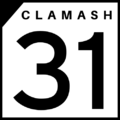
Clamash State Highway Shield for State Highway 31, the longest state route in Clamash.

The Sunsetter is a passenger rail service in west FSA. The main stations in Clamash are located in Wahanta, Cook Springs, Dunlap, Saunebago, and Gantiac. Freight rail lines cross the state connecting The Lakes Region with the Port of Wahanta and the port in Jundah, Tauhon.
There are four commercial airports in Clamash: Wahanta-Clifford International Airport, Cook Springs Regional Airport, Saunebago Regional Airport and Dunlap Regional Airport.
Protected Areas
| Name | Location | Acreage | Information |
|---|---|---|---|
| Fort Walprove National Historic Site | Wahanta | ||
| Hurricane Caverns National Park | Sundan |
| Name | Location | Acreage | Information |
|---|---|---|---|
| Basin State Park | Basin | ||
| Clamash Bluffs State Park | Tauhon City | ||
| Confuence State Park | Confluence | ||
| Floyd Lake State Park | Marcher | ||
| Henry Sturholdt State Park | Wahanta | ||
| Indigo Canyon State Park | Indigo Rapids | unmapped | |
| Lake Spalding State Park | West Gahaha | ||
| Old Limey State Park | Humor Springs | ||
| Poison Ivy Falls State Park | Granit | ||
| Sundan State Park | Sundan | ||
| Tall Pine State Park | Thorbecke |
| Name | Location | Acreage | Information |
|---|---|---|---|
| Arborland Reservoir State Recreation Area | Elmland | ||
| Chadman State Recreation Area | Chadman | ||
| Chalmers Reservoir State Recreation Area | Quitman | ||
| Covered Wagon Lake State Recreation Area | Campbell | ||
| Crab Beach State Recreation Area | Dayport | ||
| Fawn Creek Reservoir State Recration Area | Normsfield | ||
| Grebe Lake State Recreation Area | Vesper | ||
| Henrietta River State Recreation Area | Rushram | ||
| Lake Louisa State Recreation Area | Louisa | ||
| Rubicue Lake State Recreation Area | Taylin | ||
| South Bay Beach State Recreation Area | South Bay | ||
| Strawes Reservoir State Recreation Area | Mimrose | ||
| Tekbota State Recreation Area | Tekbota | ||
| Tenn Butte State Recreation Area | Tenn Butte |
| Name | Location | Acreage | Information |
|---|---|---|---|
| Gilbert State Forest | |||
| Limestone Hills State Forest | |||
| Lumquah State Forest | |||
| McFranklin State Forest | |||
| San Ramon State Forest | |||
| Verde Rivers State Forest |
| Name | Location | Acreage | Information |
|---|---|---|---|
| Black Feather Hill State Historical Park | Kotzbauer | ||
| Castillo San Ramon Oeste State Historical Park | San Ramon | unmapped | |
| Debock Farm Fossil Beds State Historical Park | Franzer | ||
| Fort Hunderstatt State Historical Park | Fort Hunderstatt | ||
| Kilby Mine State Historical Park | Stakesville | ||
| Toleka Point State Historical Park | Toleka |
| States | Alcortez • |
|---|---|
| Capital District | Huntington(c) |
| Overseas Territories | |