Collab:Federal States/Transportation
This page provides information for mapping highways in AR120.
Summary
The Federal States Defense and Commerce Motorway Network is a nationwide system of motorways within the Federal States of Archanta. These high-speed, limited-access roads connect all regions and most states from coast to coast and border to border. The network, which includes both free motorways and tolled motorways, is mapped using the FS-xx labels, with FS-xx (TOLL) used for tolled motorways. Odd-numbered routes run north-south, starting with Motorway 1 in the east and Motorway 99 in the west, with primary routes generally ending in "1". Even-numbered routes run east-west, starting with Motorway 2 (theoretically) in the south and Motorway 98 in the north, with primary routes generally ending in "0". Bypass routes through or around cities are three-digit routes where the last two digits are the same as the "parent" route; spur routes (that connect only once to the motorway network) are generally not considered part of the motorway system and should be labeled as state routes.
The Motorway Network
After extensive, protracted discussions in the AR120 forums, the FSA coordinator was tasked with establishing a unified numbering system for the network. As part of this process, the FSA coordinator created a basic network map of priority corridors based on existing, planned, and possible future urban areas within the FSA, with additional considerations for geographic constraints and network coverage. From there, based on discussions in the forums and proposals submitted, the following numbering scheme was established.
Rules
Major Routes
- Even-numbered routes generally run east-west, and generally increase from south to north; odd-numbered routes generally run north-south, and generally increase from east to west.
- This system was chosen based on the overall assumption that the FSA generally grew from southeast to northwest.
- Primary routes end in 0 (east-west) or 1 (north-south).
- This system was chosen to be logical and somewhat intuitive, but also to be different from the U.S. Interstate system.
- Each state is solely responsible for the routings of their highway numbers.
- Routes shown as concurrent in the system map below are not required to be assigned to the same highway if a parallel highway exists.
- Coordination is encouraged between the mappers in the metropolitan Stanton area (New Carnaby, Penquisset, Delenshire Islands) to determine routings and terminus locations.
- Since the metropolitan Stanton area is large, complex, and relatively well-mapped in regards to highways, mappers in this area will have more control over routings and labeling.
- States may elect to change the terminus of a primary route provided a direct connection is still available to the designated terminus.
- Example 1: A route with a terminal city short of a national boundary may be extended to the boundary, or may otherwise be extended beyond the terminal city provided the route does not leave the state.
- Example 2: If two routes run concurrent to a city that is the terminus of the routes, that route may be truncated to where the concurrency would begin.
- All 2-digit routes must connect at least three states or travel at least 400 miles, whichever is less restrictive.
- This encourages coordination, and reduces the likelihood of a situation where the FSA "runs out" of numbers.
- This map is not absolute. Neighboring states are encouraged to coordinate routings based on geography, built infrastructure, and other constraints.
- For non-primary routes, states are permitted to use any available highway number that fits in the overall numbering scheme and satisfies the rest of these rules.
- All states must agree to the overall route concept. When a general route is chosen, stateowners should contact the FSA coordinator, who will assign an available route number from the table below.
- Exceptions to the numbering scheme, or a special request for a particular route number, may be permitted with the approval of the FSA coordinator.
Bypass Routes
- Bypass routes are permitted and may be numbered by individual states.
- Bypass numbers do not require FSA Coordinator approval.
- To number a bypass route, add a digit to the left of the "parent" route (e.g., Highway 211 is a spur route of Highway 11).
- This was chosen based on how route numbers tend to be pronounced: "Highway eleven has a spur route of Highway two-eleven" or "Highway fifty has a spur route of Highway two-fifty". Adding the supplemental digit to the end of the major route number leads to confusion, especially for single-digit highways (Highway 12 being a spur of Highway 1 would lead to confusion; Highway 012 being a spur of Highway 1 would be awkward to pronounce), pronounciation ("Highway eleven has a spur route of Highway eleven-two" or "Highway eleven has a spur route of Highway one-twelve" or "Highway eleven has a spur route of Highway one-hundred-twelve"), and potential misunderstandings ("Highway fifty has a spur route of Highway fifty-two").
- The same bypass route number is not permitted to be used more than once within a single state, unless a link between the two individual routes is planned as a future route, currently mapped as under construction, or if the link was abandoned/demolished in the past.
- States are encourage to map disruptions to highways, which adds realism (freeway revolts, decommissionings, budget restrictions, natural disasters, etc.)
- Bypass routes that cross state lines should have the same number, and states should coordinate with neighbors before mapping them.
- To avoid confusion, do not use the same spur route number as any other spur route within 300 miles/500 kilometers.
- ALL bypass routes MUST connect with at least two parent highways.
- Connecting with the same parent route twice is permitted.
- Connecting to another bypass route is permitted.
- Spur routes that do not reconnect with the national system should be labeled as state highways.
- Exception: spur routes that connect airports, seaports, ferries, or military installations are permitted to be labeled as FS-xxx motorways.
Exceptions
Some motorways "break" the numbering grid based on their alignments. Exceptions are permitted on a case-by-case basis, but should generally be avoided wherever possible.
- Motorway 1, one of the historically earliest primary highways in the FSA (connecting Burton, Stanton, and Huntington) crosses Motorways 11 and 21.
- Motorway 15 crosses Motorways 11 and 21.
- Motorway 20 crosses Motorway 24 west of Lake City in Minnonigan.
- Motorway 22 runs south of Motorway 20 east of Cobbet, NC.
- Motorway 85 crosses Motorway 89 in northwestern Seneppi.
System Map
This map is for planning purposes only. Individual routings are the sole discretion of each state owner, provided the route serves the same general areas shown below. If you'd like to make a significant change to the route shown below, please contact the FSA coordinator. Decent-sized cities with at least some mapping are shown with red icons; these cities should be served by the primary routes shown. Known planned cities are shown with green icons; if the plan for your state changes or if there's a different city you'd wish to use on the map, feel free to correct or add it. Likely future city locations in future states are shown with black icons; these are purely theoretical and should not be assumed to be permanent locations of intersecting highways. Not all cities are shown, since intra-state routings are the sole responsibility of each individual state owner. This map shows primary routes only.
Loading map...
Table of Route Numbers
Locations noted with an asterisk (*) are outside the FSA; the motorway is expected to serve a port of entry with the neighboring country listed. States listed with a slash (XX/XX) indicate an alignment that will need coordination between the two listed states to determine which state should have the primary route. This does not preclude a bypass route in the other state. States listed in parenthesis are optional states in the corridor, based on motorway routing.
All available route numbers must be released by the FSA Coordinator before mapping. See Talk page for more details. Bypass routes (FS-xxx) do not require approval before mapping and should not be listed below.
Route relations include the southbound/westbound direction and are tagged with "type" = "route" + "route" = "road" + "ref" = "FS-XX".
| Route Number | Priority | Status | Major Cities | States | Notes | |
|---|---|---|---|---|---|---|
| 1 | Primary | Assigned | Burton - Standish - Stanton - Huntington | TI, PA, TH, OK, CR, NC, PQ, AG, WH, OL, NL, CP | Old Main Motorway | |
| 3 | Secondary | Available | ||||
| 5 | Secondary | Assigned | Hope Harbor - Standish | AS, OK | ||
| 7 | Secondary | Available | ||||
| 9 | Secondary | Available | ||||
| 11 | Primary | Assigned | Ardencia* - Vermouth - Stanton - Lafayette - Rivertown - Morsboro - Yorksey - Hazelboro - Unesia* | FL, AS, CR, NC, PQ, AG, WH, 05, NL, 21, 22, EY, LN, EU | East Coast Motorway | |
| 13 | Secondary | Assigned | Stanton - Waltmore - Chestnuts - Fulton - Ardencia* | NC, FL | ||
| 15 | Secondary | Assigned | Oceansborough - Yorksey - Randalia* | 24, LN, EU, 26 | Northeast Corridor | |
| 17 | Secondary | Available | ||||
| 19 | Secondary | Available | ||||
| 21 | Primary | Assigned | Otisport - Saint Jacobs - Huntington - New Annshire - Unesia* | FL, NC, GL, CP, 28, 27, 26, EU | Inland Bypass Motorway | |
| 23 | Secondary | Available | ||||
| 25 | Secondary | Available | ||||
| 27 | Secondary | Available | ||||
| 29 | Secondary | Available | ||||
| 31 | Primary | Assigned | Ardencia* - Meyersburg - Saint Jacobs | FL, NC, GL | East Face Motorway | |
| 33 | Secondary | Available | ||||
| 35 | Secondary | Assigned | Waitesfield - Stelfeld | MC | Approved to create FS-60 gap through East Massodeya and Michisaukee | |
| 37 | Secondary | Assigned | Odrickville - Ardencia* | FL | ||
| 39 | Secondary | Available | ||||
| 41 | Primary | Assigned | Ardencia* - Creadingsfield - Madawan - Massodeya City - Randalia* | 37, NP, 35, GN, MC, EM | West Face Motorway | |
| 43 | Secondary | Available | ||||
| 45 | Secondary | Reserved | 37, GN, WM | Reserved for future use | ||
| 47 | Secondary | Available | ||||
| 49 | Secondary | Available | ||||
| 51 | Primary | Planned | Ardencia* - Cape Chardonnay - Austinburg - Minneuka | 56, 37, NP, 35, GN, (ME) | Preliminary corridor planning underway | |
| 53 | Secondary | Available | ||||
| 55 | Secondary | Assigned | Ardencia* - Ramani - Kennsville - Atkinsville - South Minneuka - Andreapolis | 56, 59, NP, 35, GN, WM, AL | ||
| 57 | Secondary | Available | ||||
| 59 | Secondary | Assigned | Lee - Lemmington - Beckford | 59 | ||
| 61 | Primary | Assigned | Ardencia* - Ohunkagan - Harmegido - Minneuka - Thinis - Andreapolis | MK, MI, 44, ME, OQ, TJ, AL | Alormen River Valley Motorway | |
| 63 | Secondary | Available | ||||
| 65 | Secondary | Available | ||||
| 67 | Secondary | Available | ||||
| 69 | Secondary | Available | ||||
| 71 | Primary | Assigned | Ardencia* - Marksville - Tokatawoape - Des Nonnes - Saint Joseph - Apricity - Alamar - San Pascual - Pavonearse* | MK, MI, 44, ME, OQ, TJ, AL | Central Plains Corridor | |
| 73 | Secondary | Available | ||||
| 75 | Secondary | Assigned | Playa Gomez/El Rayo - Silverdale/Gainesboro - Swansonville - Kirkaldy/Chottane - Eriksburg - Nordseehaven | 73, AW, RI, TE, OT | ||
| 77 | Secondary | Available | ||||
| 79 | Secondary | Available | ||||
| 81 | Primary | Assigned | Ardencia* - Ste. Margaux - Franklinsburgh - Wallawaukee - Pike - Gleason - Dennison | NI, SN, OT, TE, AQ, RI, SA | Southwest Corridor | |
| 83 | Secondary | Available | ||||
| 85 | Secondary | Assigned | Varnel (via FS-81) - Finch Hill - Gleason - Ingram Junction (via FS-91) | NI, SN, MN | ||
| 87 | Secondary | Available | ||||
| 89 | Secondary | Assigned | Barre Harbor - Gleason - Barstone/Nenova | MN, 47, AQ, TN | ||
| 91 | Primary | Assigned | Lake City - Thomasford - Ingram Junction - Wahanta - Jundah - Los Reyes | MN, WJ, CL, TA, AT, TM | West Coast Corridor | |
| 93 | Secondary | Assigned | Deodeca* (via FS-30) - Ondassagam - Thomasford - Ingram Junction | MN, WJ | ||
| 95 | Secondary | Available | ||||
| 97 | Secondary | Assigned | San Pietro - Inquisicion - Laurensville - Mojaca - Esperanza | AT, (BE), CO | Spur route to link with FS-99 in Santa Clarita also planned | |
| 99 | Primary | Assigned | Jundah (via FS-91) - San Faustina - Santa Clarita - Gallego Bay - Mojaca - Esperanza - Los Reyes | TA, AT, BE, CO, TM | Cosperica Coast Corridor |
| Route Number | Priority | Status | Major Cities | States | Notes |
|---|---|---|---|---|---|
| 2 | Secondary | Reserved | Reserved for future use | ||
| 4 | Secondary | Reserved | Reserved for east-west motorway in AR120-57 | ||
| 6 | Secondary | Reserved | Reserved for east-west motorway in AR120-56/59 | ||
| 8 | Secondary | Assigned | Deodeca* - Wychelle - Wytusky - Varnel - Marksville - Ohunkagan | MN, NI, 54, MK | Southlake Corridor |
| 10 | Primary | Assigned | Lee - Meyersburg - Newport - Hope Harbor - Wearhead - Burton | 59, 37, FL, AS, TI, PA | Southeast Corridor |
| 12 | Secondary | Available | |||
| 14 | Secondary | Assigned | Meyersburg - Chestnuts - Sadikady - Divinity's Grace | FL, NC, CR | |
| 16 | Secondary | Assigned | Ann'harbor - Hearthsbridge - Waltmore | OK, CR, NC | |
| 18 | Secondary | Assigned | Deodeca* - Thomasford - Lake City - Wallawaukee | MN, 53, 54 | |
| 20 | Primary | Assigned | Deodeca* - Barre Harbor - Lake City - Pike - Maquadena - Peiwachatt - Wasserstadt - Stanton - Newburyport - Warwick - Saint Renecene | MN, 53, OT, ZH, 51, 36, NC, AG, PQ, DI | Southern Transcon |
| 22 | Secondary | Assigned | Belleville - Ruidhall - Saint Jacobs | NC, AG, GL | |
| 24 | Secondary | Assigned | Wychelle - Lake City - Finch Hill - Eriksburg | NI, MN, 53, OT | |
| 26 | Secondary | Assigned | Eriksburg - Plainsburgh - New Harmony - FS-20 | OT, ZH, ME, 36 | |
| 28 | Secondary | Available | |||
| 30 | Primary | Assigned | Gleason - Donovan - Eriksburg - Twin Rocks - Saint Jacobs - Oleana | (MN), 47, OT, 44, ME, 35, GL, OL, | Central Transcon |
| 32 | Secondary | Assigned | Eriksburg - Fort Constable | OT, 44, ME | |
| 34 | Secondary | Available | |||
| 36 | Secondary | Reserved | Reserved for east-west motorway in Mennowa | ||
| 38 | Secondary | Available | |||
| 40 | Primary | Assigned | Nenova/Barstone - Des Nonnes - Minneuka - Massodeya City - Huntington (via FS-50 and FS-1) | (AQ), TE, ME, GN, EM, MC | Heartland Corridor |
| 42 | Secondary | Available | |||
| 44 | Secondary | Available | |||
| 46 | Secondary | Available | |||
| 48 | Secondary | Available | |||
| 50 | Primary | Assigned | Deodeca* - Wahanta - Saint Joseph - Thinis - Huntington - New Annshire - Morsboro | CL, RI, OQ, WM, EM, MC, WS, NA | Northern Transcon |
| 52 | Secondary | Available | |||
| 54 | Secondary | Available | |||
| 56 | Secondary | Available | |||
| 58 | Secondary | Available | |||
| 60 | Primary | Assigned | Jundah - Dennison - Silverdale - Apricity - Jericho - Shawcross | TA, SA, AW, TJ, AL, EM | Tauhon Pass Corridor |
| 62 | Secondary | Available | |||
| 64 | Secondary | Available | |||
| 66 | Secondary | Available | |||
| 68 | Secondary | Available | |||
| 70 | Primary | Assigned | Randalia* - Unesia* | 26, EU | Transnational Corridor |
| 72 | Secondary | Available | |||
| 74 | Secondary | Available | |||
| 76 | Secondary | Available | |||
| 78 | Secondary | Available | |||
| 80 | Primary | Assigned | Dennison - Alamar | SA, 73, AL | Northeast Coast Corridor |
| 82 | Secondary | Available | |||
| 84 | Secondary | Available | |||
| 86 | Secondary | Available | |||
| 88 | Secondary | Available | |||
| 90 | Primary | Assigned | Esperanza - Sasepcro - Los Reyes - Scottsboro - Puerto Eloisa - San Pascual | CO, TM, CD, 74, 73, AL | Northwest Coast Corridor |
| 92 | Secondary | Available | |||
| 94 | Secondary | Available | |||
| 96 | Secondary | Available | |||
| 98 | Secondary | Available |
Development
A full archive of the discussions and voting regarding the motorway system is available at Collab:Federal States/Archive#Highways.
Shield Design

Other Highways
Motor Trails
In addition to the national motorway network, an informal network of older, lower-speed highways also exist in the Federal States. These Motor Trails are not planned on a national basis, but rather through direct coordination among the various states. As such, this chart is not moderated, and mappers should coordinate with other states regarding naming, shield design, routings, etc. before posting here. Space to collaborate is available on the Discussion page. While motor trail names will likely appear in various locations throughout the map (for instance, as the existing name of a primary street through a small town), modern motor trails may not be readily apparent on the map due to bypasses, replacements by motorways, or other disruptions in the network. Motor trails should be mapped as relations for future wiki mini-map purposes.
Since the Federal States do not have an official national network of primary highways (see above sections regarding motorway development conversations), motor trails should be named (e.g., "Old Main Highway") rather than numbered. However, some motor trails will also likely be part of state highway networks and may carry state highway numbers in each state.
| Name | Shield design | Northern or western terminus | Southern or eastern terminus | States served | Major cities served | Notes |
|---|---|---|---|---|---|---|
| Ingerish Post Highway | [In development] | Dunchurch, Arghenna | Stanton, New Carnaby | Arghenna, Penquisset, New Carnaby | Dunchurch, Newburyport, Stanton | Old Stanton - Newburyport - Dunchurch Postal Route |
| Oceanic Highway | [In development] | Cape Stockton, Olselen | Delenham, Delenshire Islands | Olselen, Whitestone, Arghenna, Penquisset, Delenshire Islands | Cape, Stockton Fairfax, Ardentic Beach, Whaleburyport, Delenham | |
| Northeast Highway | [In development] | (Randalia Border) | Bonnaventure, Boscainifornio | Boscainifornio, Arlington, (Laine)?, (AR120-25)?, (AR120-26)? | Bonnaventure, Marlington Valley, etc..? | |
| Wallawaukee-Kirkadly Route | [In development] | Chottane/Kirkadly, Tennewa | Wallawaukee, Seneppi | Tennewa, Oronotia, Seneppi | Wallawaukee, Nordseehaven, Eriksburg [possible diversion], Chottane/Kirkadly | |
| Gleason Trace | 
|
Nenova, Aquilia | Lake City, Minnonigan | Minnonigan, Walkegan, Aquilia | Nenova, Gleason, Lake City | Largely bypassed by FS-89. |
| Fort Braxton Post Road | [In development] | Fort Braxton, Wahauja | Wallawaukee, Seneppi | Seneppi, Minnonigan, Wahauja | Wallawaukee, Finch Hill, Gleason, Fort Braxton |
Highway Mapping Standards by State
Eventually the FSA should have national standards; in the meantime, state mappers are encouraged to add their state to describe how they've been mapping their roadway networks.
| highway= | ||||||||
|---|---|---|---|---|---|---|---|---|
| State | motorway | trunk | primary | secondary | tertiary | unclassified | residential | service |
| F.S. motorways and state-level dual carriageway: grade separated and controlled access highways: Speed Limit 75 mph rural and 70 mph urban. | Major highways with dual carriageways: limited access: Speed Limit 65 mph rural and 45 mph urban. | Major highways. Typically two lanes in rural areas, may be divided by a median in urban areas: Speed Limit 60 mph rural and 35 mph urban. | Minor highways. Typically two lanes in rural areas, may be divided by a median in urban area: Speed Limit 60 mph rural and 35 mph urban. | Minor highways with single carriageway: Speed Limit 55 mph rural and 35 mph urban. | N.A. | Minor roads and streets: Speed Limit 50 mph rural and 25-30 mph in urban. | Private roads, service roads or alleys. | |
| Costa Dorada | Divided, multi-lane highways with no at-grade intersections. Access controlled with entrance and exit ramps. Speed limits generally set at 70 mph in urban areas and 80 mph in rural areas, with exceptions for congested and mountainous sections. | Multi-lane, divided highways with at-grade intersections. Speed limits ranging from 50 mph to 75 mph. | Major highways, generally with a single lane in each direction and no center divider. Also used for the most important urban thoroughfares. | Minor highways with a single lane in each direction and no center divider. Also used for major city streets. | Roads generally used to connect neighbourhoods with secondary and primary routes. | Minor roads often in rural or industrial areas. | Minor roads in neighbourhoods often connecting residential areas to higher capacity roads. | Private roads and access roads. |
| Template:Culpepper | F.S. motorways and state-level dual carriageway, grade separated, controlled access highways that otherwise meet federal motorway standards | Dual carriageway, high volume, high speed roads that do not meet federal motorway standards. They may have some at grade intersections and traffic lights. | Major arterial roads with higher capacity and speeds (up to 50mph) than secondary roads. | Arterial roads that are narrower with less capacity and lower speeds (up to 40mph). | Minor roads that act as arterials for neighborhoods and small settlements. | Unpaved gravel roads or rural roads | Low speed roads in neighborhoods | Private roads and access roads |
| Template:Elway | Multi-lane high speed highways. Usually, all the national ones crossing the state. | Major arterial highways with dual carriageways. Usually, all the state highways. | Minor arterial highways with dual carriageways. Usually, all the county highways. | Minor arterial roads with either dual or single carriageways, in a city or metropolitan area. | Minor roads with either dual or single carriageway in a city or town. | Not in use in Elway roadway network | Rural roads with lower width and speed limits and less important city streets. | Private roads, access roads or alleys. |
| Template:Fellshire | All Federal States motorways, as well as other fully access controlled and grade separated dual-carriageways | Divided, partially access controlled parkways or bypasses of towns that only have a single carriageway | Major State Routes | Other State Routes, or roads of much local significance that aren't part of the State Route System. | State Routes of the least importance, as well as other roads of local significance. | N/A | Rural roads with lower width and speed limits, as well as neighborhood roads and less important city streets. | Low-speed access roads and alleys. |
| Template:Gnaerey | Controlled Access Highways, including all FS routes, designated FS-000 or GY-000 (FS) | Mostly Controlled Access Highways, open to all traffic, usually sections of other routes, keeping the designation of that category | State Roads, connecting counties, or connections between those routes, usually designated without letter suffix | State or County Roads, connecting locations within a county, usually designated with the respective county's letter suffix | County Roads, connecting locations to higher order roads, usually designated with the respective county's letter suffix | Local roads, not intended but open for thru-traffic | Local routes, generally not suitable for thru-traffic | |
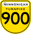
| Fully access-controlled with full grade separation from railroads and other roads. Includes the F.S. Motorway network, freeway portions of the Minnonigan 900-series expressway system, and other fully access-controlled facilities. Interchanges are numbered based on mileage, increasing from the southern or eastern terminus within the state of Minnonigan. | In rural areas, divided high-speed highways with limited access from cross-streets. Some major intersections may be grade-separated. In urban areas, generally denotes a high-volume, high-speed (above 50mph) roadway with six lanes or more that may or may not have a median. | In rural areas, high-speed two-lane roads with full access to and from most cross-streets. In suburban and urban areas, generally denotes a high-volume roadway with four-to-six lanes with speed limits generally between 35mph and 50mph. | In rural areas, similar two-lane cross-section as primary roads, but with lower volumes of traffic. In suburban and urban areas, generally denotes a mid- to high-volume roadway with two-to-four lanes with speed limits generally below 35mph. | Urban and suburban collector roads to connect neighborhoods to higher-speed roadways. Generally two lanes with speed limits below 35mph. Rarely used in rural areas. | Indicates a private or semi-private road off of the official state or municipal road networks, such as internal streets on college campuses, industrial facilities, or airports. | All other roads, generally serving properties immediately adjacent to the road and rarely used for through traffic. | Low-speed access roads and alleys. Also used for dedicated bus-only facilities in urban areas. | |
| Federally funded highways | State funded highways, most nearly motorway standard | Major Arterial Roads; All state routes in New Carnaby are either trunk or primary roads | Arterial roads; locally funded | Connecting and residential roads that carry high volumes of vehicles | Not used | Roads, usually non-through-ways, that serve residential communities | Privately owned (Public or Private sector) roads | |
| Template:Nishowigan | FS Routes. Dual-carriage, fully segregated roadways assigned to the state by the federal government. | Downgraded former FS-routes. | Significant arterial roads, often traversing State borders. | Arterial roads, often not traversing State borders. Often marking Concession lines. All fully-paved. | Roads often marking sideroad lines. Such roads might not be paved. | Not-paved, not significant rural roads not following a concession or sideroad lines. In cities and towns, all will mark two-way streets. | Smaller roads traversing communities or blocks. In cities and towns, all will be one-way streets. | Roads serving an individual location. |
| (Note: Classifications are not strict and based on OSM)
FS Motorways and other limited access freeways |
Major highways connecting large towns or covering large distances | Major commercial highways or important arterial roads | Medium commercial roads, major rural roads | Minor commerical or major residential streets | N.A. | All roads that don't fit other classifications | Alleys, Driveways, Parking, Access Roads, etc. | |
| Template:Olselen | F.S. motorways including spurs and auxiliary, and state-level dual carriageway: separated and controlled access highways: Speed Limit 65 In Urban Areas, 70 In Suburban Areas, 80 In Rural Areas. | Major arterial highways with dual carriageways. Speed Limit 55 in Rural Areas, 55 in Suburban Areas, 65 in Rural Areas | Primary roads , certain highways, state roads, and other city / town connectors. Speed Limits between 30-45 in Urban Areas 40-50 in Suburban Areas and 55-65 in Rural Areas | Medium traffic commercial roads and town connecting rural roads. Speed Limit 35-45 in Urban Areas, 45-50 in Suburban Areas, and 50-65 in Rural Areas | Medium sized roads primarily found in Urban and suburban areas. Connecting side roads to main roads. Speed Limit 30-40 in Urban areas, 40-50 in Suburban Areas 50-60 In Rural Areas | N/A | Residential roads usually found in Urban and Suburban areas with parking on one or both sides. Speed Limit 30-35 in Urban areas, 30-40 in Suburban Areas. If in Rural Areas 35-50 | Private roads |
| Federally funded highways | State funded highways | Major Arterial Roads; All Penquisset state routes are either trunk or primary roads | Arterial roads; locally funded | Connecting and residential roads that carry high volumes of vehicles | Not used | Roads, usually non-through-ways, that serve residential communities | Privately owned (Public or Private sector) roads | |
| Controlled access dual carriageways. Used only for FS-routes and spurs. | Not used | All state highways. Always at-grade and one lane in each direction apart from the Northern Turnpike, which is dual carriageway. | Intrastate route designations or major roads in cities. | Used for county roads/routes. Often paved roads, but can be partially or fully unpaved in high mountain areas. | Minor roads, largely unpaved. | Primarily residential roads, paved in most parts but can be unpaved in mountains. | Access, private or other minor roadways | |
| High-speed, fully access-controlled, divided, with at least two lanes in each direction. All FS Routes and certain primary state routes. | High-speed, limited-access (at-grade intersections), divided highways with at least two lanes in each direction. Part of primary state route system. | Major arterial routes typically connecting larger population areas. Usually part of primary state route system. | Minor arterial routes and routes connecting smaller towns. Usually part of primary state route system. | Low capacity minor routes that are lined and paved with at least one lane in each direction. Usually part of secondary state route system. | Paved or unpaved lower capacity roads through rural areas. Usually part of secondary state route system. | Paved lower capacity roads through urban areas. | Low speed private roads, access roads, or alleys. | |
Gallery of License Plates
- EY LicensePlate.png
- Olselen License Plate.png


Gallery of State Highway Shields
- EYstatehighway.png

Michisaukee (standard) 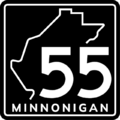
 Minnonigan (standard)
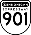 Minnonigan (expressway, free)
 Minnonigan (expressway, tolled)
 Minnonigan (motor trail)
- Olselen Road Sign .jpg
- Olselen Turnpike.jpg
Template:Olselen (Turnpike FS-1 / FS 11)

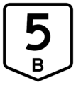
 Tempache (motorway)
 Tempache (secondary)
- TH shield.png
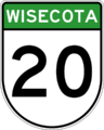
 Wisecota (primary)
 Wisecota (secondary)


| Collaborative Projects | States: Territories: Protectorates: |
|---|---|
| Natural Environment | National Parks • Natural features |
| Commerce | Franchises • Industries |
| Infrastructure | Government • Military • Transportation |
| Worldbuilding | History • Important persons • International relations • Non-governmental organizations • Sports • State profiles |
| Project Communication | Main project page • Discord (request access) • Federal States Forum (archive) • Newcomers Guide • Archives |