Index talk:Bodies of water
See also: OGF:2015 Naming Vote
Old discussion: not relevant anymore and numbers have changed as of the new map of April 2015
Please do not write in this topic anymore ! --Histor (talk) 09:21, 14 April 2015 (CEST)
Sea # 1 Norour Fjord? Firth of Norour? wangi (talk) 12:31, 6 August 2014 (CEST)
Sea # 2 In Dagelanden sea no. 2 is called "Grote Noordzee" (Great North Sea). But it could be called differently in other countries.
So now it is "Grote Noordzee". If "waa" want, this gulf can get too the similiar polnish name --10:14, 6 August 2014 (CEST)
- The name is really good! So Polish name will be Wielkie Morze Północne, what means exactly same as in English. Also, we can try to name these (2a, 2b?) two southern parts? Sea between Galicia and Dagelanden is called in Galicia Morze Glinickie (English name would be Glynian Sea). Any opinions? --Waa (talk) 11:48, 6 August 2014 (CEST)
- Why not "Glynian Sea" for the western part? And the eastern part? But let us hear the meaning of "Bhj867" for Dagelanden.--Histor (talk) 12:06, 6 August 2014 (CEST)
- name it what you want, i really don't care. When I made that list on the geography page I was just making an overall page for everyone to use to place geographical areas. I like the great North Sea, or the grote nordzee. It can have an English name and a polish name. It can be changed. It makes no difference to me. I really don't have a country up there, so I have very little stake in the physical name. You guys have fun :) Bhj867 (talk) 12:57, 6 August 2014 (CEST)
- Why not "Glynian Sea" for the western part? And the eastern part? But let us hear the meaning of "Bhj867" for Dagelanden.--Histor (talk) 12:06, 6 August 2014 (CEST)
O.k. - I think it is important, that all user here in the wiki used same name for the same item - namely the oceans and the parts of it. So I think, it is more then "fun". If someone writes over his own land or towns and so on, sure he can make his own thing. It is not to me, to give the names - that must be the opinion of the users, theyr land lay at the place. I am only the funny guy, to try to coordinate this. --Histor (talk) 13:12, 6 August 2014 (CEST)
- I am not trying to insult you friend. I am trying to be polite. Hold a vote. There is a serious lack of communication going on on this wiki. Not only that, but half of the people here don't even know where to go to have discussions, and most have been very lazy with their editing, many not editing at all. My opinion: the name the very northern ocean should be, "The Great North Sea" and the southern sea, "Glynian Sea." The two arms of the lower sea should have the SAME NAME for continence. If anybody wants to have their own name in their own language, FINE, as long as when they link the name it has an explination on their page, a "[ [Glynian Sea|examplename] ]" as the link name. That way when people click on it, they get a redirect to the international name. So far this is only an english wiki. So people should either brush up in their english, or start a separate wiki in their native language. Unfortunately English is the international business language at the moment and it should reflect that in our fictional world. Bhj867 (talk) 20:00, 6 August 2014 (CEST)
"I am trying to be polite." Always a good idea. I write here in english only because I am polite. So are sentence as "brush up your english" or so not very helpful. This is an english wiki only in a polite manner. The starter of the page are german-speaking (I too). I don't know, what is your natural language. If it is english, you then have an advantage. So I think, be fair with it.
You are right in this: some are lazy with her editing. So I try to make more structure in the names. My intention is, that we have in this wiki for "international" water-items always the same name. What name it is, is not my beer. But I think, we must have a place, where the discussion runs. This place here. You can see it at my list under the geographic names, that the english names stands at first and this should be the international. If you want do this work - why not? --Histor (talk) 20:35, 6 August 2014 (CEST)
- I think the problem in this discussion is that it is hard to give a sea an international name. Every country near the sea can give it a different name. So in Dagelanden the Great Rift Sound is called Grote Soen or in English Great Soen. This is also a problem on Earth. See for example the Sea of Japan/East Sea (of Korea). Personally I really don't mind what the article is called. So I am fine with Great Rift Sound instead of Great Soen. And the same for the Great North Sea, if anybody wants to give it a different international name.
- To find the right article using a local name, you can make the page 'Local name' containing only: #REDIRECT[[International name]]. It will redirect you to the international article. It did this with Grote Soen. In a case with a sea between to countries that give the sea a different name, you could make the article Name A/Name B (the slash can be used in a pagename) with Name A and Name B redirecting to the article.
- I like the name 'Glynian Sea' for the sea between Galicia and Dagelanden. I named it Soen Bay from a Dagelandic view, but Glynische Zee in Dagelandic sounds much better.
- And please don't make a fight about a fictional world. It should be fun :) KVh (talk) 21:14, 6 August 2014 (CEST)
As I know, it is not easy possible, to mark names of greater units in OpenStreetMap. So the same problem is in OpenGeoFiction. I try it in the "histor style", to name bays and so on. See near Latina Template:Coordslink. So I think it is helpful, to make in the geographic portal to each continent a map with the names. (see discussion at the portal). --Histor (talk) 13:28, 7 August 2014 (CEST)
Sea # 3 I'd like to request 'Awisuitok Sea' to fit with some of the place names around Sonela Gohi --Renal cow (talk) 05:59, 14 November 2014 (CET)
- For international use this name is a little bit too complicate, or? Other meanings? --Histor (talk) 14:16, 14 November 2014 (CET)
- It's an Inuit word for 'inseparable' indicating that it is iced over for most of the year. If you think it is too long, it could be shortened or bastardized (as many native names for places have been) to something like "Awisui," "Aswi," or "Suitok." If the idea is to have names with literal meanings, then I'd suggest "Still Sea," "patient sea," or "impassable sea" (in Inuit, the words "still" and "patient" are built off of the same roots as "inseparable"). --Renal cow (talk) 16:03, 22 November 2014 (CET)
Sea # 4 I declare the body of water east of Picard the Picard Sea --FBG (talk) 17:52, 19 November 2014 (CET)
Sea # 5 I'll propose the name 'Orinocan Sea', or 'Sea of Orinoco' at Sea # 5. (Boge)
Sea # 6 = Gulf of Axia is named "Gulf of Axia" because the states of Wiwaxia and Ataraxia --Histor (talk) 12:39, 8 August 2014 (CEST)
Sea # 7 Maybe "Sea of Mojaca" from the initials of the six neighboring countries? --Isleño (talk) 00:31, 9 August 2014 (CEST)
Sea # 8 Can I propose Tarephian Sea for this body of water, as more than half it's surrounding coastline is from that continent? Martograph (talk) 06:56, 13 September 2014 (GMT)
I propose Utewic Sea (Gaerman: Utewisches Meer). Just because it sounds nice... --Oxalia (talk) 18:58, 5 November 2014 (CET)
My proposal was for Tarethal Sea since its in between Tarephia and Uletha User: Ernestpcosby 3:33, 6 August 2015 (EST)
- Wow - 6th of August. Time-travelling? But o.k. - the next day I will collect the suggestions for this and other names nad draw a new overlook-map for this. --Histor (talk) 21:56, 6 April 2015 (CEST)
- Oops, I meant April :) User:Ernestpcosby 4:26 6 April 2015 (EST)
- Wow - 6th of August. Time-travelling? But o.k. - the next day I will collect the suggestions for this and other names nad draw a new overlook-map for this. --Histor (talk) 21:56, 6 April 2015 (CEST)
Sea # 9 = Great Whale Sea or Valian Sea (Sea of Thul should be # 17) The sea # 9 I give this name, because Thul is the only land at this bay with infrastructure and a harbour in Overgest --Histor (talk) 23:29, 8 August 2014 (CEST)
- Sea # 17 is the Sea of Thul. I propose something else for Sea # 9 - the Østermarkers call it the Valgårdshavet, the Whale Garden Sea, which is where they do much of their whaling. How about something like the Great Whale Sea? --Demuth (talk) 14:36, 24 January 2016 (CET)
Sea # 10 = Bahia Bergez Bight # 10 I give the name "Bahia Bergez", because this bight is the southcoast of my land Latina. --Histor (talk) 19:09, 5 August 2014 (CEST)
- Hi again - just so you know, in English "bight" is a very uncommon word (and it typically refers to an area of water bounded by a slightly curving coastline). The bodies of water numbered here we would normally call "seas" or "gulfs." (example) Hope that helps!
--Isleño (talk) 08:46, 6 August 2014 (CEST)
- There's no one-to-one match in English. Bay will be most common, but Gulf, Sea, Sound, Firth, Channel all used too. Bahia is Spanish or Portuguese, yeah? http://en.wikipedia.org/wiki/Template:Coastal_geography is good.
Hello wangi. Please write your name after your script (-- and four ~ as usul). Because there is latinian speaking area, it is "bahia". --Histor (talk) 11:39, 6 August 2014 (CEST)
Sea # 11 = Gulf of Archanta Gulf of Archanta? wangi (talk) 12:31, 6 August 2014 (CEST)
A body of water that large the East / West of something which isn't connected makes little sense surely? Gulf of Archanta sound much more natural. wangi (talk) 15:36, 7 August 2014 (CEST)
- Why you give waterplaces a name? In first line for shipping. So if you are in Archantia, it is a differnce, if your ship is in the "White Sea" (west of Mecyna) or in the "East Archantian Gulf" or "Gulf of Archanta" (East of Mecyna). So I think, there are two different names the better soloution. With "East" or without - let us hear Boge --Histor (talk) 18:43, 7 August 2014 (CEST)
- Thanks. It's worth looking at names we've got here... "North Sea" is a great example - it's only north of Germany and Netherlands, which form a small part of the southern shores. Naming's more about power & influence at a certain point in time. wangi (talk) 03:24, 8 August 2014 (CEST)
Sea # 12 = White Sea If # 11 is the East Archantian, so # 12 logically the West Archantian Gulf? --Histor (talk) 07:15, 7 August 2014 (CEST)
West Arcantian Gulf is good. I also suggested a name for the subcontinent north of this sea (http://opengeofiction.net/#map=6/-23.745/123.442), "Au" - see my comment at discussion under the continent of Archanta. So I was suggesting "Sea of Au" ("Mar de Au"). I'm new to all this... if people don't like this idea, no problem, just want to give a context for my country in this region.
Sea # 17 = Sea of Thul See Histor's note above at Sea # 9. --Demuth (talk) 14:36, 24 January 2016 (CET)
Central Ocean What about the Central Ocean? It certainly looks central when you see a full world map, but it must have been named long before people had access to complete geographic knowledge. Maybe something like the Calian Ocean (from Latin calidum = warm) or the Almian Ocean (from Latin alme = bountiful) or the Immian Ocean (from Latin immensa = immense)... --Isleño (talk) 08:53, 8 August 2014 (CEST)
- "Mare Medeterraneo" - the sea between the lands was early common name (or "mare nostrum"). So I think, in early times as the bronce age shipping around the coast (and to islands like Onnutu) was beginning to be usual. The peaple learn, that the coast of this ocean was a bow to south, if they follow the coasts of northern Tarephia, southern Uletha and western Archanta. And some brave may follow the straight way along the 10° North or so over the sea, to short up the way (so between Arabia and India, as Ibn Battuta wrote). That there are the imagine of the planet as a ball is old and degrees of longitude and latitude (see Eratostehenes). So I think, that early the people know, that this ocean is like a very great central pool - only in the south is no land. So people had given local names - sure - such as Calian or Immian. But geographers push "Central". So I think, this other names should be noted in the article over the Ocean and with redirects to the article. --Histor (talk) 10:29, 8 August 2014 (CEST)
- This isn't like the Mediterranean though. It's more like the Indian Ocean. I can't imagine European adventurers arriving at the exotic shores of Arabia or India and saying, "let's call this the Central Ocean." To them, it was the opposite of central. It was distant and foreign and full of mystery. --Isleño (talk) 12:06, 8 August 2014 (CEST)
Yes, it is a question of history. If we think, peoples of northwest Uletha haven given the name that could be "Gobrassy Ocean", because the Gobras peninsula is the next great land (so as India at the Indian Ocean). But this seemed me better to be a good name for the gulf north of Onnutu, or? --Histor (talk) 12:33, 8 August 2014 (CEST)
- Well I'm not sure Sea #7 actually borders the Gobras Peninsula... so I don't know, maybe "Sea of Mojaca" from the initials of the six neighboring countries? As for the ocean, it touches so many nations that it may be better to have a name which is not too specific in terms of geography or language, which is why I suggested some names that were short and fairly neutral sounding, but still a bit more interesting than Central. I'm sure people could come up with other ideas too if they wanted. --Isleño (talk) 13:21, 8 August 2014 (CEST)
- O.k. - let us hear more meanings. If there is a good suggestion, then let us change the name. But if one hangs on the other (maps, wiki-articles), this name of this central sea then should be common. What is your concrete suggestion of a name? Shall we wait til tomorrow (saturday) evening for other meanings? --Histor (talk) 13:33, 8 August 2014 (CEST)
- I'll leave it up to you to decide. How about "Solian Ocean" (after sol, the sun)? As for locator maps, ideally they should be wordless, like this or this, so that they do not need to be changed as often. --Isleño (talk) 00:31, 9 August 2014 (CEST)
location map
- I guess ideally it would be good to have equivalent to the "location map" template on Wikipedia? http://en.wikipedia.org/wiki/Wikipedia:WikiProject_Maps#Coordinate-referenced_map_templates /wangi (talk) 00:59, 9 August 2014 (CEST)
Indeed. But I think, it is not only done with maps, who shows, where a point is. In the geographic portal for the continents I think it is helpful to have overlook-maps. They must not so be, as they are now. And this map here in this discussion-article is generally only provisoric - only to show, of what is talken. --Histor (talk) 01:42, 9 August 2014 (CEST)
- Totally appreciate it's an aid to working just now. Anyway, the template on Wikipedia can show more than one point, indeed very powerful: http://en.wikipedia.org/wiki/Template:Location_map_many http://en.wikipedia.org/wiki/Template:Location_map%2B /wangi (talk) 12:21, 10 August 2014 (CEST)
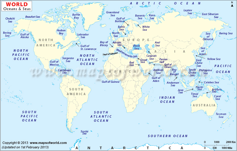
About map It wouldn't be better to have table with names of seas in article instead of map image? It would be easier to make edits in future. Also, you can add internal links to pages about these seas. I can help with making table like this. --Waa (talk) 11:57, 6 August 2014 (CEST)
- In the moment the thing is in work. If we get names for all bays and so on, then I think it is time to make an "offical" map and a table with links (or links in the map?), which shows all the names. Later then this "international" names not schould to be changed. --Histor (talk) 12:11, 6 August 2014 (CEST)
Ocean Currents
Hi, I'd like to do a similar thing with the ocean currents. I made a first attempt here: Ocean Circulation. I can put in labels based on the names here, but it'd be cooler if people come up with names tailored to their countries' histories :) --Renal cow (talk) 06:09, 14 November 2014 (CET)
Seas lapping Darcodia
Hi! How you can see, my country (Darcodia) has two seas: one (the western) that is connected to the second (the eastern) through a natural canal. Now: I think that they could be colled respectively Kaspen Sea and Darcodian Sea. Opinions? --Yiyi (talk) 14:13, 19 November 2014 (CET)
- Which part? --Histor (talk) 01:46, 16 April 2015 (CEST)
- What shall we call the channel connecting those seas? It's very important and should have a name. I propose that we divide it into two straits: first - Strait of Plenia and second - Strait of Lusi or Strait of Filangeri. What do you all think? --tule00 01:53, 23 February 2019 (CET)
Ocean at East of Archanta
Same as there is a "Western Ocean", there should be an "Eastern Ocean", East of Archanta. This is actually the same body of water as the Western Ocean - like the Pacific Ocean on Earth, it crosses the 180º Meridian. As this area is the first one to see the sun every day (assumming that OGC World works same as the Earth), I suggest calling this body of water: Eastern Ocean or Helios Sea. Helios is the God of the Sun.
Seas in Eastern Uletha
Sea nr. 30
Would it be possible to name sea nr. 30 (bordering the Northeastern Confederacy, UL052, Wyster, (Glaster), Latania, Neberly, and Jörmungand) Gulf/Bay of Hel (named after the town in southern Jörmungand/UL080)? I noticed however that its owner User Herickdaufenbauch hasn't mapped anything in the last six months. Would it be a risk to name a sea (or whatever else) after something related to particular countries whose owners (and therefore their shapes) may be subject to change? --Rasmus Rasmusson (talk) 14:03, 2 January 2016 (CET)
- I would rather like to give it a completely new name, unrelated to the nearby countries. Like "Cyan Sea", or "Starving Sea". Or to remember a well forgotten real-life name. E.g. it could be Axine Sea (after original Ancient Greek / Scythian name for the Black Sea; so old that even the classical sources don't use it.) Hellerick (talk) 06:48, 8 January 2016 (CET)
- (December 2017: Jörmungand is now Eelanti) What about the Emerald Sea? I decided that that will be the Wystrian name of sea nr 30 (Faer Moorg, in Wystrian); if others adopt (translations of) this name, it would match, but I won't be sad if they don't. --Rasmus Rasmusson (talk) 00:26, 8 December 2017 (CET)
- Since nobody added anything to this discussion for two years and one day :) , could we adopt Emerald Sea for this sea? --Rasmus Rasmusson (talk) 18:22, 25 July 2020 (CEST)
Sea # 34 'Scythian Sea'
Since the sea borders the Scythe of Uletha --Demuth (talk) 14:36, 24 January 2016 (CET)
Sea # 38
If Sound of Pa reference from the country of Pasundan-Padjadjaran, i disagree with this name, because Pa-an means land, so Pa-sunda-an means sundaland/land of sunda people and Pa-djadjar-an means djadjarland/land of djadjar people So i suggest the new name for sound of pa is Sound of Sunda --okiazr (talk) 14 April 2015
- I have a suggestion for Okiazr: that the name came from a misunderstanding of people in Wiwaxia, Ataraxie, etc of the Djadjaris and Sundanis (as has no doubt happened many times with many names) - and the Djadjaris and Sundanis call it the Sound of Sunda even if the "incorrect" name is the one that has unfortunately become the one that's used globally. I could write that into the Wiki article if you'd like! --Demuth (talk) 14:43, 20 July 2015 (CEST)
- Misunderstood happens many times in the realworld too. American Indians got their name from the european explorer who thougt that they landed on india, south asia, so when they met indigenous people of america they think they met indian people....
yess demuth offcourse you can write the article,i cant do it my self coz my limited in english... Okiazr (talk) 15:40, 20 July 2015 (CEST)
Sea # 39
I am hereby name the sea between Belphenia and Commonia as the Sea of Belphenia at Sea #39. BelpheniaProject (talk) 21:02, 13 April 2015 (CEST)
Central Western Antarephian Bay
So, if there's no objections, could bay #19 be called Narmouth Bay? Imhotep (talk) May 9, 2015
-+-+-+-+-+-+-+-+-+-+-+-+-+-+-+-+-+-
Hi, I've recently exchanged messages with Paxtar over naming bay #19 (that bordered that once was B'tuaga ,hence the change of topic to the more general Central Western Antarephian Bay) as we are currently the only two active mappers on its shores. To ease the discussion, a relation has been drawn and should be read as follows:
- Southern lines: possible southern limit of the Greater Bay
- Northern lines: possible northern limit of the Greater Bay and southern limit of the Lesser Bay
To give some non-European-based flavour to their names, we opted for the following Māori names:
- Greater Bay: Koropiko meaning to bow (as to bow one's head) or bend.
- Lesser Bay: Kōpere meaning a bow or arc.
Both refer to the shape of the bays but their etymology could be of course different in the OGF-world. The words were also chosen because their origin is less recognizable. Kopere could be in Slavish Europa (sounds like Slovenian Koper) and Koropiko could be a Inca site in Peru. The bays don't necessarily need to be qualified as bay or gulf as The Koropiko or The Kōpere with or without the article sound as good as The Kattegat in real world.
For variations on the names in different languages, Kopere could be transformed into "Kovere", "Govere", "Gover" or "Govel" with voicing some or all of the consonants, or leaving the syllable after the stress as Old French did with Latin words. The same goes with Koropiko that could easily be "Coropique" in Franquese or "Koropik" in Gaerman.
What would you say on this topic? --Aiki (talk) 20:49, 28 June 2017 (CEST)
Waters around Calliesano
If approved, I've been calling sea #44 Alliterzei (Ingerlish: Sea of Alliter [Aw-lih-ter]) and the channel connecting #44 and #45 Chaene di Mayar (Ingerlish: Mayar [My-are] Channel)
I suggest the name of the sea #45 with "south andalaz sea" ,coz its located southern of andalaz prime island...Okiazr (talk) 10:57, 20 July 2015 (CEST)
2015 voting for naming the new continents and oceans
Details can be found at: OGF:2015 Naming Vote.
Names for Seas and Bays arround Mergany (east of the Darcodian Sea)
Hi, I propose names for some unnamed seas in Uletha, east region of the Darcodian Sea, around Mergany.
33 = Gulf of Volta
64 = Strait of Madrin
South of 64 there's another strait on my territory, I called it Strait of Chünmen.
Does everybody agree? --Mstr (talk) 12:20, 2 January 2016 (CET)
- No
- What is that for a silly play with the german names? 1) Nümchen is München and 2) München lays not at the sea. So this name is no acceptable name for a shipping-strait. (You can answer in german, if you want)
- And please singn your text with two - and four ~ as usual in a wiki
--Histor (talk) 13:47, 2 January 2016 (CET)
- The fact that real world München is not a coastal town doesn't affect fictional Nümchen's situation, I think (Mergany as a whole is surrounded by much more sea than Germany), but I agree with Histor's remark on the name plays on real world Germany. I understand the fun of changing consonants and/or vowels in words and I've seen similar fictional countries before outside OGF (even created a few myself), but I fear that after some time you'll find these names less funny and perhaps even boring. To avoid that you lose interest in elaborating your country, I would suggest that you change some names. I think that e.g. Nümchen, Yabern, Rüthingen, and even Mergany itself could be random enough to keep (so then the Strait of Nümchen - to keep this comment on-topic - would be acceptable i.m.o.), but e.g. Pheinland-Ralz, Bürttemwerg, and Vocklenburg-Merpommern sound somewhat over the top to me. --Rasmus Rasmusson (talk) 14:35, 2 January 2016 (CET)
- Hi, I'm sorry that the names of my cities are not approved by other users. I know where München and other German cities are located in real, but my intention was not to copy them.
- What's about the Gulf of Volta and Strait of Madrin (the question)?
- For me those two are OK, but see also my side question in my proposal below regarding sea nr. 30: since OGF participants may change (and with them their countries), the original names after which seas are named could disappear at one point; if that's no big problem, then Gulf of Volta and Strait of Madrin could be good - but the opinions of the users that have countries bordering those seas should weigh heavier than mine.
- As said regarding the names: Nümchen etc could pass as coincidental look-alikes, but with Pheinland-Ralz it's very obvious that they were based on the German originals, so other users may expect them to be copies of their real world originals. --Rasmus Rasmusson (talk) 15:49, 2 January 2016 (CET)
Name for sea nr. 30
Is it possible to name sea nr. 30 (bordering the Northeastern Confederacy, UL052, Wyster, (Glaster), Latania, Neberly, and Jörmungand) Gulf/Bay of Hel (named after the town in southern Jörmungand/UL080)? I noticed however that its owner User Herickdaufenbauch hasn't mapped anything in the last six months. Would it be a risk to name a sea (or whatever else) after something related to particular countries whose owners (and therefore their shapes) may be subject to change? --Rasmus Rasmusson (talk) 14:03, 2 January 2016 (CET)
- I would rather like to give it a completely new name, unrelated to the nearby countries. Like "Cyan Sea", or "Starving Sea". Or to remember a well forgotten real-life name. E.g. it could be Axine Sea (after original Ancient Greek / Scythian name for the Black Sea; so old that even the classical sources don't use it.) Hellerick (talk) 06:48, 8 January 2016 (CET)
- What about the Emerald Sea? I decided that that will be the Wystrian name of sea nr 30 (Faer Moorg, in Wystrian); if others adopt (translations of) this name, it would match, but I won't be sad if they don't. --Rasmus Rasmusson (talk) 00:26, 8 December 2017 (CET)
Naming question
Well, on my territory there's an mostly enclosed bay (which is so minor part of the ocean, that it's not even numbered on map shown on the page). Can I name it if it's only surrounded by my territory, and it's not possible for it to have borders with any other country? --Trabantemnaksiezyc (talk) 19:39, 12 April 2016 (CEST)
If you mean this bay, then I can't see any problem at all with you naming it - it is almost entirely enclosed by your country, as you say. Call it what you like - and of course in your country's language any part of the world can also be called anything you like. The only rule you should probably bear in mind is this one: 'Be original. Try to avoid using well-known place names, real or fictional.'--Udilugbuldigu (talk) 21:55, 12 April 2016 (CEST)
Suggestions for other names
- Sea no.41: Watamak Bay (after a state of Commonia near the bay)
- Sea no.42: West Commonian Sea (not named after West Commonia,but after the western half of Commonia)
- Sea no.43: Augieas Bay (after the West Commonian island close to the sea)
- Sea no.44: North Gwynian Bay
- Sea no.45: Gulf of Andalaz
New Map for Easier Searching (and Editing)
The old static map seemed difficult to edit, so I created the version below, which would be easier to add/delete names. I added everything that's listed on the current Names of Continents and Oceans page and then checked individual country pages to see if there had since been names determined for large bodies of water that weren't listed here, and added a few more. I stuck to major bodies of water that were either international or very large—not all of the hundreds of smaller bays, since the map would get very crowded (though I did add several straits which seemed like they'd be important to global shipping routes). Could we replace the static map with this version?
Also, does anyone know how/if it's possible to have different-colored markers? If so, I could add markers to major seas, gulfs, and bays that don't currently have names to make them easy to spot, similar to how the static map is structured. Also, no matter what coordinates I chose I couldn't get it the Ardentic to show up...any ideas as to why? -- LW (talk) 26 January 2018 (EST)
Loading map...
An incorrect filename "Marker-water-large.png" was provided for the marker icon.
An incorrect filename "Marker-water-large.png" was provided for the marker icon.
An incorrect filename "Marker-water-medium.png" was provided for the marker icon.
An incorrect filename "Marker-water-medium.png" was provided for the marker icon.
An incorrect filename "Marker-water-medium.png" was provided for the marker icon.
An incorrect filename "Marker-water-medium.png" was provided for the marker icon.
An incorrect filename "Marker-water-small.png" was provided for the marker icon.
An incorrect filename "Marker-water-medium.png" was provided for the marker icon.
An incorrect filename "Marker-water-medium.png" was provided for the marker icon.
An incorrect filename "Marker-water-small.png" was provided for the marker icon.
An incorrect filename "Marker-water-medium.png" was provided for the marker icon.
An incorrect filename "Marker-water-medium.png" was provided for the marker icon.
An incorrect filename "Marker-water-medium.png" was provided for the marker icon.
An incorrect filename "Marker-water-medium.png" was provided for the marker icon.
An incorrect filename "Marker-water-medium.png" was provided for the marker icon.
An incorrect filename "Marker-water-medium.png" was provided for the marker icon.
An incorrect filename "Marker-water-medium.png" was provided for the marker icon.
An incorrect filename "Marker-water-medium.png" was provided for the marker icon.
An incorrect filename "Marker-water-medium.png" was provided for the marker icon.
An incorrect filename "Marker-water-small.png" was provided for the marker icon.
An incorrect filename "Marker-water-large.png" was provided for the marker icon.
An incorrect filename "Marker-water-medium.png" was provided for the marker icon.
An incorrect filename "Marker-water-medium.png" was provided for the marker icon.
An incorrect filename "Marker-water-medium.png" was provided for the marker icon.
An incorrect filename "Marker-water-medium.png" was provided for the marker icon.
An incorrect filename "Marker-water-small.png" was provided for the marker icon.
An incorrect filename "Marker-water-medium.png" was provided for the marker icon.
An incorrect filename "Marker-water-medium.png" was provided for the marker icon.
An incorrect filename "Marker-water-medium.png" was provided for the marker icon.
An incorrect filename "Marker-water-medium.png" was provided for the marker icon.
An incorrect filename "Marker-water-medium.png" was provided for the marker icon.
An incorrect filename "Marker-water-medium.png" was provided for the marker icon.
An incorrect filename "Marker-water-medium.png" was provided for the marker icon.
An incorrect filename "Marker-water-medium.png" was provided for the marker icon.
An incorrect filename "Marker-water-medium.png" was provided for the marker icon.
An incorrect filename "Marker-water-medium.png" was provided for the marker icon.
An incorrect filename "Marker-water-medium.png" was provided for the marker icon.
An incorrect filename "Marker-water-medium.png" was provided for the marker icon.
An incorrect filename "Marker-water-medium.png" was provided for the marker icon.
An incorrect filename "Marker-water-medium.png" was provided for the marker icon.
An incorrect filename "Marker-water-small.png" was provided for the marker icon.
An incorrect filename "Marker-water-medium.png" was provided for the marker icon.
An incorrect filename "Marker-water-medium.png" was provided for the marker icon.
An incorrect filename "Marker-water-small.png" was provided for the marker icon.
An incorrect filename "Marker-water-small.png" was provided for the marker icon.
An incorrect filename "Marker-water-medium.png" was provided for the marker icon.
An incorrect filename "Marker-water-medium.png" was provided for the marker icon.
An incorrect filename "Marker-water-medium.png" was provided for the marker icon.
An incorrect filename "Marker-water-small.png" was provided for the marker icon.
An incorrect filename "Marker-water-small.png" was provided for the marker icon.
An incorrect filename "Marker-water-small.png" was provided for the marker icon.
An incorrect filename "Marker-water-small.png" was provided for the marker icon.
An incorrect filename "Marker-water-small.png" was provided for the marker icon.
An incorrect filename "Marker-water-small.png" was provided for the marker icon.
An incorrect filename "Marker-water-small.png" was provided for the marker icon.
An incorrect filename "Marker-water-small.png" was provided for the marker icon.
An incorrect filename "Marker-water-small.png" was provided for the marker icon.
An incorrect filename "Marker-water-small.png" was provided for the marker icon.
An incorrect filename "Marker-water-medium.png" was provided for the marker icon.
An incorrect filename "Marker-water-medium.png" was provided for the marker icon.
An incorrect filename "Marker-water-medium.png" was provided for the marker icon.
An incorrect filename "Marker-water-medium.png" was provided for the marker icon.
An incorrect filename "Marker-water-medium.png" was provided for the marker icon.
An incorrect filename "Marker-water-medium.png" was provided for the marker icon.
An incorrect filename "Marker-water-medium.png" was provided for the marker icon.
An incorrect filename "Marker-landnisland-small.png" was provided for the marker icon.
An incorrect filename "Marker-landnisland-small.png" was provided for the marker icon.
An incorrect filename "Marker-landnisland-small.png" was provided for the marker icon.
An incorrect filename "Marker-landnisland-small.png" was provided for the marker icon.
An incorrect filename "Marker-landnisland-small.png" was provided for the marker icon.
An incorrect filename "Marker-landnisland-small.png" was provided for the marker icon.
An incorrect filename "Marker-landnisland-small.png" was provided for the marker icon.
An incorrect filename "Marker-landnisland-small.png" was provided for the marker icon.
An incorrect filename "Marker-landnisland-small.png" was provided for the marker icon.
An incorrect filename "Marker-water-medium.png" was provided for the marker icon.
- This map is nice, but very confusing somehow. You can create your own markers. Maybe it is not the aim of this page to simply add/delete names? Only international bodies of water should be shown here. International means: e.g. areas with many neighboring countries or straits which connect large seas.--Mstr (talk) 18:02, 27 January 2018 (CET)
- Fixed your problem with the Ardentic - you used a slash instead of a comma. _zM (talk) 18:52, 27 January 2018 (CET)
- @Mstr - Feedback appreciated! Though I admit to some confusion about your comment. Right now only bodies of water like those you've described (international waters and key straits) are mapped, for the most part. There are a few exceptions: namely seas located completely within one country that are already included on the static map (i.e. the Sea of Orinoco), or are so huge that it seemed strange not to have them labeled (i.e. the Norðsþverganga in Norðurland). Which small seas outside of international areas should be removed? I'm happy to update!
- Also, I was thinking that the goal of the page make it easy to figure out the name of shared bodies of water if you are new to mapping in an area with established neighbors, not just to add/delete names (though ease of updating was a big motivator). It seems easier to me to click on a marker on the map and see the name (and link to a related wiki page) rather than find the number and scroll down to the list, since it eliminates the scrolling and searching parts and consolidates all of the info into one place (the map).
- @_zM - Oy, dumb mistake! Thank you! No idea how I missed that. LW (talk) 13:16, 27 January 2018 (EST)
- I've changed some markers to show that different sizes improve the map. You're right, at the moment there is only the old list replaced, but it is very common in the wiki that as soon as there's a map where you can add something very easily, everybody does so.--Mstr (talk) 19:36, 27 January 2018 (CET)
- OK, markers have been updated. I tried to create a new set specifically for this map but they didn't look quite right, so I went with existing markers, though if anyone with an eye for icon design wants to take a crack at something different I think they could still be tweaked to more clearly communicate what they're marking. LW (talk) 01:29, 28 January 2018 (EST)
You missed out 'Archanta Major' and 'Archanta Minor'.--Happy mapping and God bless, ZK (talk) 09:36, 28 January 2018 (CET)
- Thanks, added those in! Also worth noting: if the main page were updated with this map, I could also create lists of all of the major international bodies of water and landmasses hyperlinked to their respective pages, so that people could do a quick Ctrl+F search for place names, too. LW (talk) 10:35, 28 January 2018 (EST)
There are more regions and rivers stated on the page concerning Uletha.--Happy mapping and may God bless you, ZK (talk) 13:21, 2 February 2018 (CET)
- Should rivers be included? It seems like the original map was just focused on large bodies of water and major landmasses, but not rivers. I think that makes sense since rivers are much more likely to change over time as mappers revise, or leave and delete their old work, whereas big bays and seas and straits shared by multiple countries aren't likely to disappear. But if we can all agree what makes a river "major" (i.e. at least XX km in length and crossing through at least three countries) they could probably be added. --LW (talk) 12:09, 2 February 2018 (EST)
Peninsula with Peninsulas
Okay, so, I noticed that the stretch of land in Uletha that starts in Midistland is a peninsula, and a very large one at that. Does anybody here think it'd work to mark it on the map? Midine Peninsula might be a nice name.
- Yes, this peninsula should definitely have a name. I estimate that around 450 000 000 people live there. It could even be considered a subcontinent -- either way, it does need a name. --tule00 01:57, 23 February 2019 (CET)
Miotian Sea
I was wondering, now that I'm the only active user mapping at the Miotian Sea (with user Clik who I'm in full collaboration with) and that Miotia, a region of Ispelia, has officially moved to Eastern Uletha, could I rename the sea to something more.. Antharian? like Antharian Sea? I mean it would make sense because Hellanesians (Ancient Eganians) had to cross this sea to get from the Asperic Ocean to Antharia, a former Eganian oversea territory. --Stjur (talk • OGF) 19:50, 24 July 2018 (CEST)
- It isn't always a good idea to name the body of water after the existing country... Anyway something needs to be done. Maybe the sea has a characteristic feature like algas which gave it a specific color or something? User:Rustem Pasha/signature 20:20, 24 July 2018 (CEST)
- Well it's not a problem anymore as I'm the only user mapping at the Miotian Sea and as I have a fairly reasonable historical explanation for the name. And about the others who will come, well, as you see in this discussion, it's the "first comer" who is able to name a place the way he wants --Stjur (talk • OGF) 20:48, 24 July 2018 (CEST)
Name for the brace of water between Gwynian and the FSA and limits for the White Sea
Hi, owner of Adaria here. Early in my work here in the wiki, I was looking for the names given for the bodies of water around my area. I saw that Adaria was at least partially bathed by the waters of the White Sea, but the limits of it seem blurry. It is clear that the White Sea is the interior body of water that lies west of the Mecyna Isthmus, but some depict the White Sea to go as far west as being all the coast of southern Gwynian, the place which in this very article is called as the "Gwynian sea", with an alternate name calling it the White Sea as well.
As far as I know, the White sea is called this way in reference to Gwynian, which is also called "Blanquiana" in Castellanese, which would translate as "Whiteland". There are many ways for naming the bodies of water of the region, but I see three distinct landmasses; An outer sea, open to the Asperic Ocean to the west and south, which is tagged as the "Gwynian Sea" in the map; An inner sea between southern Archanta Major and eastern Gwynian, which is tagged as "White Sea", and a brace of water, joining both, that separates southern Adaria and the eastern coast of Ordania from the FSA, more concretely Cosperica. My proposal is to call the channel in between as the "Gwynian Channel". That's the way I call it from Adaria to differentiate the eastern from the southern coast. However, this is still open to additional namings, specially from the FSA side. If I don't see any signifficant backlash or other suggestion, I'm gonna add it on the map on the next day or two. --Martinawa (talk) 16:58, 17 October 2018 (CEST)