Weekly site maintenance is scheduled Thursday 04:00–06:00 UTC.
Editing will not be possible during this time, and there may be other brief disruptions. (additional info)
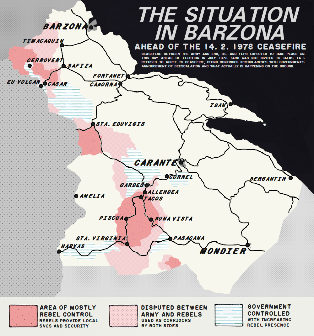
File:Barzona conflict map 1978.png
Jump to navigation
Jump to search
Size of this preview: 559 × 599 pixels. Other resolution: 1,000 × 1,072 pixels.
Original file (1,000 × 1,072 pixels, file size: 380 KB, MIME type: image/png)
Summary
Map of Barzona conflict in 1978. My own design.
| This image is licensed under the Creative Commons Attribution-NonCommercial-ShareAlike License |
File history
Click on a date/time to view the file as it appeared at that time.
| Date/Time | Thumbnail | Dimensions | User | Comment | |
|---|---|---|---|---|---|
| current | 08:24, 9 May 2022 | | 1,000 × 1,072 (380 KB) | Brunanter (talk | contribs) | Map of Barzona conflict in 1978. My own design. Category:BarzonaCategory:Historical maps |
You cannot overwrite this file.
File usage
The following page uses this file: