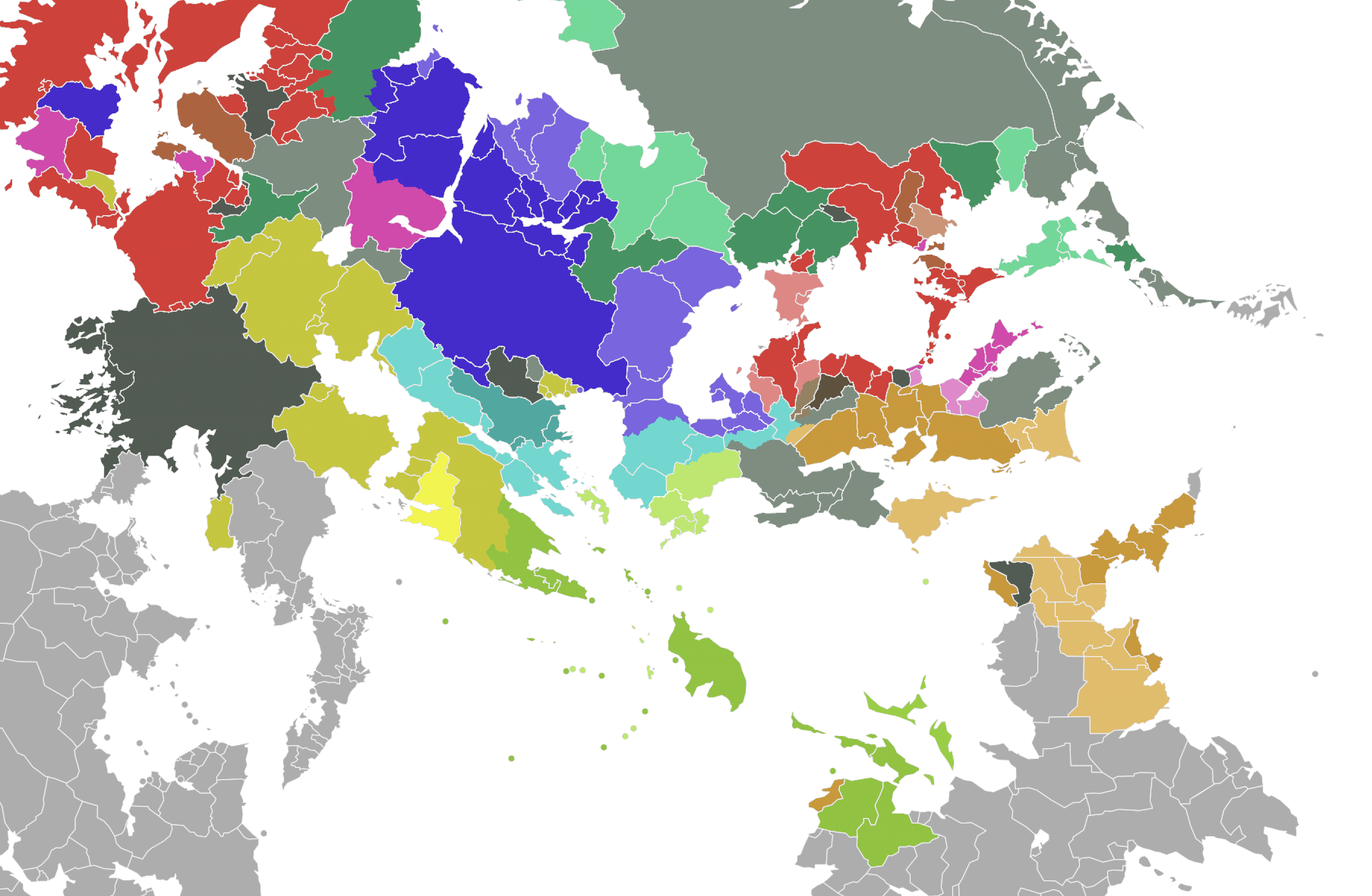
File:East uletha culture proposal.png
Jump to navigation
Jump to search
Size of this preview: 800 × 523 pixels. Other resolution: 2,710 × 1,770 pixels.
Original file (2,710 × 1,770 pixels, file size: 1.38 MB, MIME type: image/png)
Summary
Own work based on the SVG map template created by User:Timboh.
The darker shade represents the cultures/languages of countries that currently exist on the map, whereas the lighter shade represents the proposed culture for currently unoccupied/inactive territories.
Slavic
West Asian (Turkic, Persian, etc.)
Romance
Germanic
Austronesian/Tai
East Asian/Sino-Tibetan
English
Finnic / "Balto-Uralic"
Celtic
Conlang – Semanish
Isolate or Conlang
New ideas (introducing real-world language families with no current representation on the map, conlangs, expanding surrounding ethnolinguistic "neighborhoods", etc.)
Licensing
| This map is a derivative of the OpenGeofiction base map, which is licensed under the Creative Commons Attribution-NonCommercial-ShareAlike License and is released under the same license. |
File history
Click on a date/time to view the file as it appeared at that time.
| Date/Time | Thumbnail | Dimensions | User | Comment | |
|---|---|---|---|---|---|
| current | 02:56, 27 June 2022 | | 2,710 × 1,770 (1.38 MB) | Geoboi (talk | contribs) | |
| 00:33, 27 June 2022 | Error creating thumbnail: File missing | 2,694 × 1,804 (1.33 MB) | Geoboi (talk | contribs) | Own work based on the SVG map template created by User:Timboh. |
You cannot overwrite this file.
File usage
The following page uses this file: