File:FS-1-2 Plan.png
Size of this preview: 800 × 586 pixels. Other resolution: 1,611 × 1,181 pixels.
Original file (1,611 × 1,181 pixels, file size: 1.51 MB, MIME type: image/png)
Summary
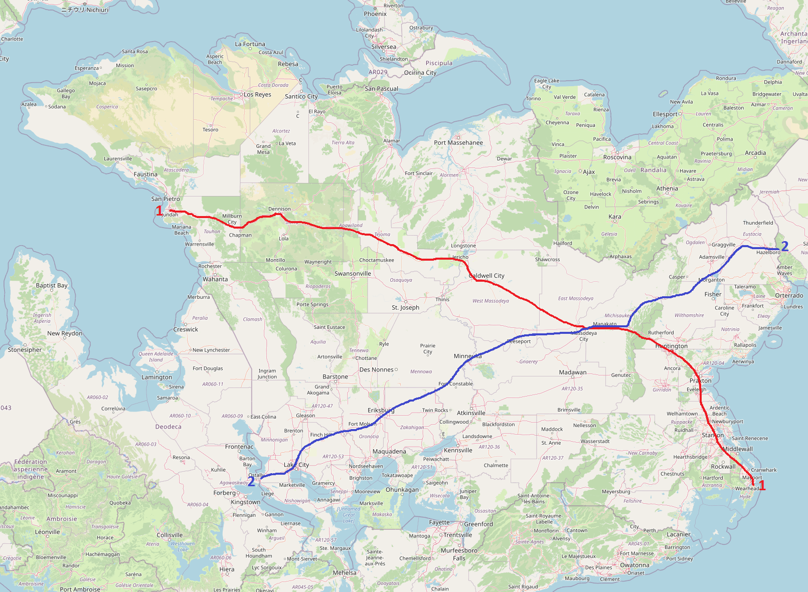
Concept plan for the "original" two major cross-country FSA motorways, FS-1 (partially extant, southeast of Huntington) and FS-2 (proposed).
Licensing
| This map is a derivative of the OpenGeofiction base map, which is licensed under the Creative Commons Attribution-NonCommercial-ShareAlike License and is released under the same license. |
File history
Click on a date/time to view the file as it appeared at that time.
| Date/Time | Thumbnail | Dimensions | User | Comment | |
|---|---|---|---|---|---|
| current | 22:05, 7 July 2022 | | 1,611 × 1,181 (1.51 MB) | TheMayor (talk | contribs) | Concept plan for the "original" two major cross-country FSA motorways, FS-1 (partially extant, southeast of Huntington) and FS-2 (proposed). Category:Federal States |
You cannot overwrite this file.
File usage
The following page uses this file: