File:West Uletha Sectors map.png

Size of this preview: 600 × 600 pixels. Other resolutions: 2,049 × 2,048 pixels | 2,725 × 2,724 pixels.
Original file (2,725 × 2,724 pixels, file size: 885 KB, MIME type: image/png)
Summary
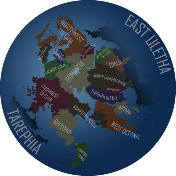
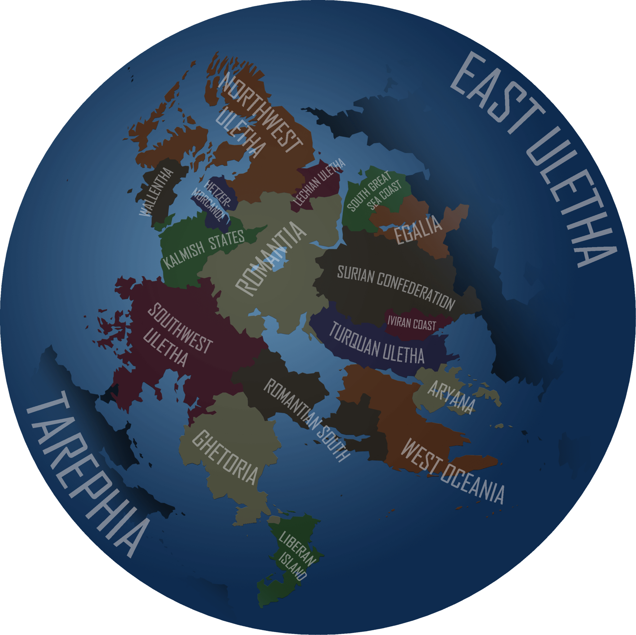
West Uletha sectors map, created by User:Stjur from trace of OGF map data.
Licensing
| This image is licensed under the Creative Commons Attribution-NonCommercial-ShareAlike License |
File history
Click on a date/time to view the file as it appeared at that time.
| Date/Time | Thumbnail | Dimensions | User | Comment | |
|---|---|---|---|---|---|
| current | 18:48, 28 August 2021 | | 2,725 × 2,724 (885 KB) | Alessa (talk | contribs) | West Uletha sectors map, created by User:Stjur from trace of OGF map data. |
You cannot overwrite this file.
File usage
The following page uses this file: