Forum:North Archanta - free to edit blue territories/Kshang, Rhododactylia, contour work: Difference between revisions
Jump to navigation
Jump to search
m ({{unsigned}}) |
No edit summary |
||
| Line 11: | Line 11: | ||
: Looks good, but I think you've got the rivers running in reverse! /[[User:Wangi|wangi]] ([[User talk:Wangi|talk]]) 09:26, 3 March 2023 (UTC) | : Looks good, but I think you've got the rivers running in reverse! /[[User:Wangi|wangi]] ([[User talk:Wangi|talk]]) 09:26, 3 March 2023 (UTC) | ||
:: Actually that's a weird convention of mine on my contour maps - the "rivers" are "thalweg contours" - they are broken at each contour line they cross as they climb the valleys, and have an interpolated ele=X value. For whatever reason, I developed a convention that I draw the thalwegs in the uphill direction. It's arbitrary, and the contour conversion program doesn't care about direction. But I'm very consistent about it. They are *not* rivers, to be clear. Relative to any rivers drawn on the OGF map, they are redundant mapping maintained in the osm-squares. But also note they are valley thalwegs, which might not actually parallel existing rivers in every instance - they have lower precision.--[[User:Luciano|Luciano]] ([[User talk:Luciano|talk]]) 13:02, 3 March 2023 (UTC) | |||
Revision as of 13:02, 3 March 2023
Forums → North Archanta - free to edit blue territories → North Archanta - free to edit blue territories/Kshang, Rhododactylia, contour work
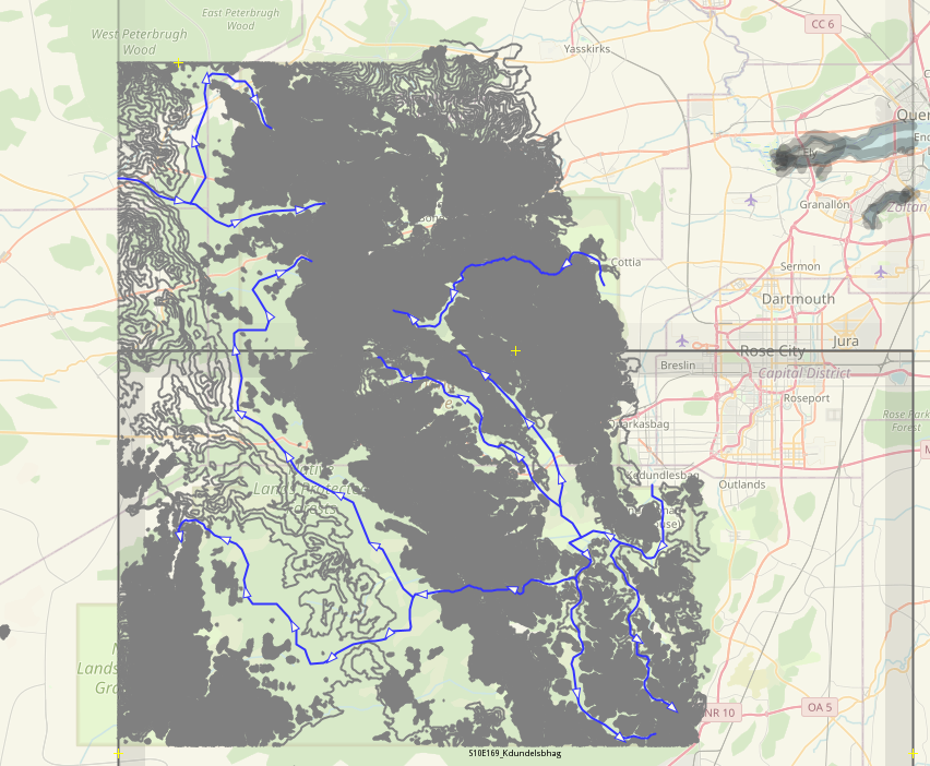
I have been working on a contour area for the Kshang Native Lands in Rhododactylia. I originally made the Kshang maybe 5 or 6 years ago, but I kind of dropped the project. Recently I decided that I will make contours.
To support new contours, I'll probably end up rearranging rivers and towns in the area.
If anyone has objections to this, let me know here. —Unsigned comment by Luciano (talk).
- Looks good, but I think you've got the rivers running in reverse! /wangi (talk) 09:26, 3 March 2023 (UTC)
- Actually that's a weird convention of mine on my contour maps - the "rivers" are "thalweg contours" - they are broken at each contour line they cross as they climb the valleys, and have an interpolated ele=X value. For whatever reason, I developed a convention that I draw the thalwegs in the uphill direction. It's arbitrary, and the contour conversion program doesn't care about direction. But I'm very consistent about it. They are *not* rivers, to be clear. Relative to any rivers drawn on the OGF map, they are redundant mapping maintained in the osm-squares. But also note they are valley thalwegs, which might not actually parallel existing rivers in every instance - they have lower precision.--Luciano (talk) 13:02, 3 March 2023 (UTC)
