Forum:Territory application/TA026c - Ta Seti
- Please fill in the information below to make a territory request.
| Territory ID and proposed name | |
|---|---|
| The Territory ID (from OpenGeofiction:Territories, e.g. AR123a) and proposed name of the country |
TA026c - Ta Seti
| Physical geography | |
|---|---|
| An overview of climate, topography and landscape of the country. It is advised to also create a sketch, you can add a link to this (hosted on imgur or similar) |
Most of the Ta Seti's territory contains scrubland and desert as currently is. It is expected that there is a medium elevation (not higher than 3000 meters), which is found in the intermediate zones and in the most distant zones of the expected country. It is planned to largely follow the existing geography, with major changes to ensure credibility and better quality. Feel free to watch our proposal for the river network in northern Tarephia here.
 | Human geography |
|---|---|
| A brief description of the territory demographics, economic development, land occupation, infrastructure and mapping style |
Details about the human geography of Ta Seti are as follows:
- Territory demographics. The coastal areas are expected to be more densely populated, with the area near the capital
(which will be located in the area where Haez is)with the largest population. The areas that are located further from the coast have a relatively smaller population and, of this group, it is concentrated near the river that flows towards the capital (https://opengeofiction.net/relation/330181). - Economic development. Historically, Ta Seti's economy is based on agriculture, livestock and the exchange of goods (trade); furthermore, in contrast to Ancient Egypt, there is an important fishing activity that takes place between the territories requested for the expected country. The country's infrastructure is relatively archaic and the most modern elements are only used on the coasts and more populated areas.
- Land occupation. As presented in the previous section, most of the territory will be covered with desert and semi-arid areas. The remaining territory will present a variety of landuses and ecosystems, until reaching more fertile areas on the coast (slightly suitable for more consistent agriculture).
- Infrastructure and mapping style. Ta Seti is expected to be similar to a modern version of Ancient Egypt, with minor elements coming from Mediterranean areas of the Middle East and Greece. The pyramids (mostly mausoleums/burial monuments) and characteristic Ancient Egyptian temples are expected to be well-present and preserved, as they would not have been abandoned or neglected.
| History & culture | |
|---|---|
| A brief description of the intended culture and language |
The language used is mostly a latinization of ancient Egyptian based on Budge's dictionary of 1920, with some added Punic and Greek vocabulary added whenever vocabulary in AE is non-existant. Also a genitive form was added for facility in name creation. It is expected to base the predominant culture of the territory on Ancient Egypt, with certain elements obtained from classical Greek and Punic; consequently, they are expected to have a similar historical chronology but altered to allow for the prevalence of the culture.
| Past mapping | |
|---|---|
| To support your request provide links to areas of OGF mapping which showcase your mapping skill. Mapping relevant to the requested theme & geography is especially useful | |
| The {{coord}} template can optionally be used to link to the OGF map - it results in a nice formatted link. Or you can paste in a URL. |
From Mapping Expert and Imperator:
 State of Costa Dorada, Federal States
- Former state of Trinity Island, Federal States (currently named Hyde, some minor changes were made by the new owner)
- Lentië mountain range
- Hertogswilt, Lentië
- Egyptian-styled settlement (Sirrhae)
- Imperium, the most important project of the Arhet community and a milestone in our mapping careers
- Magium (Magonia), the capital and largest city of Imperium
- Hypogeum (Necropolis), located near the Imperial City of Magium
- Mountain ranges in eastern Imperium (between Ecphoraea and Gargaphia)
- Vastia and Siccum deserts in southern Imperium (from Partagia to Atrocaea)
- Tiudunhaim, a project in the Arhet community inspired by the many duchies that existed in modern Germany
- Southwestern Aretia, a region fundamentally related to Imperium, including countries like Mandagora, Arpitania, Ecija, Tizona and Hircania, among others
- Natural mapping of Western Aretia, the main continent in the Arhet community
| Username & date | |
|---|---|
| Sign and date the application by typing four tildes like this: ~~~~ |
Mapping Expert (talk) 18:37, 4 December 2022 (UTC)
 | Discussion |
|---|---|
| Discussion for clarification & decision |
Just a minor note. As you probably know, TA031 (Sirrhae) is already Imperator's territory (previously known as Moskva), so our request is for an expansion, as stated in the title. If you have any additional questions, let us know. Mapping Expert (talk) 18:42, 4 December 2022 (UTC)
Hi,
While I can understand your plans are both ambitious and expansive, it seems overzealous to immediately then request for 5 territories to be merged; especially considering your pre-existing projects in mapping -- while Imperium's scale makes it hard to comment; Costa Dorada appears to be of a similar mapping style; an exciting focus on large-scale mapping with very little focus on detail. For this reason, I'm incredibly hesitant to provide an additional 4 territories to the both of you -- especially while there is already a territory which you are mapping in. Additionally, I raise my eyebrows at the "modern Egyptian" style inspirations you provided, and hope the Bolas horns from Amonkhet won't make an entrance on OGF... but I do applaud the overall ideas outlined, as for using a language based on ancient Egyptian, and making use of the overall outline of ancient Egyptian cities... but perhaps leave sphinxes, pyramids and generally the Egyptian pantheon out, except as forlorn monuments, as in modern Egypt.
Given the above, I not convinced there's any need to grant this request - I think what's being done in TA031 is a good start, but expanding the territory at this stage seems hasty and unnecessary. Much rather would I see the territory slowly grow over time, as the space is being filled with quality mapping. I'll mark Mapping Expert as a co-mapper in TA031. Taka (talk) 11:29, 8 December 2022 (UTC)
Hi Taka,
First of all, I want to thank you for taking your time to read our expansion request despite the delay for personal reasons, which I understand. However, I would like to make a few comments about your feedback on the application:
- I contemplated your concern about the number of territories requested. In fact, we were thinking of refocusing our request (as discussed on Discord) to TA026c and perhaps a slight expansion into other nearby territories. In any case, our decisions were based on the exponential development of the initiative, which was seen with good eyes by the OGF community.
- I differ with your point of view on the detail of our previous and current territories. We both believe that while there are some shortcomings, the work we have shown is quite detailed on different levels. The center of Magium is our best example of small-scale mapping, while the mountains and deserts of Imperium are the opposite example. Also, most of the examples of small-level detail within the OGF community are focused on certain areas, and not widely spread; however, the detail with which we have treated Costa Dorada, for example, is quite visible within OGF.
- As I mentioned in the application, the examples give an idea of what the mapping could look like within the territory. Something like the one-off example you mention would not be mapped as such, but rather used as inspiration for what would have happened in a modern Ancient Egyptian setting. That said, I also differ in your opinion that the monuments and infrastructure that we propose (sphinxes, pyramids, Egyptian pantheon, mausoleums...) should be abandoned, to resemble modern Egypt.
- Our expected project is focused on ANCIENT Egypt, not the contemporary version of the country we all know.It is important to remember that the transformation from Ancient Egypt to its contemporary version was strongly influenced by foreign interference (Greece, Rome, the Arabs, the Ottomans, the United Kingdom...), basically due to invasions, conquests, and colonization. Without these interferences, which were mostly focused on eradicating the previous culture, something like what we propose would be possible even in real life, in most of the world. There are efforts (especially in the neighboring continent, Antarephia) to preserve the culture and architecture of native and ancient peoples through mapping, with similar ideas to what we propose. So something like Ancient Egypt existing in a pretty similar way to how it used to be (probably with Greek or Roman influences) is plausible within OGF, and doesn't necessarily have to be in the form of abandoned infrastructure.
- Finally, I want to know your opinions about an eventual migration to TA026c and I appreciate that you have marked me as a co-mapper of TA031. However, I hope you will also take the time to read my comments.
Thanking you for your time and wishing you happy mapping! --Mapping Expert (talk) 17:32, 8 December 2022 (UTC)
- Hello, neighbors. I have just a couple questions that I'd have as someone with a territory right across the Uthyran Sea from the present and proposed locations.
- I understand that the culture you're attempting would have resisted the cultural colonization and assimilation that Egypt underwent in the real world. At the same time, no culture stays static; there would be necessary changes and adaptations as time unfolds and as the world around it modernizes. For a culture on the shore of a major ancient shipping/trade route with a prominent estuary, it would have interacted with its regional neighbors at the minimum. How do you propose to have the country interact with those around it? What influences would there be?
- Similarly, what do the modern versions of these cities look like? I understand how you're modeling the ancient cores, but what would the cities look like in the 21st century? Surely there would have been things over time to withstand potential invasion, like city walls; improvements in the gunpowder era; cultural outposts like merchant quarters; or (the OGF favorite) corporate colonization. After all, we have some interesting what-ifs in our area (surviving Romanized Greece, Castilian conquest of Renaissance-era Roman cities, surviving post-Roman Maghreb, Turkish colonial empire, etc.). I think all of us in the region are open to a twist on a modern Demotic or pre-Demotic-derived culture… I'd like to see what a modern city or large town would like. Sirrhae highlights ancient settlements and doesn't seem to reflect the modernity that OGF requires for a finished product (set in our present day). I'm curious what that would look like.
- Thanks! Have a great day. — Alessa (talk) 21:26, 8 December 2022 (UTC)
- Hello, Alessa! I appreciate your questions, as it allows me to highlight some important points that we may not have mentioned before:
- Our initial version of Ta Seti, which would be located near the area of ancient Sirrhae, implied a more conservative view of what a current version of Ancient Egypt would be like. However, now that we are expecting to place the project in an area that is even more influenced by regional/international trade and, above all, Greek culture, I feel that it is necessary to make some important adjustments, which are related to your questions:
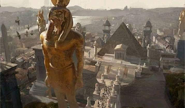
- First of all, Greek influence would be more important, mainly due to trade and the geographical proximity to their territories. I imagine pyramids surrounded by Greek architecture, with Egyptian statues and infrastructure (something like what you see here), basically a low-key Ptolemaic Egypt, which would retain various aspects of the classical periods of Ancient Egypt. The Greek influence, and of other cultures (possibly), would be more present in the capital, coastal and commercial cities; while rural and less commercial areas would maintain a more "Egyptian" version of what we are proposing.
- As I said before, a contemporary Ancient Egypt would need no significant influence (or imposition, as was the case with American colonization) from the prominent cultures of each era. This would imply a defense system based on walls, a more militarily prepared army and friendlier relations with the neighbors. This would not make Ta Seti an "undefeatable country", but it would make it more stable compared to what Ancient Egypt might have been during the height of the invasions.
- Complementing the first idea, if we plan to have a Latinized version of the Ancient Egyptian language, it is most likely that the language was adapted as Greek commercial and cultural influence (and other nearby cultures, probably related to the Romans) grew. I reiterate the use of the word "influence", since if we talk about a stronger presence (like the one that happened from Ptolemaic Egypt) it would imply something like the fusion of Greek and Egyptian deities, and even their disappearance when a monotheistic religion arrived (as it happened with the Abrahamic religions, mainly Islam).
- As the one with the most open vision of this project, I think that in a contemporary context it is important that an Ancient Egypt had adapted, on some level, to global changes while preserving its culture, religion and traditions. I imagine something like what happened to the Arab countries from the oil and gas "rush", which developed modern transport infrastructure and transformed their cities according to commercial requirements. All this happened while preserving the traditional aspects of the country, generally applying a largely religious constitutional and legal system.
- That said, cities with the greatest cultural influence would preserve the classic infrastructure of their glory days in the "historic" center, but modern areas would feature larger and more organized residences, relatively contemporary infrastructure, and public service facilities. This is somewhat similar to what we do at Imperium but to a lesser extent, as Imperium is "the United States" of the Arhet mapping community.
- Contrary to what Taka has suggested, I still believe that a significant part of Ta Seti culture would involve preserving the classical infrastructure, rather than abandoning it or allowing it to be affected by foreign interference (think of something like the story of Napoleon attacking the Sphinx of Giza). Without the presence of a culture that wishes to eradicate the influence of the previous one, such as the Spanish with the Native American polytheistic cultures and the Arabs with the pre-Islamic tribes.
- If you have any questions, feel free to tell us. Thanking you for your time and wishing you happy mapping! Mapping Expert (talk) 23:02, 8 December 2022 (UTC)
- Hi,
- My primary concern was how much the "style inspirations" you provided appeared riddled with fantasy elements, which we'd all be best off to avoid. Additionally, I share Alessa's concern that you did believe a territory anywhere on OGF outside of the middle of the ocean would be immune to cultural influences from nearby territories; TA026c borders several other islamic/Arabian themed territories, and indeed also a Greek influence would be of importance to include. Going from the intentions you've shared, I have little concern whether your mapping would be fitting for the area.
- In an off-forum discussion I had with Imperator, I also voiced my concerns regarding the mapping style you've used in the past. I understand that Imperium is your primary project, and I understand the difficulties its scale brings; which is why I also looked into the OGF territory you shared until recently for how your mapping evolves. With all due respect, I disagree that there is detail in Costa Dorada; and without bashing Imperium, which is in itself a very impressive project, the two look very alike in style. What currently exists in former Sirrhae is a great start to avoid the same pattern, and I'd much appreciate to see the intentions you've outlined evolve onto the map. That's why my suggestion to Imperator also was to continue mapping in TA031 -- to show how you would place the Greek influences, and to show what your idea of a modern Egyptian city looks like on the map. His concerns would be that it would be too difficult to transfer the mapping done into the new territory afterwards, which I find reasonable. As such, my suggestion to you is to create a sub-area within TA026c, for you to place this mapping into, so that you can provide urban, suburban and rural example(s) of modern Egyptian mapping, and also progress TA026c at the same time. For country-scale mapping, you'd be recommended to create a basic outline off-site. I trust that if you continue on the way you've been going already in TA031, you'll be able to convince me, but seeing is believing. Please let me know if that's workable for you. Taka (talk) 17:04, 11 December 2022 (UTC)
That sounds nice for me. As I mentioned earlier, we would prefer the area near what would become the river delta to map the capital and some natural mapping. If the idea is to preserve TA031 while working in the subarea, then we could make examples of natural and rural mapping in that territory while preserving it. Let me know your thoughts on this. --Mapping Expert (talk) 18:16, 11 December 2022 (UTC)
All right. I've delimited an area for you to work in: https://opengeofiction.net/relation/338073#map=9/26.8155/28.6688&layers=B I'll put a reminder for 1 months from now (11th of January) to review. Taka (talk) 21:05, 11 December 2022 (UTC)