Help:Configuring JOSM for OpenGeofiction
Jump to navigation
Jump to search
How can I use JOSM for editing the OpenGeofiction map?
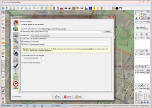
If you want to use the JOSM editor, configure the "Connection settings" (via the "Edit -> Preferences" menu), so that the OSM server URL points to our server https://opengeofiction.net/api
as shown here:
How can I display the OpenGeofiction map as background in JOSM?
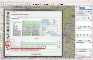
To display the OpenGeofiction map as background in JOSM, add our server to the "selected entries" in the "Imagery preferences", using the "+TMS" button, as shown in this screenshot:
"OpenGeofiction" should then appear in the "Imagery" menu.
The input values for the OGF map layers are as listed below.
| Layer (5.) | URL template (2.) |
|---|---|
| OGF-Carto (OSM's default style) | https://tile.opengeofiction.net/ogf-carto/{zoom}/{x}/{y}.png (Max zoom = 19)
|
| OGF-Topo (OpenTopoMap's style) | https://tile.opengeofiction.net/ogf-topo/{zoom}/{x}/{y}.png (Max zoom = 17)
|
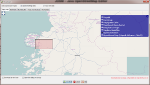
Once you completed this step, you can then select "OpenGeofiction" as background for the "Download" dialog:


