Leresso: Difference between revisions
No edit summary |
mNo edit summary |
||
| (25 intermediate revisions by the same user not shown) | |||
| Line 1: | Line 1: | ||
{{Infocard | |||
| name = Leresso | |||
| flag = Flag-le.png | |||
| symbol = COA-le.jpeg | |||
| symbol_caption = Coat of arms | |||
| native_name = ᠬᡃᠠᠨᡪᡝᠭᠠᠴᡃᠠ ᢇ᠋ ᡕᡠᠶᡝᠴᠠᠨ᠌ | |||
| native_language = Yerevi | |||
| capital = ᠠᠯᡠᡨ᠌ᡰᡝᡄ ''Aludres'' | |||
| population = 12,306,670 | |||
| population_year = 2021 | |||
| motto = ᠭᡝᠨᡃᡨ᠌ᡠᠮᠠ ᡧᠠᡄᠠᡕ ''Kendẹma Qasay'' | |||
| anthem = ᡔᡝᡰᡝᢣᡃᠠᠨᡆ ''Tsenets’ạno'' | |||
| latitude = -35.3118 | |||
| longitude = 5.4420 | |||
| zoom = 7 | |||
| relation = 21958 | |||
| intro = The '''Leressan Republic''' ('''ᠬᡃᠠᠨᡪᡝᠭᠠᠴᡃᠠ ᢇ᠋ ᡕᡠᠶᡝᠴᠠᠨ᠌''' ''kạnṛegahạ 'a yurehan''), also known as '''Leresso''' ('''ᡕᡠᡰᡝᠴᠠ''' ''yureha''), is a country located in Western [[Antarephia]] along the upper portions of the continent's [[Hesperic Ocean | Hesperic]] coast. It is bordered by [[AN138]] to the north and [[AN141c]] to the east. The capital and largest city is [[Aludres]], which is one of two main economic and population centers in the country, the other being the port city of [[Maqạnta]]. The country covers an area of approximately 37,000 square kilometers and hosts a population of around 12.3 million. The official language is [[Yerevi]], though [[Ingerish]] is also widely used. | |||
Much of Leresso's modern history is defined by its status as an [[Ingerland | Ingerish]] colony in the late 18th and early 19th centuries. | |||
The country experiences a dry mid-latitude climate. | |||
}} | |||
{| width="100%" | |||
| width="49%" valign="top"|'''Leresso''', officially the '''Leressan Republic''', is a country located on the southern coast of western [[Antarephia]]. Leresso is bordered to the north by [[AN138]], to the east by [[AN141c]], and by the Hesperic Ocean to the south and west. Its capital is [[Aludres]], which is also the largest city. | |||
It is a small country of 37,000 km² (≈14,280 sq mi) and has a population of almost 13 million. | |||
| width="2%"| | |||
| width="49%" valign="top"|(WIP):'''ᡕᡠᡰᡝᠴᠠ᠂ᠡᡃᠶᡝᠨᡝᠴᢈ᠋ᡃᠠᡰᢈ᠋ ‘ᡩᢈ᠋ᠨᠠᠮᠯᠠᡝᡄ ᡕᡠᡰᡝᠴᠠᢊ, ᡍᡝ᠌ ᡩᠠᠴᠠᢊ ᠬ᠋ᠠᠶᡃᡨ᠌ᡠᠨᠠᢊ ᠠᠨᡨ᠌ᠠᡰᡝᠹᡕᠠ ᠡᠴᢈ᠋ᢊ ᠡᢈ᠋ᡃᡨ᠌ᢈ᠋ᡨ᠌ᠨᡝᢈ᠋ ᠮᠠᠨᠠᡴ᠌ᠠᡃᠶᢈ᠋ ᠮᠠᢔᡃᠠᠨᡨ᠌ᠠ ᠡᠴᠠᡶ᠋ᠮᠠᡃᠳ᠋ᡝ᠌ ᡩᠨᠠᠶᠠᡄ ᡩᡄᠠᡕ ᡕᡝᢔᠠᠯᢈ᠋ᢈ᠋ ᡄᠠᢔᠠ ᡩᠠᠨᡝᡴ ᠹᡕᠠᠴᠠᠨᡴ᠌ᡡ ᡍᡃᠠᠯᠠᡐᠴᠠᢊ ᠹᡝ᠊ ᠠᠯᡈᡘ᠊ᡰᡝᡄ''' | |||
'''ᠨᠠᢈ᠋ᡝᡎ ᡦᠠᠴᡃᠠᡃᡨ᠌ᢈ᠋ᢈ᠋ ᡩᠠᡄ ᠓᠗᠐᠐᠐ ᠬ᠋ᠠᡃᠶᠬᡃᠠ ᡍᢈ᠋ᠯᠣᠮᡝᡨ᠌ᡝᡶ᠋ᢈ᠋ ᠡᡝ᠌ ᡩᠠᡃᠶᡎ᠋ᡃᠠᠨᠠᡄ ᡦᡝᡕᠠ ᠑᠓ ᠮᢈ᠋ᠯᡃᢈ᠋ᠣᢊ᠃''' | |||
|} | |||
{{Infobox country | {{Infobox country | ||
|coords_zoom = 6<!-- The zoom coords /#map=THIS/xx.xx/xx.xx?layers=x --> | |coords_zoom = 6<!-- The zoom coords /#map=THIS/xx.xx/xx.xx?layers=x --> | ||
| Line 83: | Line 114: | ||
==Geography== | ==Geography== | ||
{{Infobox geography | |||
| name = Leresso | |||
| continent = Antarephia | |||
| region = | |||
| population = 12,306,670 | |||
| population_year = 2021 | |||
| area_km2 = 37,007.73 | |||
| area_sq_mi = 14,288.49 | |||
| percent_water = 22.9 | |||
| density_km2 = | |||
| density_sq_mi = | |||
| custom_label1 = Highest point | |||
| custom1 = [https://opengeofiction.net/#map=18/-34.24943/5.82348&layers=B Ḥayqetò] (3188m) | |||
| custom_label2 = Calling code | |||
| custom2 = +39 | |||
| time_zone = WUT +0:00 <br> <small>''WUT+1:00 first Sunday in October – first Sunday in April''</small> | |||
}} | |||
Much of Leresso's geography is defined by its mountains and rivers. There are five major rivers that run through the country: to the south and east, the Sani River flows from the eastern Kusane Mountains and into the Bay of Nakhaz. To the north and west, the Kadmar river flows from the nation's highest point, Mount Levantụ, along the northern parts of the country and empties out in the Kadmar Estuary near Maqanta. Two of the other three major rivers flow into the Kadmar: The Kiyerma River, which has its origins in Northern Palumar, and the Khetsan River, which is the third-longest river in the country, after the Kadmar and Sani rivers. The Valerian River is also a major river because it serves as a sort of geographic boundary between the coastal hills of the west and the coastal hills of the south. | Much of Leresso's geography is defined by its mountains and rivers. There are five major rivers that run through the country: to the south and east, the Sani River flows from the eastern Kusane Mountains and into the Bay of Nakhaz. To the north and west, the Kadmar river flows from the nation's highest point, Mount Levantụ, along the northern parts of the country and empties out in the Kadmar Estuary near Maqanta. Two of the other three major rivers flow into the Kadmar: The Kiyerma River, which has its origins in Northern Palumar, and the Khetsan River, which is the third-longest river in the country, after the Kadmar and Sani rivers. The Valerian River is also a major river because it serves as a sort of geographic boundary between the coastal hills of the west and the coastal hills of the south. | ||
| Line 92: | Line 140: | ||
Leresso is a geographically diverse country dominated by an array of mountains and rivers. The two largest rivers are the Kadmar and Sani rivers. Meltwaters from the nation's highest point – Ḥayqetò (ᠬ᠋ᠠᡕᡎ᠋ᡝᡨ᠌ᠣ) (3188m) – are generally accepted as the earliest source of the Kadmar river, which flows southwest through an expansive valley of the same name and meets the Hesperic Ocean at Maqanta. A collection of mountain springs that span the Leresso-AN141c border are thought to originate the Sani river, which flows through the eastern third of the country and empties out into the Hesperic Ocean just northeast of Aludres. | Leresso is a geographically diverse country dominated by an array of mountains and rivers. The two largest rivers are the Kadmar and Sani rivers. Meltwaters from the nation's highest point – Ḥayqetò (ᠬ᠋ᠠᡕᡎ᠋ᡝᡨ᠌ᠣ) (3188m) – are generally accepted as the earliest source of the Kadmar river, which flows southwest through an expansive valley of the same name and meets the Hesperic Ocean at Maqanta. A collection of mountain springs that span the Leresso-AN141c border are thought to originate the Sani river, which flows through the eastern third of the country and empties out into the Hesperic Ocean just northeast of Aludres. | ||
Much of the country's flat land, both on the coast and in the interior, is comprised of grassland or shrubland, known locally as ''sogarey''. | |||
===Climate=== | ===Climate=== | ||
[[File:Leresso Climate.png|thumb|right|350px|A map of Leresso's climate zones.]] | |||
{{climate chart | |||
| Aludres, Qamanạ Uras (ᠠᠯᡠᡨ᠌ᡰᡝᡄ - ᡧᠠᠮᠠᠨᡃᠠ ᡇᡰᠠᡄ) | |||
|17.4|30.8|18.9 | |||
|17.8|31.2|15.7 | |||
|14.1|28.7|20.7 | |||
|10.8|24.4|41.1 | |||
|8.3|20.6|57.2 | |||
|6.9|17.4|78.8 | |||
|5.1|15.8|93.1 | |||
|6.3|17.1|84.4 | |||
|8.2|20.1|68.3 | |||
|9.4|23.7|37.1 | |||
|11.8|25.2|30.2 | |||
|14.7|28.1|22.8 | |||
|float=left | |||
|clear=left | |||
}} | |||
Due to its small size, Leresso does not experience a vast array of climates as one might expect from the topography. Generally, the Leressan climate is classified as Csa, with regional variants. The coast typically has the most stable climate, whereas further inland the temperatures begin to vary more, with hotter summers and colder winters, as moisture from the ocean is too far away to regulate the inland climate. | Due to its small size, Leresso does not experience a vast array of climates as one might expect from the topography. Generally, the Leressan climate is classified as Csa, with regional variants. The coast typically has the most stable climate, whereas further inland the temperatures begin to vary more, with hotter summers and colder winters, as moisture from the ocean is too far away to regulate the inland climate. | ||
The Leressan Climate is | The Leressan Climate is temperate and dry, with warm, sunny summers and cool, mild winters. The average temperature throughout the year remains comfortable thanks to the offshore wind current that flows into the major valleys. | ||
The climate zones contained within Leresso are as follows: | |||
{{legend|#FFFF00|Csa}}{{legend|#C6C700|Csb}}{{legend|#969600|Csc}}{{legend|#FFDB63|BSk}}{{legend|#C600C7|Dsb}}{{legend|#B2B2B2|ET}} | |||
===Administrative Divisions=== | ===Administrative Divisions=== | ||
Leresso is divided into 32 cantons. The capital, Aludres, is located within its own | {{Infobox admin div | ||
| name = Leresso | |||
| first-level = 32 ''uras'' (ᡇᡰᠠᡄ) | |||
| second-level = | |||
| third-level = | |||
| fourth-level = | |||
}} | |||
Leresso is divided into 32 ''urasà'' (counties/cantons). The capital, Aludres, is located within its own ''uras''. Each ''uras'' is then grouped into one of five regions: Western, Central, Southern, Eastern, and Northern. These regions hold no administrative power and primarily exist for data collection, supposed regional identities, and other minor matters. Each ''uras'''s government is centered in its largest city. | |||
{| | |||
| style="vertical-align:top;" | | |||
{| class="wikitable" | {| class="wikitable" | ||
|- | |- | ||
! Region | ! Region | ||
! | ! ''Uras'' | ||
! Land Area | |||
! Capital | ! Capital | ||
|- | |- | ||
| rowspan="8" | | | rowspan="8" | Western | ||
| | | '''ᠮᠠᡸᡃᠠᠨᡨ᠌ᠠ'''<br><small>MAQẠNTA</small> | ||
| Maqạnta | | 587.37 km² <br><small>226.78 sq. mi</small> | ||
| Maqạnta | |||
|- | |- | ||
| | | '''ᡸᠠᡃᡨ᠌ᠠᠨ᠌'''<br><small>QADAN</small> | ||
| | | 432.93 km² <br><small>167.15 sq. mi</small> | ||
| CAPITAL | |||
|- | |- | ||
| | | '''ᠬ᠋ᠠᢈ᠋ᡃᠠᠨᡃᡨ᠌ᠠ'''<br><small>ḤAYẠNDA</small> | ||
| 706.42 km² <br><small>272.75 sq. mi</small> | |||
| CAPITAL | |||
|- | |||
| '''ᡄᠠᢊ᠋ᡝᠨᢈ᠋ᢈ᠋'''<br><small>SANHENI</small> | |||
| 1040.48 km² <br><small>401.73 sq. mi</small> | |||
| Valerport | |||
|- | |||
| '''ᠭᠣᡰᠠᢊ᠋ᠠᠠ'''<br><small>KORANHA</small> | |||
| 995.79 km² <br><small>384.48 sq. mi</small> | |||
| Haverley | | Haverley | ||
|- | |- | ||
| | | '''ᠡᡔᠠᠨᡃᡨ᠌ᠠᠨᡆ'''<br><small>CANDANO</small> | ||
| 1167.95 km² <br><small>450.95 sq. mi</small> | |||
| Rhoddanton | | Rhoddanton | ||
|- | |- | ||
| | | '''ᡩᠠᡴᢔᠠᠨ᠌'''<br><small>DAKSHAN</small> | ||
| | | 1073.37 km² <br><small>414.43 sq. mi</small> | ||
| Tayareq | |||
|- | |||
| '''ᠡᠴᡠᡰᠠᠶᠠᡕ'''<br><small>HẸRAVAY</small> | |||
| 1654.09 km² <br><small>638.65 sq. mi</small> | |||
| CAPITAL | |||
|- | |- | ||
| | | rowspan="5" | Central | ||
| | | '''XXXX'''<br><small>XXXXX (C1)</small> | ||
| 1512.45 km² <br><small>583.96 sq. mi</small> | |||
| CAPITAL | |||
|- | |- | ||
| | | '''XXXX'''<br><small>XXXXX (C2)</small> | ||
| | | 2380.30 km² <br><small>919.04 sq. mi</small> | ||
| CAPITAL | |||
|- | |||
| '''XXXX'''<br><small>XXXXX (C3)</small> | |||
| 1214.94 km² <br><small>469.09 sq. mi</small> | |||
| CAPITAL | |||
|- | |||
| '''XXXX'''<br><small>XXXXX (C4)</small> | |||
| 784.61 km² <br><small>302.94 sq. mi</small> | |||
| CAPITAL | |||
|- | |||
| '''XXXX'''<br><small>XXXXX (C5)</small> | |||
| 1164.77 km² <br><small>449.72 sq. mi</small> | |||
| CAPITAL | |||
|- | |||
| rowspan="3" | Southern | |||
| '''XXXX'''<br><small>XXXXX (S1)</small> | |||
| 1202.49 km² <br><small>464.28 sq. mi</small> | |||
| CAPITAL | |||
|- | |||
| '''ᠠᠨᡝᢗᠠᠠ'''<br><small>ANEY'A (S2)</small> | |||
| 1227.38 km² <br><small>473.89 sq. mi</small> | |||
| CAPITAL | |||
|- | |||
| '''ᠨᠠᢊ᠋ᠭᠠᡨ'''<br><small>NANGGAT (S3)</small> | |||
| 1283.22 km² <br><small>495.46 sq. mi</small> | |||
| CAPITAL | |||
|} | |||
| style="vertical-align:top;" | | |||
{| class="wikitable" | |||
|- | |||
! Region | |||
! ''Uras'' | |||
! Land Area | |||
! Capital | |||
|- | |||
| rowspan="5" | Southern | |||
| '''ᡸᠠᠮᠠᠨᡃᠠ'''<br><small>QAMANẠ (S4)</small> | |||
| 788.05 km² <br><small>304.27 sq. mi</small> | |||
| CAPITAL | |||
|- | |||
| '''ᠬ᠋ᠠᡰᡠᡄᡴ᠌ᠠᠠ'''<br><small>HHARÉS'HA (S5)</small> | |||
| 471.26 km² <br><small>181.95 sq. mi</small> | |||
| CAPITAL | |||
|- | |||
| '''XXXX'''<br><small>XXXXX (S6)</small> | |||
| 1256.59 km² <br><small>485.17 sq. mi</small> | |||
| CAPITAL | |||
|- | |||
| '''XXXX'''<br><small>XXXXX (S7)</small> | |||
| 1389.18 km² <br><small>536.36 sq. mi</small> | |||
| CAPITAL | |||
|- | |||
| '''ᠠᠯᡠᡨ᠌ᡰᡝᡄ'''<br><small>ALUDRES</small> | |||
| 173.46 km² <br><small>66.97 sq. mi</small> | |||
| Aludres | |||
|- | |||
| rowspan="5" | Northern | |||
| '''XXXX'''<br><small>XXXXX (N1)</small> | |||
| 2041.27 km² <br><small>788.14 sq. mi</small> | |||
| CAPITAL | |||
|- | |||
| '''ᢗᠠᠨᠠᠮᠴᠠᠨ᠌'''<br><small>Y'ANAMHAN (N2)</small> | |||
| 1383.78 km² <br><small>534.28 sq. mi</small> | |||
| CAPITAL | |||
|- | |||
| '''XXXX'''<br><small>XXXXX (N3)</small> | |||
| 1331.07 km² <br><small>513.93 sq. mi</small> | |||
| CAPITAL | |||
|- | |||
| '''XXXX'''<br><small>XXXXX (N4)</small> | |||
| 1592.33 km² <br><small>614.76 sq. mi</small> | |||
| CAPITAL | |||
|- | |||
| '''XXXX'''<br><small>XXXXX (N5)</small> | |||
| 1903.76 km² <br><small>735.05 sq. mi</small> | |||
| CAPITAL | |||
|- | |- | ||
| | | rowspan="6" | Eastern | ||
| | | '''ᢔᡝᠮᠠᢋᠠᠨ᠌'''<br><small>QEMAJAN (E1)</small> | ||
| 994.42 km² <br><small>383.95 sq. mi</small> | |||
| CAPITAL | |||
|- | |- | ||
| | | '''ᠭ᠌ᠠᠣᢈ᠋ᠠᢊ'''<br> <small>ḤOYAȠ (E2)</small> | ||
| | | 773.96 km² <br><small>298.83 sq. mi</small> | ||
| | | CAPITAL | ||
|- | |- | ||
| | | '''ᢗᠠᡃᡨ᠌ᠠᡅᠠ'''<br><small>Y'ADAZA (E3)</small> | ||
| | | 856.71 km² <br><small>330.78 sq. mi</small> | ||
| CAPITAL | |||
|- | |- | ||
| | | '''ᠭᠠᡴ᠌ᡝᠨᠠ'''<br><small>GAḤẠNA (E4)</small> | ||
| | | 1573.80 km² <br><small>607.65 sq. mi</small> | ||
| CAPITAL | |||
|- | |- | ||
| | | '''ᡄᠠᢊ᠋ᠠᠶᡴ᠍ᠠᠠ'''<br><small>SAȠARQA (E5)</small> | ||
| | | 1519.70 km² <br><small>586.76 sq. mi</small> | ||
| Sataqa | |||
|- | |- | ||
| | | '''ᢊᡝᡐᠠ'''<br><small>ȠEWA (E6)</small> | ||
| | | 921.77 km² <br><small>355.90 sq. mi</small> | ||
| CAPITAL | |||
|} | |||
|} | |} | ||
===Borders=== | ===Borders=== | ||
Leresso's border to the north with AN138 is primarily composed of the Kadmar delta in the west and the Khusan Mountains in the east. Leresso's eastern border with AN141c is made up of the Khusan Mountains, the Sani River, and the Teqmay Mountains. | Leresso's border to the north with AN138 is primarily composed of the Kadmar delta in the west and the Khusan Mountains in the east. Leresso's eastern border with AN141c is made up of the Khusan Mountains, the Sani River, and the Teqmay Mountains. | ||
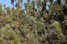
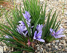
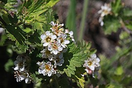
===Flora & Fauna=== | |||
<gallery mode=packed caption="Yerevi Flora"> | |||
File:Agathosma_betulina_MargrietB_4.jpg|Agathosma betulina | |||
File:Metalasia_muricata00.jpg|Metalasia muricata | |||
File:Rooibos_(Aspalathus_linearis).jpg|[https://en.wikipedia.org/wiki/Rooibos Qamaric majah] | |||
File:Lyonothamnus_floribundus_floribundus.jpg|Lyonothamnus floribundus | |||
File:Corymbium_congestum_Rebelo_3.jpg|Corymbium congestum | |||
File:Cliffortia_cuneata_var._cuneata.jpg|Cliffortia cuneata | |||
File:Babiana_sambucina_1.jpg|Babiana sambucina | |||
File:2015.05.30_11.55.54_IMG_2477_-_Flickr_-_andrey_zharkikh.jpg|Physocarpus alternans | |||
</gallery> | |||
<gallery mode=packed caption="Yerevi Fauna"> | |||
File:Chaetops_frenatus_1838.jpg|[https://en.wikipedia.org/wiki/Cape_rockjumper Cape rockjumper] | |||
File:Garden_acraea_(Acraea_horta).jpg|[https://en.wikipedia.org/wiki/Acraea_horta Garden acraea] | |||
File:Southafrica-capegrysbok.jpg|[https://en.wikipedia.org/wiki/Cape_grysbok Qamaric antelope] | |||
File:Male_greater_kudu.jpg|[https://en.wikipedia.org/wiki/Greater_kudu West Antarephian kudu] | |||
File:Taurotragus_oryx_2_(Piotr_Kuczynski).jpg|[https://en.wikipedia.org/wiki/Common_eland Common kudu ("hyangai")] | |||
</gallery> | |||
Leresso is widely regarded as a region of exceptionally high rates of endemism and biodiversity. The country is home to over 7,500 different plant species, of which 73 percent are endemic. Many of these endemic plants are concentrated in a type of dry temperate biome unique to the area known as ''sogarey'' (Yerevi: ''ᡄᠣᠭᠠᡰᡝᡕ''). | |||
==Politics== | ==Politics== | ||
| Line 162: | Line 362: | ||
===Government=== | ===Government=== | ||
{{Infobox government | |||
| name = Leresso | |||
| government_type = Unitary Parliamentary Republic | |||
| capital = Aludres, Maqạnta | |||
| title1 = President | |||
| hos1 = Aruhi T’agitsạno<br><small>ᠠᡰᡠᠴᢈ᠋ᠰ᠋ ᡗᠠᠭᢈ᠋ᡔᡃᠠᠨᡆ</small> | |||
| title2 = Prime Minister | |||
| hos2 = Ledeḥi Sherkem | |||
| title3 = | |||
| hos3 = | |||
| legislature = Qis'heneb | |||
| upper_house = | |||
| upper_house_diagram = Qis'heneb.svg | |||
| judiciary = High Court | |||
| custom_label1 = | |||
| custom1 = | |||
| custom_label2 = | |||
| custom2 = | |||
| political_parties = {{legend|#6026A3|AY}}{{legend|#ED9B0E|EH}}{{legend|#0DBF16|DU}}{{legend|#ED0E7E|SH}}{{legend|#BD100D|RA}} | |||
| international_orgs = AC (observer), AN, Ingerish Commonwealth (observer) | |||
}} | |||
Leresso is one of a select few nations that technically have more than one capital city. [[Aludres]] is recognized as the national capital since the legislative and judicial branches are based in the city. The executive branch of the government, namely the President, conducts almost all affairs through the ''Ḥereqineṛaṇ'' ‹ᠬ᠋ᡝᠶᡝᡴ᠍ᢈ᠋ᠨᡝᡶ᠋ᠠᢊ›, a large chamber within the Qis'heneb, and has a designated residence at ''Kerere House'' ‹ᠬᡝᠶᡝᠶᡝ ᠬᢈ᠋ᡸᠠ› in Aludres; however, the official residence of the Yerevi President is listed as Koqansarà ‹ᠬᠣᡸᠠᠨᡄᠠᠶᡃᠠ›, which is located in [[Maqạnta]]. Maqạnta is considered a capital of Leresso because it hosts the official residency of the nation's President. | |||
* {{legend|#6026A3|Adi Yẹreha: 49 seats}} | |||
* {{legend|#ED9B0E|Equnda Ḥizan: 20 seats}} | |||
* {{legend|#0DBF16|Duruqat: 16 seats}} | |||
* {{legend|#ED0E7E|Seı̒mạ Ḥizan: 8 seats}} | |||
* {{legend|#BD100D|Raliḥat: 9 seats}} | |||
Political parties in Leresso: | |||
* '''Adi Yereha (AY):''' | |||
* '''Equnda Hhizan (EH):''' | |||
* '''Duruqat (DU):''' | |||
* '''Seı̒mạ Ḥizan (SH):''' | |||
* '''Raliḥat (RA):''' | |||
===Law and judicial system=== | ===Law and judicial system=== | ||
| Line 168: | Line 403: | ||
===Foreign relations=== | ===Foreign relations=== | ||
As a small regional power in Antarephia, Leresso maintains strategic economic, political, and military alliances with its neighbors, as well as the other continental powers of Antarephia, such as [[Guai]] | As a small regional power in Antarephia, Leresso maintains strategic economic, political, and military alliances with its neighbors, as well as the other continental powers of Antarephia, such as [[Guai]] and [[Ullanyé]]. Leresso also has a notable presence in northern Tarephia, given its embassy in Al-Kaza. Perhaps the country's most vital trade partner is the Federal States, being Leresso's biggest importer and contributing a sizeable amount to the Leressan economy. | ||
Leresso also maintains relations with the [[Antarephian Coalition]]; however, it is not a member state and the Antari is not an accepted currency in Leresso. In recent years, Leresso has signed a "porous border" agreement with the AC, authorizing a streamlined immigration process for AC passport holders. | Leresso also maintains relations with the [[Antarephian Coalition]]; however, it is not a member state and the Antari is not an accepted currency in Leresso. In recent years, Leresso has signed a "porous border" agreement with the AC, authorizing a streamlined immigration process for AC passport holders. | ||
===Military=== | ===Military=== | ||
Leresso's position at the far western edge of Antarephia and the geographic isolation caused by the country's mountainous north and east explain Leresso's relative dependence on the Hesperic Ocean. When it comes to the country's military, the naval force receives the largest budget of the three branches since the ocean is where the country's influence can be most effectively projected. In the recent past, | |||
==Economy== | ==Economy== | ||
{{Infobox economy | |||
| name = Leresso | |||
| economy_type = Market-leaning Mixed Economy | |||
| currency = Rivan (৲) <br> <small>ᡰᢈ᠋ᠶᠠᠨ᠌</small> | |||
| monetary_authority = | |||
| gdp_ppp_year = 2021 | |||
| gdp_ppp_total = $301.47bn | |||
| gdp_ppp_per_capita = $24,496 | |||
| gdp_nominal_year = 2021 | |||
| gdp_nominal_total = $153.81bn | |||
| gdp_nominal_per_capita = $12,498 | |||
| hdi = 0.768 | |||
| hdi_year = 2021 | |||
| main_exports = minerals/metals, agricultural products, textiles, chemicals, fertilizer | |||
| main_imports = clothes, computer chips, oil, natural gas | |||
| sector_bars = | |||
| custom_label1 = | |||
| custom1 = | |||
}} | |||
[[File:Leressan bank notes.jpg|thumb|right|250px|The Leressan bank notes.|link=Special:FilePath/Leressan_bank_notes.jpg]] | [[File:Leressan bank notes.jpg|thumb|right|250px|The Leressan bank notes.|link=Special:FilePath/Leressan_bank_notes.jpg]] | ||
The Leressan economy is mainly based on the service, manufacturing, and agriculture sectors, as well as the mining and tourism industries. It ranks as the world's thirty-second largest economy and in 2018 generated a nominal GDP of approximately $114 billion. | The Leressan economy is mainly based on the service, manufacturing, and agriculture sectors, as well as the mining and tourism industries. It ranks as the world's thirty-second largest economy and in 2018 generated a nominal GDP of approximately $114 billion USD. | ||
The country exports textiles, wool, sea salt, perfumes, fish, and minerals (mainly bauxite and mica). | The country exports textiles, wool, sea salt, perfumes, fish, and minerals (mainly bauxite and mica). | ||
| Line 187: | Line 441: | ||
===The currency=== | ===The currency=== | ||
Leresso uses the drivan ( | Leresso uses the rivan (LER) as official currency. Its current exchange rate sits at 1.000 LER per 0.0837 USD. It has no subdivisions. Physical currency can be found in the form of coins and bills, with each piece's denomination marked in both Mazanic and traditional Yerevi numerals. Coins are made in ৲᠑ (1 LER), ৲᠒ (2 LER), ৲᠕ (5 LER), ৲᠑᠐ (10 LER), ৲᠒᠐ (20 LER), and ৲᠕᠐ (50 LER) denominations. Bills are made in ৲᠑᠐᠐, ৲᠒᠐᠐, ৲᠕᠐᠐, ৲᠑᠐᠐᠐, and ৲᠒᠐᠐᠐ denominations. | ||
Leresso uses the drivan (Ɗ, ৲) as official currency. First introduced to Leresso and West Kadmar in the summer of 1889, the drivan proved to be a more efficient currency to exchange than its predecessor, the Ingerish pound. | |||
The drivan is produced by the Leressan National Mint located in Aludres and circulates around the country. It is not used by any other country. | The drivan is produced by the Leressan National Mint located in Aludres and circulates around the country. It is not used by any other country. | ||
The Leressan currency comprises coins of 1 drivan and 10 and 50 cent denominations and notes of 1, 5, 10, 20, 50 and 100 drivan denominations. | The Leressan currency comprises coins of 1 drivan and 10 and 50 cent denominations and notes of 1, 5, 10, 20, 50 and 100 drivan denominations. | ||
The drivan has been designed and printed by the Reserve Bank Of Leresso, the Kadmar coat of arms appears on every coins and notes. | The drivan has been designed and printed by the Reserve Bank Of Leresso, the Kadmar coat of arms appears on every coins and notes. | ||
*the | *the 1 note features the Battery of Magenta. | ||
*the ֏5 note features the hart, an animal endemic to the Kadmar river valley. | *the ֏5 note features the hart, an animal endemic to the Kadmar river valley. | ||
*the ֏10 note features the first ship to ever become part of the Leressan Confederate Navy, the ''L.S.S. Seruso'' | *the ֏10 note features the first ship to ever become part of the Leressan Confederate Navy, the ''L.S.S. Seruso'' | ||
| Line 206: | Line 463: | ||
==Infrastructure== | ==Infrastructure== | ||
{{Infobox infrastructure | |||
| name = Leresso | |||
| driving_side = right | |||
| rail_side = right | |||
| gauge = 1435 | |||
| electrification = 25 kV AC | |||
| mains_electricity = 230V 50Hz (Type L socket) | |||
| telephone_code = 39 | |||
| internet_code = .le | |||
}} | |||
===Energy=== | ===Energy=== | ||
===Transport=== | ===Transport=== | ||
| Line 215: | Line 482: | ||
====Airports==== | ====Airports==== | ||
Leresso's main form of international transport is air travel. The country's main international airport is '''Aludres | Leresso's main form of international transport is air travel. The country's main international airport is '''Aludres Gidhı̒e International Airport (ALU)''' (Yerevi: ᠭᠣᠯᡝᠨᡝᡴ᠌ᠠᠠ ᠠᠯᡠᡨ᠌ᡰᡝᡄ ᡤ᠋ᢈ᠋ᡨ᠌ᠴᡃᢈ᠋ᡝ ''Koleneḥā Alẹdres Gidhı̒ē'') which doubles as the hub for the national carrier (RKA, name still being workshopped). | ||
The main airline offers nonstop service to more than twenty major destinations in the Tarephias and beyond (Pirindi-Vai, Paravel, Safrisco, Etatono, Jeidan, Meridien, Stanton, San Martin, Rivador, Khaiwoon, Iola, Quentinsburgh, Fojenica, Voracy, Alcantara, Layrityan, Sante-Agustin, Corrostance, Ochent, Giliarca, Latina, Saviso, Tarkenton, Valoris). | The main airline offers nonstop service to more than twenty major destinations in the Tarephias and beyond (Pirindi-Vai, Paravel, Safrisco, Etatono, Jeidan, Meridien, Stanton, San Martin, Rivador, Khaiwoon, Iola, Quentinsburgh, Fojenica, Voracy, Alcantara, Layrityan, Sante-Agustin, Corrostance, Ochent, Giliarca, Latina, Saviso, Tarkenton, Valoris, Sediharaja). | ||
==Demographics== | ==Demographics== | ||
===Cities=== | ===Cities=== | ||
As of 2021, approximately | As of 2021, approximately 41% of Leresso's population lives in cities. The most populous cities are: | ||
* Aludres ('''ᠠᠯᡇᡨ᠌ᡰᡝᡄ / Ալուդռես)''' | * Aludres ('''ᠠᠯᡇᡨ᠌ᡰᡝᡄ / Ալուդռես)''' | ||
* Maqanta ('''ᠮᠠᡎ᠋ᡃᠠᠨᡨ᠌ᠠ / Մաձօնպա)''' | * Maqanta ('''ᠮᠠᡎ᠋ᡃᠠᠨᡨ᠌ᠠ / Մաձօնպա)''' | ||
| Line 236: | Line 503: | ||
Beginning in the mid-1980s, the government has been actively promoting the use of Everian over Ingerish in daily use so as to "preserve the national heritage and solidify the national identity" as well as attempting to limit Ingerish use to formal settings, such as educational institutions and business settings. | Beginning in the mid-1980s, the government has been actively promoting the use of Everian over Ingerish in daily use so as to "preserve the national heritage and solidify the national identity" as well as attempting to limit Ingerish use to formal settings, such as educational institutions and business settings. | ||
Everian uses the Kadmaric Alphabet, a writing system with no known connections to any other writing system in the world. Like most southern Antarephian nations, Leressans take pride in their unique language and consider it to be integral to the national identity. It is also one of the few non- | Everian uses the Kadmaric Alphabet, a writing system with no known connections to any other writing system in the world. Like most southern Antarephian nations, Leressans take pride in their unique language and consider it to be integral to the national identity. It is also one of the few non-Romantian writing systems in the world with a unique punctuation system. It has 32 letters. | ||
* Ա Օ Բ Ծ Ժ Դ Չ Ե Թ Գ Ձ Ը Ք Ւ Ղ Լ Մ Ն Ո Տ Ռ Ս Ց Պ Շ Ու Օւ Ր Յ Զ Կ Վ | * Ա Օ Բ Ծ Ժ Դ Չ Ե Թ Գ Ձ Ը Ք Ւ Ղ Լ Մ Ն Ո Տ Ռ Ս Ց Պ Շ Ու Օւ Ր Յ Զ Կ Վ | ||
* ա օ բ ծ ժ դ չ ե/է թ գ ձ ը ք ւ ղ լ մ ն ո տ ռ ս ց պ շ ու օւ ր յ զ կ վ | * ա օ բ ծ ժ դ չ ե/է թ գ ձ ը ք ւ ղ լ մ ն ո տ ռ ս ց պ շ ու օւ ր յ զ կ վ | ||
| Line 245: | Line 512: | ||
The official language of Leresso is Yerevi ('''ᡕᡠᡰᠠᡕ ᢢᠠᠨᡃᡨ᠌ᢈ᠋''' ''yẹray ginạs''), a Kadmaric language primarily known for its complex writing system. | The official language of Leresso is Yerevi ('''ᡕᡠᡰᠠᡕ ᢢᠠᠨᡃᡨ᠌ᢈ᠋''' ''yẹray ginạs''), a Kadmaric language primarily known for its complex writing system. | ||
There also exists a Romanized alphabet used mainly in educational contexts. There are a total of 32 letters. Three diacritics (grave è, line ē, and acute é) are also used as tone markers at the end of a word. | |||
* A Ạ B C C̣ D Ḍ E Ẹ F G Q H Ḥ I I̒ Y K L M N O P R S X T Ṭ U V W Z | |||
An example sentence in traditional written Yerevi, its transliteration using the Faye Romanization System, and its translation in Ingerish: | |||
* '''᠈ᠠᠨᡗᠠᡏ ᠨᡝ᠍ ᠡᢣᡝᠮᡨ᠌ᡠᠴᠠᡕ᠃''' | |||
* ''Anḳaw nà chemtẹhay?'' | |||
* Where is the map? | |||
===Education=== | ===Education=== | ||
| Line 252: | Line 525: | ||
==Culture== | ==Culture== | ||
===The National Flag=== | ===The National Flag=== | ||
[[File:Flag-le.png|thumb|right|250px|The National Flag of Leresso]] | [[File:Flag-le.png|thumb|right|250px|The National Flag of Leresso since October 1903.]] | ||
The flag of Leresso is considered an icon amongst the Leressan people, and is | The Yerevi flag is considered a highly important symbol of Leresso. The flag, which is in a 4:7 ratio, consists of two vertical yellow bands surrounding a vertical blue band with a ''kubaṛe'' symbol in the middle of the flag. The blue symbolizes the Kadmar and Sani rivers, as well as peace, determination, and loyalty. The yellow bands represent prosperity, fortune, and eternal wealth. The ''kubaṛe'' is a traditional adornment that has been at the center of Yerevi culture for centuries. It is worn exclusively by men on their forehead and is considered a symbol of vigor, prowess, fertility, and power. It is a traditional gift for young Yerevi men on their 17th birthday, indicative of their ascension to manhood. It used to also be an indication of status (particularly high nobility or even royalty), but since the late 19th century the adornment has taken on a wider cultural significance and became socially acceptable for all men to wear. | ||
[[File:hist_flag_le.png|thumb|right|250px|The Flag of Leresso used from 1849 to 1903.]] | |||
The old flag of Leresso is still considered an icon amongst the Leressan people, and is sometimes used as a common identifier for ethnic Everians across the world. The flag's yellow stripes represent eternal wealth and prosperity, the blue stripes represent the Kadmar and Sani rivers, and the white represents peace and progress, though some scholars and vexillologists may argue that white represents the avalanche lily as well as the Leressan people. The blue star in the middle of the flag was used to and organize anti-Ingerish militias during the struggle for independence in the 1840s. | |||
===Religion=== | ===Religion=== | ||
===National Holidays=== | ===National Holidays=== | ||
* ''' | * '''ᠹᡝᠶᡝᠴᠠᠨᡸᠠᠨ᠌ ᡕᡠᠶᡝ᠌ (Nation Day):''' May 19. | ||
* '''ᠹᡝᠶᡝᠴᠠᠨᡸᠠᠨ᠌ ᢋᠠᠭᡠᠶᠨᠠ (Flag Day):''' October 22. | |||
===Cuisine=== | ===Cuisine=== | ||
===Music=== | |||
Music is a huge part of Yerevi culture. | |||
Leresso participates in the Geovision Song Contest, placing eighth overall in the country's last appearance in 2021 with Qayna Manxayre's song "Dhure". | |||
===Other=== | ===Other=== | ||
Revision as of 18:36, 11 October 2022

|
Leresso  ᠬᡃᠠᠨᡪᡝᠭᠠᠴᡃᠠ ᢇ᠋ ᡕᡠᠶᡝᠴᠠᠨ᠌ (Yerevi) Capital: ᠠᠯᡠᡨ᠌ᡰᡝᡄ Aludres
Population: 12,306,670 (2021) Motto: ᠭᡝᠨᡃᡨ᠌ᡠᠮᠠ ᡧᠠᡄᠠᡕ Kendẹma Qasay Anthem: ᡔᡝᡰᡝᢣᡃᠠᠨᡆ Tsenets’ạno |
Loading map... |
The Leressan Republic (ᠬᡃᠠᠨᡪᡝᠭᠠᠴᡃᠠ ᢇ᠋ ᡕᡠᠶᡝᠴᠠᠨ᠌ kạnṛegahạ 'a yurehan), also known as Leresso (ᡕᡠᡰᡝᠴᠠ yureha), is a country located in Western Antarephia along the upper portions of the continent's Hesperic coast. It is bordered by AN138 to the north and AN141c to the east. The capital and largest city is Aludres, which is one of two main economic and population centers in the country, the other being the port city of Maqạnta. The country covers an area of approximately 37,000 square kilometers and hosts a population of around 12.3 million. The official language is Yerevi, though Ingerish is also widely used.
Much of Leresso's modern history is defined by its status as an Ingerish colony in the late 18th and early 19th centuries.
The country experiences a dry mid-latitude climate.
| Leresso, officially the Leressan Republic, is a country located on the southern coast of western Antarephia. Leresso is bordered to the north by AN138, to the east by AN141c, and by the Hesperic Ocean to the south and west. Its capital is Aludres, which is also the largest city.
It is a small country of 37,000 km² (≈14,280 sq mi) and has a population of almost 13 million. |
(WIP):ᡕᡠᡰᡝᠴᠠ᠂ᠡᡃᠶᡝᠨᡝᠴᢈ᠋ᡃᠠᡰᢈ᠋ ‘ᡩᢈ᠋ᠨᠠᠮᠯᠠᡝᡄ ᡕᡠᡰᡝᠴᠠᢊ, ᡍᡝ᠌ ᡩᠠᠴᠠᢊ ᠬ᠋ᠠᠶᡃᡨ᠌ᡠᠨᠠᢊ ᠠᠨᡨ᠌ᠠᡰᡝᠹᡕᠠ ᠡᠴᢈ᠋ᢊ ᠡᢈ᠋ᡃᡨ᠌ᢈ᠋ᡨ᠌ᠨᡝᢈ᠋ ᠮᠠᠨᠠᡴ᠌ᠠᡃᠶᢈ᠋ ᠮᠠᢔᡃᠠᠨᡨ᠌ᠠ ᠡᠴᠠᡶ᠋ᠮᠠᡃᠳ᠋ᡝ᠌ ᡩᠨᠠᠶᠠᡄ ᡩᡄᠠᡕ ᡕᡝᢔᠠᠯᢈ᠋ᢈ᠋ ᡄᠠᢔᠠ ᡩᠠᠨᡝᡴ ᠹᡕᠠᠴᠠᠨᡴ᠌ᡡ ᡍᡃᠠᠯᠠᡐᠴᠠᢊ ᠹᡝ᠊ ᠠᠯᡈᡘ᠊ᡰᡝᡄ
ᠨᠠᢈ᠋ᡝᡎ ᡦᠠᠴᡃᠠᡃᡨ᠌ᢈ᠋ᢈ᠋ ᡩᠠᡄ ᠓᠗᠐᠐᠐ ᠬ᠋ᠠᡃᠶᠬᡃᠠ ᡍᢈ᠋ᠯᠣᠮᡝᡨ᠌ᡝᡶ᠋ᢈ᠋ ᠡᡝ᠌ ᡩᠠᡃᠶᡎ᠋ᡃᠠᠨᠠᡄ ᡦᡝᡕᠠ ᠑᠓ ᠮᢈ᠋ᠯᡃᢈ᠋ᠣᢊ᠃ |
| Leresso ᡩᢈ᠋ᠨᠠᡅᡃᠠᡴ ᡕᡠᡰᡝᠴᠠᢊ Dinazạk Yẹrehan | |||||
|---|---|---|---|---|---|
| |||||
Loading map... | |||||
| Motto: "ᡩᢈ᠋ᢊ ᠡᠴᠠᡔᠠᠮᡝᠶᢈ᠋ ᡕᡠᡰᠠᡕ" Din Hachamev Yẹray The Yerevi Spirit | |||||
| Anthem: ᠠᡶ᠋ᠠᡎ ᠹᠠᢈ᠋ ᡍᡝᠮᡨ᠌ᡝᢈ᠋ Aṛaq Fa’ Kemde’ | |||||
| Capital and largest city | Aludres ᠠᠯᡠᡨ᠌ᡰᡝᡄ | ||||
| Official languages | Yerevi | ||||
| • National languages | Ingerish | ||||
| Demonym | Yerevi | ||||
| Government | Classical Republican Democracy | ||||
| • President | |||||
| • Prime Minister | Saleḥ Ayumaqdi ᡄᠠᠯᡝᠬ ᠠᡕᡇᠮᠠᢔᡃᡨ᠌ᢈ᠋ᢈ᠋ | ||||
| Legislature | Qis'heneb | ||||
| Area | |||||
| • Total | 37007.03 km2 14288.49 sq mi | ||||
| • Water (%) | 22.9 | ||||
| Population | |||||
| • Census (2021) | 12,306,670 | ||||
| HDI (2019) | high | ||||
| Timezone | WUT 0 | ||||
| Currency | Yerevi Rivan (Ʀ) (LER) | ||||
| Drives on the | right | ||||
Leresso, officially the Leressan Republic, is a country located on the southern coast of western Antarephia. Leresso is bordered to the north by AN138, to the east by AN141c, and by the Hesperic Ocean to the south and west. Its capital is Aludres, which is also the largest city. It is a small country of 37,000 km² (≈14,280 sq mi) and has a population of almost 13 million.
Etymology
It is unknown where the name "Leresso" comes from, though it is widely believed that the name is a rough transliteration of the native Everian name Yereha, meaning "big land".
History
Pre-colonization
Based on data from surrounding countries, it is believed that the Kadmar and Sani River Valleys have been inhabited for around 8,000 years, though the earliest records of a permanent settlement were found in the Sani river valley dating back to the 14th century BCE.
Discovery and early colonization (1764-1778)
In 1764, an Ingerish galleon landed in the estuaries of the Kadmar River, in present-day Maqạnta.
Independence movement (1849-1851)
Industrialization (1850s-1910s)
Geography
 | |
|---|---|
| Geography of Leresso | |
| Continent | Antarephia |
| Population | 12,306,670 (2021) |
| Area | |
| • Total | 37,007.73 km2 14,288.49 sq mi |
| • Water (%) | 22.9 |
| Highest point | Ḥayqetò (3188m) |
| Calling code | +39 |
| Time zone | WUT +0:00 WUT+1:00 first Sunday in October – first Sunday in April |
Much of Leresso's geography is defined by its mountains and rivers. There are five major rivers that run through the country: to the south and east, the Sani River flows from the eastern Kusane Mountains and into the Bay of Nakhaz. To the north and west, the Kadmar river flows from the nation's highest point, Mount Levantụ, along the northern parts of the country and empties out in the Kadmar Estuary near Maqanta. Two of the other three major rivers flow into the Kadmar: The Kiyerma River, which has its origins in Northern Palumar, and the Khetsan River, which is the third-longest river in the country, after the Kadmar and Sani rivers. The Valerian River is also a major river because it serves as a sort of geographic boundary between the coastal hills of the west and the coastal hills of the south.
The topography of the country can roughly be divided into three zones: the south is hilly, the center is flat, and the north is mountainous. The coast of the country is well-defined by its rolling hills, spanning the entire coast, with peaks that rarely exceed 1200m (3,937ft).
The northern and eastern borders are well-defined by the Kusane mountains.
The highest point is Ṭimarashụn Peak, at a height of 3071m (10,075ft).
Leresso is a geographically diverse country dominated by an array of mountains and rivers. The two largest rivers are the Kadmar and Sani rivers. Meltwaters from the nation's highest point – Ḥayqetò (ᠬ᠋ᠠᡕᡎ᠋ᡝᡨ᠌ᠣ) (3188m) – are generally accepted as the earliest source of the Kadmar river, which flows southwest through an expansive valley of the same name and meets the Hesperic Ocean at Maqanta. A collection of mountain springs that span the Leresso-AN141c border are thought to originate the Sani river, which flows through the eastern third of the country and empties out into the Hesperic Ocean just northeast of Aludres.
Much of the country's flat land, both on the coast and in the interior, is comprised of grassland or shrubland, known locally as sogarey.
Climate

| Aludres, Qamanạ Uras (ᠠᠯᡠᡨ᠌ᡰᡝᡄ - ᡧᠠᠮᠠᠨᡃᠠ ᡇᡰᠠᡄ) | ||||||||||||||||||||||||||||||||||||||||||||||||||||||||||||
|---|---|---|---|---|---|---|---|---|---|---|---|---|---|---|---|---|---|---|---|---|---|---|---|---|---|---|---|---|---|---|---|---|---|---|---|---|---|---|---|---|---|---|---|---|---|---|---|---|---|---|---|---|---|---|---|---|---|---|---|---|
| Climate chart | ||||||||||||||||||||||||||||||||||||||||||||||||||||||||||||
| ||||||||||||||||||||||||||||||||||||||||||||||||||||||||||||
| ||||||||||||||||||||||||||||||||||||||||||||||||||||||||||||
Due to its small size, Leresso does not experience a vast array of climates as one might expect from the topography. Generally, the Leressan climate is classified as Csa, with regional variants. The coast typically has the most stable climate, whereas further inland the temperatures begin to vary more, with hotter summers and colder winters, as moisture from the ocean is too far away to regulate the inland climate. The Leressan Climate is temperate and dry, with warm, sunny summers and cool, mild winters. The average temperature throughout the year remains comfortable thanks to the offshore wind current that flows into the major valleys.
The climate zones contained within Leresso are as follows:
Administrative Divisions
 | |
|---|---|
| Administrative divisions of Leresso | |
| First-level | 32 uras (ᡇᡰᠠᡄ) |
Leresso is divided into 32 urasà (counties/cantons). The capital, Aludres, is located within its own uras. Each uras is then grouped into one of five regions: Western, Central, Southern, Eastern, and Northern. These regions hold no administrative power and primarily exist for data collection, supposed regional identities, and other minor matters. Each uras's government is centered in its largest city.
|
|
Borders
Leresso's border to the north with AN138 is primarily composed of the Kadmar delta in the west and the Khusan Mountains in the east. Leresso's eastern border with AN141c is made up of the Khusan Mountains, the Sani River, and the Teqmay Mountains.
Flora & Fauna
- Yerevi Flora

Agathosma betulina

Metalasia muricata

Lyonothamnus floribundus

Corymbium congestum
Cliffortia cuneata
Babiana sambucina
Physocarpus alternans


.jpg)


- Yerevi Fauna

.jpg)


.jpg)
Leresso is widely regarded as a region of exceptionally high rates of endemism and biodiversity. The country is home to over 7,500 different plant species, of which 73 percent are endemic. Many of these endemic plants are concentrated in a type of dry temperate biome unique to the area known as sogarey (Yerevi: ᡄᠣᠭᠠᡰᡝᡕ).
Politics
Government
| Government of Leresso | |
|---|---|
| Unitary Parliamentary Republic | |
| Capital | Aludres, Maqạnta |
| Head of state | |
| • President | Aruhi T’agitsạno ᠠᡰᡠᠴᢈ᠋ᠰ᠋ ᡗᠠᠭᢈ᠋ᡔᡃᠠᠨᡆ |
| • Prime Minister | Ledeḥi Sherkem |
| Legislature | Qis'heneb |
 | |
| Judiciary | High Court |
Major political parties | |
AY EH DU SH RA | |
| AC (observer), AN, Ingerish Commonwealth (observer) | |
Leresso is one of a select few nations that technically have more than one capital city. Aludres is recognized as the national capital since the legislative and judicial branches are based in the city. The executive branch of the government, namely the President, conducts almost all affairs through the Ḥereqineṛaṇ ‹ᠬ᠋ᡝᠶᡝᡴ᠍ᢈ᠋ᠨᡝᡶ᠋ᠠᢊ›, a large chamber within the Qis'heneb, and has a designated residence at Kerere House ‹ᠬᡝᠶᡝᠶᡝ ᠬᢈ᠋ᡸᠠ› in Aludres; however, the official residence of the Yerevi President is listed as Koqansarà ‹ᠬᠣᡸᠠᠨᡄᠠᠶᡃᠠ›, which is located in Maqạnta. Maqạnta is considered a capital of Leresso because it hosts the official residency of the nation's President.
- Adi Yẹreha: 49 seats
- Equnda Ḥizan: 20 seats
- Duruqat: 16 seats
- Seı̒mạ Ḥizan: 8 seats
- Raliḥat: 9 seats
Political parties in Leresso:
- Adi Yereha (AY):
- Equnda Hhizan (EH):
- Duruqat (DU):
- Seı̒mạ Ḥizan (SH):
- Raliḥat (RA):
Law and judicial system
Foreign relations
As a small regional power in Antarephia, Leresso maintains strategic economic, political, and military alliances with its neighbors, as well as the other continental powers of Antarephia, such as Guai and Ullanyé. Leresso also has a notable presence in northern Tarephia, given its embassy in Al-Kaza. Perhaps the country's most vital trade partner is the Federal States, being Leresso's biggest importer and contributing a sizeable amount to the Leressan economy.
Leresso also maintains relations with the Antarephian Coalition; however, it is not a member state and the Antari is not an accepted currency in Leresso. In recent years, Leresso has signed a "porous border" agreement with the AC, authorizing a streamlined immigration process for AC passport holders.
Military
Leresso's position at the far western edge of Antarephia and the geographic isolation caused by the country's mountainous north and east explain Leresso's relative dependence on the Hesperic Ocean. When it comes to the country's military, the naval force receives the largest budget of the three branches since the ocean is where the country's influence can be most effectively projected. In the recent past,
Economy
 | |
|---|---|
| Economy of Leresso | |
| Market-leaning Mixed Economy | |
| Currency | Rivan (৲) ᡰᢈ᠋ᠶᠠᠨ᠌ |
| GDP (PPP) | 2021 |
| • Total | $301.47bn |
| • Per capita | $24,496 |
| GDP (nominal) | 2021 |
| • Total | $153.81bn |
| • Per capita | $12,498 |
| HDI (2021) | 0.768 high |
| Principal exports | minerals/metals, agricultural products, textiles, chemicals, fertilizer |
| Principal imports | clothes, computer chips, oil, natural gas |
The Leressan economy is mainly based on the service, manufacturing, and agriculture sectors, as well as the mining and tourism industries. It ranks as the world's thirty-second largest economy and in 2018 generated a nominal GDP of approximately $114 billion USD.
The country exports textiles, wool, sea salt, perfumes, fish, and minerals (mainly bauxite and mica). Leresso is a net exporter of food, with much of its farmland devoted to wheat, canola, barley, citrus fruits, potatoes, vegetables, poultry, sheep, and cattle.
Manufacturing industries include steel, agricultural machinery, computer systems, aquaculture, industrial chemicals, fertilizer, and the healthcare industry. Companies founded in Leresso include Xaymathi (Քայմաշւ), Suqäryäte (Սուձօռյօպէ / ᡄᡇᡎ᠋ᡃᠠᡰᡕᡃᠠᡨ᠌ᡝ), and RKA (ՌՂԱ).
The currency
Leresso uses the rivan (LER) as official currency. Its current exchange rate sits at 1.000 LER per 0.0837 USD. It has no subdivisions. Physical currency can be found in the form of coins and bills, with each piece's denomination marked in both Mazanic and traditional Yerevi numerals. Coins are made in ৲᠑ (1 LER), ৲᠒ (2 LER), ৲᠕ (5 LER), ৲᠑᠐ (10 LER), ৲᠒᠐ (20 LER), and ৲᠕᠐ (50 LER) denominations. Bills are made in ৲᠑᠐᠐, ৲᠒᠐᠐, ৲᠕᠐᠐, ৲᠑᠐᠐᠐, and ৲᠒᠐᠐᠐ denominations.
Leresso uses the drivan (Ɗ, ৲) as official currency. First introduced to Leresso and West Kadmar in the summer of 1889, the drivan proved to be a more efficient currency to exchange than its predecessor, the Ingerish pound.
The drivan is produced by the Leressan National Mint located in Aludres and circulates around the country. It is not used by any other country.
The Leressan currency comprises coins of 1 drivan and 10 and 50 cent denominations and notes of 1, 5, 10, 20, 50 and 100 drivan denominations.
The drivan has been designed and printed by the Reserve Bank Of Leresso, the Kadmar coat of arms appears on every coins and notes.
- the 1 note features the Battery of Magenta.
- the ֏5 note features the hart, an animal endemic to the Kadmar river valley.
- the ֏10 note features the first ship to ever become part of the Leressan Confederate Navy, the L.S.S. Seruso
- the ֏20 note features the national swallow, Cecropis kadmarae
- the ֏50 note features the Leressan Parliament in Aludres.
- the ֏100 note features the national flower of Leresso, the avalanche lily.
The exchange rate is Int$0.837 per ֏1.
Agriculture
The agriculture sector is highly localized in Leresso.
Tourism
Infrastructure
| Infrastructure of Leresso | |
|---|---|
| Driving side | right |
| Railways | |
| • Passing side | right |
| • Gauge | 1435mm |
| • Electrification | 25 kV AC |
| Mains electricity | 230V 50Hz (Type L socket) |
| Telephone code | +39 |
| Internet TLD | .le |
Energy
Transport
Roads
Traffic keeps to the right side of the road.
Trains
Airports
Leresso's main form of international transport is air travel. The country's main international airport is Aludres Gidhı̒e International Airport (ALU) (Yerevi: ᠭᠣᠯᡝᠨᡝᡴ᠌ᠠᠠ ᠠᠯᡠᡨ᠌ᡰᡝᡄ ᡤ᠋ᢈ᠋ᡨ᠌ᠴᡃᢈ᠋ᡝ Koleneḥā Alẹdres Gidhı̒ē) which doubles as the hub for the national carrier (RKA, name still being workshopped).
The main airline offers nonstop service to more than twenty major destinations in the Tarephias and beyond (Pirindi-Vai, Paravel, Safrisco, Etatono, Jeidan, Meridien, Stanton, San Martin, Rivador, Khaiwoon, Iola, Quentinsburgh, Fojenica, Voracy, Alcantara, Layrityan, Sante-Agustin, Corrostance, Ochent, Giliarca, Latina, Saviso, Tarkenton, Valoris, Sediharaja).
Demographics
Cities
As of 2021, approximately 41% of Leresso's population lives in cities. The most populous cities are:
- Aludres (ᠠᠯᡇᡨ᠌ᡰᡝᡄ / Ալուդռես)
- Maqanta (ᠮᠠᡎ᠋ᡃᠠᠨᡨ᠌ᠠ / Մաձօնպա)
- Hari (ᠡᠴᠠᡰᢈ᠋ᢈ᠋ / Ըառւ)
- Nayvar (ᠨᠠᡕᠶᠠᡰᢈ᠋)
- Kónta (ᡍᡆᠨᡨ᠌ᠠ)
- Tihel (ᠳᢈ᠋ᠴᡝᠯ)
Languages
The official languages of Leresso are Ingerish and Everian (Երւռյանօն, Yevernanạn), a Kadmaric language known for its alphabet and unique use of linguolabial consonants.
All signs around the country are written in both Ingerish and Everian. All Pre-Primary, Primary, Secondary, and Tertiary education facilities are required by national law to teach both Ingerish and Everian Linguistics courses. Some courses, such as Mathematics, Physics, Chemistry, and World Economics, are taught solely in Ingerish due to the fact that Ingerish dominates the world stage in those fields. Beginning in the mid-1980s, the government has been actively promoting the use of Everian over Ingerish in daily use so as to "preserve the national heritage and solidify the national identity" as well as attempting to limit Ingerish use to formal settings, such as educational institutions and business settings.
Everian uses the Kadmaric Alphabet, a writing system with no known connections to any other writing system in the world. Like most southern Antarephian nations, Leressans take pride in their unique language and consider it to be integral to the national identity. It is also one of the few non-Romantian writing systems in the world with a unique punctuation system. It has 32 letters.
- Ա Օ Բ Ծ Ժ Դ Չ Ե Թ Գ Ձ Ը Ք Ւ Ղ Լ Մ Ն Ո Տ Ռ Ս Ց Պ Շ Ու Օւ Ր Յ Զ Կ Վ
- ա օ բ ծ ժ դ չ ե/է թ գ ձ ը ք ւ ղ լ մ ն ո տ ռ ս ց պ շ ու օւ ր յ զ կ վ
- ani, ạmi, ban, cari, chaḍi, dani, ḍene, yeha, fau, gạn, qar, hau, xad, inil, kax, laḍạ, met, nat, omạq, par, rusa, sen, shen, tay, ṭay, umi, ọna, van, yada, zaṭọ, jaṭọ, djane
- ɑ, ə, b, ts, tʃ, d, d̼, je / e, f, g, ɣ, h, x, i, k, l, m, n, o, p, ɾ, s, ʃ, t, t̼, u, ɨ, v / ʋ, j, z, ʒ, dʒ
Yerevi
The official language of Leresso is Yerevi (ᡕᡠᡰᠠᡕ ᢢᠠᠨᡃᡨ᠌ᢈ᠋ yẹray ginạs), a Kadmaric language primarily known for its complex writing system.
There also exists a Romanized alphabet used mainly in educational contexts. There are a total of 32 letters. Three diacritics (grave è, line ē, and acute é) are also used as tone markers at the end of a word.
- A Ạ B C C̣ D Ḍ E Ẹ F G Q H Ḥ I I̒ Y K L M N O P R S X T Ṭ U V W Z
An example sentence in traditional written Yerevi, its transliteration using the Faye Romanization System, and its translation in Ingerish:
- ᠈ᠠᠨᡗᠠᡏ ᠨᡝ᠍ ᠡᢣᡝᠮᡨ᠌ᡠᠴᠠᡕ᠃
- Anḳaw nà chemtẹhay?
- Where is the map?
Education
Health
Culture
The National Flag
The Yerevi flag is considered a highly important symbol of Leresso. The flag, which is in a 4:7 ratio, consists of two vertical yellow bands surrounding a vertical blue band with a kubaṛe symbol in the middle of the flag. The blue symbolizes the Kadmar and Sani rivers, as well as peace, determination, and loyalty. The yellow bands represent prosperity, fortune, and eternal wealth. The kubaṛe is a traditional adornment that has been at the center of Yerevi culture for centuries. It is worn exclusively by men on their forehead and is considered a symbol of vigor, prowess, fertility, and power. It is a traditional gift for young Yerevi men on their 17th birthday, indicative of their ascension to manhood. It used to also be an indication of status (particularly high nobility or even royalty), but since the late 19th century the adornment has taken on a wider cultural significance and became socially acceptable for all men to wear.

The old flag of Leresso is still considered an icon amongst the Leressan people, and is sometimes used as a common identifier for ethnic Everians across the world. The flag's yellow stripes represent eternal wealth and prosperity, the blue stripes represent the Kadmar and Sani rivers, and the white represents peace and progress, though some scholars and vexillologists may argue that white represents the avalanche lily as well as the Leressan people. The blue star in the middle of the flag was used to and organize anti-Ingerish militias during the struggle for independence in the 1840s.
Religion
National Holidays
- ᠹᡝᠶᡝᠴᠠᠨᡸᠠᠨ᠌ ᡕᡠᠶᡝ᠌ (Nation Day): May 19.
- ᠹᡝᠶᡝᠴᠠᠨᡸᠠᠨ᠌ ᢋᠠᠭᡠᠶᠨᠠ (Flag Day): October 22.
Cuisine
Music
Music is a huge part of Yerevi culture.
Leresso participates in the Geovision Song Contest, placing eighth overall in the country's last appearance in 2021 with Qayna Manxayre's song "Dhure".