Mennowa

|
State of Mennowa Capital: Fort Constable
Population: 7,894,321 (2021) Motto: "Fortiter et fideliter" ("Bravely and faithfully") |
Loading map... |
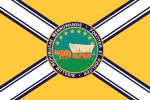
Mennowa is a state in the central Federal States. Bounded on the east by the Alormen River, the state is known primarily for its rolling prairies and river corridors. The capital of the state is Fort Constable, but the largest city is Minneuka. Other notable metropolitan areas include Des Nonnes, New Harmony, and Twin Rocks. Although it boasts a couple large metropolitan areas in Minneuka and Des Nonnes, the state has a vast amount of arable prairie used for agriculture. Agriculture and agribusiness remain two of the most important industries in the state.
The name "Mennowa" comes directly from the Mennowee peoples, who inhabited much of the present state prior to settlement from the east and south. Prior to Ulethan settlement, the native Mennowee peoples formed a confederation that extended across the majority of what became the Mennowa Territory, from the northern regions of Mennowa to the southern panhandle of the state. During the last part of the seventeenth century, a group of explorer-missionaries known as the Alexandrines migrated north through Franquese-controlled lands in Ardencia and the FSA's Grand Lakes area. Although the Alexandrines were comprised of individuals from multiple cultures, they primarily used the Franquese language and many of these settlements (e.g. Des Nonnes, Belle Plaine) are evidence of their naming. The Alexandrines were remarkably successful in converting a large number of the Mennowee tribes in the confederation, but the newfound faith also widened longstanding divides between tribes. This led to a series of bloody conflicts between the Mennowee Confederation and neighboring tribes within the territory. Over the course of the late eighteenth century, Mennowa began to become the historical crossroads for the Federal States as settling caravans and trails moved through the state toward both the southeastern lake areas and the northwest. With Alexandrine Rite of Ortholic Christicism entrenched among the dominant native tribes, the majority of those Ingerish settlers that did stay were themselves Ortholics or sympathetic to that denomination.
As the Ingerish expanded into the state, the Alexandrine-Christic Mennowee confederation allied and worked with the federal government. In exchange, the "civilized" tribes of the confederation were permitted to somewhat integrate and assimilate into the society of the newly organized Mennowa Territory. The alliance, however, also meant that those not part of the Mennowee Confederation were forcibly removed and treated with indignity. By 1803, Mennowa had enough registered people to apply for statehood: namely, Ingerish settlers and "civilized" Mennowee families. Distrust of both the large native population and the Ortholic Christics caused the territory to be divided a few times and delayed statehood. In 1811, however, Mennowa was finally granted statehood after political tides turned in favor of the frontier and prairie territories. In the present, Mennowa still boasts a notable percentage of its population that is of at least partial Mennowee ethnicity (about 29%). Its culture is still largely dominated by agriculture, Alexandrine Christicism, and a general contrarian social perspective compared to the rest of the FSA.
| States | Alcortez • |
|---|---|
| Capital District | Huntington(c) |
| Overseas Territories | |