OpenGeofiction:Antarephia: Difference between revisions
m (Protected "OpenGeofiction:Antarephia" ([Edit=Allow only administrators] (indefinite) [Move=Allow only administrators] (indefinite))) |
(Few corrections/additions - Gallery left to fill) |
||
| Line 1: | Line 1: | ||
This page is dedicated to admin plans concerning the development and organisation of '''Antarephia'''. | This page is dedicated to admin plans concerning the development and organisation of '''Antarephia'''. | ||
It may help potential territory owner to choose the territory that fits their mapping project. | It sets general directions and may help potential territory owner to choose the territory that fits their mapping project. The maps displayed on this page being for organisation purposes, limits for cultural and climate sectors are not to be understood as strict "borders" but rather the midpoint of the buffer zone when one zone blur into the next one. | ||
== Geography == | == Geography == | ||
| Line 6: | Line 6: | ||
[[File:Antarephia_Geo_Sector.png|600px|right]] | [[File:Antarephia_Geo_Sector.png|600px|right]] | ||
Antarephia is a slender continent that, if it were in real-life North hemisphere, would stretch from roughly the latitude of Nouakchott, Mauritania all the way up to Kiruna, Sweden. Keep this in mind for how it may affect the climate, the culture, the general functioning of a given territory and their impact on the mapping you plan. Maps on the right were designed keeping in mind natural features already in place, inputs/details from local mappers and notions of Geography (e.g. own knowledge, Wikipedia, "tutorials" by [https://www.youtube.com/c/Artifexian/videos Artefexian]). Local variations, details are up to territory owners as long as those are consistent. | Antarephia is a slender continent that, if it were in real-life North hemisphere, would stretch from roughly the latitude of Nouakchott, Mauritania all the way up to Kiruna, Sweden (or check real world [https://opengeofiction.net/relation/84531#map=2/-38.7/69.6&layers=X Northwest] and [https://opengeofiction.net/relation/131103#map=2/-57.0/57.3&layers=X Southeast] extreme "points" superposition). Keep this in mind for how it may affect the climate, the culture, the general functioning of a given territory and their impact on the mapping you plan. Maps on the right were designed keeping in mind natural features already in place, inputs/details from local mappers and notions of Geography (e.g. own knowledge, Wikipedia, "tutorials" by [https://www.youtube.com/c/Artifexian/videos Artefexian]). Local variations, details are up to territory owners as long as those are consistent. | ||
=== Bioregions === | === Bioregions === | ||
| Line 33: | Line 33: | ||
=== Gallery === | === Gallery === | ||
The aim of this gallery is to give potential territory owners an idea of how a given region may look like. | |||
<gallery mode=packed caption="Tropical Antarephia"> | <gallery mode=packed caption="Tropical Antarephia"> | ||
File:Chaco_Boreal_Paraguay.jpg|Tropical Savanna in wet season | File:Chaco_Boreal_Paraguay.jpg|Tropical Savanna in wet season | ||
| Line 71: | Line 71: | ||
[[File:Antarephia_Cultural_Sectors.png|600px|right]] | [[File:Antarephia_Cultural_Sectors.png|600px|right]] | ||
=== Culture === | |||
Antarephia is mainly made up of indigenous cultures, some with their own conlang(s), with limited Ulethan influence in some coastal regions, mappers would define. | Antarephia is mainly made up of indigenous cultures, some with their own conlang(s), with limited Ulethan influence in some coastal regions, mappers would define. | ||
As of November 2021, a lots of regions have not been mapped extensively or territory recently owned. The description of these sectors is consequently left rather vague at this stage. | |||
NB: The [[Collab:Southern_Islands|Southern Islands]] are a community-owned and managed in a form of collaboration. | NB: The [[Collab:Southern_Islands|Southern Islands]] are a community-owned and managed in a form of collaboration. | ||
=== Mapping Style === | |||
Antarephia having, in most cases, a long established History before coming into contact with the Ulethans, it is likely that it translates somehow into the mapping style(s), with most settlements having at their core a historic neighbourhood/city-centre of some form. Its exact rendition is up to the territory owners who may find inspiration in their neighbours' mapping. | |||
Settlements that would have been designed more recently, e.g. 20<sup>th</sup> century planned cities, settlements in extreme climatic conditions - hot or cold - that would have required "modern" technology to truly expand, are not expected to strictly follow the aforementioned pattern. | |||
[[Category:Continental administration pages]] | [[Category:Continental administration pages]] | ||
Revision as of 21:15, 24 November 2021
This page is dedicated to admin plans concerning the development and organisation of Antarephia. It sets general directions and may help potential territory owner to choose the territory that fits their mapping project. The maps displayed on this page being for organisation purposes, limits for cultural and climate sectors are not to be understood as strict "borders" but rather the midpoint of the buffer zone when one zone blur into the next one.
Geography


Antarephia is a slender continent that, if it were in real-life North hemisphere, would stretch from roughly the latitude of Nouakchott, Mauritania all the way up to Kiruna, Sweden (or check real world Northwest and Southeast extreme "points" superposition). Keep this in mind for how it may affect the climate, the culture, the general functioning of a given territory and their impact on the mapping you plan. Maps on the right were designed keeping in mind natural features already in place, inputs/details from local mappers and notions of Geography (e.g. own knowledge, Wikipedia, "tutorials" by Artefexian). Local variations, details are up to territory owners as long as those are consistent.
Bioregions
1- Tropical Antarephia
Tropical Antarephia is the name given to the zone located in the Northeast of the continent. It displays a two-season pattern with seasonal rains mostly likely during its hot summer - when the air is saturated with humidity - that follow a dry and sunny "winter". Depending on the location and altitude, savanna (different types) or tropical forests (most likely where humidity is higher: East/North East coast on heights close to the sea).
2- Arid Antarephia
Arid Antarephia is located on the North West of the continent (roughly same latitudes as Namib or Atacama Deserts). Deserts can be sand, gravel or rock desert according to the mappers' imagination. Depending on the altitude, the desert hot or cold (both have hot summers but cold deserts have cold winters). Due to the latitude, the cold deserts will not be as cold as the Gobi Desert but may resemble other plateaus deserts such as those in the US South East highlands. Very little vegetation is encountered in this region that is likely to feature no perennial stream, river or body of freshwater.
3- Semi-arid Antarephia
Semi-arid Antarephia is located east of Arid Antarephia. As for the deserts, the climate varies according to the altitude and latitude, regions along the Trans-Antarephian mountains are likely to have milder summers, colder winters and nights than regions more North and/or lower. All this leads to a variation of vegetations: steppe, montane grassland, shrublands or even some Arizona-Mountains-forest-like woods where favourable.
4- Subtropical Antarephia
Subtropical Antarephia is located south of Tropical Antarephia and displays a climate similar to the one of the US South East or around the Rio de la Plata in South America (or Sydney, Australia). Winters are mostly mild and Summers are generally hot with potential hurricanes from the Northeast in the late season. Humidity is high year-round leading to large mixed forests (they may have been partially replaced by fields).
5- Mediterranean Antarephia
Mediterranean Antarephia is located south of Arid and Semi-Arid Antarephia, and displays mild winters and, depending on the latitude and proximity from the ocean and prevailing winds, warm or hot summers. Rains fall mainly in winter and become rare or absent in summer the closer one goes to the deserts. This influences vegetation: Mediterranean pine/oak-like forest, shrubland. Highlands may display oceanic climate, especially in the southernmost regions, as they block humidity from the Hesperic Ocean.
6- Temperate Antarephia
Temperate Antarephia starts roughly around the 45°S parallel and displays variations of the oceanic climates: mild summers and cool winters. Regions to the West are likely to be "milder" year-round with a lot of rain, especially in winter. Further South, the temperature range narrows and lowers with more rain. The Mid-Antarephian Gap allows oceanic winds to cross and temper the climate of northern regions of the Harda Archipelago. Vegetation would be naturally represented by large deciduous forests with conifers being located mainly at higher altitude or further South.
7- Austral Antarephia
Austral Antarephia is some kind of inverted Scandinavia, the landmass does not allow true comparison with North America or Northeast Asia. Coming from Temperate Antarephia, warm summers reach lower maximum temperatures than further North and winters are cold with snow far from being uncommon. Regions further south, further from the sea and/or not facing the prevailing oceanic winds from the Northwest have cold to freezing-cold winters with cool and rather short summers. The northernmost regions have large mixed forests giving way to the taiga further south, which in turn is replaced by the tundra and glaciers (from 800-1000m or lower - ~3,000ft on the slopes facing South). The same series (mixed forests, conifers, taiga, tundra, glaciers) is triggered by height further north.
NB: The Southern Islands are a community-owned and managed in a form of collaboration. Given their latitude and isolation, they are likely to be covered with glaciers, glacial debris and little tundra (e.g. lichens) along the northernmost coasts.
Gallery
The aim of this gallery is to give potential territory owners an idea of how a given region may look like.
- Tropical Antarephia

Tropical Savanna in wet season
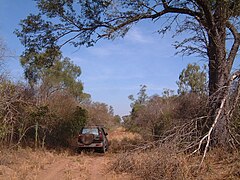
Tropical Savanna in dry season

Highland forest

Highland forest further East
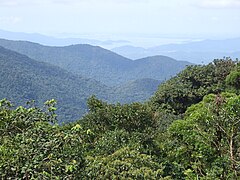
Highland forest further East
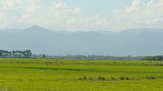
Coastal piedmont

Holmic island


- Arid Antarephia
- Semi-arid Antarephia
- Subtropical Antarephia
- Mediterranean Antarephia
- Temperate Antarephia
- Austral Antarephia
Culture

Culture
Antarephia is mainly made up of indigenous cultures, some with their own conlang(s), with limited Ulethan influence in some coastal regions, mappers would define. As of November 2021, a lots of regions have not been mapped extensively or territory recently owned. The description of these sectors is consequently left rather vague at this stage.
NB: The Southern Islands are a community-owned and managed in a form of collaboration.
Mapping Style
Antarephia having, in most cases, a long established History before coming into contact with the Ulethans, it is likely that it translates somehow into the mapping style(s), with most settlements having at their core a historic neighbourhood/city-centre of some form. Its exact rendition is up to the territory owners who may find inspiration in their neighbours' mapping. Settlements that would have been designed more recently, e.g. 20th century planned cities, settlements in extreme climatic conditions - hot or cold - that would have required "modern" technology to truly expand, are not expected to strictly follow the aforementioned pattern.