Sierra: Difference between revisions
m (→Early cultures) |
|||
| Line 43: | Line 43: | ||
The Cayos were found near the Clinton area and southern *AR120-74*, noted active around the year 1000, but this tribe appeared to no longer exist after the 1500s, likely being killed and integrated into an ever-expanding Zusi empire. | The Cayos were found near the Clinton area and southern *AR120-74*, noted active around the year 1000, but this tribe appeared to no longer exist after the 1500s, likely being killed and integrated into an ever-expanding Zusi empire. | ||
{| class="wikitable" | |||
|- | |||
!Period | |||
!Dates | |||
!Cultures | |||
|- align="center" bgcolor="#CCCCCC" | |||
!colspan="3" |'''Aceramic period''' | |||
|- | |||
| Early Preformative era | |||
|8000 BC –4000 BC | |||
| Tenda culture (ca. 6000-5000 BC), Early Colurona (ca. 4500 BC) | |||
|- | |||
| Preformative era | |||
|4000 BC –1500 BC | |||
| Late Colurona (ca. 4000 BC-3000 BC), Mosen culture (ca. 2000 BC) | |||
|- align="center" bgcolor="#CCCCCC" | |||
!colspan="3" |'''Ceramic period''' | |||
|- | |||
| Formative era | |||
|1500 BC –200 CE | |||
| Elvira culture (1000 BC-100 CE), Estancia culture (300 BC-200 CE) | |||
|- | |||
| Intermediate era | |||
|200 CE –1400 CE | |||
| Late Estancia culture (200-600 CE), Great Timona culture (600-1400 CE), Cayos culture (1000-1500 CE) | |||
|- | |||
| Early late and late eras | |||
|1400 CE – 1850 CE | |||
| Zusi culture, Timona culture, Sakuas culture, Anokasa culture | |||
|} | |||
===Zusi and Timona eras=== | ===Zusi and Timona eras=== | ||
Revision as of 21:45, 23 March 2022
| State of Sierra Sierra | |||
|---|---|---|---|
| |||
Loading map... When parsing the passed parameters had the following errors: unable to parse parameter "center" value is "," | |||
| Constituent state of | |||
| Capital | Elvira | ||
| Largest city | Dennison | ||
| Official languages | None | ||
| Demonym | Sierran | ||
| Government | Undetermined | ||
| • Governor | TBD | ||
| • Lieutenant Governor | TBD | ||
| Legislature | State Assembly | ||
| • Upper house | State Senate | ||
| • Lower house | State House | ||
| Area | |||
| • Total | 136,088.42 km2 52,544.03 sq mi | ||
| • Water (%) | xx% | ||
| Population | |||
| • Census | less than 3 million | ||
| • Density | xxx/km2 xxx/sq mi | ||
| Timezone | +8 | ||
.png)
The State of Sierra (Castellanese: Estado de Sierra) is a state is the western Federal States. It is one of the largest states in terms of area, but more sparsely populated. The state is known for its landscape consisting of the Sierras, wide, open high plains and plateaus, desert areas and rivers. It borders Tauhon in the west, Clamash to the south, Riopoderos to the southeast, Apawiland to the east, AR120-74 to the north and AR120-73 to the northeast.
Sierra was first settled around the year 800, had vibrant Native Archantan cultures, settlements and even some cities by 1000-1200. Sierra was explored by the Castellanese from around 1530, though primarily from 1650 onward. The first settlements sprang up around the rivers, primarily in the west. Sierra became a possession of the FSA from 1841, and a territory in 1858. Statehood was achieved in April 1872.
The capital of Sierra is Elvira, though the largest city is Dennison.
History
Early cultures
The territory of present-day Sierra was inhabited by a variety of different native Archantan tribes. Most early cultures inhabited the Colurona valley, western lowlands and as high as the altiplano near Dennison, being nomadic and moving with domesticated animals such as llamas, dogs and goats. The Estancia culture (fl. ca. 300 BC-600) was fairly advances, making use of stone tools, producing pottery and leaving behind the earliest stone structures in the area. Most physical remains of culture cease around the year 600, with a likely forced unification with the first Great Timona era. Around the year 600 is when the Great Timona culture began flourishing. Originating in what is now western Estancia County, they may have been the first peoples to traverse the mountains, along the Harding Pass. The Great Timona exhibited the earliest use of terraced farming, present in the Pokaibca site north of Ballard.
The Cayos were found near the Clinton area and southern *AR120-74*, noted active around the year 1000, but this tribe appeared to no longer exist after the 1500s, likely being killed and integrated into an ever-expanding Zusi empire.
| Period | Dates | Cultures |
|---|---|---|
| Aceramic period | ||
| Early Preformative era | 8000 BC –4000 BC | Tenda culture (ca. 6000-5000 BC), Early Colurona (ca. 4500 BC) |
| Preformative era | 4000 BC –1500 BC | Late Colurona (ca. 4000 BC-3000 BC), Mosen culture (ca. 2000 BC) |
| Ceramic period | ||
| Formative era | 1500 BC –200 CE | Elvira culture (1000 BC-100 CE), Estancia culture (300 BC-200 CE) |
| Intermediate era | 200 CE –1400 CE | Late Estancia culture (200-600 CE), Great Timona culture (600-1400 CE), Cayos culture (1000-1500 CE) |
| Early late and late eras | 1400 CE – 1850 CE | Zusi culture, Timona culture, Sakuas culture, Anokasa culture |
Zusi and Timona eras
Around 1400, the Zusi began emerging as a major power in northwest Sierra. Related to Tempache and Cosperican tribes, the Zusi came from the desert and were known for their adobe housing and warrior culture. From 1500 to 1700, they began expanding eastward as they sought better land and more resources. The Zusi were a confederation with various chiefs working together, and were well-organized despite the lack of a single leader.
Around 1550, the various Timona descendants of the 7th century culture were united under a towats (king), and began expanding north and then west. By 1650 they Timona became the dominant tribe in eastern and central Sierra due to their weaponry, organization and knowledge of the mountain area. They formed a kingdom with a vassalage system with various other tribes, the Kwiskona, Anokasa and Saguas, who remained largely independent put provided food, grain and soldiers to the army.
By 1700 the Zusi and Timona were in conflict, and the Timona built Avirca as a modern city near their border, the most impressive pre-contact indigenous settlement.
The Sakuas, Timona and Estancia culture were known for their impressive stone buildings and temples, leaving behind such sites as the Tabica Ruins (Timona), Sun Rock mummies (Sakuas) and Harding Archaeological Site, where remains of the Estancia culture's largest stepped pyramids can be seen.
The fall of the Timona Kingdom was precipitated by fighting among the Saguas; around 1760 the lowland Sakuas, in particular along the Colurona, began resisting the influence of mountain Sakuas, leading to various battles and attempts at reconciliation to try and maintain the unity of the kingdom. Towats Queogani (r. ca. 1766-1789) tolerated the Sakuas conflict as he attempted to appease the lowland chiefs, but was losing confidence among the military and nobility. Murdered in 1789, this led to various competing claims by his two younger brothers. By 1790, the Castellanese had an armed presence in several locations west of the Colruona, and having pacified the Planos people, used them to attack the Sakuas and foment instability in the border regions of the kingdom. The Sakuas were unable to stem the Planos' advance, especially by 1795 as they had acquired muskets, which were superior to the stone axes and obsidian spears of the Sakuas and Timona.
The Castellanese sent missionaries and a few officials to Avirca and made contact with the Timona in 1801, sending the first accounts of their great constructions. Towats Quantige (1761-1825), king from 1804, welcomed more Castellanese as advisors, hoping they would enable him to maintain control over a weakening empire. By 1820 it became apparent that the Castellanese did not really support him, and were promulgating rebellions and revolts by various princes and other nobles to internally weaken the kingdom. In 1824 he ordered the killing of six Castellanese officials present in the town, for which the Castellanese sent an army up the mountain and defeated the Timona army in 1825. Quantige was killed in battle and the Timona quickly became a divided peoples. Many Timona fled over the mountains and continued their traditional way of life until well into the 19th century, but fairly isolated and no longer the power in the area as the F.S. Army and settlers came in large numbers to Sierra.
Castellanese period
Castellanese settlement became permanent by the 1780s, with the founding of Fortín de la Sierra near modern-day Folsom; this was a small wooden fortress with several families building houses in the area. Various settlements were founded and often abandoned due to raids by indigenous warriors, but portions of the state were in continuous Castellanese control by then. Francisco de Carranza y Bergara (1755-1817) was the first military commander of the area, and successfully founded the oldest continually-inhabited town, Fronteras in 1789 (founded as Fortín de la Frontera]). Carranza y Bergara was killed in a clash with the Sakuas in 1817.
Construction of Mision de Lola around 1790, and shortly after the Fortín gave the Castellanese control over the Upper *Colurona* River area. In 1820 a cavalry outpost on the opposite side of the Colurona was also built, today the basis of Fort Nickerson. By the 1830s the Castellanese had settlements in the east of the state, as far as San Daniel, primarily as mining towns for lucrative copper deposits.
Early settlement
Overland caravans of settlers began arriving to Sierra in the late 1840s and through the 1850s. Lovell Braxton led the 5th Cavalry Regiment to war against the Castellanese in 1849, and managed a number of key victores before consolidating F.S. hold over the area. The Western Territories were proclaimed as part of the FSA and Braxton was appointed its first military governor.
Sierra Territory
The Sierra Territory was proclaimed in January 1858; the small mining town of Colurona was named temporary capital prior to the confirmation of Lola as capital that year. The growth of Elvira and particularly Dennison threatened Lola's position as the most important city, and in 1864 Dennison's businessmen proclaimed it the capital. Assemblymen from Colurona, Montillo and Dillon supported the Lola government and helped form a militia, and those in Chapman, Elvira, Hernandez and elsewhere backed the Dennison government. Fighting between rival militias broke out in April 1864 and ended in 1866, a period called the Sierran Civil War.
The only major pitched battle was fought north of Fountainhead in June 1864, which proved a victory for Lola's militias, but they were unable to advance any further due to the weather. Most of the fighting was in turn small skirmishes and raids, but after 1865 fighting was much reduced. 2000 federal troops were moved to Fort Lola (now Fort Nickerson) and helped prevent significant fighting, but some raids persisted until 1866. The Congress in Huntington eventually named Dennison capital in 1866.
Statehood
The first moves for statehood were in 1868 with the first constitutional convention. While a constitution was drawn up, the issue was derailed on the selection of a capital. Elvira also began to position itself as an alternative for a capital, especially due to its central location between Lola and Dennison. With the construction of a railroad from to connect the state with Tauhon in the west and the rest of the country, all three cities hoped for either the railway passage or the capital. Elvira's businessmen and politicians were eventually the most adept, and with rumors of much bribing vitally ensured that the railway would pass through it in 1869. By early 1870 offices of the Great Western and Asperic company were built in Elvira, and construction of the railway reached the city in late 1870.
The selection of Elvira as capital in 1871 paved the way for statehood, achieved 1 April 1872. In 1873, women were allowed the right to vote after a law passed in the state legislature. Large deposits of silver and gold were discovered in the center-west in 1874, leading to a huge influx of prospectors and their families, though many would leave as the easy gold was mostly gone around 1879. Many small towns sprung up, thrived and then declined with the gold, and later silver and other mining.
Conflict with native Archantans
.jpg)
Conflict with the various native Archantan tribes began in the 1820s, with two battles fought near Lola, in 1823 and 1828, between the Castellanese and Whitehead tribe.
When Sierra became F.S. territory, wars were fought with various tribes on numerous occasions. F.S. cavalry fought the Whitehead in 1852 and secured a treaty with them to end fighting. A bloody war was fought with the Planos tribe (near Dennison) from 1854 to 1857. Many early settlers to Dennison and Redonda were killed, but vast numbers of Planos people were in turn killed by F.S. troops. Militias formed in Lola and Dennison by the late 1850s also were used to fight. Most tribes agreed to peace treaties with the Federal States, and many were forced to give up much land in exchange for reservations, and others were specifically moved to a Native Territory (today part of Brenton and Elgin counties).
Battles were fought in the northwest with the Yahomas, Undaia and Zusi tribes in 1877, and from 1880 to 1882 with the Navarro and San Pedro Zusi. The longest-lasting conflict was the Kaitenas Wars, beginning in 1859 and lasting until 1887. Led firstly by Ancawa (d. 1872) and later by his son Teni (c. 1850-1910), they frequently attacked overland caravans, disrupted construction of the transcontinental railroad and kept up to 1000 soldiers tied up between La Rue and Harding. The death of Ancawa in a failed raid saw many Kaitenas captured, but Teni led most of the tribe to safely by hiding out in the Vilchez Peak area in the winter of 1872-73. Teni was captured in 1875 and imprisoned in La Rue, but a famous jailbreak by 100 Kaitenas tribesmen saw them free him and cross into Apawiland, and into western Tejoma in 1876. Teni avoided capture, but was engaged at least three times by F.S. troops, in 1877 near Homage Mountain, in 1879 near Andaguani City and in 1880 in Elgin County. He likely spent several years hiding in the Native Territory among other tribes until being found and detained in Lovell in 1884. Other bands of Kaitenas warriors continued raiding until 1887.
Reservations were established for several tribes in the late 19th century, for: the Western (San Pedro) Zusi (1882), for Poyé Zusi (1882), the Undaia (1884) and Kwiskona. Most other tribes ended living outside of the reservations.
Early 20th century

In 1913 the Native Territory was disbanded; the western portion went to Brenton County and the east was made a new county. Part of the former Native Territory was turned into the Kaitenas Reservation.
From the 1920s onward, Sierra became known as a skiing destination, and winter sports would become a highlight of the state. Expanded and ever luxurious train service to the state made tourism much larger, and the Sierra Tourism Burea was set up in 1928, to promote skiing, ice skating, nature walks to people out of state and outside the FSA.
Later 20th century
Government and politics
Sierra has a government similar to that of the FSA. It is headed by an elected Governor, supported by a Lieutenant Governor. The governor appoints other members to government, such as the secretary of state, attorney general and treasurer. The current governor is Maggie Woods, of the [right-wing party] elected in 2017 to a second term.
Sierra has been a key swing state in Federal States politics since the early 1940s, and is often known as the "flip-flop state". The state has often gone from left-wing to right-wing governments in succession, and is known for election patterns that buck the general nationwide trend. The east, south and northeast is often considered to be a more conservative voting region in the state, while the center and west are more left-leaning. The major cities are more left-leaning, though Lola has been more right-leaning than all the others.
Governor and legislature
Prior to statehood in 1872, there were various civilian governors of the Sierra territory going back to 1858. The first F.S. governor was Lovell Braxton ,as military-appointed. The first military commander in the area by the Castellanese was Francisco de Lola y Bergara. The modern governorship dates to statehood in 1872. Since the 1920s the governor has been limited to three terms in office, though the only one to complete those since then was John R. Sanchez, in the 1970s and early 1980s.
The first legislature was set up in 1858, replaced by the state legislature in 1872. The current capitol building was built in the mid-1960s, replacing the original one on 7th Avenue and Parrish Street, built in the 1880s.
Healthcare
Uniquely within the Federal States, Sierra has a publicly subsidized health system; employers, employees and the state government contribute to a public health insurance, and state residents are able to augment it with private insurance as well.
Environment
The State Wildlife Department was set up in the 1930s and oversees the management and protection of a variety of state parks, forests, preserves, sanctuaries and wilderness areas. The natural areas overseen by the state include Northern Peaks Wildlife Preserve, Santa Elena Forest, Telles State Forest, Meseta State Preserve, Kaitenas Forest, Tumona and Elgin Forest, Vilchez Peak Protected Area, Fulton State Park, Fielding State Forest, South Winston Wilderness Area, Fronteras State Forest and San Felipe River Basin Nature Reserve.
Sierra has also set up the Sierra Disaster Management Office, which assists in planning and coordination around natural disasters, such as floods, mudslides, volcanic eruptions and others, assisting in monitoring and response work primarily.
Education
Sierra has three main universities, the University of Sierra (main campus in Dennison and second in Lola), State University of Sierra in Elvira and University of Dennison.
Municipalities
Sierra has a number of cities, towns and villages, and a single city-county (Dennison). Especially in rural and mountain areas, a variety of unincorporated communities can be found, which depend on other nearby towns and villages for many public services.
Culture
Language
Sierra has no official language. Ingerish is the most widely spoken language in the state. Many of the indigenous peoples in the state speak Zuso-Saguan, a continuum of mutually related and intelligible dialects. In parts of Cusatia, Serrano, Meseta, Estancia and Los Valles County, many indigenous peoples may only speak their mother dialect, and in some areas knowledge of Ingerish may be very minimal at best.
Media
Print media has existed since the mid-18th century. The Dennison Observer is the best-known and most-read newspaper in Sierra (and from the state nationally).
Television in the state has been present since the middle of the 20th century. Free Television (Free Television Sierra) is a popular Sierran station, a public television non-profit channel partly funded by the state. National broadcasters have local stations in the state as well.
Music
Wooden flutes, claves and drums are some of the earliest instruments used by Sierra's indigenous peoples, dating back hundreds of years. Indigenous music dates back centuries if not thousands of years, with both oral and purely instrumental music being noted by the Castellanese and Archantans. Indigenous musicians adapted a four-stringed guitar of early Castellanese settlers into their instrument repertoire, helping to give their music a further distinctive sound. One of the best-known indigenous music groups is Kintis, which was formed in 1994 and has released a number of well-received albums of traditional music, In the 2010s a number of artists have been combining indigenous instrumentation and song into pop and rock settings.
One of the most famous early Sierran music stars was Jack Mitchell (1923-1961). He became a famous country and western star, not just in the state but also nationally before his death in a car accident. Another popular singer in this period was the folk artist Mary Rivas; she recorded most of her hits at the famous Modern Sounds Studio in redonda and was part of the 1960s folk revival in the west. The Down Under was an early proto-punk group from Redonda; active for four years they only put out nine singles but had a popular underground following.
MARIO on DRUMS is one of the more popular recent musicians to come out of Sierra. He is a rapper and drummer known for his use of 1970s-inspired drum breaks and vocal styles.
Food and drink
Traditional Sierran food was based around small and medium-sized mammals, either wild or herded and raised in indigenous settlements, such as some camelids, mountain goats, cavies and some birds. The indigenous peoples prepared various beverages, including puspa, a fermented potato beverage, and teas made from coca leaves and other herbs. Cookouts and smoked meat became commonplace in the 19th century and are considered typical, with charcoal-grilled meats abundant throughout many smaller towns and villages. Potatoes, quinoa, corn and other tubers and grains are grown in Sierra and used in the local cuising.
Sierra is known for having a variety of small and medium breweries. Montana, brewed in San Daniel since 1886, is one of the most popular brands nationally.
Sports
A variety of sports teams are present in the state of Sierra, both amateur and professional. The University of Dennison's sports teams are known as the Lions, the University of Sierra (Lola) teams are known as the Rangers and the University of Sierra Dennison's teams are known as the Hawks. All universities are competitive in Archantan football, soccer (football) and baseball among other sports. The USL Rangers team has the oldest history of Archantan football in the state, with their team known to have played a version with a round ball as early as 1876.
Professional sports teams include the Dennison Sierrans (baseball), the Dennison Bombers (basketball) and Dennison Wranglers (Ar. football). The Bombers basketball team is the one with the oldest history, founded in 1955 and entering the Archantan national league in 1961. The Wranglers have been present in Sierra since 1975 when a franchise was moved to Dennison, and the Sierrans franchise was awarded to the state in 1984. Newer professional teams include Dennison City SC (2007), which is based in Redonda.
Cycling is also very popular in Sierra, with a number of high mountain specialist climbers coming from the state. Sierra hosts a variety of cycling events, of which the most famous, in recent years, is the Big Pico Route. This is a high altitude unpaved climb attempted by mountain/gravel bikers, beginning at the town of Harding (elevation of 2650m), through a road point at 5003m (16415ft) elevation, believed to be the highest road point in Sierra, and ending after a 22km descent to the I-110, adjacent to Big Pico, a large mountain. This is an exceptionally difficult climb, due to the grades, the very high altitudes and the climb lengths, and has onky been achieved by a handful of climbers.
Other popular sports include tennis, rally racing, and in some parts, bullfighting and horse racing. Bullfighting in Sierra is part of the state's Castellanese heritage, present only in a handful of towns. Lola's bullring is the most famous, holding corridas since the 1820s. The bullfighting season has traditionally ended with win the first weekend of June, where the biggest names in the sport have been brought in for fights before the winter. Since the early 1970s, a variant that does not harm the bulls, but bullfighters can still be harmed, and some opposition remains due to the taunting of the bulls during the spectacle.
Clothing

Traditional indigenous clothing was designed to be worn for the cool and cold mountain temperatures, and weavers made use of wool from alpaca, guanaco and other animals to design ponchos, pants, hats and mittens to withstand temperatures that could fall below freezing. Early Castellanese settlers (mainly ranchers and vaqueros) west of the Colurona adopted the poncho, together with their straw, short brimmed hat. Indigenous peoples also adapted a variant to their clothing, made from woolen felt instead, used by ranchers at higher altitudes. At one point at the very late 19th century, wide-brimmed hats were popular and comically-brimmed hats became bigger as ranchers tried to outdo themselves, with the wide floppy straw hats of the 1890s the peak of the excessive style.
Typical Sierran clothing is not normally worn in the modern day, but the traditional wrangler hats and woolen ponchos are still used, especially prevalent among high-altitude and mountain regions. Alpaca and guanaco clothing and felt and straw wrangler hats continue to be produced in a handmade fashion, protected in Sierra as a symbol of cultural heritage.
Modern Sierran fashion is a smaller industry, centered around a few designer houses. The most notable is Sergio Bidarte, Castellanese-born designer who was active in Dennison from 1949.
State Symbols
Sierra has a variety of state symbols. All of the official state symbols are recorded in the State of Sierra Blue Book, a book outlining official state information. Aside from the official symbols there are many unofficial ones, such as state career (cowboy or miner), state farm animal (llama), state colors (red and gold), state natural formation (volcano), state beer (Montana), state ballad (The Legend of Desperado) and many others.

Front side of the flag of Sierra

Back side of the flag of Sierra

Seal of Sierra

State Flower: Cassiope mertensiana
State Tree: Polylepis rugulosa
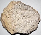
State Rock: Pumice

State Gem: Red Beryl

State Bird: Grey-hooded Sierra finch

State Mammal: Sierran bighorn sheep

State Dinosaur: Sierracosaurus
State Song: From the Mountains to the Seas, Sierra Tis of Thee (1912)
- Lorenzo Roel 13.jpg
State Sport: Rodeo and bullfighting

State Microbe: Saccharomyces cerevisiae

State vegetable: Potato

State Hat: Wrangler hat (felt or straw)
.png)

.jpg)
.jpg)
.jpg)

.jpg)


Political divisions
The state is divided into 22 counties. Estancia County is the largest in terms of area, and the City-County of Dennison is the smallest and most populous. Sierra is unofficially divided into five regions: West, Central, East, North and South.
| County | County Seat | Area in km² | Area in miles | Population | Pop. Density in km² | Established |
|---|---|---|---|---|---|---|
| Andaguani | Andaguani City | 10108.03 | 3092.73 | 29,400 | 2.91 | 1910 |
| Asuma | 2579.9 | 996.11 | 6,100 | 2.36 | 1906 | |
| Braxton | Lola | 1827.49 | 705.6 | 288,450 | 157.84 | 1850 |
| Brenton | Montillo | 12997.09 | 5018.2 | 77,900 | 5.99 | 1877 |
| Colurona | Colurona | 3538.91 | 1366.38 | 52,104 | 14.72 | 1870 |
| Cusatia | Huntington | 8443.58 | 3260.08 | 38,100 | 4.51 | 1872 |
| Dennison | Dennison | 97.82 | 37.77 | 672,500 | 6874.87 | 1890 |
| Dillon | Dillon | 6233.63 | 2406.82 | 56,225 | 9.02 | 1899 |
| Elgin | Vilsack | 12522.96 | 4835.14 | 63,200 | 5.05 | 1913 |
| Estancia | La Rue | 21375.53 | 8253.14 | 41,200 | 1.93 | 1921 |
| Gerrard | Everson | 10725.94 | 4141.31 | 66,885 | 6.24 | 1886 |
| Los Valles | Timona | 2608.68 | 1007.22 | 51,200 | 19.63 | 1976 |
| Meseta | Elvira | 5975.67 | 2307.22 | 429,600 | 71.89 | 1854 |
| Pinault | Chapman | 5272.2 | 2035.61 | 144,500 | 27.41 | 1865 |
| Pink | Hernandez | 599.9 | 231.62 | 46,800 | 78.01 | 1875 |
| Saguas | Canon City | 2018.09 | 779.19 | 9,250 | 4.58 | 1904 |
| Sanchez | Caldwell | 5503.97 | 2125.1 | 3,200 | 0.58 | 1881 |
| Santa Cruz | Carlin | 2490.37 | 961.54 | 19,400 | 7.79 | 1911 |
| Serrano | Unita | 5504.29 | 2125.22 | 922,115 | 167.53 | 1857 |
| Wilfried | Barclay | 1805.69 | 697.18 | 413,220 | 228.84 | 1871 |
| Yahomas | Billard | 4247.8 | 1640.08 | 206,000 | 48.5 | 1869 |
| Zusi | Burris | 9424.37 | 3638.77 | 66,250 | 7.03 | 1872 |
- Map of Sierra in 1886.png
Sierra in 1886 (note the 13 counties/1 territory)
- Sierra Population Density map.png
Population density by county, 2019
Geography
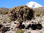
Sierra has a varied geography with many distinct natural features. Northwestern Sierra is characterized by semi-arid and partially arid landscape, with few table formations like mesas and buttes, and a lot of scrub and low-lying vegetation, if at all. Western Sierra is generally fairly flat. Central Sierra is dominated by the *Colurona* River valley, known for its verdant canyons and drops in altitude to form valleys. The area between Dennison and Folsom lake (part of the Upper Colurona) is the Sierran high plain, which ranges from around 1800m in the west to about 2100m in the east, and tends to be slightly drier and colder than , is the Most of the center and east (north and east of the river) is the backbone of the western mountain range, where the FSA's highest peaks can be found. These include snow-capped peaks, green mountains, some volcanoes and other elevated rocky formations.
Desert
The Northwest desert is located partly in Sierra, and is a very arid, dry salt flat. The northwest desert ranges from about 2500 to 4700m elevation, roughly flat apart from from some peaks and flat mesa-like structures, the remains of islands from when the desert was an ancient lake or sea.
Altiplano/high plain
The Sierran altiplano, high plain, is an area roughly in central part of the state. It is a fairly flat plateau measuring over 6500km², ranging in elevation from about 1800m in Folsom and Hernandez to 2000m in Dennison and Redonda. The high plain is semiarid like much of western and southern Sierra, but due to its higher elevation than those tends to have a drier climate with less precipitation.
Mountain area
The Western Sierras originate in far northwest Sierra, with various mesas found in the Northwest Desert the highest formations before the mountain zone. The range continues east and south, with peaks reaching altitudes of over 5000m in the northern sections. The Eastern Sierras begin in north central Sierra, and are marked by peaks of over 6000m. All of Sierra's volcanoes are found in the eastern Sierras. Both the western and eastern ranges converge in central Sierra, and then the western peaks continue southward while the eastern peaks continue towards the southeast.
Much of the mountain area begins at an altitude of 3000-3400m, stretching across much of middle Sierra. At 4500-4800m, the high mountain zone is found in central and north central Sierra, a high plateau of dry, arid landscape interjected with many high peaks. The mountains in eastern Sierra are at a lower altitude and prominence, and many do have some tree cover.
The snow line in the Sierran mountains varies considerably depending on the latitude and altitude of mountains. At the northwestern high peaks (here and here) (about 31.5 to 32 degrees south), the tree line hovers around 4700 and 5100m. In central Sierra (around and below 33 degrees south), the snow line drops to about 4400 to 4800m. The outlier Goblin Peak, the southernmost 4000er (peak above 4000m), has some permanent snow at around 4950m, though has increasingly become minimal and looks like powdered sugar.
In the winter months (May to October), permanent and temporary snow can be found at much lower altitudes. In cities and towns like Harding, Kaitenas, La Rue, and Burris (central/eastern Sierra), snow can remain on the ground at altitudes of over 3500m, though usually closer to 3800m. In northwestern and north-central Sierra, snow remains just below and above the 4000m mark, blanketing towns like Burris-Braxton, Clinton, Huntington and others.
Glaciers can be found on peaks above 5000m in northern Sierra, but at altitudes of close to 5400 or 5600m. Olson Mountain's glacier is the one found at the lowest altitude, but it is retreating at a fairly fast pace. Most peaks in this area over 5700 or 5800m are not experiencing such retreating glaciers, though they are certainly at risk. In central and eastern Sierra, most peaks above 5000m have some amount of glacier areas. Mount McInnes was known for a fairly large glaciated area, but following its 1882 and 1960 eruptions, and occasional volcanic activity, much of the glacier has melted away.
The High Mountain Society, based in Dennison, is one of the largest organizations involved in management, study and monitoring of mountains, volcanoes and their unique ecosystems, both in Sierra and around the world.
Hydrology
Central Sierra is defined by the *Colurona* River, which begins in the northwest portion of the state in Asuma County, flowing east to Sebita lake and then south until reaching *Lake 1* of the great lakes. The *Colurona* is fed into by several tributaries, notably the San Fernando River, Rio Gordo (and Barras River) and Royston River. The *Colurona* is significantly managed, with a variety of dams having been constructed between 1937 and the 1970s.
The San Fernando River was the first to be dammed, with the creation of the San Fernando Dam and Goldman Reservoir in the late 1930s. The San Fernando was further dammed in 1975, the last of the dams build in the state, further upstream. The Upper Colurona Dam was completed in 1970 and led to the creation of Sebita Lake; this was planned together with a Lower Colurona Dam near Dillon, but was opposed and defeated by the environmental movement. The Rio Gordo was dammed in the 1950s, creating the Las Barras Reservoir.
Many of the rivers and creeks in the state are fed by glacial water, and depending on the location of the glacier within the mountain flow in different directions. Glacial water on the western side of the mountains (ie. Yunas and San Fernado Rivers) flow into the Colunrona basin, and on the east (Rosalie and Tunkas Rivers) into the Alormen basin. Glacial waters in the far north and northwest of Sierra flow into the Asperic Ocean, with some west through Tauhon and others north through AR120-74/Tempache.
The largest lake in the state, Lake Mona, is natural, but the two next largest, Lake Folsom and Sebita Lake, are all man-made.
Protected areas
Sierra has 32 natural areas protected at a state and national level, including State/National Forests, national aprks, national monuments, state and wildlife preserves, wilderness areas and preserves, protected and recreation areas. In western Sierra, the Northwest Desert National Monument, Fronteras State and National Forests and San Felipe River Basin Nature Reserve are the protected areas in the region. the Northwest Desert is dry and high, known for mesas and buttes. The others are heavily forested and largely unmolested areas. West central Sierra has state parks in a couple of the man-made lakes.
Protected areas in Sierra
Biodiversity
Sierra has a varied diversity in its flora and fauna, known for its distinct biomes and ecosystems. The Sierra state constitution specifically protects "the state's diverse flora and fauna" in the newest amendment. The state has a variety of subtropical, subalpine and alpine plants, flowers and animals and is known for various endemic species due to its elevation and altitudinal zonation. A lot of the biodiversity has historically been at risk due to commercial farming, mining and resource extraction and global climactic changes. Efforts to help preserve and conserve the unique flora and fauna are undertaken by the state Forestries and Wildlife Department, and more recently by the WICO (Wildlife Conservation Organization), an NGO that works to help conserve flora and fauna.

Sierran mountain bear
Tourism poster


Fauna in Sierra
Sierra has some unique animals such as the Sierran mountain bear, vicuñas, Sierra bighorn sheep and guanacos, found only at high altitudes within the state. Various small rodents are found throughout the state, of which some were traditionally raised and consumed by some indigenous peoples. Many native bird species are present in the state as well, of which some of the largest include condors, eagles, harriers and various vultures.
List of fauna in Sierra
| Name | Status[1] | Image | Notes |
|---|---|---|---|
| Black-chested buzzard-eagle (Geranoaetus melanoleucus) | Healthy |  |
|
| Golden eagle (Aquila chrysaetos) | Healthy |  |
|
| Cinereous harrier (Circus cinereus) | Healthy |  |
|
| Turkey vulture (Cathartes aura) | Healthy | .jpg) |
|
| Black vulture (Aquila chrysaetos) | Healthy | _(21519728296).jpg) |
|
| Grey-hooded Sierra finch (Phrygilus gayi) | Healthy |  |
|
| Sierra goose (Neochen melanoptera) | Healthy |  |
|
| Lesser rhea (Rhea pennata) | Healthy | .JPG) |
|
| Montane guinea pig (Cavia tschudii) | Healthy |  |
|
| Southern viscacha (Lagidium viscacia) | Healthy |  |
|
| Guanaco (Lama guanicoe) | Healthy |  |
|
| Vicuña (Vicugna vicugna) | Healthy | ||
| Astrasian cougar (Puma concolor couguar) | Healthy | ||
| Culpeo (Lycalopex culpaeus) | Healthy |  |
|
| Mountain condor (Vultur gryphus) | At-risk |  |
|
| James's flamingo (Phoenicoparrus jamesi) | At-risk |  |
At risk due to lithium extraction. |
| Mountain flamingo (Phoenicoparrus montanus) | At-risk | .jpg) |
At risk due to lithium extraction. |
| Sierran bighorn sheep (Ovis sierrensis) | At-risk |  |
|
| Pudu (Pudu puda) | At-risk |  |
|
| Colocolo cat (Leopardus colocola) | At-risk | ||
| Astrasian gray fox (Lycalopex griseus) | At-risk | ||
| Sierran mountain bear (Melursus ursinus inornatus) | Vulnerable | ||
| Long-tailed chinchilla (Chinchilla lanigera) | Vulnerable |  |
|
| Altiplano mouse (Juscelinomys altiplanus) | Vulnerable | Small population only in grasslands between Billard and Rocky Mount. | |
| Kodkod (Leopardus guigna) | Endangered | ||
| Baxter's toad (Anaxyrus baxteri) | Unrecoverable |  |
Extinct in wild. Breeding program by conservation efforts have led to limited reintroduction in Ostend Protected Biome. |
Climate
Sierra's climate is not incredibly complex nor does it experience extreme temperature changes. Sierra tends to have a drier and not particularly humid climate, with cool to cold winters and warm summers. Sierra is roughly divided into three climate elevations, lowland Sierra (up to 2000-2100m), mid-mountain (2300-4000m) and high mountain (4000m+).
Some areas in the mountain, particularly in high altitude valleys tend to have warmer humid climates, so towns like Burris/Braxton may be more susceptible to significant precipitation and snowfall. The temperature increases with the elevation, with cooler alpine weather found in the mountains and very cold temperatures of below the freezing point in a few high mountain towns and many summits.
Western Sierra (and parts of the east) tend to be warmer due to lower altitudes, but they do not get significant temperature changes, rather only moderately warmer than the high mountain. Lola's location in a lower elevation valley in the Colurona (about 1200m) allows for warmer summers that most of the state. The Northwest Desert is one of the hottest places in the state, where daytime highs hover at just below or quite above 20°C (70°F), and record highs have exceeded 30°C (about 90°F). Lows can be cold and at night tend to be close to freezing, dropping well below in the winter. This area is particularly dry, with monthly precipitation around 10mm or less all year round.
Economy
Sierra has a diversified economy. Finance, transportation, mining, retail and tourism form a majority of the economy in the state. Companies based in the state include Western Bank (finance), flySmart (airline), ShopperSmart Companies (owners of Maxima and Shoppersmart) and Planet Desktop (electronics).
Agriculture
Sierra is home to a variety of agriculture found throughout the state. The Colurona Valley (around and south of Lola) is one of the most fertile areas for vineyards and winemaking, due to its warm summers and low likelihood for winter frosts. Listan and syrah are the most common varieties of grapes produced. Eastern Sierra is known for its large livestock farms, aided by the gentle sloping farmland. The mountain areas of Sierra depend on smaller communal and family plots, using traditional land and cultivation methods of the indigenous peoples dating back centuries. Many of these are located on hillsides and along mountains, and some terraces may still be used. In mid-mountain elevations up to 3400m, corn is well-suited to growing. Up to 4000m, though in some places higher, many potato varieties are grown in farms or grow in the wild. Beyond 4000m most crops do not grow due to the cold and chance for frost; though quinoa and canihua (chenopodium pallidicaule) are the tow main crops grown up to and beyond 4500m, due to being high in protein and fiber, hardy in time of drought and resistant to the cold, able to survive in below-freezing temperatures.

Canihua plants in Shupca
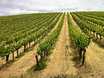
Syrah vineyards near Lola

Various potato varieties
_at_Atuncolla_near_Sillustani_Juliaca.jpg)


Energy
Much of the energy in the state of Sierra is provided by three major hydroelectric dams, followed by natural gas, nuclear power, coal and wind power. Since the mid-2000s, there has been a push to get away from overreliance on coal.
Reeder Dam
Reeder Dam was built from 1949 to 1953 and was the first major dam built in the state, on the *Truchas* River. It led to the creation of Lake Vilsack and growth of Vilsack and Stith (Apa.). The dam very nearly failed in 1954, when heavy rains led to minor overflows. It was heightened by about 10 meters in 1956 to prevent any further chance of water spilling over. The dam continues to provide energy to eastern Sierra and western Apawiland.
Upper Colurona Dam
The Upper Colurona Dam is a 705 ft (215m) tall dam on the *Colurona* River. Built from 1965 to 1970, it is one of the tallest dams in the country, and is used for hydroelectric energy and water supply to the Dennison-Redonda area, Elvira and Lola. The dam was one of the largest engineering works of the latter 20th century, and when completed cost nearly $170 million, $12 million over estimate. The dam led to the creation of the 18 km long Sebita Lake, which is now a recreation area, but led to the loss of many natural ecosystems.
Folsom Dam
Folsom Dam was built on the San Felipe River from 1969 to 1973, and was planned in conjunction with the Upper Colurona Dam. Considerable opposition from the nascent environmental movement led to several court cases, but construction eventually began in 1969. The dam led to creation of Lake Folsom when flooded.
Lake Mona Generating Station
Lake Mona Generating Station is a nuclear power station located near Chapman. The plant consists of 760 MW boiling water reactor (Mona 2). Construction of Lake Mona Generating Station began in 1968 and was completed in November 1974. Mona 1 was an experimental sodium fast breeder reactor and Mona 2 was a more conventional boiling water reactor.
The plant suffered a significant partial meltdown in Mona 1 in July 1973. The nearby town of Geraldine was evacuated but ultimately it was determined that there was no leakage into the environment. Initial reports did announce radioactive material entering the environment, and was feared much more serious than it was. The reaction was shut down and decommissioned in 1978. Mona 2 became operational in 1974 and continues to provide power to much of western Sierra. The accident led to the cancellation of an under-construction plant in eastern Sierra, near Lovell. It has been tentatively slated to begin decommissioning in 2025, though this may likely be extended.
Renewable energy projects
The state began a social project in 2020 called Energy to the Mountains, aims to provide electrification to rural communities in the state, with an aim to focus on more environmentally-conscious sources. THe project aims to provide small solar generators to homes in communities where electricity may be limited, and allow them to power basic electronics and lighting.
Mining
Mining is one of the largest primary sectors in central and eastern Sierra due to the abundance of galena, copper and significant deposits of gold, silver and other metals. The Sakuas, Yunica and Timona mined gold as well as some silver and copper, but this was mostly artisanally extracted and used for decorative objects. The Castellanese were the first to begin commercial mining, with extraction of copper in the San Daniel area from the 1830s. Early mining in the era of the gold and rushes of the 19th century focused on surface and some shaft mining in the areas west of Elvira and particularly beyond the west bank of the Colurona. Early settlers were aware of the gold and other metals in the mountain, but did not have resources to begin exploiting them. Most of the easy gold and silver was exhausted by the 1880s, and shaft mining by larger enterprises occurred until most of this was exhausted in the 1920s and no longer commercially viable. In the center west the only large mining left is for coal in the Rocky Mount area.
Mining in the mountains began its commercial stages in the 1830s near San Daniel, and near Ballard in the 1880s with the advent of the railway along what became the copper belt, an area over 150km long and between 2500 and 4000m altitude. Commercial gold mining also began in the 1910s, but at altitudes of well over 3000m in the mountains. The northwest desert also has a number of mines and mining towns in this era, such as Wells, but were largely abandoned by the 1950s and 1960s as the gold became unprofitable to extract. Today galena (lead) and copper mining are the two largest recovered ores, and has led to some of the largest, deepest and highest elevation open pit mines in the world as companies dig ever deeper to find more ore. The only present-day Sierran-owned company is Serrano, owned mainly by the state itself and created from the old Marrion Gold company in the 1990s.
List of commercially active mines
| Name | County | Type | Resource | Owner | Area (km²) | Elevation (at entrance) | Depth (shaft/pit) | Notes |
|---|---|---|---|---|---|---|---|---|
| Holy Faith Mine | Cusatia | Open-pit | Galena | 20.4 | 4950 m | 500 m | Began operations in the 1940s. One of the highest commercial mines in the world. | |
| Robertson Mine | Cusatia | Shaft mine | Gold | 1.9 | 4600 m | TBD | ||
| Yania Mine | Cusatia | Shaft mine | Gold | 3.8 | 4770 m | 1086 m | ||
| Hayes Mine | Serrano | Open-pit | Galena | 23 | 3800 m | 700 m | Large mine. | |
| Jones Mine | Meseta | Open-pit | Copper | 34.3 | 2500 m | 750 m | Largest mine in the state. | |
| Ballard Mine | Meseta | Open-pit | Copper | 21.2 | 2700 m | 720 m | ||
| Colbert Canyon Mine | Estancia | Open-pit | Copper | 10.8 | 3750 m | 1000 m | Deepest open-pit mine in the state at 1 km (almost 3300 ft) | |
| Villerica Mine | Estancia | Open-pit | Copper | Ulusal Madencilik Konsorsiyumu |
17.4 | 3950 m | 800 m | Oldest active mine (dates to surface mining in the 1830s) |
| Hayworth Mine | Estancia | Open-pit | Copper | 16.9 | 4250 m | 600 m | ||
| Bullock Mine | Yahomas | Longwall | Coal | 19.2 | 2050 m | TBD | ||
| Chester Mine | Yahomas | Open-pit | Coal | 8.4 | 2100 m | TBD | ||
| North Rocky Mine | Yahomas | Longwall | Coal | 5.1 | 1950 m | TBD | ||
| South Rocky Mine | Yahomas | Longwall | Coal | 1.5 | 2030 m | TBD |
Industry
Contair
Contair is an aircraft manufacturer based in Redonda. They are known for producing small/regional turboprop and jet aircraft. They previously produced larger aircraft, but have focused in past decades on a smaller niche, to better profitability.
CMS
CMS is a military vehicle manufacturer based in La Rue. Formerly known as Corona, they produced cars until the 1970s, and have since focused on the military vehicle business, producing tanks, tracked vehicles and armored cars.
Montana
Montana is a brewery headquartered in Lola. Founded in 1886, they are one of the top national brands, best known for its wheat beer. Montana was founded in San Daniel (eastern Sierra). The headquarters moved to Lola in 1966. The main brewing facility remains in San Daniel, being one of the top employers in the town. A second production facility opened in Lola in 1967.
Springton
Springton Tennis Company is a tennis equipment company based in Lola. Their offices are on Higgins Street, and their first and oldest manufacturing facility is in the industrial ward of Lola. Springton was founded in 1946 and is best-known for the Springton Five-Ply, (Super) Nine-Ply, Challenger (Cup, Rally pro), Challenger V-II and other racket models.
Tourism
Tourism is a key sectors in the economy, and vital to the informal economy in Sierra. Most tourism to Sierra is nature-oriented, with people coming to visit and climb mountains, volcanoes and see glaciers and snow, which are rarely present elsewhere in the FSA. The high glaciated northern Sierra peaks (along the glacier route), many of the volcanoes and the Yahica Peak area are among the more visited areas in the state.
Transportation
Motorways in Sierra
See: Highways in Sierra
There are 3 types of major highways in Sierra, FS-routes, state routes and instrastates. National routes are all dual carriageway separated highways, of which four are present in the state. State routes are primary roads managed by the state, and intrastate are secondary state routes. The counties each have their own network of county roads or routes as well.
- FS-85.svg
F.S. highway sign

State route sign

Intrastate route sign
- CR-3 (Estancia).svg
County road sign


Railways
The first state railway was built in 1859, connecting Lola with Elvira, and in 1861 with Dennison. The development of the intercontinental railway was an important moment in early Sierran history. The Great Western and Asperic connected Jundah in the west with Elvira and then onto Apricity.
Vehicle registration plates

.png)
License plates were first required in 1910, but were issued by Dennison County and not by the state. Statewide plate issuance occurred only in 1917.
The standard-issue plates in Sierra feature a landscape with pine trees and a sunset. This design was issued with flat letters and numbers (from 2009 to 2017) and with embossed registration number from 2018. Special plates are issued by the state. The most common ones include a gold on blue design with the motto "The Historic West", for vintage automobiles (reissue of 1966-1971 design), and a reissue of a late 1980s design with the motto "Protect Our Wildlife", for which a percentage of sales goes to nature conservation. Veteran, University and sports-related plates are also issued.
A new standard license plate design was introduced in 2020 on the anniversary of Sierra's sesquicentennial in 2022. They have "Sierra 150" on the top, "The Historic West Untamed" on the bottom and feature wheat fields, the mountains and details from the Sierran coat of arms.
Military
Sierra is home to various military facilities and installations.
- Fort Nickerson: army base east of Lola
- Barclay Air Force Base: major bomber base in Barclay, near Dennison
- JFPG Las Truchas: testing ground west of La Rue
- Sierra National Guard based near Braxton and Sierra Air National Guard
- ↑ Species are given a conservation state status ranking by WICO