Ta Seti: Difference between revisions

From OpenGeofiction
Jump to navigation Jump to search
No edit summary
Line 19: Line 19:


== Administrative divisions ==
{| align="right" style="border:1px solid black; margin:.25em 0 .25em 1em;"
|-
| {{#multimaps: | center = 25.825,26.510 | width = 450px | height = 450px | zoom = 6 | maxzoom = 8 | minzoom = 2
| layers = +Standard
| overlays = +PER,+AIT,+IXA,+KHE,+NEK,+TEP,+AMT,+HET,+RAH,+NIT,+KHNE,+HEK,+AMA,+KHUR,+MER
| overlaydef = {
  "PER": {"function": "boundaryRelation", "param": [367206, {"weight": 2, "fillColor": "green", "color": "green", "fillOpacity": 0.2, "opacity": 1, "fillInterior": true}]},
  "AIT": {"function": "boundaryRelation", "param": [367208, {"weight": 2, "fillColor": "orange", "color": "orange", "fillOpacity": 0.2, "opacity": 1, "fillInterior": true}]},
  "KHE": {"function": "boundaryRelation", "param": [367210, {"weight": 2, "fillColor": "gold", "color": "gold", "fillOpacity": 0.2, "opacity": 1, "fillInterior": true}]},
  "IXA": {"function": "boundaryRelation", "param": [367209, {"weight": 2, "fillColor": "blue", "color": "blue", "fillOpacity": 0.2, "opacity": 1, "fillInterior": true}]},
  "NEK": {"function": "boundaryRelation", "param": [367205, {"weight": 2, "fillColor": "red", "color": "red", "fillOpacity": 0.2, "opacity": 1, "fillInterior": true}]},
  "TEP": {"function": "boundaryRelation", "param": [367231, {"weight": 2, "fillColor": "brown", "color": "brown", "fillOpacity": 0.2, "opacity": 1, "fillInterior": true}]},
  "AMT": {"function": "boundaryRelation", "param": [367232, {"weight": 2, "fillColor": "black", "color": "black", "fillOpacity": 0.2, "opacity": 1, "fillInterior": true}]},
  "HET": {"function": "boundaryRelation", "param": [367207, {"weight": 2, "fillColor": "cyan", "color": "cyan", "fillOpacity": 0.2, "opacity": 1, "fillInterior": true}]},
  "RAH": {"function": "boundaryRelation", "param": [367224, {"weight": 2, "fillColor": "gray", "color": "gray", "fillOpacity": 0.2, "opacity": 1, "fillInterior": true}]},
  "NIT": {"function": "boundaryRelation", "param": [367225, {"weight": 2, "fillColor": "magenta", "color": "magenta", "fillOpacity": 0.2, "opacity": 1, "fillInterior": true}]},
  "KHNE": {"function": "boundaryRelation", "param": [367229, {"weight": 2, "fillColor": "pink", "color": "pink", "fillOpacity": 0.2, "opacity": 1, "fillInterior": true}]},
  "HEK": {"function": "boundaryRelation", "param": [367228, {"weight": 2, "fillColor": "purple", "color": "purple", "fillOpacity": 0.2, "opacity": 1, "fillInterior": true}]},
  "AMA": {"function": "boundaryRelation", "param": [367230, {"weight": 2, "fillColor": "yellow", "color": "yellow", "fillOpacity": 0.2, "opacity": 1, "fillInterior": true}]},
  "KHUR": {"function": "boundaryRelation", "param": [367227, {"weight": 2, "fillColor": "salmon", "color": "salmon", "fillOpacity": 0.2, "opacity": 1, "fillInterior": true}]},
  "MER": {"function": "boundaryRelation", "param": [367226, {"weight": 2, "fillColor": "violet", "color": "violet", "fillOpacity": 0.2, "opacity": 1, "fillInterior": true}]}
} }}
|-
|}
{| class="wikitable sortable"
|-
|-

Revision as of 03:22, 22 May 2023

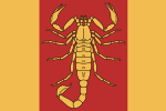
Flag of Ta Seti Ta Seti
Coat of arms of Ta Seti

Ⲧⲁ Ⲥⲉⲧⲓ (TBD)
Capital: Khenu
Population: TBD (2023)
Motto: TBD
Anthem: TBD

Loading map...

Ta Seti (TBD: Ⲧⲁ Ⲥⲉⲧⲓ), officially the Kingdom of Ta Seti, is a country located in North Tarephia. It covers the most northwestern portion of the Serion Desert and the outflow of the [major Tarephian river], and has a land area of 261,354 km² (100,909 sq mi). It is bordered by the [watermass] to the northeast; Dematísna and TA011 to the north; Andrar to the northwest; TA002 to the west; TA020 to the south; and TA014 to the southeast. The [watermass] separates Ta Seti from Egani and the rest of Southwest Uletha. The capital is Khenu (map).


Administrative divisions

Province name Capital city Largest city Size (km²) Population
Periemthet
(Ⲡⲉⲣⲓⲉⲙⲑⲉⲧ)
TBD TBD Total area: 8853.96 km² TBD
Ait
(Ⲁⲓⲧ)
TBD TBD Total area: 1029.05 km² TBD
Ixamut
(Ⲓⲝⲁⲙⲩⲧ)
TBD TBD Total area: 1774.27 km² TBD
Khent
(Ⲭⲉⲛⲧ)
TBD TBD Total area: 5190.21 km² TBD
Nekentf
(Ⲛⲉⲕⲉⲛⲧⲫ)
TBD TBD Total area: 5041.42 km² TBD
Hetep
(Ϧⲉⲧⲉⲡ)
TBD TBD Total area: 17853.47 km² TBD
Amtiu
(Ⲁⲙⲧⲓⲩ)
TBD TBD Total area: 13061.02 km² TBD
Het
(Ϧⲉⲧ)
TBD TBD Total area: 29577.97 km² TBD
Repit Ahiten
(Ⲣⲉⲡⲓⲧ Ⲁϧⲓⲧⲉⲛ)
TBD TBD Total area: 25951.07 km² TBD
Nitur
(Ⲛⲓⲧⲩⲣ)
TBD TBD Total area: 26886.65 km² TBD
Kheriu Nehaher
(Ⲭⲉⲣⲓⲩ Ⲛⲉϧⲁϧⲉⲣ)
TBD TBD Total area: 21354.71 km² TBD
Hekhhesi
(Ϧⲉⲭϧⲉⲥⲓ)
TBD TBD Total area: 30244.70 km² TBD
Amakh Aneren
(Ⲁⲙⲁⲭ Ⲁⲛⲉⲣⲉⲛ)
TBD TBD Total area: 22424.06 km² TBD
Khu Urhebaten
(Ⲭⲩ Ⲩⲣϧⲉⲃⲁⲧⲉⲛ)
TBD TBD Total area: 15333.58 km² TBD
Merit
(Ⲙⲉⲣⲓⲧ)
TBD TBD Total area: 32012.82 km² TBD