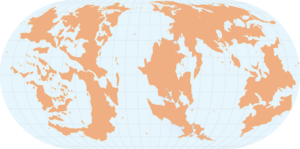
 Featured Map Featured Map
|
Loading map... {"tileLayer":"//{s}.tile.openstreetmap.org/{z}/{x}/{y}.png","attribution":"\u0026copy; \u003Ca href=\" http://osm.org/copyright\"\u003EOpenStreetMap\u003C/a\u003E contributors","center":{"lat":-0.9888,"lon":125.4172},"zoom":"16","maxzoom":"19","minzoom":"13"}
University of Lutang Panikasay and environs, Bagong Bandila,  Lutang Lutang. Created by Lemuria. |
 From the Saint-Openge Travel Guide From the Saint-Openge Travel Guide
|
- The Hotel Mariette is the perfect place to stay for those visiting the old city of Nikolovac,
 Mallyore. It sits right near the central square and features the shopping along the street Jakovljeva. Mallyore. It sits right near the central square and features the shopping along the street Jakovljeva.
- If you're visiting Maka, be sure to relax in the sun on a day trip to the isolated and ecologically diverse island of Runa∈⊾.
- The Cook Hot Springs Hotel and Spa, located in Cook Springs,
 Clamash, is a beautiful place to relax by soaking in one of the many natural hot spring pools or enjoying a massage at Mountain Vistas Spa. Clamash, is a beautiful place to relax by soaking in one of the many natural hot spring pools or enjoying a massage at Mountain Vistas Spa.
|
|
 Explore the Countries of Our World Explore the Countries of Our World
|
|
|
 "Mappers Mapping with Mappers" "Mappers Mapping with Mappers"
|
| Did you know that there are over thirty collaborative projects currently open to mappers? There are projects based on real-world themes to more unique endeavors. To get involved, simply find the project you would like to participate in and contact the coordinator. Working in a collab is a fun way to do something different, work with other mappers, and help develop our world even further.
|
 Forum Activity Forum Activity
|
Current community forum discussions:
- Announcements/Wiki server upgrade - Last edited 22:26, 15 April 2024 by Wangi
- Official collaboratives/Malesoria - Last edited 20:03, 14 April 2024 by Rustem Pasha
- Global and regional issues/History of Ancient West Uletha and North Tarephia - Romantish Empire - Last edited 06:50, 14 April 2024 by Imperator
- Request help/Flag template requests - Last edited 01:08, 13 April 2024 by Alessa
- Global and regional issues/History of Northern Archanta - Last edited 02:41, 11 April 2024 by Zhenkang
- Ingerland/Capital city - Last edited 09:54, 10 April 2024 by Pawl
- Global and regional issues/Association of South Ulethan Nations - Last edited 01:16, 8 April 2024 by KAB
- Tarephia Cooperation Council/Headquarters Location - Last edited 18:25, 5 April 2024 by Lithium
- Federal States/Northeastern FSA Motorways - Last edited 03:22, 14 March 2024 by Fluffr Nuttr
- Official collaboratives/Mecyna - Last edited 22:58, 12 March 2024 by Ika-chan!
|
|
