File:Antarephia Geo Sector.png
Jump to navigation
Jump to search
Size of this preview: 800 × 397 pixels. Other resolution: 1,126 × 559 pixels.
Original file (1,126 × 559 pixels, file size: 112 KB, MIME type: image/png)
Summary
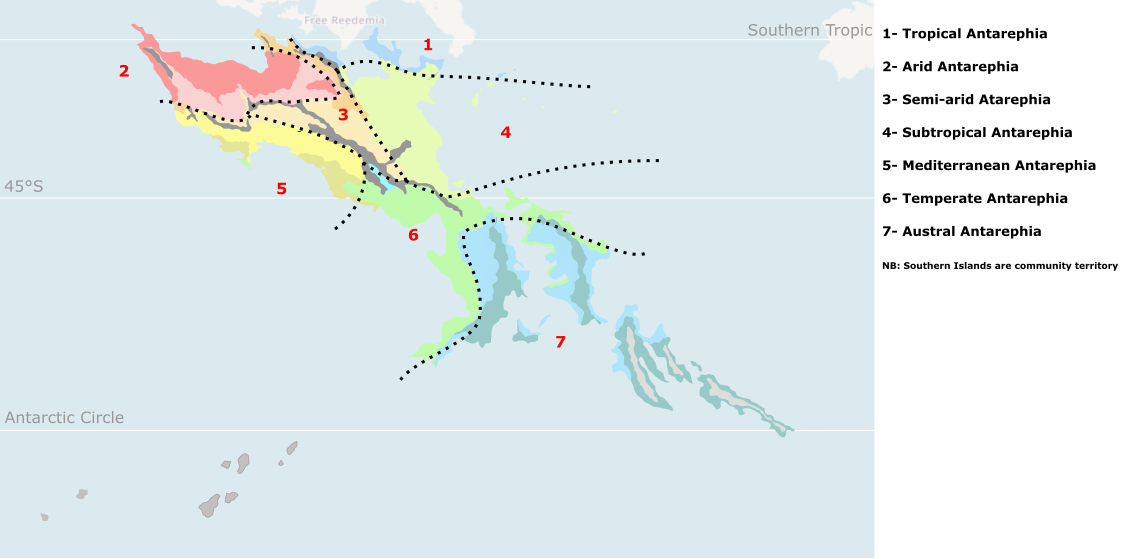
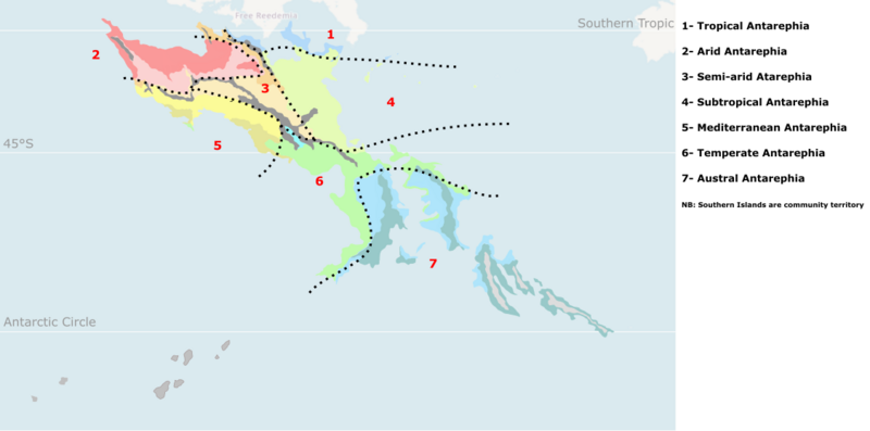
Overview of Antarephia: potential "Bioregions"(local variations and details may be considered). Main mountain ranges are depicted in black as climate/vegetation there would depends on altitude, orientation, latitude and position from the nearest ocean/sea.
Licensing
| This image is licensed under the Creative Commons Attribution-NonCommercial-ShareAlike License |
File history
Click on a date/time to view the file as it appeared at that time.
| Date/Time | Thumbnail | Dimensions | User | Comment | |
|---|---|---|---|---|---|
| current | 20:22, 9 June 2022 | | 1,126 × 559 (112 KB) | Aiki (talk | contribs) | Adapting map to latest large continental updates |
| 20:06, 12 May 2022 | Error creating thumbnail: File missing | 1,126 × 559 (112 KB) | Aiki (talk | contribs) | New version removing ex-Paxtar notherwestern border mountains (branch of Trans-Antarephian mountain range) + adapting general view of climates | |
| 16:46, 21 November 2021 | Error creating thumbnail: File missing | 1,126 × 559 (172 KB) | Aiki (talk | contribs) | == Summary == Overview of Antarephia: potential "Bioregions"(local variations and details may be considered). Main mountain ranges are depicted in black as climate/vegetation there would depends on altitude, orientation, latitude and position from the nearest ocean/sea. Category:Administrative images == Licensing == {{Cc-by-nc-sa}} |
You cannot overwrite this file.
File usage
The following page uses this file: