File:IC CC1.svg

Size of this PNG preview of this SVG file: 585 × 478 pixels. Other resolution: 2,507 × 2,048 pixels.
Original file (SVG file, nominally 585 × 478 pixels, file size: 180 KB)
Summary
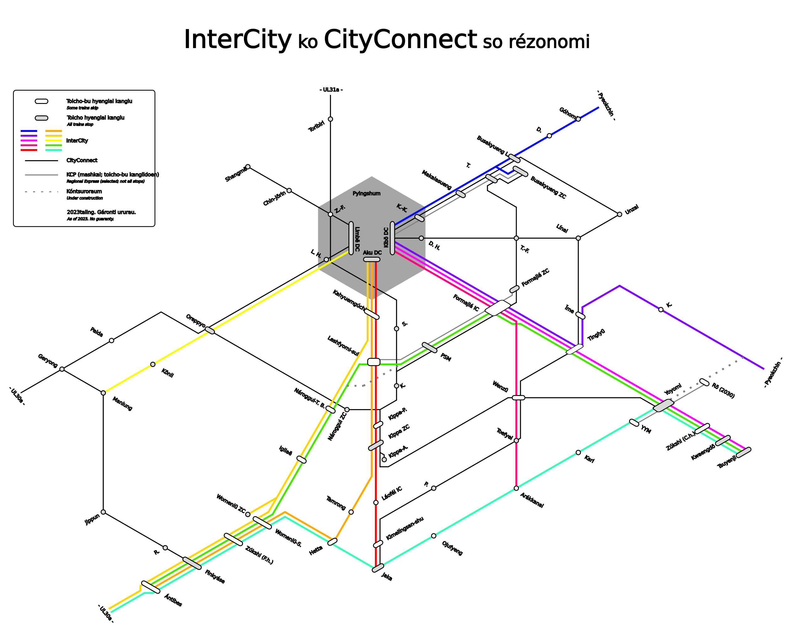
IC and CC network map of Kojo, made by me in LibreOffice "Draw".
Licensing
| This image is licensed under the Creative Commons Attribution-ShareAlike License |
File history
Click on a date/time to view the file as it appeared at that time.
| Date/Time | Thumbnail | Dimensions | User | Comment | |
|---|---|---|---|---|---|
| current | 18:13, 11 August 2023 | | 585 × 478 (180 KB) | Leowezy (talk | contribs) | complete rework. Own work done in Inkscape. |
| 19:43, 1 February 2022 | Error creating thumbnail: File missing | 2,105 × 1,346 (151 KB) | Leowezy (talk | contribs) | minor fixes | |
| 19:25, 1 February 2022 | Error creating thumbnail: File missing | 2,105 × 1,488 (151 KB) | Leowezy (talk | contribs) | IC and CC network map of Kojo, made by me in LibreOffice "Draw". |
You cannot overwrite this file.
File usage
There are no pages that use this file.