File:Navenna economic activity.png
Size of this preview: 510 × 599 pixels. Other resolutions: 1,743 × 2,048 pixels | 2,875 × 3,377 pixels.
Original file (2,875 × 3,377 pixels, file size: 794 KB, MIME type: image/png)
Summary
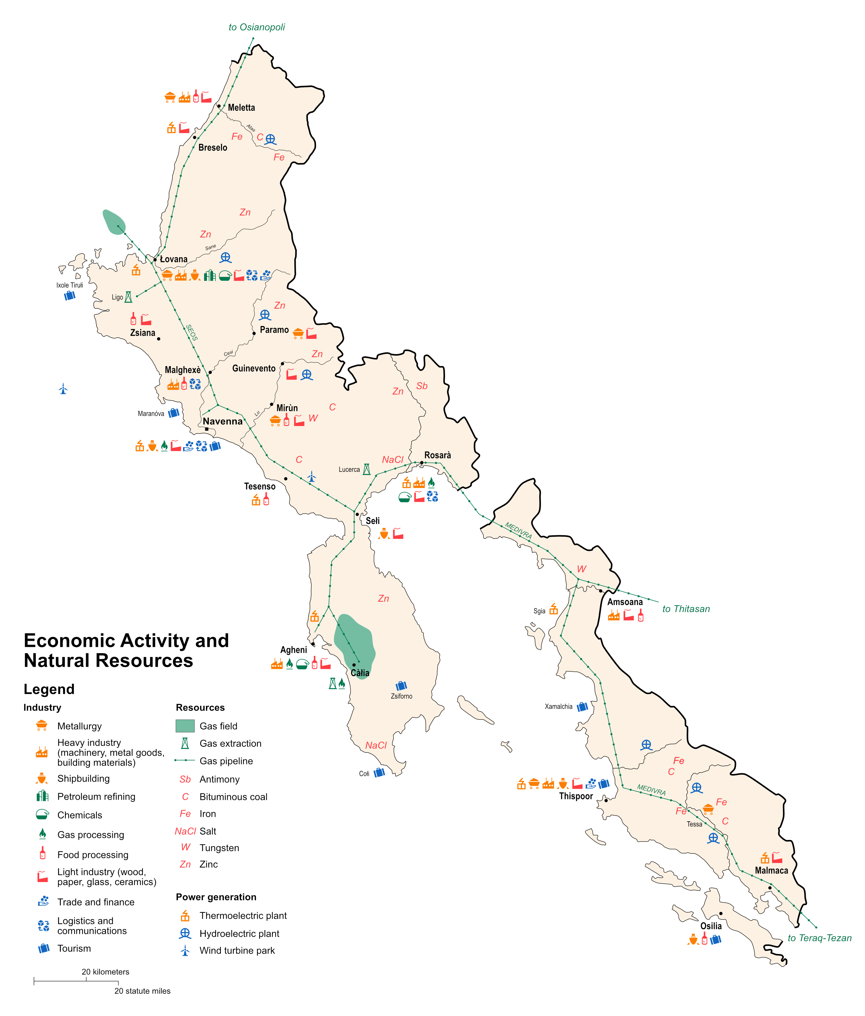
Rough economic/resource map of Navenna, in the style of 90s CIA maps. Own work.
Licensing
| This map is a derivative of the OpenGeofiction base map, which is licensed under the Creative Commons Attribution-NonCommercial-ShareAlike License and is released under the same license. |
File history
Click on a date/time to view the file as it appeared at that time.
| Date/Time | Thumbnail | Dimensions | User | Comment | |
|---|---|---|---|---|---|
| current | 16:36, 29 December 2023 | | 2,875 × 3,377 (794 KB) | Timboh (talk | contribs) | Rough economic/resource map of Navenna, in the style of 90s CIA maps. Own work. Category:Navenna Category:Resource maps |
You cannot overwrite this file.
File usage
The following page uses this file: