Forum:Territory application/AN127 - Casterlinia
- Please fill in the information below to make a territory request.
| Territory ID and proposed name | |
|---|---|
| The Territory ID (from OpenGeofiction:Territories, e.g. AR123a) and proposed name of the country |
AN127 - Casterlinia (Republic of Casterlinia)
| Physical geography | |
|---|---|
| An overview of climate, topography and landscape of the country. It is advised to also create a sketch, you can add a link to this (hosted on imgur or similar) |
https://imgur.com/a/qQ2yuzA Climate zoomed in map from the wiki page of Antarephia
As we can see on the map, the western part of the country is mainly semi-arid while the east is tropical, and a little bit, in the south there are parts that are arid. On the middle of the country lay the Shawkee mountains, an indigenous name given to the northern Antarephian mountain range branch, which is a colder and drier mountain range with higher heights, on it's southwest, the mountainrange splits the climate in three in some way, separating arid from semiarid and tropical.
The eastern coast recieves the most amount of rainfall as it has a tropical climate, the western coast recieves the second least amount of rainfall, which makes the plains in the west coast very suitable for crop harvesting with a lot of control of irrigation. The south of the country gets the least amount of rainfall in the entire country due to the arid climate, however it is very rich in resources unlike the other areas (but the mountainous). The ocean swell spins near Cygagon's East coast, making a lot of waves on the western coast which boosts tourism.
https://imgur.com/a/PJRHBSE Rivers and Topography map
The southern moutainrange in the south of the country is has got highest points of elevation in the country, along with the Shawkee mountainrange having the second highest. Those mountainranges split Casterlinia from AN125 which has an arid climate due to the height of the mountains. The east river basin is the most arid region in the entire country and is also the area with the most rainfall. The peninsula on the north is called Jackson Peninsula, it splits two regions of the country, the tropical one and semi arid, this region has many irrigation infrastructure to support the agriculture.
Landscape
https://upload.wikimedia.org/wikipedia/commons/0/0f/Urue%C3%B1a_paisaje_lou.jpg -> Picture of West coast agriculture on the more humid areas and northern farmlands
https://upload.wikimedia.org/wikipedia/commons/5/56/Byron_Lighthouse_looking_south_2004-28-12.JPG -> Picture of the West Coast
https://upload.wikimedia.org/wikipedia/commons/c/c0/Ovacik1.jpg -> Picture of Manndeil River Valey / Shawkee Mountains
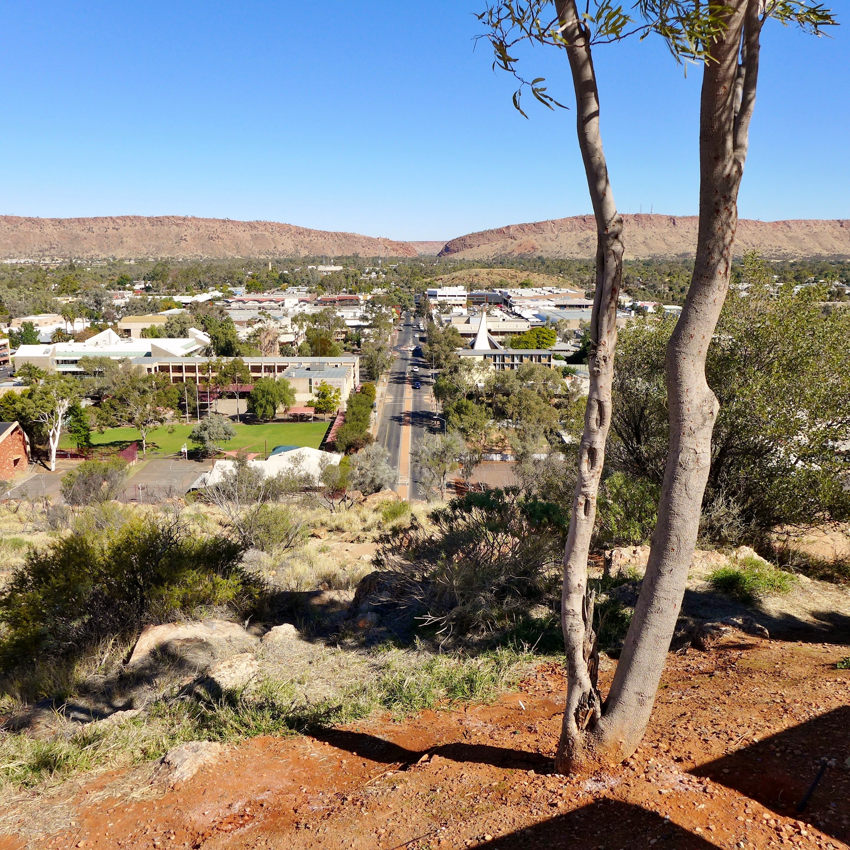
https://upload.wikimedia.org/wikipedia/commons/e/e7/Alice_Springs%2C_2015_%2801%29.JPG -> Picture of Southern Cities
https://upload.wikimedia.org/wikipedia/commons/2/20/Praia_do_Forno_-_Arraial.jpg -> Picture of Eastern coast near Jackson Peninsula (northern Peninsula)
https://upload.wikimedia.org/wikipedia/commons/d/d5/SerraGeralI.jpg -> Picture of farmlands in east plains
| History & culture | |
|---|---|
| A brief description of the intended culture and language |
Casterline was the name of a Ingerish leader's wife, this colony was named after her, being named Casterlinia. Casterlinia was a colony of Ingerland for 256 years, and briefly colonized by a few southern Antarephian tribes before the Ingerish colonisation. This territory declared independence roughly 54 years ago, under the condition that it would become politically favorable to Ingerland. Due to the Ingerish occupation, the overall culture and language of the country is simillar to Australian culture, having simillar urban development processes as Australia. This also made the language of the country Ingerish, with it's own dialect.
The Political system of this country is a Constitutional Democracy, very simillar to UK's political system in real life. The two major parties are the Conservative Casterline Party (CCP) and Liberal Democratic Party (LDP), as the majority of the country has a strong Middle-Left Political culture.
 | Human geography |
|---|---|
| A brief description of the territory demographics, economic development, land occupation, infrastructure and mapping style |
https://imgur.com/a/3tjpm4H Link to the map of the major highways and cities
The urban development is very simillar to Australia, having cities with smaller highrise centers and bigger suburbs. Due to the job opportunities and economic development of the East coast, achieved through maritime trade, and the tropical climate, the east coast has the highest density of population, concentrated through the Jacksonville - New Heidelberg strip, an area with a lot of natural harbours. The eastern plains also are the most fertile in the entire country, and the plains with strong agriculture. On the West plains, more on the inland parts, a little bit of agriculture is present, however only near the rivers and coast, as the soil is dry. In the south, smaller cities are present, with smaller sizes. Their economies is also smaller, being more dependant on extraction of natural resources like iron and stone. On the west coast, the only big city present is Westhaven, a stablishment originally from a south Antarephian nation on a natural harbour that grew a lot in size due to the tourism economy during the ingerish occupation and the modern era.
| Past mapping | |
|---|---|
| To support your request provide links to areas of OGF mapping which showcase your mapping skill. Mapping relevant to the requested theme & geography is especially useful | |
| The {{coord}} template can optionally be used to link to the OGF map - it results in a nice formatted link. Or you can paste in a URL. |
https://opengeofiction.net/#map=13/-26.2472/166.1746&layers=B -> this was my first city mapped, it was mapped almost a month ago on Tierra Nueva, a blue territory
https://opengeofiction.net/#map=13/-37.0056/155.5247&layers=B -> Linden is the city I am actively working on, its twin city, Heidelberg, is also a city that is undergoing development, those are my main cities which I am working on. The areas near South Linden Lake are the most developed so far. The rural areas around Linden and Heidelberg were all mapped by me, the most developed ones are the ones on north of Linden, west of Hannah Hamlet.
| Username & date | |
|---|---|
| Sign and date the application by typing four tildes like this: ~~~~ |
What3089 (Jake on the discord server [feel free to contact me there if more convenient]) ~10~6~23
 | Discussion |
|---|---|
| Discussion for clarification & decision |
- Hello from across the Strait! There is some development of the geography's impact on the history of the proposed nation, which is good. But I have some points which I think would benefit you if you consider them. If I understand the FSA history correctly, the FSA started in eastern Archanta and expanded westward. So I think the 256 years of being an FSA colony is a little unbelievable. Also, 24 years ago is late 1999 (during the internet revolution) and that's very recent. Tell me more about the independence movement; was the revolution televised? How did the independence movement impact the current affairs of the nation?
It's nice to see tourism in the west region, but the Strait of Lyc isn't large enough to have ocean swells for tourism. I think the tourism would be more like the Mediterranean, where the focus is on the fresh sea air, the good food, and the hospitable people. But you tell me if that's right--what is Casterlinia famous for? Pasta? Great vacation spots? Anime?
Freedemia is the major Ingerish-speaking nation in the region. Would your nation and Freedemia support one another as nations with shared language, or would the two nations become rivals competing for power in the region? And what impact do the other neighboring nations have on Casterlinia? Chazeltine (talk) 01:44, 9 October 2023 (UTC)
So Casterlinia got it's independence from Ingerland (Changed), meaning that it was geographically closer to it, and the independence movement happened later than the other nations mainly because there was no Casterlinian nationalism until the 60s (changed) due to the ethnic composition of the country being majoritarian Ingerish who saw no reason for independence. The first independence movements started because after the great war, because Casterlinia was on Ingerland's rule, many losses occured which affected the Casterline population. This made independence an idea present amongst a few members of the younger generations, which started writing newspapers about it and spreading it fast through newspaper. The region was also not getting the money it was producing, as a lot of taxes were being paid to Ingerland, this also made the general population in the 1957 Casterline housing stock market crash, willing to pay less taxes. In 1968 many protests happened in New Heidelberg and Jacksonville, which lead to an independence referendum in august 1968, which got 98% of the votes in favor of independence.
The independence took place in 25th august, 1969, after the treaty of New Heidelberg was signed, which granted independence to Casterlinia under the condition that it would be aligned with Ingerland, and not participate in any other alliances without Ingerland's approval. The independence made the economy of Casterlinia grow by 11% during 1970 and 1980 due to the heavy taxation from Ingerland being no longer present, however many miner companies from Ingerland still mine on Casterlinia and export resources to Ingerland or even trade with national manufacturing companies which all emerged in 1985 after many tax incentives and investment from the government and the population after many nationalist speeches were spoken by leaders.
Logically it makes more sense for the west coast to not have strong waves or a surfing industry itself, instead I think it would make more sense, as you said, if the tourism came mainly from the beaches, fresh air, food and hospitality, because the west coast has a smaller population and barely any polluting factors, which would make the beaches more preserved and clean. The country became known as a luxury vacation spot and also famous mostly because of its beaches and many resorts and waterparks along the west coast, which generate 15% of the entire country's GDP.
Freedemians would represent the biggest amount of tourists, due to the proximity, and the shared culture would increase simpathy between the two peoples, making the two nations friendly to each other. As for the other nations that border Casterlinia on the East and West, because of their small population, and membership of the Antarephian Coalition which Casterlinia cannot participate, relations are small, with the most trade happening through maritime shipping, not terrestrial transportation of goods to these nations. To the north, Casterlinia would be with open arms for good relations, but not alliances. Inxigne, would be a big tourism spot for Casterlines, due to the proximity.
Jake/What3089 2:57, 9 October 2023 (UTC)
- Greetings from the mapper of Freedemia across the strait. A couple thoughts:
- My impression has been that Ingerland proper kind of collapsed in the region by the late 1800s. There are Ingerish colonies that got later independence, but most of them were like, small colonies in like the developing world-inspired or Carribean-inspired spots from what I recall. For perspective, Paroy's Ingerish independence was 1733(?), Freedemia's was 1737. I am unsure about Geare. Further away, Vodeo had an especially close relationship with Ingerland and got independence in 1907. Bonavista has the latest I've seen in the region at 1957, and that seems to mostly be because as a small island nation they declined independence in the mid 1800s out of fear of being dominated by the mainland Vodean provinces they would have joined. I think there'd need to be more of a fundamental indigenous lean or something for anything after the ~1920s to really fit with the surrounding timeline.
- I'm honestly not sure that Freedemia would have that many tourists going to Casterlinia. If it's just for the beaches, we kind of have our own, and places like Vodeo to the north would probably be more of a draw. I could definitely see our countries having good relations/being friendly, but I wouldn't hinge too much on Freedemian tourism. Trade and resources seem a lot more likely to be the backbone of a relationship between the two.
- More of a minor issue, but 98% in favor of independence seems high for any period, especially if before that the country was willing to stay with Ingerland for that long.
- Besides the timeline and relations points, I mostly like your application and think you'd be good to have in the region, but if I'm being completely honest, for a territory that size it might be good to get just a little bit more practice. To be clear you're doing really good work for the time you've been here, and I feel like you're really close- your natural mapping is pretty good, and the homes, etc in Linden are well-done. That said, there are still some lingering things that could use improvement like spacing between buildings/sidewalks and roads, unsquared buildings, some road grid and interchange things, river/lake realism, etc that it might be good to work out some of the kinks in first. To be clear, I don't explicitly oppose the application being granted and would be happy to work with you on those things- but they're probably the types of details you want to figure out before you start mapping a new territory en masse. Ernestpkirby (talk) 05:25, 9 October 2023 (UTC)