Ingerish Asperia
 This encyclopedia article is about the province of Deodeca. You may be looking for the collaboration page.

|
Province of Ingerish Asperia TBD (TBD) Capital: New Reydon
Population: 10,100,550 (2022) Motto: Forged by Order Anthem: Green Pastures by Rocky Shields |
Loading map... |
Ingerish Asperia (commonly abbreviated as IA) is the northernmost province of Deodeca. Situated along the northern extent of the Great Shield Mountains and the Brydens to the northeast, Ingerish Asperia has a diverse geography. Its rugged landscapes included alpine mountains, plateaus, rolling hills, grassy plains, and sandy beaches. It borders Kastichetshan to the south and AR043 to the west. Ingerish Asperia's capital is New Reydon, while its most populous city is Stonesipher. Stonesipher and its suburbs make up the X-largest metropolitan area in Deodeca, with the 2022 census recording 3.5 million people. In December 2022, the population of Ingerish Asperia was just under 9 million, making it one of Deodeca's most populous province. Over half of the province still lives rurally or in smaller towns.
The first known inhabitants of the area settled in Ingerish Asperia around X thousand years ago. The most notable of which were the Tshayhamhash peoples of the north. The earliest Ingerish settlement in the area was Baptist Bay, founded 20 years after Port Albert in Queen Adelaide Island in 1698. The Colony of Ingerish Asperia was founded as an Ingerish colony in 1700. It originally compromised of the present-day borders of Ingerish Asperia and Kastichetshan. During the 18th and 19th centuries, the colony divided into two, with King James Island Colony joining Kastichetshan.
Ingerish Asperia is a diverse and cosmopolitan province, drawing on the wide range of cultural influences from its multiple diasporas. Notable cultural groups include Ingerish, Gaelic, Indigenous, Franquese, and Wallean. Christicism is the largest religion in the province, although the majority of the population is non-religious.
Major sectors of Ingerish Asperia's economy include forestry, mining, agriculture, tourism, manufacturing, technology, wholesale, and retail. Its main exports include lumber and timber, pulp and paper products, copper, coal, iron, steel, and natural gas. Ingerish Asperia exhibits high property value in its cities and is a major maritime trade hub for Deodeca. The Port of Baptist Bay is one of the most diversified ports in Deodeca. The majority of Ingerish Asperia's flat land is arable and agriculture is the dominant landuse on the eastern coast, where land is most arable.
Etymology
The Colony of Ingerish Asperia was named by Queen Charlotte of the Ingerish Empire in 1700 upon its declaration. The name refers to the historic Ulethan name for the southwest coast of Astrasia (and the Asperic Ocean). Queen Charlotte decided to add the prefix "Ingerish" to differentiate it from extensive Franquese claims to the south, some of which were being referred to as Asperie.
History
Prehistory
Ingerish colonisation
| | |
|---|---|
| Birth: 1676, Winburgh, Ingerland | Death: 1725, New Reydon, Colony of Ingerish Asperia |
| 1st Lieutenant Governor of Ingerish Asperia | |
| Geldoff Umbra, in office 1700—1725, was the first Lieutenant-Governor of the Colony of Ingerish Asperia (now province). He is regarded highly as an influential figure in the early formation of Ingerish Asperia, through policies that promoted democracy and universal equality. Umbra was born to a wealthy family in Winburgh and followed his father in politics. He was announced as Lieutenant Governor in 1699 by Queen Charlotte and promoted. Initially skeptical of working in a far-flung colony, Umbra quickly rose to a respected position in the colonial world. His long-lasting influence can be seen in the educational and scholarly facilities in Ingerish Asperian cities. The town of Umbra River and according river were named in his honour shortly after his commencement as Lieutenant-Governor. He died in 1725 after 25 years of service. | |
Colonial period
Provincehood
20th century
21st century
Geography
 | |
|---|---|
| Geography of Ingerish Asperia | |
| Continent | Archanta |
| Region | Asperia |
| Population | 10,100,550 () |
| Area | |
| • Total | 99,884.22 km2 38,565.51 sq mi |
| • Water (%) | 1.19 |
| Population density | 101.1 km2 261.9 sq mi |
| Time zone | +9 UTC |
Ingerish Asperia is a province located in the northwestern region of Deodeca. It is known for its diverse landscapes, encompassing mountains, plains, forests, and coastal areas. The province is bordered by the provinces of Kastichetshan to the south and AR043 to the west.
The mountains of Ingerish Asperia are compromised of the Great Shields Mountains and the Brydens, which form a natural barrier between the east and the west coast. These mountains, known for their majestic peaks, valleys, and lakes, offer breathtaking views and are a popular destination for hiking and mountaineering enthusiasts. The highest peak in Ingerish Asperia, Mount Liedbeck, stands at an elevation of 3950 meters above sea level.
Ingerish Asperia is home to expansive plains and fertile agricultural lands. The plains in the southern part of the province are ideal for farming, and agriculture plays a significant role in the province's economy. Ingerish Asperia's coastline stretches for approximately 700 kilometers along the Asperic Ocean, offering picturesque beaches, cliffs, and coves. The coastal areas are popular tourist destinations and provide opportunities for various water-based activities such as swimming, sailing, and surfing.
Large forested areas cover significant portions of Asperia, contributing to its natural beauty and ecological diversity. Protected areas are commonplace in Ingerish Asperia. One of the country's largest national parks, The Dunfold National Park, is located in Ingerish Asperia.
Climate
Ingerish Asperia experiences a temperate climate with four distinct seasons. Summers are generally mild and pleasant, with temperatures averaging between 20°C and 25°C (68°F and 77°F). Winters can be cold, with temperatures dropping below freezing, particularly in higher altitude areas. Snowfall is common during the winter months, creating a picturesque landscape. Spring and autumn are transitional seasons characterized by moderate temperatures and colorful foliage.
Hydrology
The province is blessed with numerous rivers and lakes that dot its landscape. The longest river, River Hale, originates from Lake Teetasaw and flows through the center of the province, providing a vital source of freshwater for both human consumption and irrigation.
Other notable rivers in Asperia include:
River Saint Agnes: This river originates from Lake Curon and is an important river for the northern Centerlands region. It joins with the River Hale at the Halemouth Lagoon near New Reydon.
Asperic River, the largest river in the north. It flows between the Great Shield and the Brydens, reaching the Asperic Ocean near the northernmost point of the province.
Subdivisions
Main article: Administrative divisions of Ingerish Asperia
| Name | County Seat | Largest City | Population | Total Area in km² (mi²) | Map |
|---|---|---|---|---|---|
| Tshayhamhash Governorate | Qha’chshč Sčhayaxw / Q̕áʔc̕ɬč Sč̕ə́yəxʷ | Qha’chshč Sčhayaxw / Q̕áʔc̕ɬč Sč̕ə́yəxʷ | 18,000 | 4380.91 (1691.48) | Map∈⊾ |
Government and Politics
Ingerish Asperia is a provincial constitutional monarchy with the King of Deodeca as sovereign and the Lieutenant-Governor of Ingerish Asperia as his provincial representative. It is a province of the Commonwealth of Deodeca. The bicameral provincial Parliament of Ingerish Asperia consists of the lower house known as the House of Assembly and the upper house known as the Legislative Council.
| Government of Ingerish Asperia | |
|---|---|
| Constitutional parliamentary monarchy | |
| Capital | New Reydon |
| Head of state | |
| • Monarch | Geoffrey VII |
| • Lieutenant-Governor | Graham Archehurst |
| Legislature | Parliament of Ingerish Asperia |
| • Upper house | Legislative Council |
| • Lower house | House of Assembly |
| Judiciary | Supreme Court, District Court, Magistrates Court |
| Federal Representation | X Seats in Senate, X Seats in House of Assembly |
Major political parties | |
LIA GP MAP IAG | |
Agencies
| Name | Main Office | Minister |
|---|---|---|
| Department of Justice | Queen Charlotte Building | James Barter |
| Department of Trade and Commerce | Abercrombie Tower | Hunter Fiztroy-Smith |
| Department of Transport | Ingermart Building | Helen Underwood |
| Department of Planning and the Environment | Logan Building | Alec Templestone |
| Department of Education | West Winslow Building | Luther Jones |
| Department of Customer Service | Winslow Building | Francis Le Ueburg |
| Department of the Lieutenant-Governor | Old Stock Building | William Smithby |
| Department of Regional Ingerish Asperia | Ewestock Building | Gary Alder |
In 2022, the government announced that the following departments would be newly formed from existing ones.
| Name | Main Office | Spilt from |
|---|---|---|
| Department of Emergency Services | Queen Charlotte Building | Department of Transport |
| Department of Agriculture | Abercrombie Tower | Department of Trade and Commerce |
| Department of Tourism | Old Stock Building | Department of Trade and Commerce |
Subagencies
Department of Justice
The Department of Justice is responsible for the criminal, judicial, and law enforcement aspects of Ingerish Asperia. This ranges from police to prison services.
Police
The main police force of Ingerish Asperia is the Royal Ingerish Asperian Police (POLIA). The force operates at the provincial level and is responsible for enforcing provincial law. The force has a long and dignified history. It originally formed in 17XX and managed one of the largest police districts in the colony. The nickname "The Old E", comes from the force's original designation as the E Division of the Deodecan Colonial Police. When the colony formed provinces, the majority of the E Division was redesignated as the Royal Police Force of Ingerish Asperia.
POLIA's main training facility is located in the suburb of Tesecombe in western New Reydon. It also operates a secondary water-training facility in Tidonmouth. The Ingerish Asperian Police Musuem in New Reydon features a collection of police memorabilia, exhibitions, and details on the history of the force.
POLIA has recently increased focus on highway patrols and alcohol and drug testing.
| Name | Description |
|---|---|
| General Operations | Handles all general policing matters. |
| Traffic Services | Handles all traffic matters. |
| Major Crime Investigations Branch | Investigative unit. |
| Water Operations Unit | Handles all water policing matters. |
| Dog Operations Unit | Handles all police dog operations. |
| Mounted Operations Unit | Handles all mounted police matters. |
| Forensic Services Branch | Handles all forensic and crime scene matters. |
| Band of the Royal Ingerish Asperian Police | Elected to play music for POLIA events, ceremonies, and parades. |
| Personel Security Operations (PSO) | Handle security of important individuals (e.g. politicians, governmental officials, witness protection). |
| Special Armed Response Group (SARG) | Specialised armed police unit for high-risk incidents that require quick mobilisation and lethal force. Nicknamed the "Sarges" |
Corrective Services
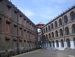
Corrective Services IA is the province-wide correctional service. It maintains a number of prisons, detention centers, and temporary holding facilities. Prisons with the prefix "HM" denote a more historical prison. Newer prisons avoid the "HM" prefix, after the Prison Convention Act of 1935 enforced prisons to not use it for naming conventions. In 2022, the prison population of Ingerish Asperia was 16,450 people, with an incarceration rate of 162 out of 100,000 people.
The profile of an average Ingerish Asperian prisoner in 2022 was:
- Male
- 30-50 years old
- Uneducated
- Had a previous conviction record
- Single, or with a de facto partner
- Tended to live in more rural areas
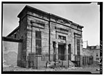
In 1989, HM Prison Evesdrove was decommissioned following a devasting electrical fire that damaged most of the historic cell blocks. No prisoners or staff were harmed, but given the age of the prison and the space in other prisons, it was decommissioned by the government. Coincidentally, the decommissioning in 1989 was exactly 100 years after its opening in 1889.
Department of Transport
The Department of Transport is responsible for maintaining the infrastructure of Ingerish Asperia. As of 2022, they are also responsible for the provincial fire and rescue service as they are used to conduct road maintenance and repairs. However, the Archehurst government is looking to add a new department called the Department of Emergency Services, which would encompass all emergency agencies including FRIA, RFS, etc.
Fire
The Royal Ingerish Asperian Fire and Rescue Service (FRIA) is the main fire service in metropolitan and semi-rural Ingerish Asperia. In the 20th century, the force formed a seperate divsion, the Rural Fire Service (RFS), to operate in more remote and less populated regions as a volunteer service. FRIA also has search-and-rescue capabilities and is mainly responsible for remote rescues, vehicles crashes and sea patrols.
The FRIA was established to combat the frequent burnings of wooden houses in the colony's early days. It was initially a volunteer force but changed to a paid force once government funding was opened. The FRIA is responsible for a wide variety of responsibilities. This was one of the main reasons that the Department of Transport decided to rename the organisation to the "Fire and Rescue Service" to denote the service's greater responsibilities.
The FRIA maintains a number of stations in major urban areas and dense corridors. The RFS has a volunteer station in every town and village in rural IA. By number, the RFS has more facilities than the FRIA. The Royal Fire Service College in Metburn is the official training facility for FRIA recruits and occasionally RFS recruits. However, most local stations train their own new recruits.
In 1999, an arsonist sparked a fire in Tablehurst County, near Lodham River Wilderness Park. The resulting fire destroyed 2452 hectares of timber forest. The RFS, with assistance from the FRIA, were able to prevent the fire from proceeding to the town of Granson through controlled burns. Sadly, one RFS firefighter was killed when his unit were surprised by a sudden jump in speed by a portion of the fire. A statue of him was erected outside of his local RFS station in Stonetown.
Economy
 | |
|---|---|
| Economy of Ingerish Asperia | |
| mixed | |
| Currency | Deodecan dollar |
| Unemployment rate | 7.5 |
Ingerish Asperia's economy mainly derives from its history as an agricultural and light manufacturing province. The fertile, flat plains of Ingerish Asperia are suited to producing large yields of grain, soybeans, vegetable, fruit, and livestock. In historic cities, post-war development lead to light manufacturing neighbourhoods developing near the urban edge. These industries attracted immigrants and workers and allowed light manufacturing to become a dominant part of the economy. Commonly produced items included plastic, metal fabrication, steel, and textiles. In some areas, heavy manufacturing is also econominally important. Shipbuilding in Baptist Bay has historically been a bastion of the city's culture and economy.
Tourism is also a recently growing industry, with Ingerish Asperia's natural beauty being a strong attraction point. The ideal of a "wild, untouched frontier" has been often marketed to holidaying Effesians and international Ulethan tourists.
Demographics
| Demographics of Ingerish Asperia | |
|---|---|
| Demonym | Ingerish Asperian, Asperian (more common) |
| Official languages | Ingerish |
| Recognized minority languages | Tshayhamhash/ƛ̕ay̕əm̕áɬ, Native Archantan languages |
Health
Education
School list
| Name | Type | Location | Capacity | Description |
|---|---|---|---|---|
| University of Ingerish Asperia | University | New Reydon | 35,000 | Oldest university in Ingerish Asperia. |
| University of New Reydon | University | New Reydon | 27,000 | ... |
| Umbra University | University | New Reydon | 16,500 | ... |
| University of Baptist Bay | University | Baptist Bay | 20,000 | Oldest university in Baptist Bay and one of the oldest in the province. |
| Cuthner University | University | Baptist Bay | 13,000 | ... |
Ethnicity
Languages
Religion
Transportation
| Infrastructure of Ingerish Asperia | |
|---|---|
| Roadways | |
| • Driving side | right |
| Railways | |
| • Passing side | right |
| • Gauge | 1435mm |
| Mains electricity | 120V at 60Hz (use V for volts and Hz for Hertz) |
| Internet TLD | .de |
Roadways
The Trans Deodeca Highway Route 1 and 1A form the major highway corridors of Ingerish Asperia. The TDH-1A is the longest branch route of the TDH Network.
The West Coast Highway is also a major route for West Coast settlements and forms one of the only connections to the greater Ingerish Asperia road network.
Road speeds in Ingerish Asperia follow the guidelines set out in the Motorroads Act of 1950. Residential roads usually have a limit of 50 kilometres an hour in urban areas. Tertiary to primary roads usually have a limit of 60 kilometres an hour in urban areas. In rural areas, the main road limit is usually 70 or 80 kilometres an hour. On the motorways and trunk roads, limits are usually set to 100 kilometres an hour.
Railways
Railways in Ingerish Asperia are used mainly for freight transportation.
Passenger rail links the cities of New Reydon, Baptist Bay, Ingerfort, and Stonesipher to the rest of Deodeca via the Ingerish Asperia Main Line. Some smaller cities and towns are connected through branch lines.
Ferries
For travel between Ingerish Asperia's islands, ferries are a mode of transport used. Westcott in Squangit County is the terminus for many ferry lines, with one even linking with Kingscote across Kingscote Bay.
Culture
Symbols
| Type | Name |
|---|---|
| Mammal | Liedbeck's Mountain goat (Oreamnos leidbeckis) |
| Bird | White-tipped stormpetrel (Hydrobates asperinus) |
| Fish | River Agnes trout (Oncorhynchus agnii) |
| Flower | White mobgray (Vinca hepburnii) |
| Song | I'll Make my Life in Ingerish Asperia (18th century sailor's song) |
| Mineral | Copper |
| Colours | Red, blue, white, gold |
Sports
Cricket and rugby are among the more popular sports in Ingerish Asperia. Football, as in most of Deodeca, is popular too. Most towns have an oval that caters to cricket and rugby playing.
Water-based sports, such as sailing, rowing and kayaking are also widely enjoyed.
Notes
See Also
| Provinces | |
|---|---|
| Capital District | Odeka District |


