Collab:Federal States/Transportation
Highways and Motorways
This section provides information for mapping highways in the Federal States.
Summary
The Federal States Defense and Commerce Motorway Network is a nationwide system of motorways within the Federal States of Archanta. These high-speed, limited-access roads connect all regions and most states from coast to coast and border to border. The network, which includes both free motorways and tolled motorways, is mapped using the FS-xx labels, with FS-xx (TOLL) used for tolled motorways. Odd-numbered routes run north-south, starting with lower numbers in the east and increasing the further west, with primary routes generally ending in "1". Even-numbered routes run east-west, starting with lower numbers in the in the south and higher numbers in the north, with primary routes generally ending in "0". Bypass routes through or around cities are three-digit routes where the last two digits are the same as the "parent" route; spur routes (that connect only once to the motorway network) are generally not considered part of the motorway system and should be labeled as state routes.
Rules
Major Routes
- Even-numbered routes generally run east-west, and generally increase from south to north; odd-numbered routes generally run north-south, and generally increase from east to west.
- This system was chosen based on the overall assumption that the FSA generally grew from southeast to northwest.
- Primary routes end in 0 (east-west) or 1 (north-south).
- This system was chosen to be logical and somewhat intuitive, but also to be different from the U.S. Interstate system.
- Each state is solely responsible for the routings of their highway numbers.
- Routes shown as concurrent in the system map below are not required to be assigned to the same highway if a parallel highway exists.
- Coordination is encouraged between the mappers in the metropolitan Stanton area (New Carnaby, Penquisset, Delenshire Islands) to determine routings and terminus locations.
- Since the metropolitan Stanton area is large, complex, and relatively well-mapped in regards to highways, mappers in this area will have more control over routings and labeling.
- States may elect to change the terminus of a primary route provided a direct connection is still available to the designated terminus.
- Example 1: A route with a terminal city short of a national boundary may be extended to the boundary, or may otherwise be extended beyond the terminal city provided the route does not leave the state.
- Example 2: If two routes run concurrent to a city that is the terminus of the routes, that route may be truncated to where the concurrency would begin.
- All 2-digit routes must connect at least three states or travel at least 400 miles, whichever is less restrictive.
- This encourages coordination, and reduces the likelihood of a situation where the FSA "runs out" of numbers.
- This map is not absolute. Neighboring states are encouraged to coordinate routings based on geography, built infrastructure, and other constraints.
- For non-primary routes, states are permitted to use any available highway number that fits in the overall numbering scheme and satisfies the rest of these rules.
- All states must agree to the overall route concept. When a general route is chosen, stateowners should contact the FSA coordinator, who will assign an available route number from the table below.
- Exceptions to the numbering scheme, or a special request for a particular route number, may be permitted with the approval of the FSA coordinator.
Bypass Routes
- Bypass routes are permitted and may be numbered by individual states.
- Bypass numbers do not require FSA Coordinator approval.
- To number a bypass route, add a digit to the left of the "parent" route (e.g., Highway 211 is a spur route of Highway 11).
- This was chosen based on how route numbers tend to be pronounced: "Highway eleven has a spur route of Highway two-eleven" or "Highway fifty has a spur route of Highway two-fifty". Adding the supplemental digit to the end of the major route number leads to confusion, especially for single-digit highways (Highway 12 being a spur of Highway 1 would lead to confusion; Highway 012 being a spur of Highway 1 would be awkward to pronounce), pronounciation ("Highway eleven has a spur route of Highway eleven-two" or "Highway eleven has a spur route of Highway one-twelve" or "Highway eleven has a spur route of Highway one-hundred-twelve"), and potential misunderstandings ("Highway fifty has a spur route of Highway fifty-two").
- The same bypass route number is not permitted to be used more than once within a single state, unless a link between the two individual routes is planned as a future route, currently mapped as under construction, or if the link was abandoned/demolished in the past.
- States are encouraged to map disruptions to highways, which adds realism (freeway revolts, decommissionings, budget restrictions, natural disasters, etc.)
- Bypass routes that cross state lines should have the same number, and states should coordinate with neighbors before mapping them.
- To avoid confusion, do not use the same spur route number as any other spur route within 300 miles/500 kilometers.
- ALL bypass routes MUST connect with at least two parent highways.
- Connecting with the same parent route twice is permitted.
- Connecting to another bypass route is permitted.
- Spur routes that do not reconnect with the national system should be labeled as state highways.
- Exception: spur routes that connect airports, seaports, ferries, or military installations are permitted to be labeled as FS-xxx motorways.
Exceptions
Some motorways "break" the numbering grid based on their alignments. Exceptions are permitted on a case-by-case basis, but should generally be avoided wherever possible.
- Motorways 1 and 2, historically the earliest primary highways in the FSA, are numbered apart from the primary scheme.
- Motorway 22 runs south of Motorway 20 east of Cobbet, NC.
- Motorway 85 crosses Motorway 89 in northwestern Seneppi.
System Map
This map is for planning purposes only. Individual routings are the sole discretion of each state owner, provided the route serves the same general areas shown below. If you'd like to make a significant change to the route shown below, please contact the regional coordinator. Decent-sized cities with at least some mapping are shown with red icons. Known planned cities are shown with green icons. Likely future city locations in future states are shown with black icons; these are purely theoretical and should not be assumed to be permanent locations of intersecting highways. Not all cities are shown, since intra-state routings are the sole responsibility of each individual state owner. This map shows primary routes only.
Loading map...
Table of Route Numbers
Locations noted with an asterisk (*) are outside the FSA; the motorway is expected to serve a port of entry with the neighboring country listed. States listed with a slash (XX/XX) indicate an alignment that will need coordination between the two listed states to determine which state should have the primary route. This does not preclude a bypass route in the other state. States listed in parenthesis are optional states in the corridor, based on motorway routing.
All available route numbers must be released by the FSA Coordinators before mapping. See Talk page for more details. Bypass routes (FS-xxx) do not require approval before mapping and should not be listed below.
Route relations include the southbound/westbound direction and are tagged with "type" = "route" + "route" = "road" + "ref" = "FS-XX".
| Route Number | Priority | Status | Major Cities | States | Notes |
|---|---|---|---|---|---|
1
|| Primary || Assigned || Burton - Stanton - Praxton - Huntington - Massodeya City - Jericho - Silverdale - Dennison - Jundah-Stuart || HY, PA, TH, 13, CR, NC, PQ, RP, WH, OL, 04, CP, 28, MC, EM, WM, 41, AW, SA, TA || Old Main/Coast-to-Coast
| |||||
3
|| Secondary || Reserved || || ||
| |||||
5
|| Secondary || Assigned || Hope Harbor - Standish || AS, 13 ||
| |||||
7
|| Secondary || Available || || ||
| |||||
9
|| Secondary || Available || || ||
| |||||
11
|| Primary || Assigned || Ardencia* - Vermouth - Stanton - Eveleigh - Praxton - Rivertown - Morsboro - Bronson City - Orterrado - Hazelboro - Unesia (via FS-21)* || FL, AS, CR, NC, PQ, RP, WH, OL, 04, 21, EY, LN, EU || East Coast Motorway
| |||||
13
|| Secondary || Assigned || Stanton - Waltmore - Chestnuts - Fulton - Ardencia* || NC, FL ||
| |||||
15
|| Secondary || Reserved || || || Previously approved for northeast corridor; presently unused pending future mappers
| |||||
17
|| Secondary || Available || || ||
| |||||
19
|| Secondary || Available || || ||
| |||||
21
|| Primary || Assigned || Otisport - Yallop - Huntington - New Annshire - Thunderfield - Unesia* || FL, NC, 08, CP, 28, OG, EU || Inland Bypass Motorway
| |||||
23
|| Secondary || Available || || ||
| |||||
25
|| Secondary || Available || || ||
| |||||
27
|| Secondary || Available || || ||
| |||||
29
|| Secondary || Available || || ||
| |||||
31
|| Primary || Assigned || Ardencia* - Meyersburg - Huntington || FL, NC, 08 || East Face Motorway
| |||||
33
|| Secondary || Available || || ||
| |||||
35
|| Secondary || Available || || ||
| |||||
37
|| Secondary || Assigned || Odrickville - Ardencia* || FL ||
| |||||
39
|| Secondary || Available || || ||
| |||||
41
|| Primary || Assigned || Ardencia* - Madawan - Massodeya City - Randalia* || (OS), 37, 35, (GY), MC, EM || West Face Motorway
| |||||
43
|| Secondary || Available || || ||
| |||||
45
|| Secondary || Available || || ||
| |||||
47
|| Secondary || Available || || ||
| |||||
49
|| Secondary || Available || || ||
| |||||
51
|| Primary || Planned || Ardencia* - Cape Chardonnay - Austinburg - Minneuka || 37, 36, 35, GY, (ME) || Preliminary corridor planning underway
| |||||
53
|| Secondary || Available || || ||
| |||||
55
|| Secondary || Assigned || Ardencia* - Juniper Bay - Kennsville - Atkinsville - South Minneuka - East Thinis - Andreapolis || WI, 36, 35, GY, WM, AL ||
| |||||
57
|| Secondary || Available || || ||
| |||||
59
|| Secondary || Reserved || || || Previously approved; presently unused pending future of AR120-51
| |||||
61
|| Primary || Assigned || Ardencia* - Ohunkagan - Kennsville - New Harmony - Minneuka - Thinis - Andreapolis || MK, 51, 36, ME, 42, 41, AL || Alormen Valley Motorway
| |||||
63
|| Secondary || Available || || ||
| |||||
65
|| Secondary || Available || || ||
| |||||
67
|| Secondary || Assigned || Harmegido - Plainsburgh - Des Nonnes || 51, ZH, ME ||
| |||||
69
|| Secondary || Assigned || Ardencia* - Marksville - Prairie Forge || MK, 51 ||
| |||||
71
|| Primary || Assigned || Ardencia (via FS-61)* - Ohunkagan - Maquadena - Eriksburg - Des Nonnes - Saint Joseph - Apricity - Alamar - San Pascual - Piscipula* || MK, 51, ZH, 52, ME, 42, 41, AL || Central Plains Corridor
| |||||
73
|| Secondary || Available || || ||
| |||||
75
|| Secondary || Assigned || Eriksburg - Kirkaldy/Chottane - Swansonville - Silverdale - Playa Gomez - Los Caminos || 52, TE, RS, AW, 73, 74, CD ||
| |||||
77
|| Secondary || Available || || ||
| |||||
79
|| Secondary || Available || || ||
| |||||
81
|| Primary || Assigned || Ardencia* - Ste. Margaux - Wallawaukee - Pike - Barstone - Dennison || 57, 54, (47), 52, TE, 46, RS, SA || Southwest Corridor
| |||||
83
|| Secondary || Available || || ||
| |||||
85
|| Secondary || Assigned || Gramercy/Clinton - Finch Hill - Gleason - Saunebago (via FS-91) || 54, IR, MN ||
| |||||
87
|| Secondary || Available || || ||
| |||||
89
|| Secondary || Assigned || Barre Harbor - Gleason - Barstone/Nenova || MN, 47, 46, TE ||
| |||||
91
|| Primary || Assigned || Lake City - Saunebago - Wahanta - Jundah - Los Reyes - Crusina || MN, 47, CL, TA, AT, TM, CD || West Coast Corridor
| |||||
93
|| Secondary || Reserved || || || Previously approved; currently unused, pending next mapper of AR120-47
| |||||
95
|| Secondary || Available || || ||
| |||||
97
|| Secondary || Assigned || San Pietro - Inquisicion - Laurensville - Mojaca - Esperanza || AT, CO || Spur route to link with FS-99 in Santa Clarita also planned
| |||||
99
|| Primary || Assigned || Jundah (via FS-91) - San Faustina - Santa Clarita - Gallego Bay - Mojaca - Esperanza - Los Reyes || TA, AT, BE, CO, TM || Cosperica Coast Corridor
|
| Route Number | Priority | Status | Major Cities | States | Notes |
|---|---|---|---|---|---|
2
|| Primary || Assigned || Deodeca* - Lake City - Eriksburg - Minneuka - Massodeya City - Hazelboro || MN, IR, 52, ZH, ME, GY, (WM, EM,) MC, OG, EU ||
| |||||
4
|| Secondary || Reserved || || || Reserved for east-west motorway in AR120-57 or additional historic diagonal
| |||||
6
|| Secondary || Reserved || || || Reserved for east-west motorway in AR120-56 and 59
| |||||
8
|| Secondary || Assigned || Miller (via FS-12) - Personsboro - Varnel - Marksville - Ohunkagan || 54, MK || Southlake Corridor
| |||||
10
|| Primary || Assigned || Deodeca* - Wallawaukee - Brighston - Maquadena - Wintersport - Meyersburg - Newport - Hope Harbor - Wearhead - Burton || MN, 56, SN, 52, ZH, MK, 36, 37, FL, AS, TI, PA || Southeast Corridor
| |||||
12
|| Secondary || Assigned || Lake City - Miller - Wallawaukee || MN, IR, SN ||
| |||||
14
|| Secondary || Assigned || Meyersburg - Chestnuts - Sadikady - Divinity's Grace || FL, NC, CR ||
| |||||
16
|| Secondary || Assigned || Waltmore - Hearthsbridge - Standish || NC, CR, OK ||
| |||||
18
|| Secondary || Available || || ||
| |||||
20
|| Primary || Assigned || Deodeca* - Ondassagam - Lake City - Pike - Maquadena - New Harmony - Wasserstadt - Stanton - Newburyport - Warwick - Saint Renecene || MN, IR, 52, ZH, ME, 36, 37, NC, PQ, DI || Southern Transcon
| |||||
22
|| Secondary || Assigned || Central AR120-08 - Ruidhall - Belleville || 08, RP, NC ||
| |||||
24
|| Secondary || Available || || ||
| |||||
26
|| Secondary || Available || || ||
| |||||
28
|| Secondary || Available || || ||
| |||||
30
|| Primary || Assigned || Eriksburg - Twin Rocks - Atkinsville - Madawan - Praxton - Oleana || 52, ZH, ME, 35, MC, 08, OL || Central Transcon
| |||||
32
|| Secondary || Reserved || || || Previously assigned for Eriksburg radial motorway
| |||||
34
|| Secondary || Available || || ||
| |||||
36
|| Secondary || Reserved || || || Reserved for east-west motorway in Mennowa and southern Gnaerey or northern -35
| |||||
38
|| Secondary || Available || || ||
| |||||
40
|| Primary || Assigned || Deodeca* - Saunebago - Nenova/Barstone - Des Nonnes - Minneuka (Massodeya City and Huntington via FS-1 and FS-2) || CL, AQ, TE, ME || Heartland Corridor
| |||||
42
|| Secondary || Available || || ||
| |||||
44
|| Secondary || Available || || ||
| |||||
46
|| Secondary || Available || || ||
| |||||
48
|| Secondary || Available || || ||
| |||||
50
|| Primary || Assigned || Wahanta - Saint Joseph - Thinis - Huntington - New Annshire - Morsboro || CL, RS, OQ, WM, EM, MC, WS, NA || Northern Transcon
| |||||
52
|| Secondary || Available || || ||
| |||||
54
|| Secondary || Available || || ||
| |||||
56
|| Secondary || Available || || ||
| |||||
58
|| Secondary || Available || || ||
| |||||
60
|| Primary || Assigned || Longstone - Shawcross - Fisher - Orterrado || AL, EM, MC, 28, LN || Intentional gap between Winter Valley, EM and Patterson Village, MC.
| |||||
62
|| Secondary || Available || || ||
| |||||
64
|| Secondary || Available || || ||
| |||||
66
|| Secondary || Available || || ||
| |||||
68
|| Secondary || Available || || ||
| |||||
70
|| Primary || Assigned || Randalia* - Unesia* || OG, EU || Transnational Corridor
| |||||
72
|| Secondary || Available || || ||
| |||||
74
|| Secondary || Available || || ||
| |||||
76
|| Secondary || Available || || ||
| |||||
78
|| Secondary || Available || || ||
| |||||
80
|| Primary || Assigned || Dennison - Alamar - Fort Sinclair - Andreapolis - Randalia* || SA, 73, AL || Northeast Coast Corridor
| |||||
82
|| Secondary || Available || || ||
| |||||
84
|| Secondary || Available || || ||
| |||||
86
|| Secondary || Available || || ||
| |||||
88
|| Secondary || Available || || ||
| |||||
90
|| Primary || Assigned || Esperanza - Sasepcro - Los Reyes - Kingston - Playa Gomez - Puerto Eloisa - San Pascual || CO, TM, CD, 74, 73, AL || Northwest Coast Corridor
| |||||
92
|| Secondary || Available || || ||
| |||||
94
|| Secondary || Available || || ||
| |||||
96
|| Secondary || Available || || ||
| |||||
98
|| Secondary || Available || || ||
|
Development
A full archive of the discussions and voting regarding the motorway system is available at Collab:Federal States/Archive#Highways.
Shield Design

Other Highways
Motor Trails
In addition to the national motorway network, an informal network of older, lower-speed highways also exist in the Federal States. These Motor Trails are not planned on a national basis, but rather through direct coordination among the various states. As such, this chart is not moderated, and mappers should coordinate with other states regarding naming, shield design, routings, etc. before posting here. Space to collaborate is available on the Discussion page. While motor trail names will likely appear in various locations throughout the map (for instance, as the existing name of a primary street through a small town), modern motor trails may not be readily apparent on the map due to bypasses, replacements by motorways, or other disruptions in the network. Motor trails should be mapped as relations for future wiki mini-map purposes.
Since the Federal States do not have an official national network of primary highways (see above sections regarding motorway development conversations), motor trails should be named (e.g., "Old Main Highway") rather than numbered. However, some motor trails will also likely be part of state highway networks and may carry state highway numbers in each state.
| Name | Shield design | Northern or western terminus | Southern or eastern terminus | States served | Major cities served | Notes |
|---|---|---|---|---|---|---|
| Ingerish Post Highway | [In development] | Dunchurch, Ruppacke | Stanton, New Carnaby | Ruppacke, Penquisset, New Carnaby | Dunchurch, Newburyport, Stanton | Old Stanton - Newburyport - Dunchurch Postal Route |
| Oceanic Highway | [In development] | Cape Stockton, Olselen | Delenham, Delenshire Islands | Olselen, Whitestone, Ruppacke, Penquisset, Delenshire Islands | Cape, Stockton Fairfax, Ardentic Beach, Whaleburyport, Delenham | |
| Wallawaukee-Kirkadly Route | [In development] | Chottane/Kirkadly, Tennewa | Wallawaukee, Seneppi | Tennewa, Oronotia, Seneppi | Wallawaukee, Nordseehaven, Eriksburg [possible diversion], Chottane/Kirkadly | |
| Gleason Trace | 
|
Nenova, Aquilia | Lake City, Minnonigan | Minnonigan, Walkegan, Aquilia | Nenova, Gleason, Lake City | Largely bypassed by FS-89. |
| Fort Braxton Post Road | [In development] | Fort Braxton, Wahauja | Wallawaukee, Seneppi | Seneppi, Minnonigan, Wahauja | Wallawaukee, Finch Hill, Gleason, Fort Braxton | |
| Road to Cosperica | [In development] | Esperanza, Cosperica | ? | Cosperica, Tempache, Atascadera, Sierra, Riopoderos, ? | Esperanza, Mission, Sasepcro, Dannison, Colurona, Porte Springs | |
| [In development] | [In development] | Esperanza, Cosperica | Alormen | Cosperica, Tempache, Alcortez, Tierra Alta, Alormen | Esperanza, Mission, Sasepcro, Tesoro, Dula, Grand Mesa, La Veta |
Gallery of License Plates
- EY LicensePlate.png


Gallery of State Highway Shields
- EYstatehighway.png

Michisaukee (standard) 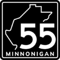
 Minnonigan (standard)
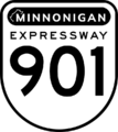 Minnonigan (expressway, free)
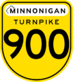 Minnonigan (expressway, tolled)
 Minnonigan (motor trail)
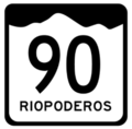
 Riopoderos (primary route)
 Riopoderos (secondary route)
 Tempache (secondary)

 Wisecota (primary)
 Wisecota (secondary)


Railways
This section details discussions on how the railway network of the Federal States came to be and provides valuable information and references in regards to mapping and tagging railways in the Federal States.
Preferred tagging of railways
Railways in the Federal States are members of the International Railway Union and have to be mapped by using the tags
- "railway"="rail"
- "railway"="station"
- "name"=name of the station
related osm-wiki articles:
![]() Tagging in North America
Tagging in North America
General agreement/consensus
See also: 2020 Advisory Survey Results
Freight
Like North America, a network of privately-owned freight railroad companies comprises the vast majority of the national railway system. More information regarding freight railway companies, including a listing of current companies and information regarding how to start new railway companies, can be found here.
Passenger
A national passenger rail provider does exist; however, similar to Amtrak, the company generally operates relatively low-speed (< 80mph / 125 km/h) passenger trains on the freight network. While the national company operates long-distance service, it is also available to operate shorter-distance regional service, but regions may choose to create separate regional passenger networks as well. A forum discussion regarding the overall network is ongoing. Keep in mind that most intercity transportation in the Federal States is done via the motorway network or through the domestic aviation network.
High-Speed
There is no national high-speed rail network; however, there are two high-speed corridors in operation:
- ArchRail operates high-speed service through the Southeast, with a main corridor spanning from Burton to Huntington via Stanton.
- LakeLynx operates high-speed service in the West Lakes focusing on a Wallawaukee-to-Lake City corridor, with branches west of Lake City to Ondassagam (and potentially Fayette, Deodeca) and to Nishaukee Falls along the Deodecan border south of Barre Harbor. Deodeca also operates a high-speed rail corridor between Kingstown and Lake City via LakeLynx in the Federal States.
A third corridor may be included in the future as plans for Cosperica develop.
Commuter
Large cities may have commuter trains. These are organized by individual or neighboring states, rather than at the national level.
North American Railroad Resources

 Rail transportation in the United States
- Rail freight transport
- Burlington Northern Santa Fe
- Union Pacific
- CSX Transportation
- Norfolk Southern
- Canadian National
- Canadian Pacific*
- Kansas City Southern*
- Amtrak

BNSF Railway 
Union Pacific 
CSX Transportation 
Norfolk Southern 
Canadian National 
Canadian Pacific* 
Kansas City Southern* 
Amtrak network map 
Top 15 Intermodal Train Terminal Markets


(*) Canadian Pacific and Kansas City Southern are currently undergoing a merger.
Rail Industry Overview
The railway network of the Federal States is organized largely at the regional level, rather than at the national level. The railway network is comprised of three key types of service:
- Multiple freight companies provide the backbone of the FSA's railway network. While there are a few truly national companies, the majority of these are planned, organized, and mapped at the regional level or with the cooperation of individual stateowners.
- The FSA has a single national passenger rail company, which owns very little, if any, of their own mainline track and is largely dependent on freight railroads to provide low-frequency, low-speed passenger rail service nationwide.
- Supplementing the national passenger rail system are regional passenger railroad companies (RPRCs), which are responsible for providing higher-frequency service between population centers in each region. Some RPRCs may also offer grade-separated electrified high speed rail (HSR) options; some regions will have very few if any RPRCs.
Freight companies are formed in one of three ways:
- The smallest "Class D" freight companies, are organized entirely by a single stateowner. These companies are restricted to a single state, or to a total mainline length of 300mi/500km or less, whichever is less restrictive. There are no limits to the number of Class D railways a stateowner can create. Class D passenger railroads (Class D-P) are generally used to classify commuter rail services or intra-state services by a single stateowner.
- Regional "Class C" freight companies are organized by each group of stateowners in each zone. Class C railways can also serve neighboring zones with up to 100mi/160km of additional mainline. Class C passenger railroads (Class C-P) are used to classify interstate regional passenger services, including high-speed rail lines connecting one or two zones.
- Stateowners, either individually or in collaborative groups, can create larger "Class B", "Class A", or "Class AA" railways:
- Class B railways serve two zones and are organized by a single chairperson. The chairperson is responsible for planning the route and working with the stateowners along the corridor to map the railway. There are no Class B passenger railroads.
- Class A railways serve three zones and are organized by a chairperson and a co-chairperson. Similar to Class B railways, the chair and the co-chair are responsible for planning the route and working with the stateowners along the mainline to map the railway. There are no Class A passenger railroads.
- Class AA railways are the largest railway companies in the Federal States; as such, they must be approved by the FSA community before they get mapped. A Class A railway can apply to become a Class AA railway by adding an additional co-chairperson, creating a plan, gaining tentative approval from stateowners, and presenting their overall plan to the community as a whole. A Class AA railway is permitted to serve up to six of the eight zones in the FSA. The national passenger rail system is considered the only Class AA-P railroad company and serves all areas of the country that desire low-speed, low-frequency passenger rail service.
Each stateowner, regardless of number of states owned or participated in, may only serve as one railway's chairperson and as one railway's co-chairperson. In other words, no stateowner can participate in organizing more than two national railway companies. (Class C and D railway companies are smaller and do not have chairs, so they do not count against this cap.) Passenger railways are organized similar to freight railroads, but are restricted to Class C and Class D systems to avoid competing with the national passenger rail company. Individual stateowners should not organize interstate passenger rail service (except commuter rail systems that serve nearby states in a metropolitan area); regional collaboration groups should take the lead on these efforts.
Zones

This map divides the FSA into eight regional context cluster zones. These zones, which were created based on existing development patterns, existing regional collaboration groups, and significant geographic constraints (rivers, mountains, etc.) form the basis of this plan.
Each zone is tasked with determining their own internal railway coordination structure. This can take the form of a regional organization group like the West Lakes Compact, an elected chairperson(s) delegated by zone stateowners to oversee coordination efforts, or some other format decided by each region. These groups will oversee development of RPRCs and Class C freight railways (see below).
Collaborative states that are master-planned are generally not included in zone committees; mappers interested in adding railway corridors and railway companies should work with each collaborative state's coordinator(s) instead. Each zone is also responsible for developing a unified tagging structure for railways mapped in their zone; these tags must include name=*, operator=*, and service=* at a minimum for mainlines. The name=* tag should include both the operator's abbreviation and the name for that particular stretch of railway (e.g., "MCRR Ondassagam Subdivision").
Freight Operators and Companies
Overview
Each railway in the Federal States should be tagged with an operating company (operator=*), who owns the railway and is the primary company operating on that stretch of railway. Other companies can have "trackage rights" with permission from the operating company; in these locations, a company's route relation is permitted to include the railway of a different operator. A railway company primarily oversees a single point-to-point mainline, although spur lines that connect the mainline to secondary destinations are also encouraged.
Collaborative states or other stateowners that prefer to have consolidated rail corridors can also choose to form their own Class D "union" railways that are shared by multiple railroad companies.
Company Formation and Classes
| Class | Structure | Max Zones | Chairpersons | Co-Chairpersons | Trackage Rights Max |
|---|---|---|---|---|---|
| Class D | State-led | 1 | n/a | n/a | 50% |
| Class C | Zone-led | 1 | n/a | n/a | 40% |
| Class B | Mapper-led | 2 | 1 | 0 | 30% |
| Class A | Mapper-led | 3 | 1 | 1 | 20% |
| Class AA | Mapper-led with community consent | up to 5 | 1 | 2 | 10% |
Each stateowner, regardless of the number of states a mapper participates in, is permitted to be chairperson of one (1) company and co-chairperson of one (1) additional company. (Coordinators of Guided Collaborative states that do not own an FSA state are also considered "stateowners".) Chairpersons are responsible for planning and organizing interstate routes with the permission of each state along the corridor. There are five classes of railway companies, as described below.
Classes are largely based on the above structure and the number of zones served by a single railway company. A railway company is only considered to "serve" a region if a railway has more than 50mi/80km of track in the region. Additionally, for the purposes of determining a railway company's class, the Mid-Ardentic "zone" should be considered either part of the Northeast Region or part of the Southeast Region, but not both.
Class D
Class D railways are the smallest railway companies in the FSA, generally restricted to a single state or under 300 miles/500 kilometers of mainline track, whichever is less restrictive. Class D railways include industrial short lines, union railroads, and terminal railroads. Class D railways are expected to be organized by an individual stateowner (with permission of adjacent states, as needed) for the primary use of their state's residents or businesses and do not count against any caps. Class D route relations should operate with less than 50% of route mileage on trackage rights.
Class C
Class C railways are regional in nature, serving multiple states in a single (1) zone. Class C railways are named, planned, and organized by the stateowners in zone. Class C railways are intended to serve as regional networks of railways, rather than largely point-to-point main lines like other classes. Each region will have significant latitude in how they choose to structure their Class C railways, including the ability to serve areas up to 100mi/160km outside a single zone. Class C route relations should operate with less than 40% of route mileage on trackage rights.
Class B
Class B railways serve two (2) zones and are organized by a single chairperson, who must be a stateowner on the company's mainline. The chairperson is responsible for negotiating routes with the permission of each stateowner along the route. Class B railways are expected to consist of a single primary point-to-point mainline, with a few additional smaller spur lines. Class B route relations should operate with less than 30% of route mileage on trackage rights.
Class A
Class A railways serve three (3) zones and are organized by a chairperson and a co-chairperson; the chair and the co-chair's states must both be located on the mainline and must be in different zones. Similar to Class B railways, the two chairpersons are responsible for planning routes and getting permission from each stateowner in planned corridors. Class A railways are also expected to consist of a single primary point-to-point mainline, but with additional spur lines that serve additional significant destinations to interchange with other railway companies. Class A route relations should operate with less than 20% of route mileage on trackage rights.
Class AA
With the approval of the FSA community, a Class A railway can become a Class AA railway and serve up to six (6) zones. (To ensure realistic competition, no freight companies are permitted to serve more than seven (7) zones.) To move from a Class A to a Class AA railway, the chairperson and co-chairperson must identify an additional co-chairperson to help organize the company. Similar to Class A railways, each of the chair/co-chair's states must be located along the mainline and must each be located in a different zones. The three chairs/co-chairs are responsible for creating a network plan with tentative agreements from each affected stateowner, which would then be presented to the FSA community, with routing and company name approval to be voted on by the FSA community as a whole. "Mergers" with Class B railways are also permitted as part of plans to create a Class AA railway. Class AA route relations should operate with less than 10% of route mileage on trackage rights.
Passenger Operators and Companies
Passenger railways are structured similarly to freight railways, except no interstate passenger routes are organized by individual stateowners.
Company Formation and Classes
Class D-P
Class D-P passenger railways are commuter railways that generally serve a single major metropolitan area, or serves several metropolitan areas in a single state. These are organized at the state level, as applicable; these may operate over freight railway trackage rights or operate on dedicated right-of-way. Permission from freight operators is recommended, but not required unless operating on a segment of single-track railway. These do not count against chair/co-chair caps. Similar to Class D freight railways, Class D-P railways should be limited to a single state or a total length of 300mi/500km, whichever is less restrictive.
Class C-P
Class C-P passenger railways are considered independent of the national passenger rail company and provide supplemental regional passenger service, which may include high-speed rail. Class C-P railways are organized at the regional level and can use freight railway trackage rights for non-high speed rail service. Regions have significant latitude in organizing, naming, and planning Class C-P routes, including operating into adjacent zones as needed.
High-speed rail routes are considered any service that operates at over 110mph (~180km/h). These railways must be electified and grade separated from freight traffic and other ground crossings (streets, paths, etc.).
As per the results of the 2020 advisory survey, there is no national high-speed rail network and the only national low-speed network is provided by the national passenger rail company; thus, Class C-P railways should not serve more than two zones (although, similar to Class C freight, a Class C-P railway does not "serve" a zone unless it has more than 100mi/160km of track in said zone).
Class AA-P
The only Class AA-P company is the national passenger rail company, operating nationwide almost exclusively on freight rail trackage rights. These operations are low-speed and low-frequency, with only one or two trains operating daily per line. To ensure both fairness and forward-compatibility with all future states and stateowners, route planning will not occur until four Class AA railroads are identified and approved. At that point, interested stateowners will be asked to submit a list of stations they wish to be served by the company and a vote will be held to determine the name of the new company. The FSA Inter-State Coordinator and/or the FSA Project Coordinator will work with each region to create a national network plan to ensure as much coverage as possible. As new stateowners come into the project, additional stations can be added and routes modified as needed on an ongoing basis.
Company Listing
Stateowners should feel free to add to this list, provided these companies meet the criteria outlined on this page. Zones and Class definitions can be found in the following sections of this page. For each entry, please be sure to include the current "Status" of each railway company using the following options:
- Conceptual: This railway is being planned, but outreach to additional stateowners or regional groups have not yet occurred. Additionally, little if any of the railway has been mapped so far.
- Draft: A general agreement between the affected stateowners exists, but the precise corridor and other key details (including naming of co-chairs, if needed) are still up for debate and discussion.
- Mapping: The mainline of the company is fully planned with all affected stateowners in agreement; mapping and tagging efforts are currently underway.
- Complete: The mainline of the company is fully mapped and appropriately tagged.
- Expanding: This railway company was complete and is planning on advancing a Class and is currently undergoing planning and mapping efforts with additional stateowners.
| Company Name | Abbreviation | Status | Class | Mainline | Zone(s) Served | Chair | Co-Chair 1 | Co-Chair 2 | Notes |
|---|---|---|---|---|---|---|---|---|---|
| TBD | TBD | Conceptual | AA-P | Various | All | Collaborative | Reserved for the national passenger railway company. | ||
| ArchRail | Mapping | C-P | Huntington-New Atwick via Stanton and Burton | Southeast | Southeast Region | High-speed passenger rail. | |||
| PenCross | PQX∈⊾ | Complete | C-P | Newburyport -> Warwick -> Saint Renecene | Southeast | Zytik | High-speed passenger regional rail. Roughly 1491 miles of track. | ||
| LakeLynx | LLYX | Mapping | C-P | Wallawaukee, SN to Nishaukee Falls, MN via Lake City | West Lakes | West Lakes Compact | High-speed passenger rail. | ||
| Southern Minnonigan Commuter Railroad d/b/a SMARTrail | SMCR | Mapping | D-P | Various | West Lakes | State of Minnonigan | Commuter rail serving Lake City. | ||
| ConnectSeneppi | Mapping | D-P | Various | West Lakes | State of Seneppi | Intra-state passenger service in Seneppi. | |||
| Minnonigan Central Railroad | MCRR∈⊾ | Mapping | A | Lake City-Andreapolis via Apricity and Barstone; branch lines to Jericho, Minneuka and Nordseehaven | West Lakes, Heartland, Alormen | JoJoBa | TheMayor | Not required | Planning of the corridor lines and branches underway. |
| Sauganash & Northern Railroad | S&N | Mapping | B | Lake City-Jundah/Stuart via Wahanta, CL | West Lakes, The West | TheMayor | Not required | Also planning a mainline extension to Cosperica. | |
| North Coast Railroad | NoCo | Draft | C | Lake City-Wallawaukee via Miller | West Lakes | West Lakes Compact | |||
| Lake City Union Railroad | LCU | Mapping | D | Lake City, MN | West Lakes | State of Minnonigan | Interchange railroad for all freight railroads in Lake City. | ||
| Frontera International Railway | FIR | Mapping | D | Frontera, MN to Deodeca border | West Lakes | State of Minnonigan | Jointly owned by S&N and MCRR to serve international interchange service to Deodeca. | ||
| Compass and Western | C&WR∈⊾ | Mapping | A | Penquisset to ME/OQ state line | Southeast, Central, Heartland | Zytik | TBD | Not required | |
| Great Eastern Stanton Folkstone | GESF∈⊾ | Unknown | Unknown | ||||||
| Scantuck & Southern Railroad | S&S∈⊾ | Complete | D | Waltmore, NC to Middlewall, TH via Divinity's Grace, CR | Southeast | State of Culpepper | |||
| Lakes, Mennowa, and Northern Railroad | LM&N∈⊾ | Mapping | A | Minneuka to…: Lake City, MN; Ondassgam, MN; Franklinsburgh, SN; Ohunkagan, MK | Heartland, Central, West Lakes | Alessa | Luciano | Not required | Detailing of the corridor lines and branches underway. |
| Weber, Ryle, and Lion City Railroad | WRLC | Mapping | C | Weber, TE to Lion City, ME | Heartland | West Lakes Compact | |||
| Rock Valley Railroad | RVRR | Mapping | D | Mennowa City, ME to location northwest of Twin Rocks, ME | Heartland | State of Mennowa | |||
| Hope Harbor Railroad | HHRR∈⊾ | Mapping | D | Newport, AS to Ampersand Beach, AS; spur line to Hartford, AS | Southeast | State of Astrantia | |||
| Astrantia Northwestern | ANWRR∈⊾ | Mapping | D | Newport, AS to NC state line; spur line to East Vermouth, AS | Southeast | State of Astrantia | |||
| Newport Harbor Belt | NHBRR∈⊾ | Mapping | D | Newport, AS area | Southeast | State of Astrantia | Belt railway serving Newport. | ||
| Wallawaukee, Seneppi & Western Railroad | WS&W∈⊾ | Mapping | C | Varnel, NI to Deodeca via Gleason, SN | West Lakes | West Lakes Compact | |||
| Great Western and Asperic | GW&A∈⊾ | Mapping | B | Jundah, TA to Minneuka, ME | The West, Heartland | Brunanter | Not required | ||
| Great Northern Terminal Railroad | GNTR | Mapping | D | Lake City, MN | West Lakes | State of Minnonigan | Jointly-owned terminal railroad serving Lake City Great Northern Station and Lake City Expo Transportation Building. | ||
| Lake City & Northeastern Railway | LC&N | Mapping | C | Lake City to Barstone-Nenova via Donovan; branch lines to Gleason, MN; Mennonia, OT; and Finch Hill, SN | West Lakes, Heartland | West Lakes Compact | Includes LM&N trackage rights between Finch Hill and Lake City. | ||
| Cordilleras Southern Railroad | CS | Mapping | A | Deodeca near Clifford, CL- Swansonsville, RI; branch lines to AR120-47 and to Port Union, CL | The West, Heartland, West Lakes | Glauber | Geoc3ladus | Not required | Operator tagging currently underway. Cordilleras Southern is the result of mergers of Clamash Coastal, Clamash Southern, Henrietta Central, and the main east-west line in RI. |
| High-Speed Deodeca | HSD | Complete | C-P | In Deodeca: various In the FSA: Ostally, Agawaskway to Lake City, MN (via LakeLynx) |
West Lakes | Deodeca Collaborative (+ TheMayor) | Branch line from Deodeca to Lake City International Airport. Hosted by LakeLynx, with a dedicated terminal and international customs facility at LCX. | ||
| Lake City and Western Interurban | LC&WI | Mapping | D-P | Lake City, MN to Farnsworth, MN and Ketiguah, MN | West Lakes | State of Minnonigan | Electric interurban passenger railway serving Lake City's western suburbs. | ||
Other Information
Disputes
States are permitted to restrict or deny access to any company who wishes to operate in their state; however, once access is granted for a particular route, it cannot be rescinded. This includes changes in ownership of the state itself: existing routes will be covenanted into the state's new ownership in the event of stateowner turnover. Additional routes would require a separate agreement between the stateowner and the railway company (co-)chair.
Even if permission is granted to the railway company, each stateowner maintains the right to determine intra-state routings, station locations, and other details specific to that state unless explicitly permitted by the stateowner.
Any efforts to "barter", "bribe", or otherwise extract concessions from either a stateowner or a railway company beyond what can be considered reasonable compromises in regards to routing, service, stopping patterns, or other considerations directly related to the mapping and operation of the railway is expressly prohibited. Any violations or attempted violations of this policy should be presented to the FSA Inter-State Coordinator for investigation and remediation.
Vacant States
If a state is available (a "green" state), chairpersons can include a route through said state provided stateowners on each side of the available state agree. If the state already has railroads mapped, the new connection can be mapped as usual; if the state does not yet have any railroads mapped, a route relation can be applied to an untagged line that does not show up on visible layers of the map itself (but would appear on relation queries and wiki multimaps).
If a state is unavailable but vacant (a "gray" state) or inactive (a "yellow" state), corridors and routes are not permitted to be planned or mapped until the status of the state changes. A stateowner who does not respond to any outreach by (co-)chairs should be considered inactive.
Aviation
The Federal States has a robust domestic and international aviation network. This page provides a list of major airports and major airlines in the Federal States.
Airports
| Airports are fun to map, and when done well they are a great addition to the map. However, make sure a city has enough mapping detail to warrant an airport before mapping your airport. If you have to ask if your city has enough detail to warrant a major airport, it probably doesn't. |
Commercial Airports
Before adding any airports here, be sure to claim the airport code by adding airports to the centralized OGF list. Note that, to add an airport to Index:Airports, a certain level of detail (length of runways, number of gates, etc.) must be mapped prior to adding an airport.
Commercial aviation is an important mode of interstate travel within the Federal States, and to/from our neighboring nations. Per OGF standards, there are three classes of commercial airports:
- Class D airports are regional in nature. These airports are generally small, and in the Federal States primarily serve domestic destinations with smaller, shorter-range aircraft. In a "hub and spoke" airline model, regional airports will primarily only fly into "hub" airports rather than have direct connections with other regional airports. Class D airports are generally used for metropolitan areas of up to 250,000 residents that are not within a reasonable (2 hours or less) drive to a larger airport.
- Class R airports are larger than Class D airports, and may have some international flights to nearby foreign destinations, but a majority of destinations will likely still be domestic flights. Most airports on this list should likely fall into the Class R category.
- Class G airports are intercontinental major airports that serve as high-volume hubs for domestic and international flights. These generally are some of the largest airports in the OGF world and should be adequately designed to handle the world's largest commercial aircraft; likewise, they should only be located in areas that would reasonably have a high demand of both domestic and international travel.
Please do not add unmapped airports to this list. Airports without regularly scheduled commercial service should not be included on this list. Airport codes shown in italics are placeholders and should not be considered official; to officially claim an airport code, airports must meet the minimum level of detail to qualify for the Index:Airports list and be listed there. Airports in vacant states are marked with a strikethrough.
| Airport | City | State | WAAT | Class | Runways | Gates | Location | Listed |
|---|---|---|---|---|---|---|---|---|
| Foley-Fillmore International Airport | Mahpe (Andreapolis) | APL | G | 4 | 170 | ❌ No | ||
| Asperic Beach-Scottsboro-Stanford County International Airport | Asperic Beach | ASS | R | 3 | ❌ No | |||
| Adamsville International Airport | Adamsville | AVA | R | 10/28 (2500m) 18L/36R (3100m) 18R/36L (2200) |
30 | ✅ Yes | ||
| Benjamin K. Hedstrom International Airport | Warwick | BKH | G | 07/25 (3800m) 14L/32R (3500m) 14R/32L (3500m) |
98 | ✅ Yes | ||
| Ondassagam-Bucks County Regional Airport | Ondassagam | BUX | R | 3/21 (2600m) 11/29 (2625m) |
21 | ✅ Yes | ||
| Northern Minnonigan Regional Airport | Carbonridge | CBX | D | 6/24 (2000m) 14/32 (3000m) 18/36 (1675m) |
7 | ✅ Yes | ||
| Huntington International | Huntington | Capital District | CDI | G | 4 | ❌ No | ||
| Chapman Airport | Chapman | CHP | D | 1 | ❌ No | |||
| Colurona International Airport | Colurona | COL | R | 15/33 (2960m) 09/18 (2120m) |
7 | ❌ No | ||
| Dennison International Airport | Redonda (Dennison) | DIA | G | 3 | ❌ No | |||
| Elvira Regional Airport | Elvira | ELR | D | 2 | ❌ No | |||
| reserved | Esperanza | Cosperica | ESP | G | Planned airport | |||
| Guerrero Airport | Guerrero | GUE | D | 2 | ❌ No | |||
| Henderson Airport | Henderson | HEN | D | 2 | ❌ No | |||
| Hope Harbor International | Hope Harbor | HHI | R | 2 | ❌ No | |||
| Hessonite County Regional Airport | Porte Springs | HPS | D | 09/18 (3720m) | 4 | ❌ No | ||
| James Moore International Airport | Baldwin | Template:Elway | JMI | R | 02L/20R (2400m) 02R/20L (2000m) |
13 | ✅ Yes | |
| Juliana Hálison International Airport | Hálison | JLH | G | 2 | ❌ No | |||
| Miller-Justice M. Wescott Regional Airport | Miller | Iroquesia | MJW | D | 08/26 (2000m) 03L/21R (2370m) 03R/21L (1710m) |
11 | ✅ Yes | |
| Jonnequiel International Airport | Ohunkagan | JQL | G | 3 | ❌ No | |||
| Jundah-Stuart International Airport | Jundah-Stuart | Template:Tauhon | JSI | G | 3 | 87 | ❌ No | |
| Lafayette International Airport | Eveleigh | LAF | R | 2 | ❌ No | |||
| Lake City International Airport | Lake City | LCX | G | 03/21 (4000m) 09L/27R (3500m) 09C/27C (3500m) 09R/27L (3000m) 10L/28R (4500m) 10R/28L (3750m) 12L/30R (3000m) 12R/30L (2500m) |
191 | ✅ Yes | ||
| Gunnison International Airport | Lake City | LKX | R | 5L/23R (1500m) 5C/23C (2000m) 5R/23L (1250m) 11L/29R (1750m) 11R/29L (2250m) |
65 | ✅ Yes | ||
| Lola-Fort Nickerson Regional Airport | Lola | LON | D | 1 | ❌ No | |||
| Los Reyes Valdez International Airport | Los Reyes | LRV | G | 3 | ❌ No | |||
| Maquadena Beartown International Airport | Maquadena | MAQ | R | 4 | ❌ No | |||
| Minneuka International Airport | Minneuka | MKX | G | 3 | ❌ No | |||
| reserved | Massodeya City | Michisaukee | MSS | G | Planned airport | |||
| Makaska Valley International Airport | Marksville | MVI | R | 2 | ❌ No | |||
| Alvia International Airport | Orterrado | ORA | R | 1 | ❌ No | |||
| Feldline International Airport | Orterrado | ORF | G | 3 | ❌ No | |||
| Gridland Gateway International Airport | Barre Harbor/Port Blaire | PBX | D | 7/25 (3500m) 13/31 (2500m) |
5 | ✅ Yes | ||
| San Daniel Airport | San Daniel | SDA | D | 1 | ❌ No | |||
| Stanton Belleville Airport | Stanton | SBE | D | 1 | ❌ No | |||
| Stanton International Airport | Stanton | STI | G | 4 | 157 | ❌ No | ||
| Fiorino International Airport | Stanton | STN | R | 3 | 69 | ❌ No | ||
| Vilsack-Stith Municipal Airport | Vilsack | VSM | D | 1 | ❌ No | |||
| Wahanta-Clifford International Airport | Wahanta | WCA | R | 2 | ❌ No | |||
| Waltmore Airport | Waltmore | WAL | R | 2 | ❌ No | |||
General Aviation Airports
General Aviation (GA) airports are small, public airports that do not have regularly-scheduled commercial air service. While private aircraft can also use commercial airports, GA airports are more common for private individuals, commercial or civil services like farming maintenance or firefighting, and organizations that own or lease private aircraft.
Each GA airport should still have a 4-letter identifying code; however, there is not yet a national consensus on a consistent lettering scheme for GA airports. A listing of GA airports will be established once ANACA code formats are established. GA airports do not use the international three-letter codes.
Airlines
Air Freedoms
With a robust domestic aviation industry including numerous FSA-based international carriers, the Federal States allows global "3rd Freedom" access to international airlines only. For all domestic flights or connections that begin and end within the Federal States, a domestic carrier must be used, with codesharing agreements permitted. International airlines are welcome to fly between the FSA and their home nation, but "4th Freedom" flights that originate or terminate in a third country are not permitted.
Domestic Airlines
| Airline | Logo | Headquarters | Callsign | WAAT Flight Code | Alliance | Primary Hubs | Secondary Hubs | Target Market(s) |
|---|---|---|---|---|---|---|---|---|
| Apex Airlines | 
|
Los Reyes, |
Apex | XR | Los Reyes Valdez International Airport | Wahanta-Clifford International Airport Foley-Fillmore International Airport |
Domestic and international | |
| Ardentic Airlines | Stanton, |
Ardentic | OA | |||||
| CL-Air | Finch Hill, Iroquesia | Lakes | CL | Finch Hill International Airport | Miller-Justice M. Wescott Regional Airport | Domestic | ||
| Federal Airlines | Stanton, |
FedAir | FA | OneSky | Stanton International Airport Jundah-Stuart International Airport |
Lake City International Airport Fiorino International Airport Gobras City International Worldport |
Domestic and international | |
| flySmart | Dennison, |
SMAR | FS | WorldStar | Dennison International Airport]] Foley-Fillmore International Airport |
Minneuka International Airport Huntington Regional Airport |
Budget | |
| PenqAir | Warwick, |
Benjamin K. Hedstrom International Airport | ||||||
| SkyRide Airlines | 
|
Lake City, |
SkyRide | SR | None | Gunnison International Airport | Cape Stockton International Airport | Budget |
| Southern Airlines | 
|
Lake City, |
Essay | SA | Four Corners | Lake City International Airport | Domestic and international | |
| Tauhon Airlines | Jundah, Template:Tauhon | Jundah | TA | Jundah-Stuart Intercontinental Airport | ||||
| Union Airways | Orterrado, |
Unair | UN | WorldStar | Orterrado- Feldline International Airport | Orterrado- Alvia International Airport | ||
| WestAir | Stuart, Template:Tauhon | West | FW | Jundah-Stuart Intercontinental Airport |
International Airlines
| Airline | Nation | Alliance | FSA Destinations | International Destinations |
|---|---|---|---|---|
| Air Plevia | OneSky | Lake City International Airport Stanton International Airport |
Osianopoli | |
| AirTamor | Template:Tamor | Lake City International Airport | Incubel | |
| AOAir | Template:Aorangëa | Stanton International Airport | Otāngia-Naora Airport Fawltryncham Airport Whangiora Airport | |
| Duncanheim Royal Airlines | Duncanheim | Stanton-Fiorino International Airport Lake City International Airport |
Kattenden Bakarsbond International Airport | |
| FreedemiAir | OneSky | Jundah-Stuart Intercontinental Airport Lake City International Airport |
Quentinsburgh-Sean Bond International Airport | |
| Guai Airways | Geolliance | Stanton International Airport Jundah-Stuart Intercontinental Airport |
Vai International Airport | |
| Izaland Airlines | WorldStar | Minneuka International Airport Burton-New Atwick International Airport Lake City International Airport Stanton International Airport Arecales Jundah-Stuart Intercontinental Airport |
Sainðaul Asunahama International Airport Warohan Takarun International Airport Makkeriya International Airport | |
| Uletha Eastern Airways | OneSky | Minneuka International Airport Lake City International Airport Stanton International Airport Arecales Andreapolis International Airport |
Sainðaul Asunahama International Airport Warohan Takarun International Airport |
| Collaborative Projects | States: Territories: Protectorates: |
|---|---|
| Natural Environment | National Parks • Natural features |
| Commerce | Franchises • Industries |
| Infrastructure | Government • Military • Transportation |
| Worldbuilding | History • Important persons • International relations • Non-governmental organizations • Sports • State profiles |
| Project Communication | Main project page • Discord (request access) • Federal States Forum (archive) • Newcomers Guide • Archives |