File:Bmore Inner Harbor-Blue.jpg

Size of this preview: 800 × 410 pixels. Other resolutions: 320 × 164 pixels | 640 × 328 pixels | 1,024 × 524 pixels | 1,280 × 655 pixels | 2,560 × 1,311 pixels | 4,759 × 2,437 pixels.
Original file (4,759 × 2,437 pixels, file size: 4.86 MB, MIME type: image/jpeg)
Summary
| Description |
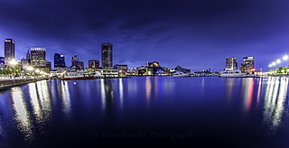
English: Baltimore Harbor skyline panorama |
| Date | |
| Source | https://www.flickr.com/photos/yeahbouyee/10831342573/ |
| Author | yeahbouyee |
| Camera location | | View this and other nearby images on: OpenStreetMap |
|---|
Licensing
This file is licensed under the Creative Commons Attribution 2.0 Generic license.
- You are free:
- to share – to copy, distribute and transmit the work
- to remix – to adapt the work
- Under the following conditions:
- attribution – You must give appropriate credit, provide a link to the license, and indicate if changes were made. You may do so in any reasonable manner, but not in any way that suggests the licensor endorses you or your use.
| This image was originally posted to Flickr by yeahbouyee at https://flickr.com/photos/95154404@N06/10831342573 (archive). It was reviewed on 21 May 2019 by FlickreviewR 2 and was confirmed to be licensed under the terms of the cc-by-2.0. |
File history
Click on a date/time to view the file as it appeared at that time.
| Date/Time | Thumbnail | Dimensions | User | Comment | |
|---|---|---|---|---|---|
| current | 13:45, 21 May 2019 | | 4,759 × 2,437 (4.86 MB) | wikimediacommons>Praxidicae | User created page with UploadWizard |
File usage
There are no pages that use this file.