Category:Territory request images
Media in category "Territory request images"
The following 52 files are in this category, out of 52 total.
-
 AN152e Plan.png 1,500 × 1,190; 341 KB
-
 AR-10 Topo.png 811 × 793; 151 KB
-
 AR060-14 Meredies Base 2024-02-24.jpg 2,555 × 1,278; 65 KB
-
 Averleigh Rough Map.png 1,603 × 2,272; 707 KB
-
 DE-15 Application Update20231224.png 1,085 × 1,080; 28 KB
-
 DE-15 Capital Application.png 1,135 × 904; 58 KB
-
 DE-15 Physical Geography Application.png 1,463 × 1,080; 560 KB
-
 DE-15 Roads Application.png 1,463 × 1,080; 551 KB
-
 Eshein Expension proposal.png 1,722 × 1,080; 722 KB
-
 Eshien expension borders regions and cities.jpeg 1,794 × 1,125; 217 KB
-
 Gharbiya1.png 828 × 807; 235 KB
-
 Glaster+Kingswin plan.png 869 × 797; 242 KB
-
 Kara context.png 856 × 846; 513 KB
-
 Karageo.png 1,268 × 924; 545 KB
-
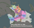
 Kwelede-peir Application 0.png 866 × 650; 326 KB
-
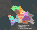
 Kwelede-peir Application 1.png 1,145 × 797; 424 KB
-
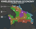
 Kwelede-peir Application 2.png 1,500 × 1,236; 985 KB
-
 Kwelede-peir Application 3.png 1,500 × 1,207; 868 KB
-
 Kwelede-peir Application 4.png 3,000 × 2,414; 1.84 MB
-
 Kwelede-peir Application 5.png 1,500 × 1,207; 875 KB
-
 Kwelede-peir Application 6.png 1,500 × 1,207; 838 KB
-
 Kwelede-peir Application 7.png 3,000 × 2,414; 1.91 MB
-
 Kwelede-peir Application 8.png 1,500 × 1,207; 722 KB
-
 Major Transportation Corridors -02.jpg 421 × 299; 30 KB
-
 Major Urban Centers -02.jpg 960 × 720; 42 KB
-
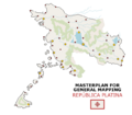 Masterplan of the República Platina.png 660 × 579; 104 KB
-
 Natural Planning with Major Rivers-02.jpg 421 × 299; 32 KB
-
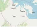
 NenninshireandWelric.jpg 1,145 × 785; 184 KB
-
 New Podolia full.png 2,057 × 1,926; 1.45 MB
-
 Norfricandsufricproposal.jpg 1,667 × 1,262; 241 KB
-
 OGF - UL08g - Plan.png 980 × 745; 500 KB
-
 Screenshot 2023-12-22 094224.png 2,516 × 1,206; 385 KB
-
 Screenshot 20241129 160647.png 1,085 × 732; 369 KB
-
 TA320 plan.png 1,615 × 1,100; 33 KB
-
 Tekurius mapping style.png 1,200 × 800; 202 KB
-
 Tekurius old vs new.png 1,357 × 882; 167 KB
-
 Telektebu Request Naturalmapping01.png 924 × 1,041; 155 KB
-
 Telektebu Request Naturalmapping1.png 924 × 1,041; 166 KB
-
 Telektebu Request Naturalmapping3.png 924 × 1,041; 129 KB
-
 Tolulu base map.png 1,501 × 1,213; 232 KB
-
 Tolulu relation.png 1,413 × 945; 300 KB
-
 Tolulu states.png 1,501 × 1,213; 227 KB
-
 Topography.png 624 × 404; 50 KB
-
 UL08c-12 - Nature et occupation des terres prévues.png 1,237 × 806; 253 KB
-
 UL08c-12 - Peuplement - Routes principales.png 1,237 × 806; 363 KB
-
 UL25 - Compressed.png 2,524 × 1,733; 1.54 MB
-
 UL26f sketch 2024-02-20.jpg 936 × 816; 101 KB
-
 UL27k - Application 2.png 1,340 × 810; 31 KB
-
 UL27k - Application 3.png 1,340 × 810; 19 KB
-
 UL27k - Application 5.png 1,615 × 803; 634 KB
-
 UL27k - Application 6.png 1,615 × 208; 126 KB
-
 UL33jSketch.jpg 960 × 640; 40 KB


