File:Iroquesia Current Rail Map.png: Difference between revisions
(Roughly mapped plan of railroad routes through Iroquesia, Federal States.) |
Rustem Pasha (talk | contribs) m (cat) |
||
| Line 3: | Line 3: | ||
== Licensing == | == Licensing == | ||
{{Cc-by-sa}} | {{Cc-by-sa}} | ||
[[Category:Federal States collaborative documentation]] | |||
Latest revision as of 09:50, 5 July 2023
Summary
Roughly mapped plan of railroad routes through Iroquesia, Federal States.
Licensing
| This image is licensed under the Creative Commons Attribution-ShareAlike License |
File history
Click on a date/time to view the file as it appeared at that time.
| Date/Time | Thumbnail | Dimensions | User | Comment | |
|---|---|---|---|---|---|
| current | 08:33, 1 July 2023 | 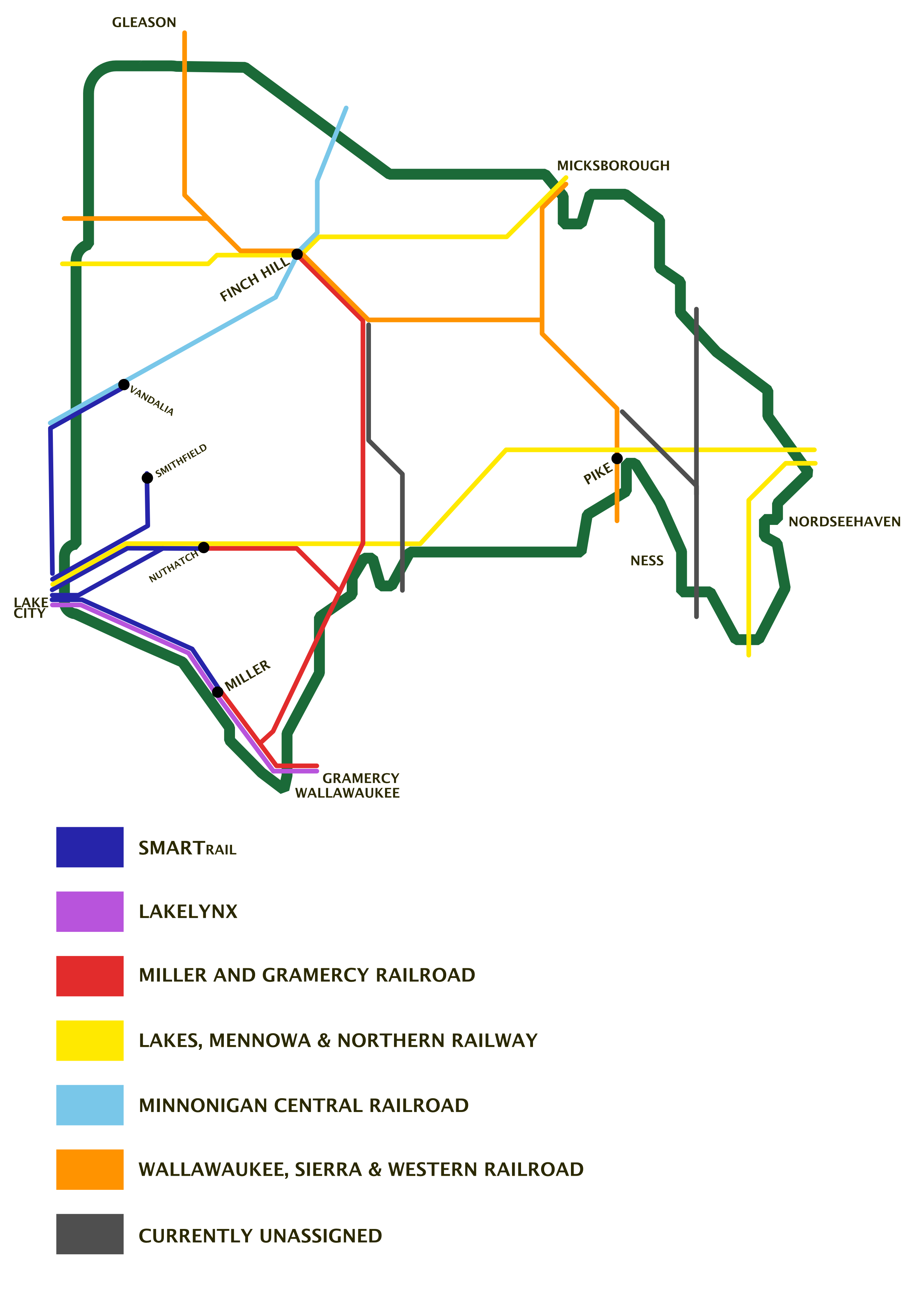 | 2,481 × 3,508 (342 KB) | Aces California (talk | contribs) | Roughly mapped plan of railroad routes through Iroquesia, Federal States. |
You cannot overwrite this file.
File usage
The following page uses this file: