File:LCTAowlservice.png: Difference between revisions
(Owl (overnight) service map of the Lake City Transit Authority's rail lines. Own work. Airport icon in public domain at https://en.m.wikipedia.org/wiki/File:Pictograms-nps-airport.svg.) |
m (→Summary: category) |
||
| Line 1: | Line 1: | ||
== Summary == | == Summary == | ||
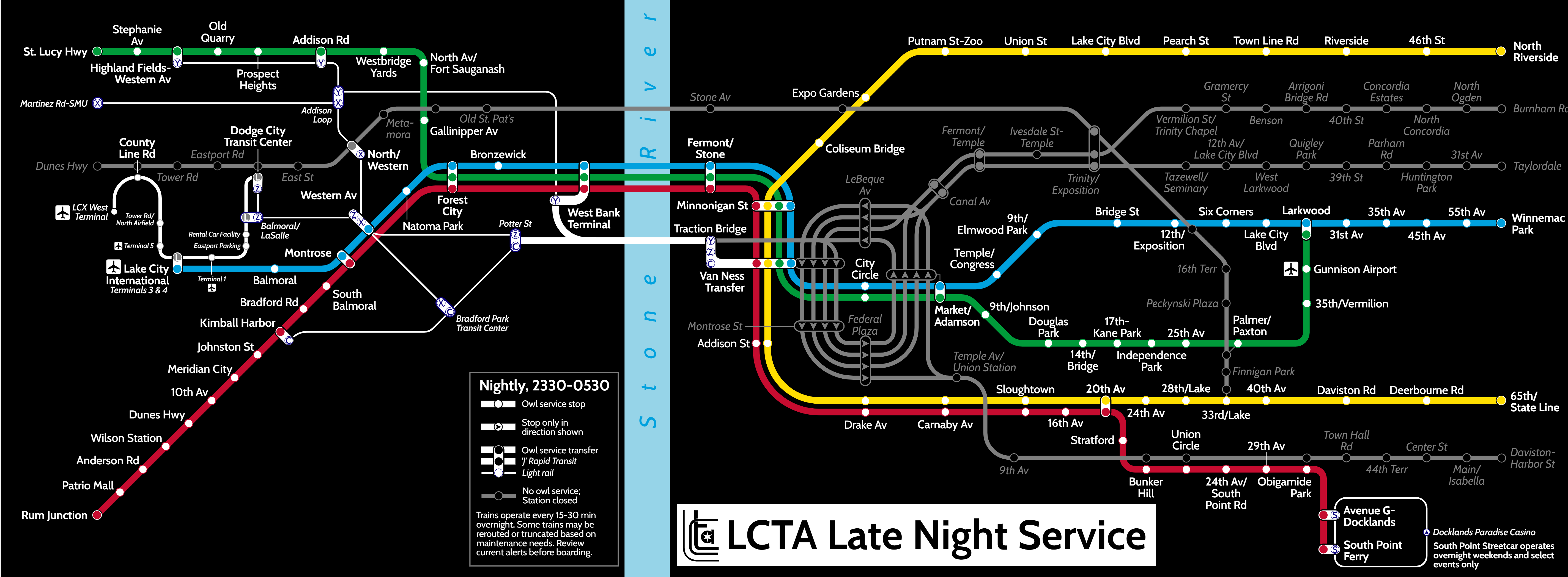
Owl (overnight) service map of the Lake City Transit Authority's rail lines. Own work. Airport icon in public domain at https://en.m.wikipedia.org/wiki/File:Pictograms-nps-airport.svg. | Owl (overnight) service map of the Lake City Transit Authority's rail lines. Own work. Airport icon in public domain at https://en.m.wikipedia.org/wiki/File:Pictograms-nps-airport.svg. | ||
[[Category:Minnonigan]] | |||
[[Category:Transport maps]] | |||
== Licensing == | == Licensing == | ||
{{Cc-by-nc}} | {{Cc-by-nc}} | ||
Latest revision as of 00:20, 8 April 2022
Summary
Owl (overnight) service map of the Lake City Transit Authority's rail lines. Own work. Airport icon in public domain at https://en.m.wikipedia.org/wiki/File:Pictograms-nps-airport.svg.
Licensing
| This image is licensed under the Creative Commons Attribution-NonCommercial License |
File history
Click on a date/time to view the file as it appeared at that time.
| Date/Time | Thumbnail | Dimensions | User | Comment | |
|---|---|---|---|---|---|
| current | 22:40, 7 April 2022 | 5,700 × 2,100 (1.49 MB) | TheMayor (talk | contribs) | Owl (overnight) service map of the Lake City Transit Authority's rail lines. Own work. Airport icon in public domain at https://en.m.wikipedia.org/wiki/File:Pictograms-nps-airport.svg. |
You cannot overwrite this file.
File usage
There are no pages that use this file.