File:LCX FlightPaths.png: Difference between revisions
(Operational schemes at Lake City International Airport. Category:Minnonigan) |
(TheMayor uploaded a new version of File:LCX FlightPaths.png) |
||
| (One intermediate revision by one other user not shown) | |||
| Line 3: | Line 3: | ||
== Licensing == | == Licensing == | ||
{{Cc-by-nc}} | {{Cc-by-nc}} | ||
[[Category:Airport diagrams]] | |||
Latest revision as of 15:19, 28 June 2023
Summary
Operational schemes at Lake City International Airport.
Licensing
| This image is licensed under the Creative Commons Attribution-NonCommercial License |
File history
Click on a date/time to view the file as it appeared at that time.
| Date/Time | Thumbnail | Dimensions | User | Comment | |
|---|---|---|---|---|---|
| current | 15:19, 28 June 2023 | 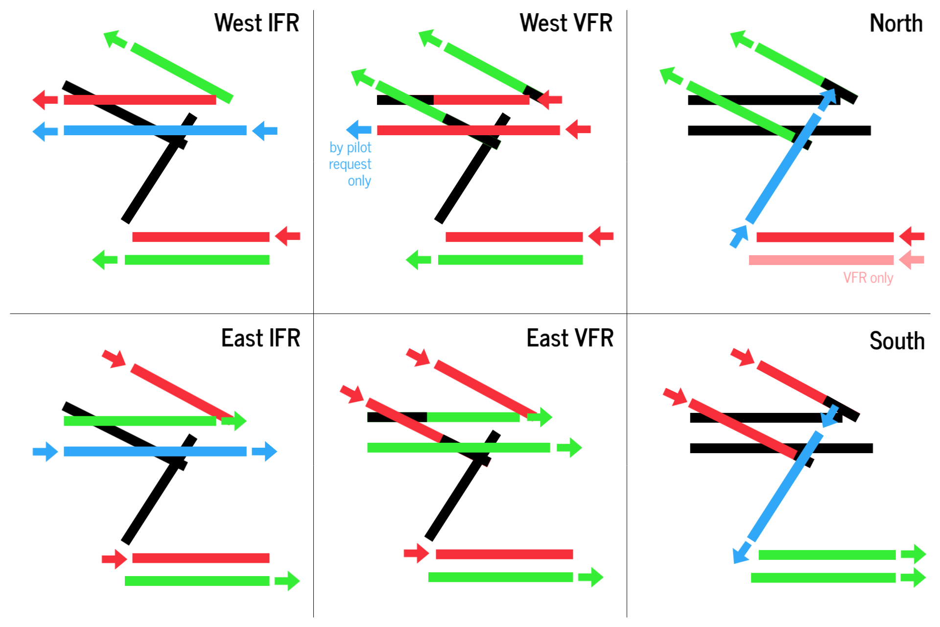 | 1,920 × 1,280 (214 KB) | TheMayor (talk | contribs) | Updated runway layout at LCX. |
| 20:41, 24 November 2021 | Error creating thumbnail: File missing | 640 × 640 (73 KB) | TheMayor (talk | contribs) | Operational schemes at Lake City International Airport. Category:Minnonigan |
You cannot overwrite this file.
File usage
The following page uses this file: