File:Trinity Island Commuter Rail.png: Difference between revisions
Rustem Pasha (talk | contribs) mNo edit summary |
m (TI > Hyde) |
||
| Line 1: | Line 1: | ||
== Summary == | == Summary == | ||
Map of the | Map of the Hyde Commuter Rail, created by [[User:Zytik|Zytik]] while developing the railway network in the map. | ||
[[Category:Hyde]] [[Category:Transport maps]] | |||
== Licensing == | == Licensing == | ||
{{Cc-by}} | {{Cc-by}} | ||
Latest revision as of 03:39, 6 July 2022
Summary
Map of the Hyde Commuter Rail, created by Zytik while developing the railway network in the map.
Licensing
| This image is licensed under the Creative Commons Attribution License |
File history
Click on a date/time to view the file as it appeared at that time.
| Date/Time | Thumbnail | Dimensions | User | Comment | |
|---|---|---|---|---|---|
| current | 02:14, 5 January 2022 | 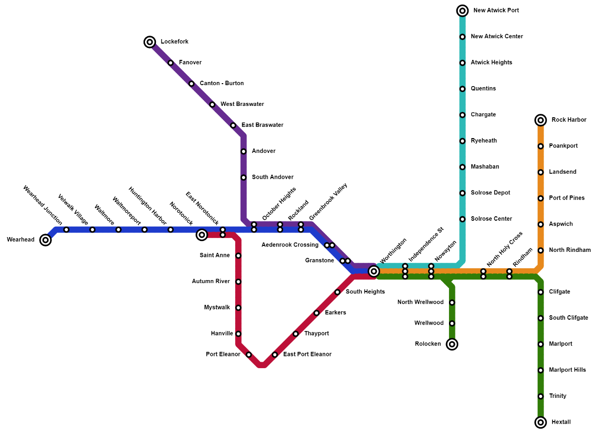 | 1,198 × 879 (141 KB) | Mapping Expert (talk | contribs) | Map of the Trinity Island Commuter Rail, created by Zytik while developing the Trinity Island railway network in the map. Category:Trinity Island Category:Railway |
You cannot overwrite this file.
File usage
The following page uses this file: