File:Who controlled BSF islands.png

Size of this preview: 800 × 421 pixels. Other resolution: 1,622 × 854 pixels.
Original file (1,622 × 854 pixels, file size: 62 KB, MIME type: image/png)
Summary
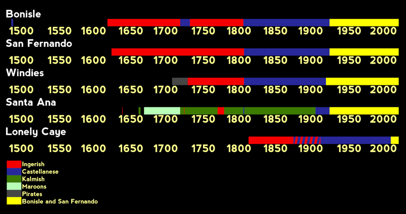
Graph showing who actually controlled which islands of BSF in history since 1500.
Licensing
| This image is licensed under the Creative Commons Attribution License |
File history
Click on a date/time to view the file as it appeared at that time.
| Date/Time | Thumbnail | Dimensions | User | Comment | |
|---|---|---|---|---|---|
| current | 06:53, 23 March 2024 | | 1,622 × 854 (62 KB) | Brunanter (talk | contribs) | Graph showing who actually controlled which islands of BSF in history since 1500. Category:Bonisle and San Fernando |
You cannot overwrite this file.
File usage
The following page uses this file: