Search results
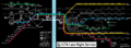
File:LCTAowlservice.png Owl (overnight) service map of the Lake City Transit Authority's rail lines. Own work. Airport icon in public domain at https://en.m.wikipedia.or [[Category:Transport maps]](5,700 × 2,100 (1.49 MB)) - 00:20, 8 April 2022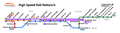
File:BudrianPeninsulaHSRStripMap.png Strip map of the High Speed Rail network serving the major cities of the Budrian Peninsula (Paroy, Freedemia Self-created in Affinity Designer. Aterro Transport logo originally designed by PortCal and recreated by me, design scheme of u(3,079 × 840 (268 KB)) - 03:26, 24 March 2024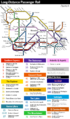
File:FSA Passenger Rail Draft.png Sketch of potential long-distance passenger rail services in the Federal States. Will be updated in the near future. [[Category:Transport maps]](1,000 × 1,700 (487 KB)) - 20:47, 2 November 2021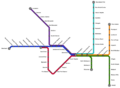
File:Trinity Island Commuter Rail.png Map of the Hyde Commuter Rail, created by [[User:Zytik|Zytik]] while developing the railway network in th [[Category:Hyde]] [[Category:Transport maps]](1,198 × 879 (141 KB)) - 03:39, 6 July 2022

