Search results
File:L-Reglè RouteMap.png ...pany, in Eastern Antarephia. Based on an adapted and redetailed version of Timboh's world map and a screenshot of the OGF regular render map.(2,455 × 989 (376 KB)) - 12:30, 5 December 2021
File:QN Subdivisions.png Map template provided by [[User:Timboh]].(1,500 × 1,729 (663 KB)) - 17:37, 2 July 2023
File:10 citiesQN.png Base map created thanks to [[User:Timboh]].(3,000 × 2,497 (706 KB)) - 12:04, 3 August 2022
File:QNPop Density.png Map template provided by [[User:Timboh]].(1,500 × 1,741 (488 KB)) - 16:46, 2 July 2023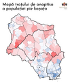
File:QNGrowth Rate.png Map template provided by [[User:Timboh]].(1,500 × 1,741 (605 KB)) - 16:48, 2 July 2023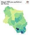
File:HDI1.png Map template provided by [[User:Timboh]].(1,500 × 1,741 (346 KB)) - 16:49, 2 July 2023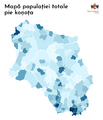
File:Population Commune.png Map template provided by [[User:Timboh]].(1,500 × 1,741 (472 KB)) - 17:29, 2 July 2023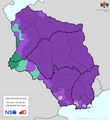
File:QNReligion.png Map template provided by [[User:Timboh]].(1,500 × 1,632 (587 KB)) - 00:08, 4 July 2023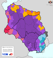
File:QNEthnicities.png Map template provided by [[User:Timboh]].(1,500 × 1,632 (611 KB)) - 16:49, 2 July 2023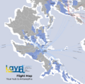
File:Layr Flight Map.png ...Map for the national carrier airline of Layr. Using a modified map made by Timboh.(1,868 × 1,835 (835 KB)) - 21:43, 28 November 2021
File:OGFatR Place.png Picture includes the flag of [[Navenna]] (by [[User:Timboh]]) and the OpenGeofiction logo.(1,375 × 745 (309 KB)) - 00:22, 5 April 2022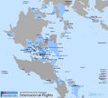
File:FreedemiAir flights Map.png ...me in Affinity Designer. Based off the OGF map using a template created by Timboh. FreedemiAir logo by me. OneSky logo also by an OGF user, but I can no long(3,000 × 2,698 (920 KB)) - 00:08, 13 April 2024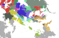
File:East uletha culture proposal.png Own work based on the SVG map template created by User:Timboh.(2,710 × 1,770 (1.38 MB)) - 16:32, 27 June 2022


