Wiesermoria: Difference between revisions
(Created page) |
No edit summary |
||
| (4 intermediate revisions by the same user not shown) | |||
| Line 1: | Line 1: | ||
{{Infocard|name=Republic of Wiesermoria|native_name=Wiesermorische Republik/Визерморская Республика|native_language=German, Russian|capital=Blauwitz, Sinegrad|intro=}} | {{Infocard|name=Republic of Wiesermoria|native_name=Wiesermorische Republik/Визерморская Республика|native_language=German, Russian|capital=Blauwitz, Sinegrad|intro=|latitude=40|longitude=95|zoom=6}} | ||
== Transportation == | == Transportation == | ||
| Line 8: | Line 8: | ||
!Road Class | !Road Class | ||
!Road Numbering Scheme | !Road Numbering Scheme | ||
!Route Shield | |||
!Function | !Function | ||
!Design Parameters (Breitwieserland) | !Design Parameters (Breitwieserland) | ||
!Design Parameters (Ivermoria) | !Design Parameters (Ivermoria) | ||
|- | |- | ||
|Autobahn/Автомагистраль (highway=motorway) | |[[File:RU road sign 5.1.svg|thumb|225x225px|Автомагистраль]][[File:BreitwieserlandAutobahn.png|thumb|225x225px|Autobahn]]Autobahn/Автомагистраль (highway=motorway) | ||
|A### | |A### | ||
|[[File:BreitwieserlandMotorway.png|thumb|Shield in Breitwieserland]][[File:IvermoriaMotorway.png|thumb|Shield in Ivermoria]] | |||
|High-quality and high-speed roads that carry primary road traffic. | |High-quality and high-speed roads that carry primary road traffic. | ||
| | | | ||
| Line 32: | Line 34: | ||
* No u-turn areas | * No u-turn areas | ||
|- | |- | ||
|Kraftfahrstraße/Скоростная дорога (highway=trunk) | |[[File:RU road sign 5.3.svg|thumb|225x225px|Скоростная дорога]][[File:BreitwieserlandKraftfahrstraße.png|thumb|225x225px|Kraftfahrstraße]]Kraftfahrstraße/Скоростная дорога (highway=trunk) | ||
|M### | |M### | ||
|[[File:BreitwieserlandTrunk.png|thumb|Shield in Breitwieserland]][[File:IvermoriaTrunk.png|thumb|Shield in Ivermoria]] | |||
|High-quality and high-speed roads that carry primary road traffic. Lower quality than motorways and opted for in places with difficult terrain or in and around cities due to the lower design requirements and construction costs. All trunk roads are motorroads but not all motorroads are trunk roads. | |High-quality and high-speed roads that carry primary road traffic. Lower quality than motorways and opted for in places with difficult terrain or in and around cities due to the lower design requirements and construction costs. All trunk roads are motorroads but not all motorroads are trunk roads. | ||
| | | | ||
| Line 52: | Line 55: | ||
* No u-turn areas | * No u-turn areas | ||
|- | |- | ||
|Hauptstraße/Дорога первой значимости (highway=primary) | |[[File:RU road sign 2.1.svg|thumb|150x150px|Priority road]]Hauptstraße/Дорога первой значимости (highway=primary) | ||
|## | |## | ||
|[[File:BreitwieserlandSingleRoute.png|thumb|Shield in Breitwieserland]][[File:IvermoriaSingleRoute.png|thumb|Shield in Ivermoria]] | |||
|Most important roads in Wiesermoria — they connect the largest cities, ports, airports and other terminals together and form a connected network across the whole country without any isolated stretches of road. | |Most important roads in Wiesermoria — they connect the largest cities, ports, airports and other terminals together and form a connected network across the whole country without any isolated stretches of road. | ||
In urban areas primary roads are the most important corridors in the city that bear the heaviest traffic loads and connect the centre with major suburbs, as well as connecting major districts. If a ring road is present then it acts as a primary road and no primary roads may exist inside the ring. | In urban areas primary roads are the most important corridors in the city that bear the heaviest traffic loads and connect the centre with major suburbs, as well as connecting major districts. If a ring road is present then it acts as a primary road and no primary roads may exist inside the ring. | ||
| Line 67: | Line 71: | ||
|Landesstraße/Дорога второй значимости (highway=secondary) | |Landesstraße/Дорога второй значимости (highway=secondary) | ||
|### | |### | ||
|[[File:BreitwieserlandDoubleRoute.png|thumb|Shield in Breitwieserland]][[File:IvermoriaDoubleRoute.png|thumb|Shield in Ivermoria]] | |||
|Next most important roads in Wiesermoria — they connect primary roads together or cities/towns to primary roads as well as linking small cities and towns. | |Next most important roads in Wiesermoria — they connect primary roads together or cities/towns to primary roads as well as linking small cities and towns. | ||
In urban areas secondary roads are those that are less important than primary roads and connect suburbs or smaller districts with each other. | In urban areas secondary roads are those that are less important than primary roads and connect suburbs or smaller districts with each other. | ||
| Line 74: | Line 79: | ||
|Kreisstraße/Дорога третьей значимости (highway=tertiary) | |Kreisstraße/Дорога третьей значимости (highway=tertiary) | ||
|#### | |#### | ||
|[[File:BreitwieserlandTripleRoute.png|thumb|Shield in Breitwieserland]][[File:IvermoriaTripleRoute.png|thumb|Shield in Ivermoria]] | |||
|Roads that are less important than secondary roads — they connect secondary roads together or towns to secondary roads as well as linking towns. | |Roads that are less important than secondary roads — they connect secondary roads together or towns to secondary roads as well as linking towns. | ||
In urban areas tertiary roads connect small suburbs or quarters with the centre and with each other. | In urban areas tertiary roads connect small suburbs or quarters with the centre and with each other. | ||
| Line 79: | Line 85: | ||
| | | | ||
|- | |- | ||
|Nebenstraße/Дорога | |Nebenstraße/Дорога четвёртой значимости (highway=unclassified/residential) | ||
|N/A | |N/A | ||
| | |||
|Roads that carry local traffic and aren't meant for heavy use. Residential roads are unclassified roads with the primary function of providing access to residential properties. | |Roads that carry local traffic and aren't meant for heavy use. Residential roads are unclassified roads with the primary function of providing access to residential properties. | ||
| | | | ||
| | | | ||
|- | |- | ||
|Wohnstraße/Жилая улица (highway=living_street) | |[[File:RU road sign 5.21.svg|thumb|225x225px|Жилая зона]]Wohnstraße/Жилая улица (highway=living_street) | ||
|N/A | |N/A | ||
| | |||
|Residential roads that have been traffic-calmed to prioritise creating a safe environment for pedestrians. Through traffic is forbidden from using these roads. Pedestrians and cyclists have priority over motor vehicles and may cross or walk along the carriageway at any point in which case they should be given way to. | |Residential roads that have been traffic-calmed to prioritise creating a safe environment for pedestrians. Through traffic is forbidden from using these roads. Pedestrians and cyclists have priority over motor vehicles and may cross or walk along the carriageway at any point in which case they should be given way to. | ||
| | | | ||
| Line 93: | Line 101: | ||
|Wirtschaftsweg/Просёлочная дорога (highway=track) | |Wirtschaftsweg/Просёлочная дорога (highway=track) | ||
|N/A | |N/A | ||
| | |||
|Roads that facilitate access to farms or forestry areas, usually unpaved. | |Roads that facilitate access to farms or forestry areas, usually unpaved. | ||
| | | | ||
| Line 99: | Line 108: | ||
|Zufahrtsweg/Проезд прилегающей территории | |Zufahrtsweg/Проезд прилегающей территории | ||
|N/A | |N/A | ||
| | |||
|Roads that facilitate access to adjoining road facilities as well as minor residential areas | |Roads that facilitate access to adjoining road facilities as well as minor residential areas | ||
| | | | ||
| Line 134: | Line 144: | ||
!Ivermoria | !Ivermoria | ||
|- | |- | ||
|150 | |[[File:RU road sign 3.24-150.svg|thumb|100x100px]]150 | ||
|Selected high-quality stretches of motorway (must have at least 3 lanes in each direction, an electronic traffic management system, regular speed enforcement and other additional safety features | |Selected high-quality stretches of motorway (must have at least 3 lanes in each direction, an electronic traffic management system, regular speed enforcement and other additional safety features | ||
|''Not used'' | |''Not used'' | ||
|- | |- | ||
|130 | |[[File:RU road sign 3.24-130.svg|thumb|80x80px]][[File:Zeichen 274-130 - Zulässige Höchstgeschwindigkeit, StVO 2017.svg|thumb|80x80px]]130 | ||
| | | | ||
* '''Default motorway limit''' | * '''Default motorway limit''' | ||
| Line 144: | Line 154: | ||
|'''Default motorway limit''' (in practice only high quality sections of motorway have this speed limit) | |'''Default motorway limit''' (in practice only high quality sections of motorway have this speed limit) | ||
|- | |- | ||
|120 | |[[File:RU road sign 3.24-120.svg|thumb|80x80px]][[File:Zeichen 274-120 - Zulässige Höchstgeschwindigkeit, StVO 2017.svg|thumb|80x80px]]120 | ||
|Medium quality rural motorroads | |Medium quality rural motorroads | ||
|''Not used'' | |''Not used'' | ||
|- | |- | ||
|110 | |[[File:RU road sign 3.24-110.svg|thumb|80x80px]][[File:Zeichen 274-110 - Zulässige Höchstgeschwindigkeit, StVO 2017.svg|thumb|80x80px]]110 | ||
|Low quality rural motorroads | |Low quality rural motorroads | ||
| | | | ||
| Line 154: | Line 164: | ||
* High quality rural motorroads | * High quality rural motorroads | ||
|- | |- | ||
|100 | |[[File:RU road sign 3.24-100.svg|thumb|80x80px]][[File:Zeichen 274-100 - Zulässige Höchstgeschwindigkeit, StVO 2017.svg|thumb|80x80px]]100 | ||
| | | | ||
* Motorways or motorroads where weaving occurs on the mainline carriageway | * Motorways or motorroads where weaving occurs on the mainline carriageway | ||
| Line 163: | Line 173: | ||
* High quality rural roads (must have central reservation or guard rail) | * High quality rural roads (must have central reservation or guard rail) | ||
|- | |- | ||
|90 | |[[File:RU road sign 3.24-90.svg|thumb|80x80px]][[File:Zeichen 274-90 - Zulässige Höchstgeschwindigkeit, StVO 2017.svg|thumb|80x80px]]90 | ||
|'''Default rural limit''', road must have provisions for vulnerable road users (pedestrians, equestrians, cyclists) | |'''Default rural limit''', road must have provisions for vulnerable road users (pedestrians, equestrians, cyclists) | ||
| | | | ||
| Line 169: | Line 179: | ||
* Medium quality rural motorroads | * Medium quality rural motorroads | ||
|- | |- | ||
|80 | |[[File:RU road sign 3.24-80.svg|thumb|80x80px]][[File:Zeichen 274-80 - Zulässige Höchstgeschwindigkeit, StVO 2017.svg|thumb|80x80px]]80 | ||
| | | | ||
* Urban motorways or motorroads | * Urban motorways or motorroads | ||
| Line 178: | Line 188: | ||
* Urban roads with the primary function of motor vehicle traffic (must have barriers separating pavement/cycleway from carriageway, must not have cycle lanes in the carriageway) | * Urban roads with the primary function of motor vehicle traffic (must have barriers separating pavement/cycleway from carriageway, must not have cycle lanes in the carriageway) | ||
|- | |- | ||
|70 | |[[File:RU road sign 3.24-70.svg|thumb|80x80px]][[File:Zeichen 274-70 - Zulässige Höchstgeschwindigkeit, StVO 2017.svg|thumb|80x80px]]70 | ||
| | | | ||
* Rural roads that do not have provisions for vulnerable road users (pedestrians, equestrians, cyclists) | * Rural roads that do not have provisions for vulnerable road users (pedestrians, equestrians, cyclists) | ||
| Line 185: | Line 195: | ||
* Urban roads with the primary function of motor vehicle traffic (must have barriers separating pavement/cycleway from carriageway, must not have cycle lanes in the carriageway) | * Urban roads with the primary function of motor vehicle traffic (must have barriers separating pavement/cycleway from carriageway, must not have cycle lanes in the carriageway) | ||
|- | |- | ||
|60 | |[[File:RU road sign 3.24-60.svg|thumb|80x80px]][[File:Zeichen 274-60 - Zulässige Höchstgeschwindigkeit, StVO 2017.svg|thumb|80x80px]]60 | ||
| | | | ||
* Urban roads with the primary function of motor vehicle traffic (must have barriers separating pavement/cycleway from carriageway, must not have cycle lanes in the carriageway) | * Urban roads with the primary function of motor vehicle traffic (must have barriers separating pavement/cycleway from carriageway, must not have cycle lanes in the carriageway) | ||
| Line 193: | Line 203: | ||
* Rural roads that have been traffic calmed due to high concentrations of vulnerable road users (pedestrians, equestrians, cyclists), usually placed as a zone (WM:zone60) | * Rural roads that have been traffic calmed due to high concentrations of vulnerable road users (pedestrians, equestrians, cyclists), usually placed as a zone (WM:zone60) | ||
|- | |- | ||
|50 | |[[File:RU road sign 3.24-50.svg|thumb|80x80px]][[File:Zeichen 274-50 - Zulässige Höchstgeschwindigkeit, StVO 2017.svg|thumb|80x80px]]50 | ||
|'''Default urban limit''' | |'''Default urban limit''' | ||
|'''Default urban limit''' | |'''Default urban limit''' | ||
|- | |- | ||
|40 | |[[File:RU road sign 3.24-40.svg|thumb|80x80px]][[File:Zeichen 274-40 - Zulässige Höchstgeschwindigkeit, StVO 2017.svg|thumb|80x80px]]40 | ||
| | | | ||
* Usually placed as a zone (WM:zone40) in residential areas | * Usually placed as a zone (WM:zone40) in residential areas | ||
| Line 203: | Line 213: | ||
* Usually placed as a zone (WM:zone40) in residential areas | * Usually placed as a zone (WM:zone40) in residential areas | ||
|- | |- | ||
|30 | |[[File:RU road sign 3.24-30.svg|thumb|80x80px]][[File:Zeichen 274-30 - Zulässige Höchstgeschwindigkeit, StVO 2017.svg|thumb|80x80px]][[File:RU road sign 5.31.svg|thumb|120x120px]][[File:Zeichen 274.1 - Beginn einer Tempo 30-Zone, StVO 2013.svg|thumb|80x80px]][[File:RU road sign 5.39.svg|thumb|120x120px]]30 | ||
| | | | ||
* Urban roads that have been traffic calmed due to high concentrations of vulnerable road users (pedestrians, equestrians, cyclists), usually placed as a zone (WM:zone30) | * Urban roads that have been traffic calmed due to high concentrations of vulnerable road users (pedestrians, equestrians, cyclists), usually placed as a zone (WM:zone30) | ||
* Bicycle roads | |||
| | | | ||
* Urban roads that have been traffic calmed due to high concentrations of vulnerable road users (pedestrians, equestrians, cyclists), usually placed as a zone (WM:zone30) | * Urban roads that have been traffic calmed due to high concentrations of vulnerable road users (pedestrians, equestrians, cyclists), usually placed as a zone (WM:zone30) | ||
|- | |- | ||
|20 | |[[File:RU road sign 3.24-20.svg|thumb|80x80px]][[File:Zeichen 274-20 - Zulässige Höchstgeschwindigkeit, StVO 2017.svg|thumb|80x80px]]20 | ||
|'''Default living street limit''' | |'''Default living street limit''' | ||
|'''Default living street limit''' | |'''Default living street limit''' | ||
|} | |} | ||
[[Category:Countries in East Uletha]] | [[Category:Countries in East Uletha]] | ||
Revision as of 21:07, 16 April 2024
| [[File:{{{flag}}}|150px|Flag of Wiesermoria]] | Republic of Wiesermoria Wiesermorische Republik/Визерморская Республика (German, Russian) Capital: Blauwitz, Sinegrad
|
Loading map... |
Transportation
Road
| Road Class | Road Numbering Scheme | Route Shield | Function | Design Parameters (Breitwieserland) | Design Parameters (Ivermoria) |
|---|---|---|---|---|---|
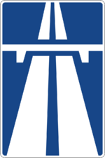
| Autobahn/Автомагистраль (highway=motorway) | A### | High-quality and high-speed roads that carry primary road traffic. |
|
| |
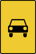
| Kraftfahrstraße/Скоростная дорога (highway=trunk) | M### | High-quality and high-speed roads that carry primary road traffic. Lower quality than motorways and opted for in places with difficult terrain or in and around cities due to the lower design requirements and construction costs. All trunk roads are motorroads but not all motorroads are trunk roads. |
|
| |
| Hauptstraße/Дорога первой значимости (highway=primary) | ## | Most important roads in Wiesermoria — they connect the largest cities, ports, airports and other terminals together and form a connected network across the whole country without any isolated stretches of road.
In urban areas primary roads are the most important corridors in the city that bear the heaviest traffic loads and connect the centre with major suburbs, as well as connecting major districts. If a ring road is present then it acts as a primary road and no primary roads may exist inside the ring. |
|
| |
| Landesstraße/Дорога второй значимости (highway=secondary) | ### | Next most important roads in Wiesermoria — they connect primary roads together or cities/towns to primary roads as well as linking small cities and towns.
In urban areas secondary roads are those that are less important than primary roads and connect suburbs or smaller districts with each other. |
|||
| Kreisstraße/Дорога третьей значимости (highway=tertiary) | #### | Roads that are less important than secondary roads — they connect secondary roads together or towns to secondary roads as well as linking towns.
In urban areas tertiary roads connect small suburbs or quarters with the centre and with each other. |
|||
| Nebenstraße/Дорога четвёртой значимости (highway=unclassified/residential) | N/A | Roads that carry local traffic and aren't meant for heavy use. Residential roads are unclassified roads with the primary function of providing access to residential properties. | |||
| Wohnstraße/Жилая улица (highway=living_street) | N/A | Residential roads that have been traffic-calmed to prioritise creating a safe environment for pedestrians. Through traffic is forbidden from using these roads. Pedestrians and cyclists have priority over motor vehicles and may cross or walk along the carriageway at any point in which case they should be given way to. | |||
| Wirtschaftsweg/Просёлочная дорога (highway=track) | N/A | Roads that facilitate access to farms or forestry areas, usually unpaved. | |||
| Zufahrtsweg/Проезд прилегающей территории | N/A | Roads that facilitate access to adjoining road facilities as well as minor residential areas |
Route Numbering System
Wiesermoria uses a route numbering system where certain pre-defined corridors are assigned a number and zones are created. Zones 1 through 5 are located in Ivermoria and zones 6 through 9 are located in Breitwieserland. All minor roads are thereby numbered according to the zone they are located. The only exception to this rule is A1, which crosses many zones. Certain roads may be improved and a prefix is then assigned to the number (A or M). If the original road is kept and a new (bypass) road is constructed the original road keeps the number and the bypass uses the same number, but with the appropriate prefix.
Speed Limits
The default speed limits for motorcars, motorcycles and goods vehicles are as follows:
- 130 km/h on motorways (WM:motorway)
- 90 km/h outside urban areas (WM:rural)
- 50 km/h inside urban areas (WM:urban)
- 20 km/h on living streets or inside service areas (WM:living_street)
The default speed limits for vehicles pulling a trailer or HGVs are as follows:
- 90 km/h on motorways
- 70 km/h outside urban areas
- 50 km/h inside urban areas
- 20 km/h on living streets or inside service areasThe default speed limits for buses are as follows:
- 100 km/h on motorways
- 80 km/h outside urban areas
- 50 km/h inside urban areas
- 20 km/h on living streets or inside service areas
HGVs are defined as cargo vehicles with a GVWR of over 3.5 tons while those with a GVWR below or equal to 3.5 tons are classed as goods vehicles. HGVs, vehicles pulling a trailer and buses must not exceed their motorway speed limit if the posted limit is higher.
| Speed Limit (km/h) | Breitwieserland | Ivermoria |
|---|---|---|
| 150 | Selected high-quality stretches of motorway (must have at least 3 lanes in each direction, an electronic traffic management system, regular speed enforcement and other additional safety features | Not used |
| 130 |
|
Default motorway limit (in practice only high quality sections of motorway have this speed limit) |
| 120 | Medium quality rural motorroads | Not used |
| 110 | Low quality rural motorroads |
|
| 100 |
|
|
| 90 | Default rural limit, road must have provisions for vulnerable road users (pedestrians, equestrians, cyclists) |
|
| 80 |
|
|
| 70 |
|
|
| 60 |
|
|
| 50 | Default urban limit | Default urban limit |
| 40 |
|
|
| 30 |
|
|
| 20 | Default living street limit | Default living street limit |

