Category:Images derived from the OGF map
| Category of images derived from the OGF map Do not add images directly to this category! Instead, update the license to be {{Cc-ogf-map}}. If the map is only a portion of the file, add the map's license template and indicate that it has more than one.. |
Media in category "Images derived from the OGF map"
The following 200 files are in this category, out of 397 total.
(previous page) (next page)-
 10 citiesQN.png 3,000 × 2,497; 706 KB
-
 1408.png 1,169 × 826; 1.15 MB
-
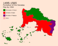 1495-1565.png 1,000 × 800; 146 KB
-
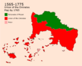 1565-1775.png 1,000 × 800; 129 KB
-
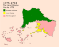 1775-1783.png 1,000 × 800; 133 KB
-
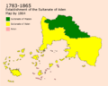 1783-1865.png 999 × 799; 135 KB
-
 1850center.jpg 1,509 × 781; 261 KB
-
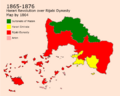 1865-1876.png 999 × 799; 143 KB
-
 1876-1906.png 999 × 799; 142 KB
-
 1906-1935.png 998 × 798; 142 KB
-
 1917 Dregolesian Moraines Plebiscite.png 1,063 × 748; 64 KB
-
 1935-1946.png 998 × 798; 136 KB
-
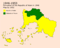 1946-1953.png 998 × 798; 130 KB
-
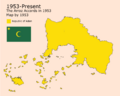 1953-present.png 998 × 798; 117 KB
-
 19c-City 1.png 1,458 × 888; 486 KB
-
 19c-City 2.png 1,458 × 880; 536 KB
-
 2022 result.png 1,546 × 1,074; 322 KB
-
 20240707 Freight Rail Proposal v2.png 1,940 × 937; 1.23 MB
-
 20c-City 1.png 1,452 × 886; 548 KB
-
 20c-City 2.png 1,458 × 890; 663 KB
-
 21c-City 1.png 1,449 × 886; 537 KB
-
 21c-City 2.png 969 × 886; 455 KB
-
 682-685.png 1,000 × 800; 151 KB
-
 685-789.png 1,000 × 800; 146 KB
-
 789-898.png 1,000 × 800; 145 KB
-
 898-973.png 1,000 × 800; 132 KB
-
 973-1495.png 1,000 × 800; 133 KB
-
 Aden Cities.png 990 × 1,400; 245 KB
-
 Aden Elevation Map.png 1,050 × 900; 518 KB
-
 Aden Population Distribution.png 1,985 × 1,405; 461 KB
-
 Administrative Borders Aden.png 1,000 × 718; 259 KB
-
 Agawaskway baseplan admin.png 2,000 × 2,000; 491 KB
-
 Agawaskway baseplan transport.png 2,000 × 1,892; 731 KB
-
 Albarakinu TN.jpg 408 × 200; 6 KB
-
 Allendea admin.png 2,087 × 2,999; 1.25 MB
-
 Alormen Climate.png 1,277 × 962; 665 KB
-
 Alormen colonisation.jpg 1,200 × 890; 1.03 MB
-
 Alormen counties - rough population estimate.jpg 768 × 586; 276 KB
-
 ALORMEN descriptive maps.jpg 2,923 × 1,528; 470 KB
-
 Alormen in fsa.png 1,445 × 1,007; 98 KB
-
 Alormen Motorway Plan 20231229.png 1,120 × 861; 499 KB
-
 Ambroisie departements.jpg 1,126 × 1,249; 212 KB
-
 Ambroisie provinces 1.jpg 1,126 × 1,249; 219 KB
-
 Ambroisie regions.jpg 1,126 × 1,249; 238 KB
-
 Ambroisie relief.jpg 1,126 × 1,249; 203 KB
-
 AN136-rustem.png 1,064 × 518; 333 KB
-
 AN136-split.svg 1,121 × 844; 674 KB
-
 AN152e Plan.png 1,500 × 1,190; 341 KB
-
 Anbira Prefecture (Izaland).svg 1,637 × 1,963; 53 KB
-
 Antarephia-Coalition-Map.png 3,000 × 1,817; 1.02 MB
-
 Antarephian coalition election 2023.png 935 × 565; 123 KB
-
 Antharia Population Change.jpeg 3,000 × 3,144; 530 KB
-
 Antharian Languages outside Romanish.jpeg 3,000 × 3,144; 592 KB
-
 AR-10 Topo.png 811 × 793; 151 KB
-
 AR060-10 Proposal - 2.png 758 × 780; 37 KB
-
 AR060-10 Proposal-1.png 758 × 780; 34 KB
-
 AR060-14 Meredies Base 2024-02-24.jpg 2,555 × 1,278; 65 KB
-
 AR918-926Exchange.png 1,280 × 561; 476 KB
-
 Area south of Arion.png 659 × 711; 153 KB
-
 ASUN Map 05 2024.png 1,937 × 2,480; 643 KB
-
 Averleigh Rough Map.png 1,603 × 2,272; 707 KB
-
 Baradin-2018-2022.png 1,802 × 1,597; 1.16 MB
-
 Barzona HDI by department.png 716 × 674; 22 KB
-
 Barzonan revolt 1832-33.gif 1,200 × 1,000; 932 KB
-
 BigStuffLittleStuff.png 600 × 655; 195 KB
-
 Border region.png 800 × 494; 270 KB
-
 Borough assembly 25.png 1,202 × 885; 77 KB
-
 Bromley city borough council elections 2025.png 1,201 × 882; 197 KB
-
 Calling Code Map by CaribbeanIslandMapper.png 611 × 742; 56 KB
-
 Castellan capital blank.png 1,136 × 907; 79 KB
-
 Castellan capital proposal Bixelkoven.png 3,200 × 3,486; 1.33 MB
-
 Castellan coast north strait.png 1,206 × 818; 458 KB
-
 Castellan coast south strait.png 1,097 × 827; 364 KB
-
 Castellan coast two straits.png 817 × 791; 260 KB
-
 Castellan coastline schematic.png 1,263 × 843; 190 KB
-
 Castellan orography base.png 879 × 661; 331 KB
-
 Castellan orography parallel.png 880 × 659; 337 KB
-
 Castellan orography perpendicular.png 879 × 661; 340 KB
-
 Castellan orography radial.png 879 × 660; 336 KB
-
 Castellan topo idea.png 1,029 × 822; 585 KB
-
 CerroBixelkoven.png 1,178 × 891; 287 KB
-
 Cities of Izaland.png 1,414 × 2,000; 233 KB
-
 City Mayoral election 25.png 1,218 × 882; 115 KB
-
 Coastline density UL 2024-02-04.png 2,825 × 1,635; 1.21 MB
-
 Counties of Trinity Island.svg 1,341 × 1,465; 298 KB
-
 Country Tempeira.svg 1,132 × 897; 1.96 MB
-
 DE-15 Application Update20231224.png 1,085 × 1,080; 28 KB
-
 DE-15 Capital Application.png 1,135 × 904; 58 KB
-
 DE-15 Physical Geography Application.png 1,463 × 1,080; 560 KB
-
 DE-15 Roads Application.png 1,463 × 1,080; 551 KB
-
 DE-AA banner.png 1,986 × 574; 1.58 MB
-
 DE-AA location.png 2,000 × 2,400; 527 KB
-
 Demirhan - road numbering.png 3,000 × 2,300; 322 KB
-
 Demirhan language map.png 3,500 × 2,300; 565 KB
-
 Demirhan topomap.png 3,500 × 2,300; 622 KB
-
 Demirhan, 1820.png 1,500 × 1,300; 207 KB
-
 Deodeca Plan.png 2,000 × 2,000; 615 KB
-
 Deodeca Provinces Updated.png 1,080 × 1,077; 294 KB
-
 DeodecaKoppen.svg 820 × 820; 1.95 MB
-
 Drull draft.png 1,530 × 773; 382 KB
-
 East uletha culture proposal.png 2,710 × 1,770; 1.38 MB
-
 East Uletha Regions for renaming purpose.png 2,451 × 2,663; 1.54 MB
-
 Eelvation - Hamidiyye-01.jpg 3,508 × 2,480; 1.65 MB
-
 Ellarca admin blank.png 3,507 × 2,480; 667 KB
-
 Empire.png 1,162 × 837; 164 KB
-
 Escadia - climate 2.png 1,366 × 856; 692 KB
-
 Escadia - climate.png 1,366 × 856; 561 KB
-
 Escadia - population and infrastructure.png 1,387 × 856; 527 KB
-
 Eshein Expension proposal.png 1,722 × 1,080; 722 KB
-
 Eshien expension borders regions and cities.jpeg 1,794 × 1,125; 217 KB
-
 Ethnicities - Hamidiye-01.jpg 5,831 × 4,123; 1.67 MB
-
 EthnicityQennes.png 3,000 × 3,000; 446 KB
-
 EUC-Sudo-UL25.png 1,754 × 739; 169 KB
-
 Flag of Venary.png 2,480 × 1,413; 99 KB
-
 Fort Hampton plan.png 1,114 × 762; 97 KB
-
 FQ Admin.png 2,120 × 2,066; 590 KB
-
 FQ Basic.png 2,120 × 2,066; 872 KB
-
 FQ Canal.png 702 × 784; 397 KB
-
 FQ Highways.png 1,331 × 1,575; 1.11 MB
-
 FQ Terrain.png 2,120 × 2,066; 663 KB
-
 Freedemiaairportstationexplanation.png 1,746 × 2,004; 1.47 MB
-
 FreedemiaClimateMap.png 1,200 × 1,134; 482 KB
-
 FreedemiAir flights Map.png 3,000 × 2,698; 920 KB
-
 FreedemiaStateMap.png 1,303 × 846; 299 KB
-
 FS-1-2 Plan.png 1,611 × 1,181; 1.51 MB
-
 FSA Core Motorway Network.png 1,313 × 865; 1.34 MB
-
 FSA Draft Passenger Rail Plan.png 800 × 1,290; 360 KB
-
 FSA FreightRailDraft.png 1,940 × 936; 1.47 MB
-
 FSA Grid Motorway Network.png 1,329 × 870; 1.32 MB
-
 FSA Passenger Rail Draft.png 1,000 × 1,700; 487 KB
-
 FSA TimeZoneProposal.png 1,589 × 935; 1.4 MB
-
 FSARailZones 20211221.png 1,913 × 1,154; 203 KB
-
 Furgenia proposal.png 1,920 × 1,005; 139 KB
-
 Gallo-Roman Oppidum.png 1,454 × 881; 126 KB
-
 Gharbiya1.png 828 × 807; 235 KB
-
 Glaster+Kingswin plan.png 869 × 797; 242 KB
-
 Gobras-city-neighbourhoods-bus.png 1,117 × 950; 1.91 MB
-
 Greater Saindzaul.png 969 × 914; 846 KB
-
 Gresonie - climate.jpg 2,945 × 2,147; 570 KB
-
 Gresonie - networks.jpg 2,945 × 2,147; 732 KB
-
 Gresonie - relief.jpg 2,945 × 2,147; 582 KB
-
 Guai Relief.svg 737 × 583; 465 KB
-
 Haijiao proposal.jpg 760 × 942; 184 KB
-
 HDI1.png 1,500 × 1,741; 346 KB
-
 Hemming Key Neighborhoods.png 832 × 1,639; 303 KB
-
 Huaxia admin 2024.png 3,730 × 3,108; 1.46 MB
-
 Huaxia expwy.png 2,459 × 1,725; 984 KB
-
 Huaxia normal rail mainline.png 4,002 × 2,887; 1.73 MB
-
 Huysburg 1715.jpg 1,479 × 827; 161 KB
-
 Huysburg 1850.jpg 1,263 × 779; 136 KB
-
 Huysburg 1955 center.jpg 1,527 × 807; 292 KB
-
 Huysburg 1955.jpg 1,601 × 833; 238 KB
-
 Huysburg.jpg 1,393 × 746; 99 KB
-
 Huysburg1660b.jpg 1,349 × 814; 174 KB
-
 Huysburg1780 center.jpg 741 × 807; 137 KB
-
 Huysburg1780.jpg 802 × 714; 87 KB
-
 Huysburg1900.jpg 1,251 × 821; 176 KB
-
 Huysburg1900Center.png 1,531 × 821; 841 KB
-
 Huysburg1990.jpg 1,431 × 805; 225 KB
-
 HuysburgC1990.jpg 1,379 × 823; 253 KB
-
 Hydrocarbons in Alormen.png 767 × 586; 137 KB
-
 IA Transportation Map.svg 635 × 845; 1.02 MB
-
 Image Suvuma Languages.png 1,918 × 1,588; 1.33 MB
-
 Imperios allendea.png 496 × 702; 47 KB
-
 Ingerish Asperia administrative districts.png 995 × 1,012; 408 KB
-
 Ingerish Asperia baseplan.png 1,051 × 1,192; 276 KB
-
 Ingerish Asperia geo regions.png 1,051 × 1,192; 343 KB
-
 Ingerland Capital Old Town - sudo91.png 1,319 × 863; 248 KB
-
 Ingerland Geography draft v1.png 672 × 808; 246 KB
-
 Ingerland Sketch Fluffr.png 886 × 791; 437 KB
-
 Ingerland sudo91 1.png 1,038 × 877; 231 KB
-
 Ingerland sudo91 2.png 816 × 579; 116 KB
-
 Ingerland sudo91 3.png 944 × 590; 70 KB
-
 Ingerland sudo91 4.png 816 × 579; 119 KB
-
 Ingerland sudo91 5.png 1,054 × 775; 244 KB
-
 Inxigne Before Great War.png 1,169 × 1,200; 146 KB
-
 Islandguidelines01.png 640 × 396; 111 KB
-
 Islandguidelines02.png 640 × 396; 47 KB
-
 Islandguidelines03.gif 640 × 396; 60 KB
-
 Islandguidelines04.png 640 × 396; 58 KB
-
 Islandguidelines05.png 640 × 396; 40 KB
-
 Islandguidelines06.png 640 × 396; 28 KB
-
 Iviran Coast 1000.jpg 6,211 × 3,626; 431 KB
-
 Iviran Coast 1400.jpg 6,211 × 3,626; 475 KB
-
 Iviran Coast 200 AD.jpg 6,211 × 3,626; 404 KB
-
 Izaland climates 4 zones.png 794 × 1,123; 152 KB
-
 JKP-25-04 D2.0 - Geographic Regions.png 2,388 × 1,774; 787 KB
-
 JKP-25-04 D2.3 - Watersheds.png 2,388 × 1,774; 717 KB
-
 JKP-25-04 D3.0 - Political.png 2,388 × 1,774; 915 KB
-
 JKP-25-04 D4.0 - Elevation 250.png 2,388 × 1,774; 545 KB
-
 JKP-25-04 D5.0 - Wind waves.png 2,388 × 1,774; 871 KB
-
 JKP-25-04 D5.2 - Koppen climate.png 2,388 × 1,774; 470 KB
-
 Kalkara preliminary sketch.png 794 × 559; 161 KB
-
 Karageo.png 1,268 × 924; 545 KB
-
 Kasaki Prefecture (Izaland).svg 1,637 × 1,548; 44 KB
-
 Khai-lma-map.png 400 × 270; 70 KB
-
 Khaiwoon-density-map.jpg 400 × 237; 28 KB
-
 Khaiwoon-metro.jpg 3,425 × 2,735; 1.72 MB
-
 Khaiwoon-straits-fort.jpg 450 × 300; 35 KB
-
 Khaiwoon-terrain-map.jpg 400 × 270; 29 KB


.svg)


.svg)


