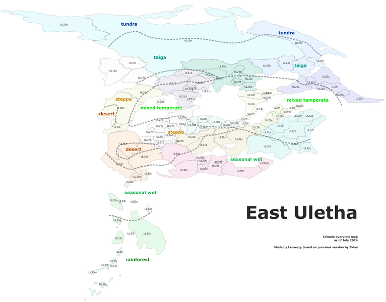
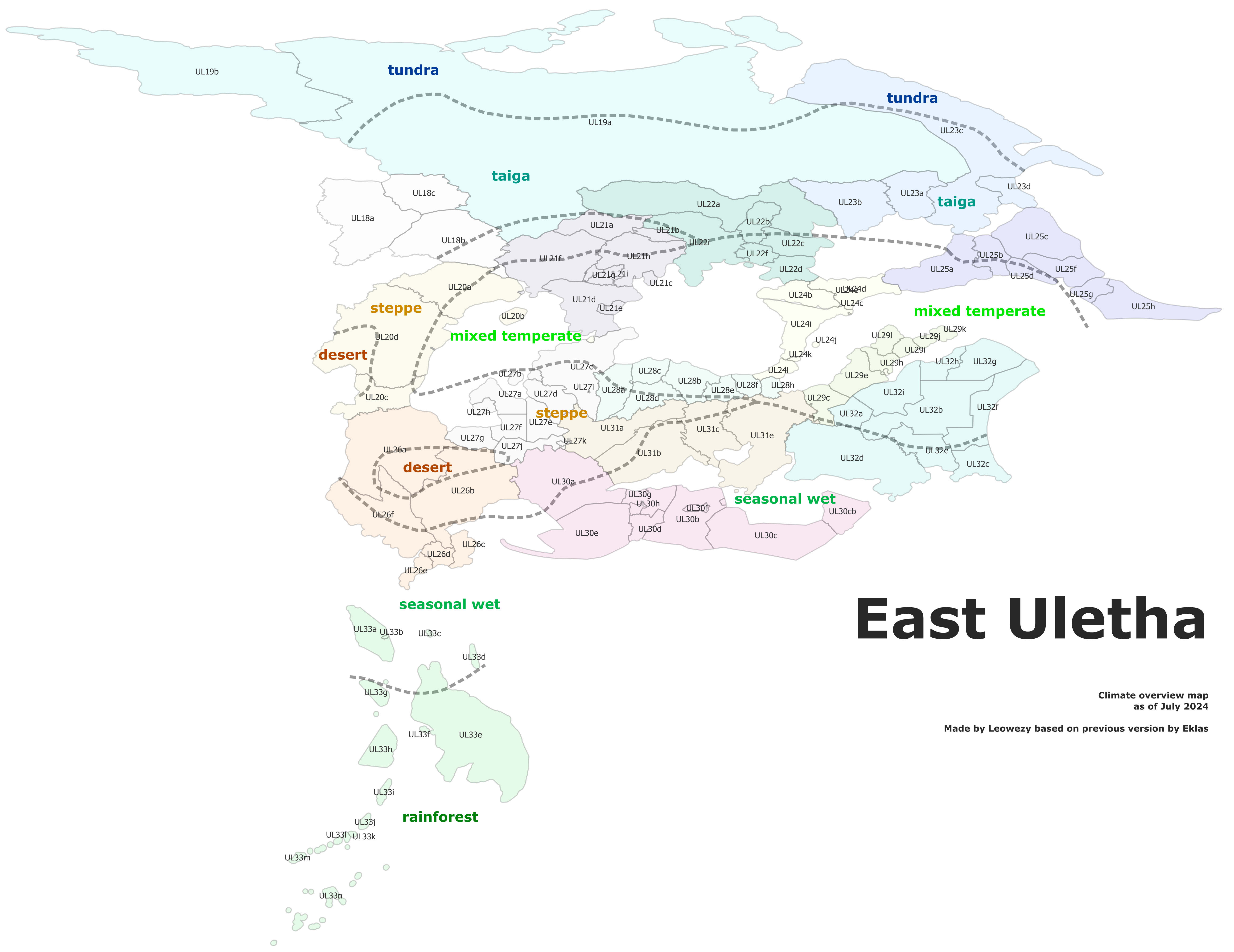
File:East Uletha overview 2024.png

Size of this preview: 766 × 600 pixels. Other resolutions: 2,560 × 2,004 pixels | 3,460 × 2,709 pixels.
Original file (3,460 × 2,709 pixels, file size: 975 KB, MIME type: image/png)
Summary
Updated East Uletha overview map made by Leowezy using OGF territory boundaries, QGIS and Inkscape. Based on and replaces previous version by Eklas: https://wiki.opengeofiction.net/index.php/File:East_Uletha_overview.png
Licensing
| This image is licensed under the Creative Commons Attribution-ShareAlike License |
File history
Click on a date/time to view the file as it appeared at that time.
| Date/Time | Thumbnail | Dimensions | User | Comment | |
|---|---|---|---|---|---|
| current | 17:52, 9 July 2024 | | 3,460 × 2,709 (975 KB) | Leowezy (talk | contribs) | changes resolution |
| 17:48, 9 July 2024 | Error creating thumbnail: File with dimensions greater than 12.5 MP | 5,236 × 4,040 (1.6 MB) | Leowezy (talk | contribs) | Updated East Uletha overview map made by Leowezy using OGF territory boundaries, QGIS and Inkscape. Based on and replaces previous version by Eklas: https://wiki.opengeofiction.net/index.php/File:East_Uletha_overview.png Category:Administrative images |
You cannot overwrite this file.
File usage
The following page uses this file: